|
Yewbarrow & Red Pike from Overbeck Bridge |
 |
 |
17th November 2025 |
 |
|
|
| |
|
Overview |
|
|
| Ascent: |
3,050 Feet - 929 Metres |
| Wainwrights: |
2, Yewbarrow - Red Pike (Wasdale) |
| Visiting: |
2, Yewbarrow North Top |
| Weather: |
Bitter Sunshine Throughout. Highs of 5°C Lows of 1°C Feels Like -9°C |
| Parking: |
Car Park, Overbeck Bridge |
| Area: |
Western |
| Miles: |
6.5 |
| Walking With: |
On My Own |
| Ordnance Survey: |
OL4 - OL5 |
| Time Taken: |
5 Hours 10 Minutes |
| Route: |
Overbeck Bridge - Dropping Crag - Bell Rib - Great Door - Yewbarrow - Yewbarrow North Top - Dore Head - Red Pike (Wasdale) - High Fell - Blackbeck Knotts - Knott Ends - Over Beck - Overbeck Bridge |
|
| |
|
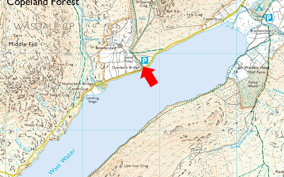
Parking Details and Map |
|
|
| Nearest Post Code: |
CA20 1EX |
| Grid Referance: |
NY 168 206 |
| Notes: |
A small car park with room for around a dozen well parked cars can be found next to Overbeck Bridge. There is an honesty box close to the entrance to the car park on the right hand side. Update: The National Trust have installed a ticket machine at Overbeck Bridge, charges apply from 26/07/2024 £5.00 for 2hrs, £7.00 for 4hrs and £9.00 all day. |
|
| |
|
Map and Photo Gallery |
|
|
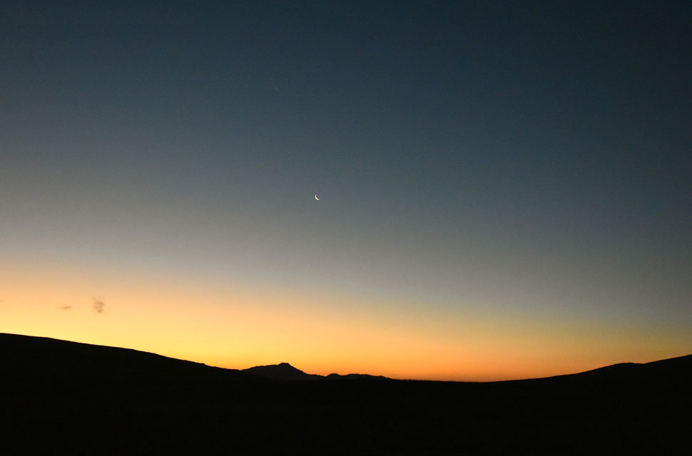 |
| Dawn over Stickle Pike from Crosbythwaite on the Birker Fell Road 7:09am |
| As your probably aware I'm partial to starting my walk well before sunsrise but today the plan was to start around sunrise just so I can capture first light as it passes over Burnmoor Tarn before flooding the Wasdale Valley in glorious sunlight. It's gotta be a clear morning and if conditions continue it looks like I'm gonna get my wish. This photo was taken just as I joined the Birker Fell road looking back on Stickle Pike with a Waning Crescent moon still visible in the dawn sky. |
 |
| Minutes before sunrise views of Sca Fell and Slight Side 1°C 7:46am |
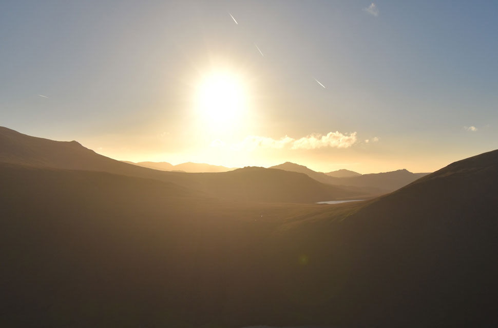
| It had been an uneventful drive west arriving at a rather dull Overbeck car park around 7:20am - I knew I was early for the sunrise so for a change I took my time kitting up which included parting with nine pound coins for all day parking at the parking meter. In hindsight what I should have done was park about half a mile back at the free parking spaces at Netherbeck Bridge which in turn would soak up the spare time but what-the-hey. Despite feeling a lot lighter change wise at least I can see where the fees had been spent with a freshly tarmaced entrance to the car park and parking bays separated by sunken wooden logs although for the life of me I can't remember if they're new or not, nice touch though.
The sun was still low when I left the car park eager to get my view but in the same breath, feeling slightly frustrated with all the time I'm wasting. With the car park behind me I flanked a swollen Over Beck towards the familiar gate at the base of the ridge. It's a steep start and my legs were feeling like they were two steps ahead of me such the eagerness to join the fell, but I was still too early to catch the sun peaking over Burnmoor Tarn, after five or six frustrating minutes I couldn't wait any longer, time was ticking and I needed to get on my way. My time management is usually bob on but this morning it's crashed and burned! |
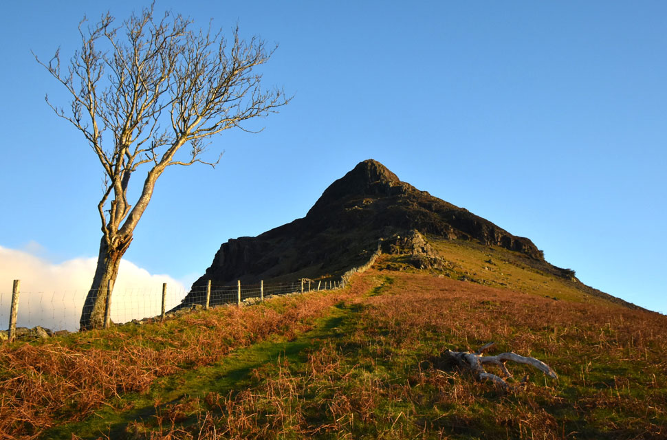 |
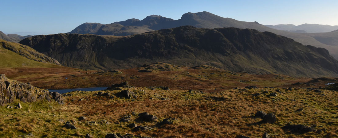
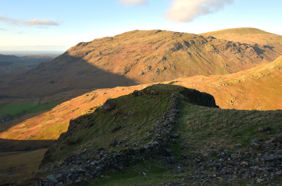
| Dropping Crag (left) and Bell Rib (centre) from Yewbarrow South ridge. |
| Within minutes of my starting my ascent I'd passed all but one of the familiar Rowan Trees until I took my foot off the gas to finally witness the sun rising over Burnmoor Tarn allowing sunlight to pour into the valley. |
 |
| First light over Bowderdale, Middle Fell and Seatallan. |
| Anyone watching me might have one finger on the 999 button because I'd been stationary for the best part of ten minutes just taking it all in. Was all the waiting around worth it? (looks away) Of course it was. |
 |
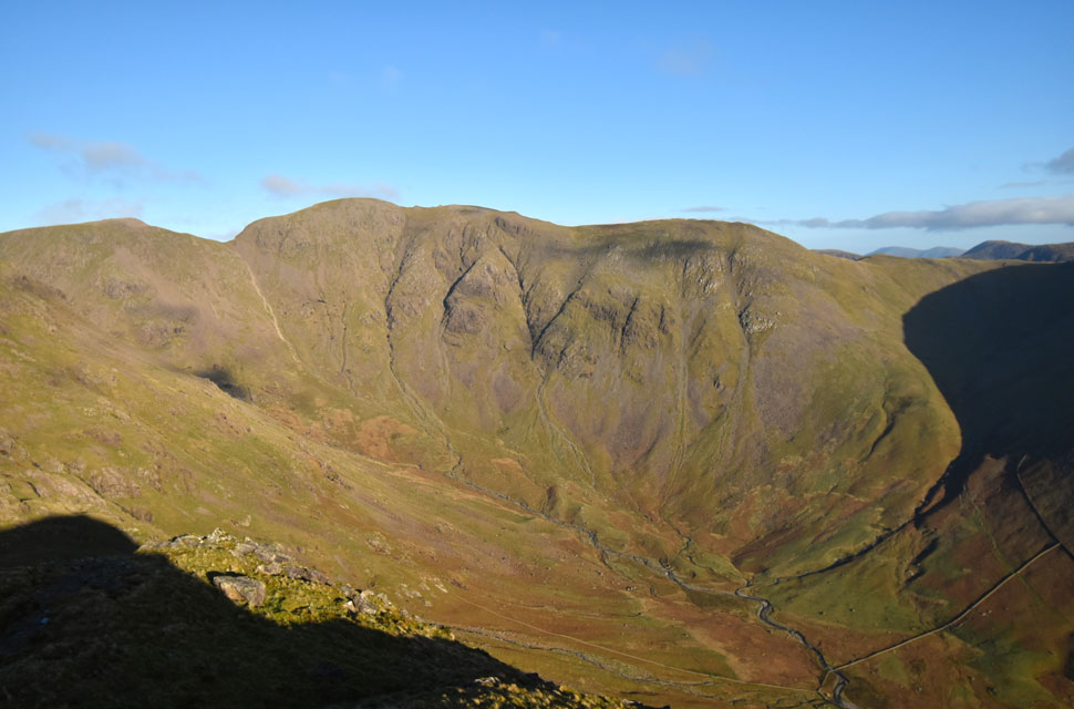
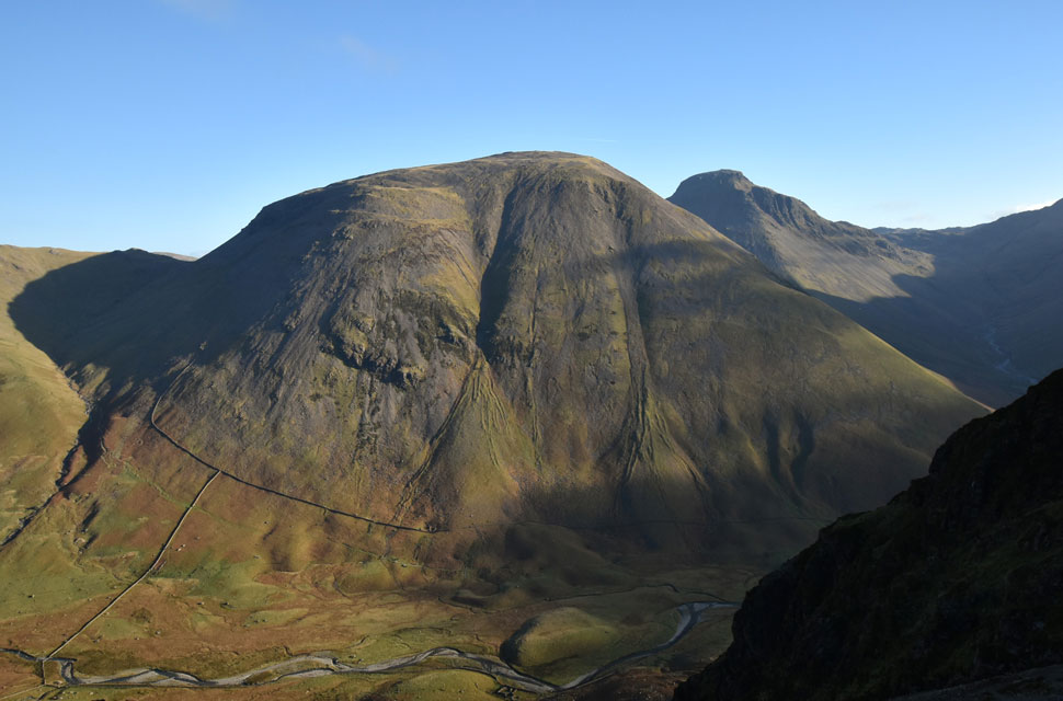
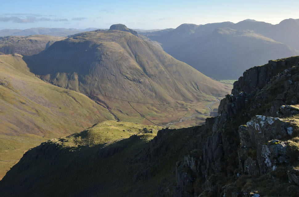
| Views across Over Beck towards Knott Ends, High Fell and Red Pike (Wasdale) |
| Back in gear I committed to the ascent wondering what had happened to my legs which by now were feeling the struggle of the steep ascent. That's Red Pike in the top right of the photo with Knott Ends seen left. |
 |
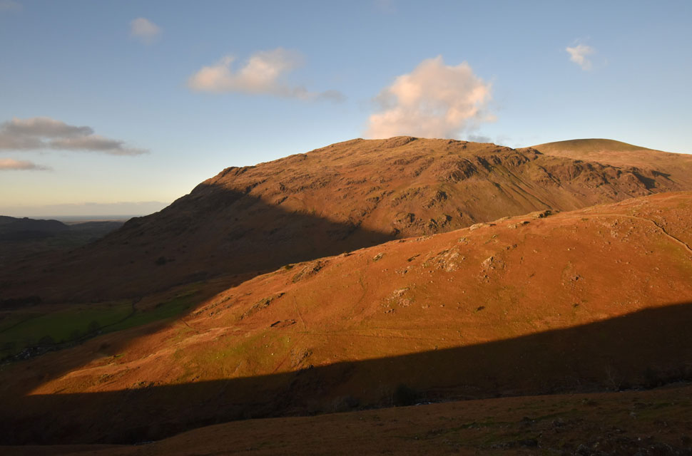
| Middle Fell, Seatallan and Knott Ends from below Bell Rib. |
| After crossing the familier wooden sty I arrived at a fork in the path and bore right towards a steep scree slope which in actual fact is pathed until two rock steps are reached. |
 |
| Looking down on Dropping Crag with Middle Fell and Seatallan in the distance. |
| It always fascinates me how the stone wall below drops steeply into the Overbeck valley below before climbing equally steep onto Knott Ends which I'll be descending by later. |
 |
| Sca Fell and Slight Side from Great Door. |
I had negotiated the two rock steps with ease but had noticed pooled, or frozen streams of water on what was already slim covered rock. At the top of the second rock step the path continues straight ahead or you can take the narrow gully to the right which ascends directly to Great Door. This gully narrows at its head walled in by Bell Rib south buttress to the right and another rock step to the left, by heading right the walker will be fully exposed on reaching the top of the gully which is why I would always advise to take the left rock step. |
 |
| Amazing views from Great Door. |
| Ten minutes of time I didn't mind wasting here. |
 |
| Sun soaked views over Burnmoor Tarn towards Harter Fell (Eskdale) the Birker and Ulpha fells. |
| After tearing myself away from Great Door I stopped again to take in the view over Burnmoor Tarn. |
 |
| Looking down on Bell Rib and Great Door. |
| Even though my legs felt like I'd reached the Yewbarrow's summit I was still a long way off yet. |
 |
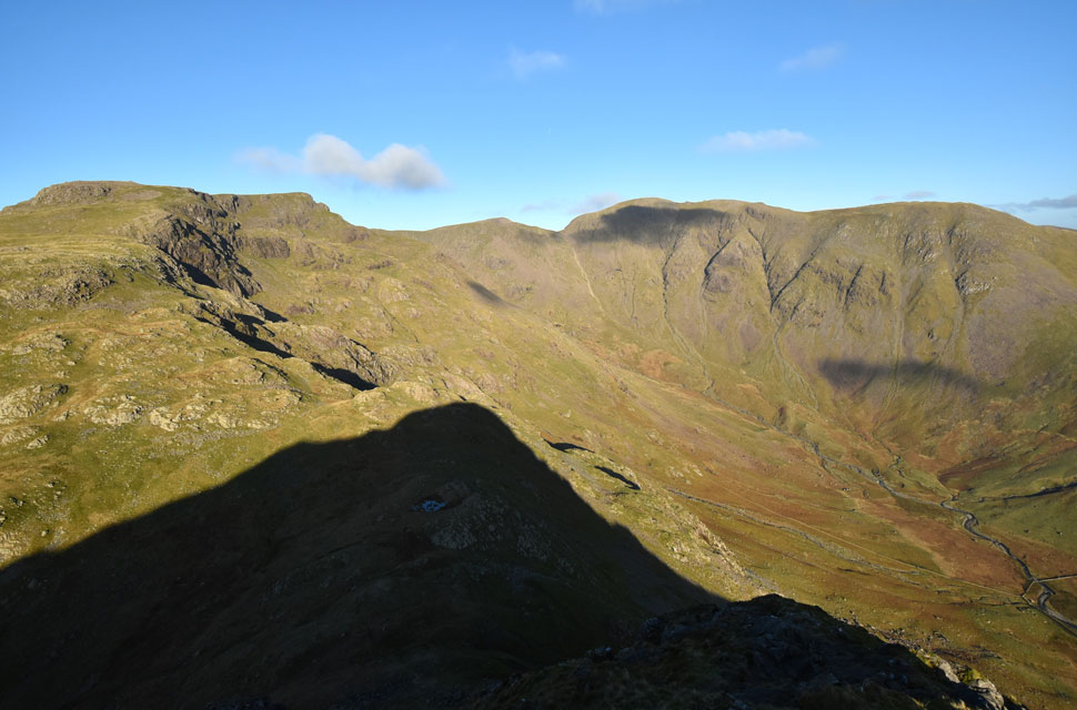
| Red Pike (Wasdale) Black Crag (Pillar) Windy Gap and Pillar from Yewbarrow summit. |
| With all of the technical stuff behind me I got stuck into the remainder of the ascent blinded by sunlight in the corner of my right eye which in turn began to water but the plummeting temperatures will soon freeze the tears. Joking aside, that view, and another we'll see in a short while are the reasons I love climbing Yewbarrow in November. |
 |
| Pillar seen over the Mosedale valley. |
| By now the summit wind was stirring causing a massive drop in the windchill which was reaching into double figures. I'd taken my neck gaiter, beanie and gloves off during the ascent of Bell Rib and was now scrambling to put them all back on again. |
 |
| Red Pike (Wasdale) Black Crag (Pillar) Windy Gap and Pillar from Yewbarrow North Top. |
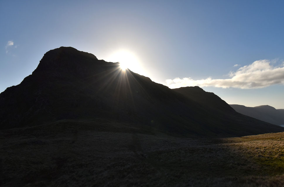
Just like a school boy I've always been fascinated by how Yewbarrow's north summit shadow dominates the valley below which is another reason why I love climbing the fell at this time of year. Below is Dore Head and between me and it is the notorious Stirrup Crag, sections of which would require a down-climb and seeing that I've already experienced icy rock below Bell Rib earlier I'm gonna give it a miss and take the horizontal path from the saddle instead.
Footnote: On the occasions that I have climbed Stirrup Crag from Dore Head it's been during Summer months I found the scramble a really enjoyable ascent. |
 |
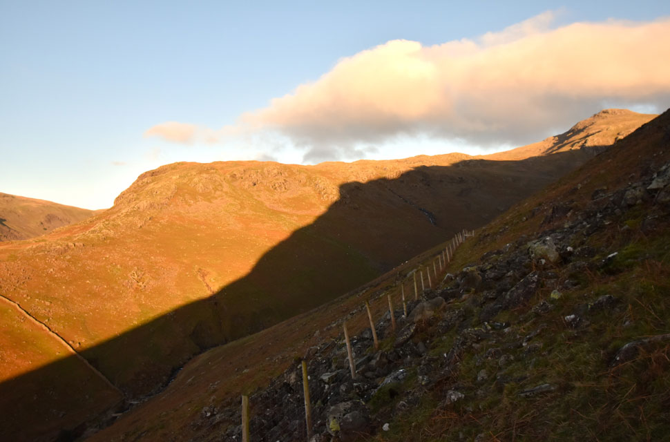
| Dore Head from the horizontal path. |
| After retracing my steps I returned to the saddle of the summit, turned right and began my descent via the horizontal path, this path is quite easy to locate by a large pool of water which was frozen today before beginning the descent via a grassy trod which leads onto the type of rocky surface you see in the photo before eventually arriving at a short scree section at Dore Head. |
 |
| Looking back on Over Beck, Knott Ends, Middle Fell and Whin Rigg. |
| |
 |
| The top of Black Sail Pass, Kirk Fell and Great Gable from Dore Head. |
| After negotiating boulder twenty five minutes after leaving Yewbarrow's north top I arrived at Dore Head, not before passing a solo walker who had just ascended the zigzags below Stirrup Crag, thought twice about it and joined the horizontal path as I left it. He was the first person I'd seen all morning and didn't seem up for conversation, not even a 'morning' |
 |
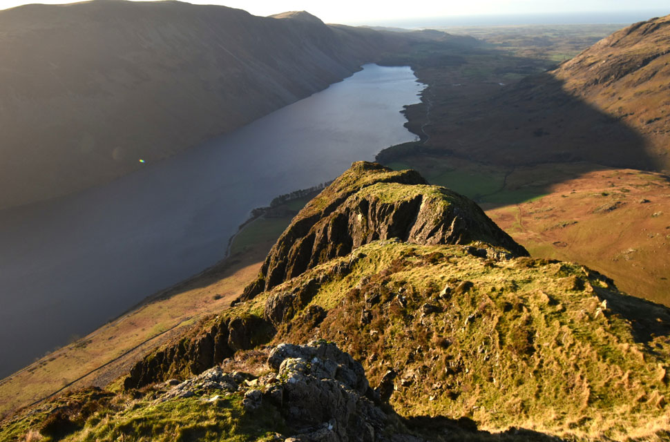
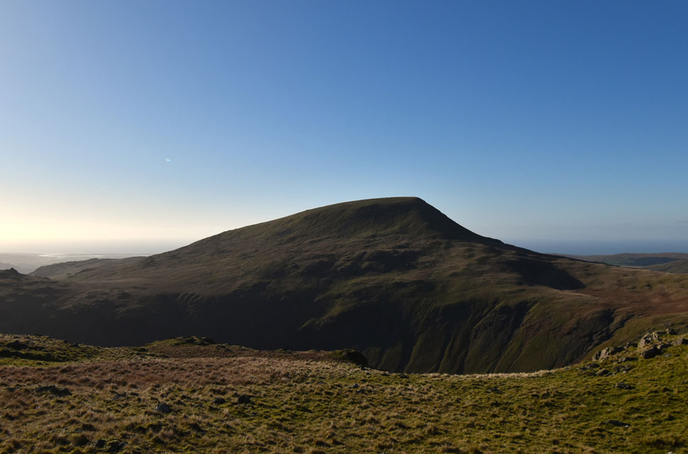
| Yewbarrow from Dore Head. |
| I'd normally take out my butties and have an early lunch at Dore Head but seeing as I was climbing Red Pike next I'd better get a move on. |
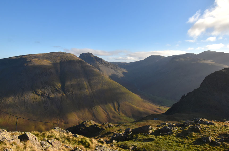 |
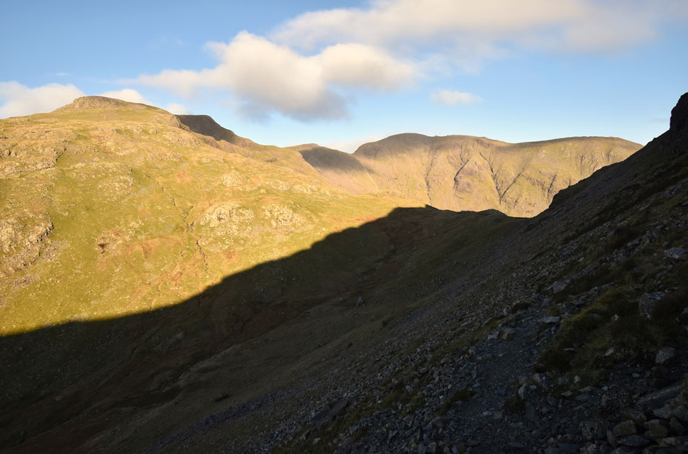
| Kirk Fell, Great Gable, Sty Head, Great End, Broad Crag, Lingmell, Yewbarrow's Stirrup Crag and Dore Head from my Red Pike ascent. |
| Amazingly in my dozen or so summits of Red Pike this is the first time I have ascended Red Pike via Dore Head. |
 |
| Dazzlingly views South Westerly from Red Pike (Wasdale) summit. |
| I was surprised by how much I enjoyed the ascent starting from a lovely zig zagged path which tops out onto a wide grassy plateau before a 500ft steep haul onto the summit proper. |
 |
| Looking down on Low Red Pike with the Mosedale Valley flanked by Kirk Fell beyond. |
| Back in July 2021 I ascended Red Pike direct via Low Red Pike below which is a very challenging route to say the least topped off by a wonderful 400ft ridge scramble before the summit is reached. |
 |
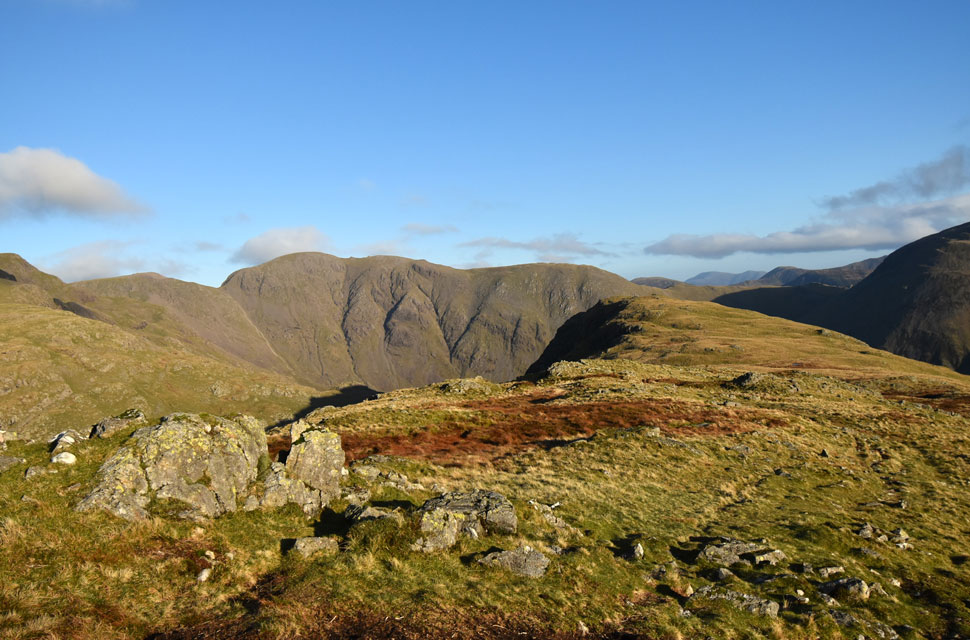
| Red Pike (Wasdale) Scoat Fell, Black Crag and Pillar. |
| With Red Pike summit reached I went about exploring the Low Red Pike ridge thinking would I do it again? Most definitely was the answer except this time make an ascent between October and March when bracken had died back. |
 |
| Pillar from Red Pike (Wasdale) |
| Another reason for todays route is to explore the area around Blackbeck Knotts and Knott Ends, dare I say two less frequented areas of the Western fells. |
 |
| Descending Red Pike (Wasdale) with views of Scoat Fell to the North. |
| From Red Pike summit I make a pathless, direct descent above Scoat Tarn via an area named High Fell not to be confused with the area south of Low Tarn also named High Fell. |
 |
| Brew with a view. |
| Sheltered from the wind I began to overheat so I removed my gloves and for the first time since March took out my small flask and treated my chilled insides to a hot brew. |
 |
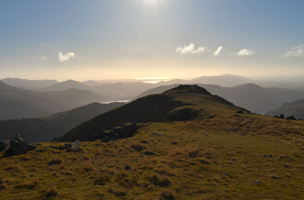
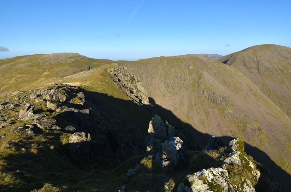
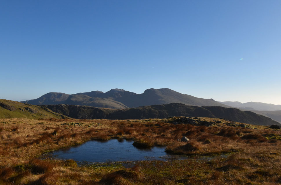
| Views towards Blackbeck Knotts with Seatallan and Middle Fell beyond. |
| It being my first time here I wasn't sure what to expect in terms of paths because on the research I did do there wasn't much out there and with some degree of difficulty when I did stumble across a path I made sure I stuck to it, or at least I tried to. |
 |
| Views over Yewbarrow towards Lingmell and the Scafells. |
| And the reason why I kept losing the path was because I kept leaving them such my want to explore and take in the views such as this one. |
 |
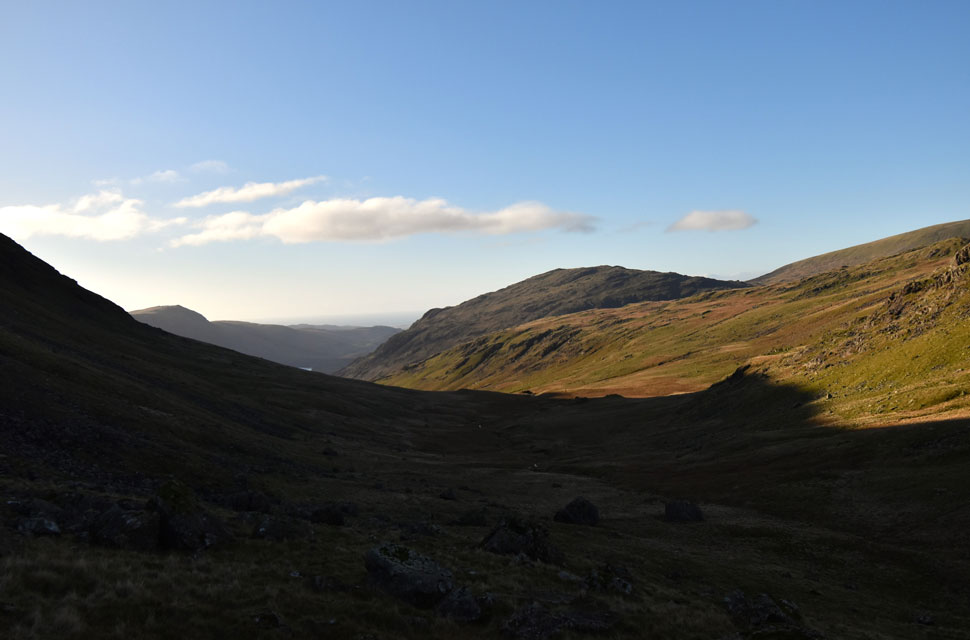
| Views West over Nether Beck towards Seatallan. |
| |
 |
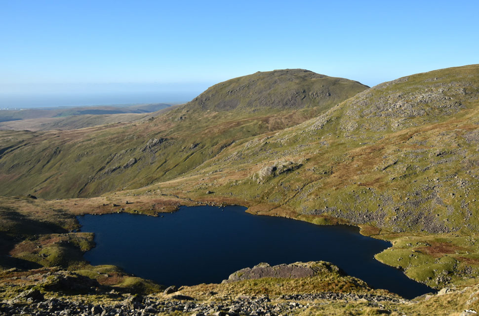
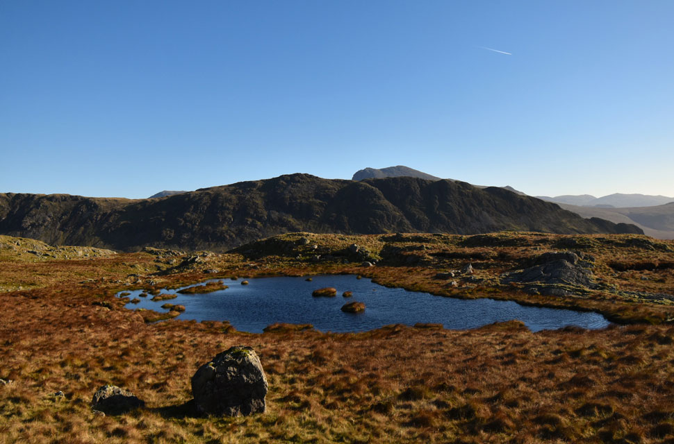
| The delightful Low Tarn comes into view. |
| With Gosforth Crag Crag seen beyond and t'other High Fell seen far right. |
 |
| What a place. |
| After losing and linking back up with various paths more times than I care to mention I left Blackbeck Knotts behind and began the gentle descent where I passed two delightful unnamed tarns. |
 |
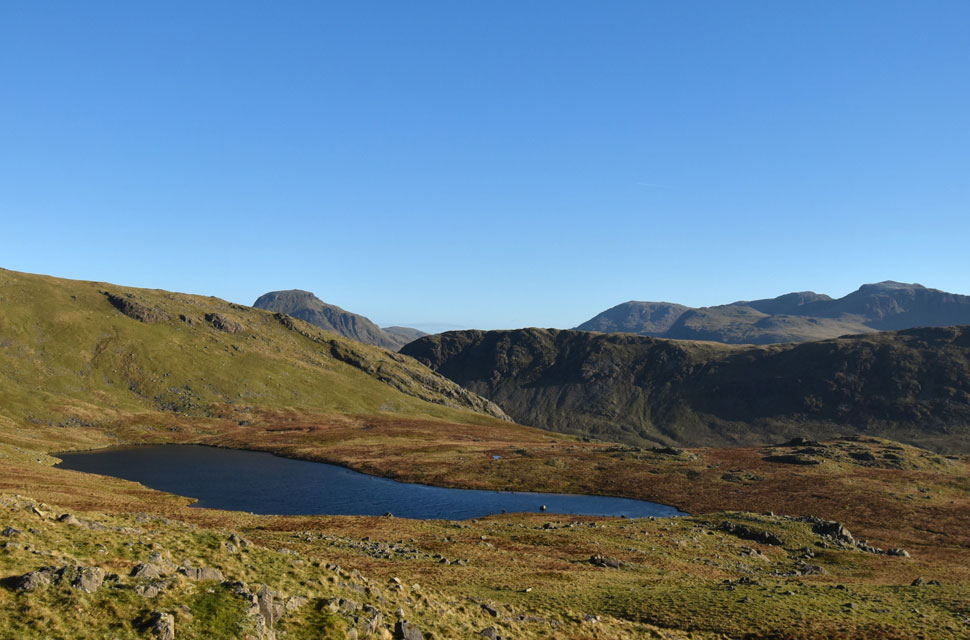
| Yewbarrrow and Sca Fell from the first tarn I passed. |
| During the drier summer months what an ideal place for a wild camp. Despite being less than a mile and half away from Wast Water this place feels so remote. |
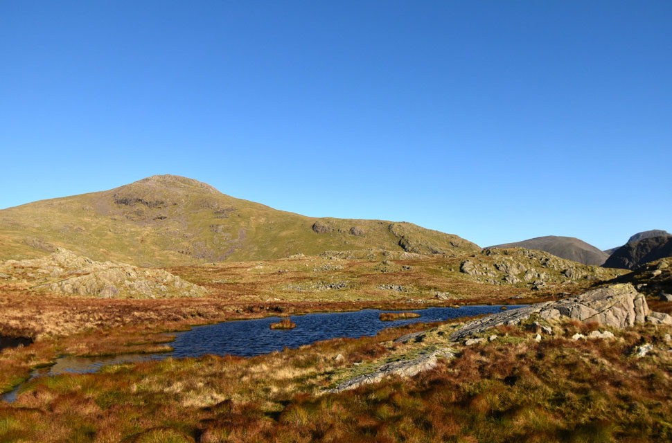 |
| High Fell and Red Pike (Wasdale) from the second tarn. |
| Feeling thrilled at the isolation of the tarns I now had a feeling of sadness at having to leave them. |
 |
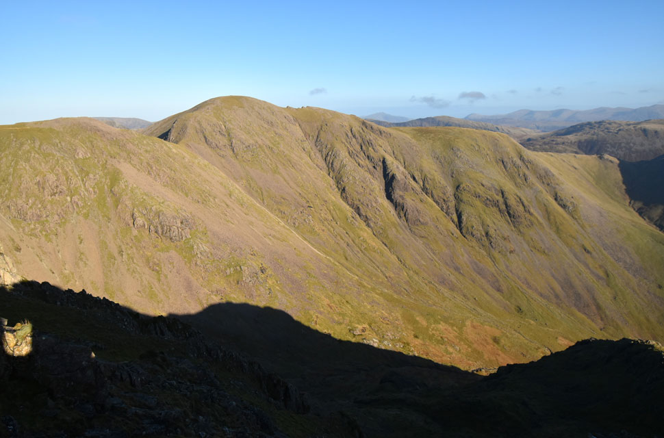
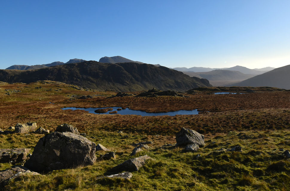
| Looking back on Blackbeck Knotts with Haycock seen distant left. |
| I wasn't going to include this picture but I thought it was a good idea to show the lay of the land including ground conditions which, despite weeks of rain weren't too wet underfoot. |
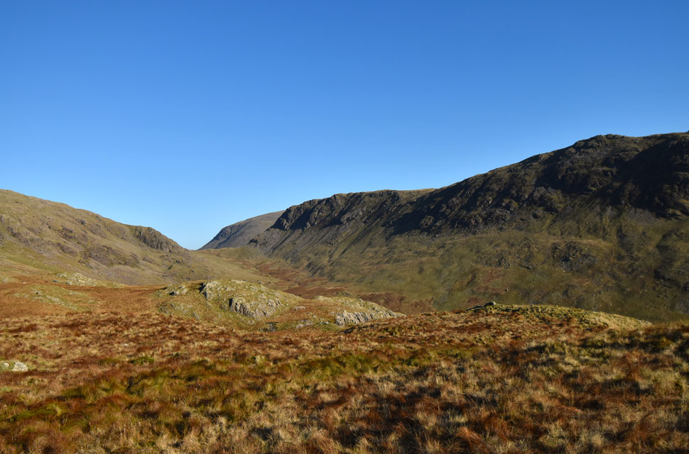 |
| View through the Over Beck valley towards Dore Head, Kirk Fell and Yewbarrow. |
| Taken from Knott Ends. |
 |
| Looking back on Knott Ends, Red Pike (Wasdale) seen to the right. |
| The obvious route of descent would be via a grass rake seen behind the large crag in the upper centre of the photo. |
 |
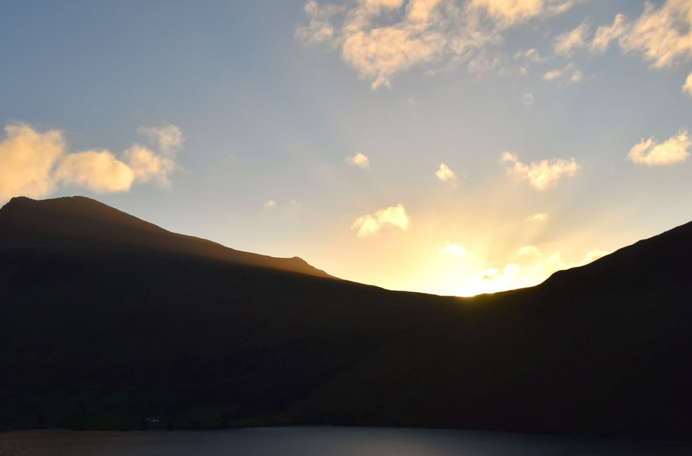
| Yewbarrow, Great Gable and Lingmell from Wast Water. |
With the descent of Knott Ends behind me I kicked my feet into the backs of my boots the shift, as always, felt heavenly. I had reached the same wall that I had looked down on from Dropping Crag earlier not realising that it was flanked with clustered boulder but I Iocated a path whilst my ears were treated to the cascades of Over Beck below. I was soon down at its bank where the remains of wooden bridge spanned the beck less its side rails whilst fifty yards downstream a replacement bridge where, oddly, access to it was blocked by a metal gate tied to the fence by the land owners 'orange rope' I gave the old bridge a solid kick, nothing moved and I hastily crossed it joining the bank on the other side still confused why access to the new bridge had been blocked by the roped gate. Dropping Crag and Bell Rib where high above my left flank after that, nothing but blue sky and sunshine. I spotted a walker descending Yewbarrow's south ridge my narrow path flanked by hill side to the left and deep gorge to the right.
The sun was shining down on Wast Water leaving a golden glow across its surface leaving it looking warm and inviting so I told myself once I was back at the car park I'd make the short stroll across to a stony beach but on arrival It felt like I'd just walked into someones front room spotting a couple enjoying a picnic. A quick nod yielded nothing in return so I left, crossed back over the road and returned to a half full car park. Due to unfavorable weather I I was unable to complete my 2024 Yewbarrow walk last November and when I spied todays forecast there was only one walk on my mind but I never knew how two unnamed tarns would leave the mark they did on me. |
|
| |
| Back to top |
 |
|