|
Around Coledale Hause |
 |
 |
20th December 2025 |
 |
|
|
| |
|
Overview |
|
|
| Ascent: |
3,663 Feet - 1,116 Metres |
| Wainwrights: |
4, Grisedale Pike - Hopegill Head - Eel Crag (Crag Hill) - Sail |
| Visiting: |
3, Kinn - Hobcarton Head - Sand Hill |
| Weather: |
After A Cloudy Start, Clear, Sunny & Windy Across The Tops. Highs of 7°C Lows of 5°C Feels Like -1°C |
| Parking: |
Car Park, Whinlatter Pass, Just above Braithwaite |
| Area: |
North Western |
| Miles: |
8.5 |
| Walking With: |
On My Own |
| Ordnance Survey: |
OL4 |
| Time Taken: |
5 Hours 30 Minutes |
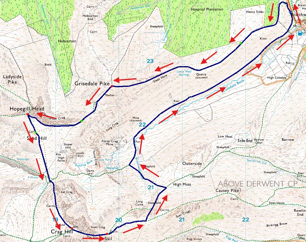
| Route: |
Car Park, Whinlatter Pass - Kinn - Sleet How - Grisedale Pike - Hobcarton Head - Sand Hill - Coledale Hause - Eel Crag - Eel Crag (Crag Hill) - The Scar - Sail - Sail Pass - Coledale Beck - Coledale - Car Park, Whinlatter Pass |
|
| |
|
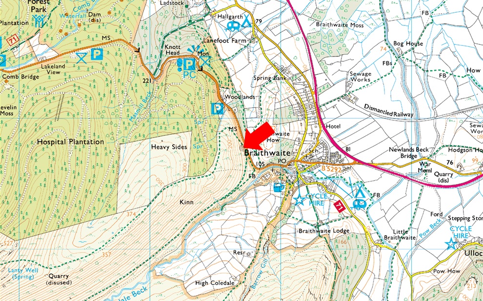
Parking Details and Map Car Park, Whinlatter Pass, Just above Braithwaite |
|
|
| Nearest Post Code: |
CA12 5TL |
| Grid Reference: |
NY 227 223 |
|
| |
|
Map and Photo Gallery |
|
|
 |
| |
| |
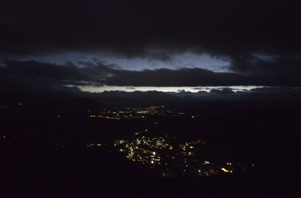 |
| Looking down on Braithwaite and a distant Keswick from the ascent of Kinn 5°C 7:16am |
The dreary December weather seemed never-ending, with a month's worth of rain falling in Cumbria in a little over a week. The rain continued day after day and truth be told I was itching for a proper walk, the frustration continued until midweek when I read the mountain forecast both Weatherline and MWIS contradicting each other yet the Met Office forecast at least stayed pretty much the same with intermittent sunshine, the brighter forecast being north of the county which worked well as an ascent of Grisedale Pike had been on the cards for a few weeks, trouble was I couldn't make my mind up on which route to take so I told myself I'd make it up as I went along. The Met Office forecast had changed again for the worse overnight, but I was determined to go ahead even if it meant walking in cloud. I just wanted to get boots onto the fell. I left home under starry skies and arrived at the car park above Braithwaite village around 6:45am, from where I could still see the odd star through broken cloud.
There was only one other car in the car park, and with no signs of its owner, I began my kit up scrounging for somewhere dry to lace up, owing to a mix of clay-mud and rotten leaves underfoot, before carrying my boots over to the base of the wooden staircase, where I swapped my mids for my boots. The odd car broke the silence as it made its way up Whinlatter Pass before silence resumed. Despite loving the early starts, kitting up in the pitch black still feels eerie, more so when surrounded by woodland, and I was eager to get underway. At exactly 7:00am, I locked the car and returned to the staircase for the steep ascent on Kinn, and with height gained, the silence was broken again by traffic travelling on the A66 below. I stopped more than once to look down on the street lights of Braithwaite and Keswick, even spotting head torches on the shoulder of Blease Fell, but it was so dark it was difficult to tell where the cloud line started. One thing I did know was that both Skiddaw and Blencathra's summits were below cloud. The bad news was I couldn't see Grisedale Pike summit from below Kinn, but the good news was I could see stars in the sky directly above so keeping fingers crossed, I marched on towards Kinn. |
 |
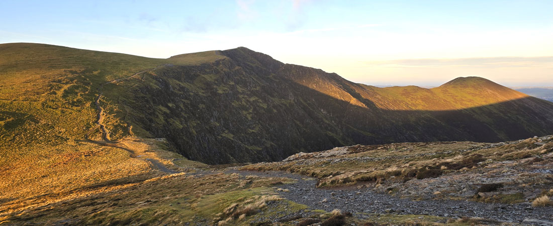
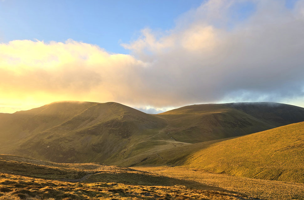
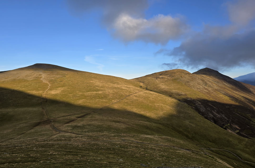
| Eel Crag (Crag Hill) Grasmoor and Grisedale Pike from Kinn 7:38am |
| Even though I hadn't been to the high fells in a few weeks, I quickly got into the steady climb on Kinn. From there, I could see the outlines of Eel Crag, Grasmoor, and, most importantly, Grisedale Pike, which was clear of cloud. There are still fifty minutes until sunrise, but in about ten minutes it will be light enough to walk without my head torch. |
 |
| Grisedale Pike from Sleet How. |
| When I reached the top of Sleet How, I saw that the dawn light showed more clouds than the forecast from three hours earlier. I checked the Met Office App and, sure enough, the forecast had changed again. At first, I felt frustrated, but after a few minutes I let it go, shrugged, and reminded myself how lucky I was just to be here. |
 |
| Looking back on Sleet How and a distant cloud topped Skiddaw and Blencathra 8:22am |
| I had seen two walkers heading towards Kinn, and on Sleet How, a fell runner was ploughing towards me and pawing at the rock in a crouching style and soon passed me with a "morning" as if I were stood still. |
 |
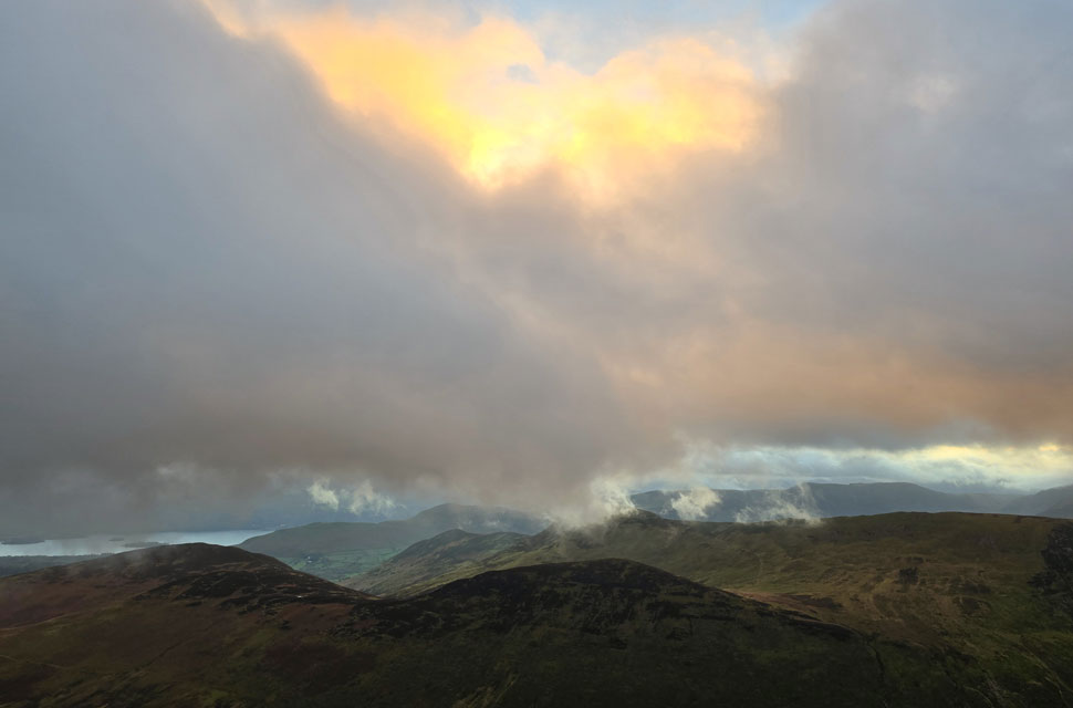
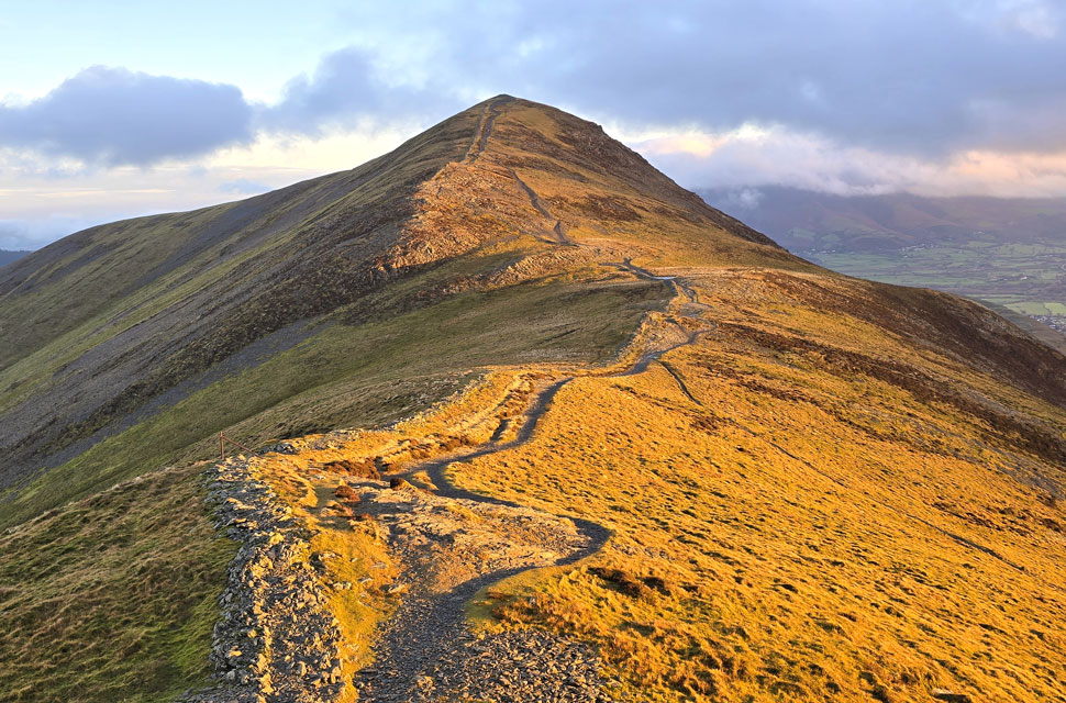
| Looking north from Grisedale Pike summit. |
| I had caught glimpses of dawn hue from the corner of my right eye as I zigzagged the last hundred yards onto the summit, and I wasn't expecting to see the colours of dawn further north because directly behind me it was still grey and very cloudy. What a wonderful surprise, and it was about to get even better. |
 |
| The view South towards Outerside, Stile End, Causey Pike and Cat Bells. |
| When I left the car park earlier the last thing on my mind was to time my arrival on Grisedale Pike with the sunrise arriving just seven minutes after the event. |
 |
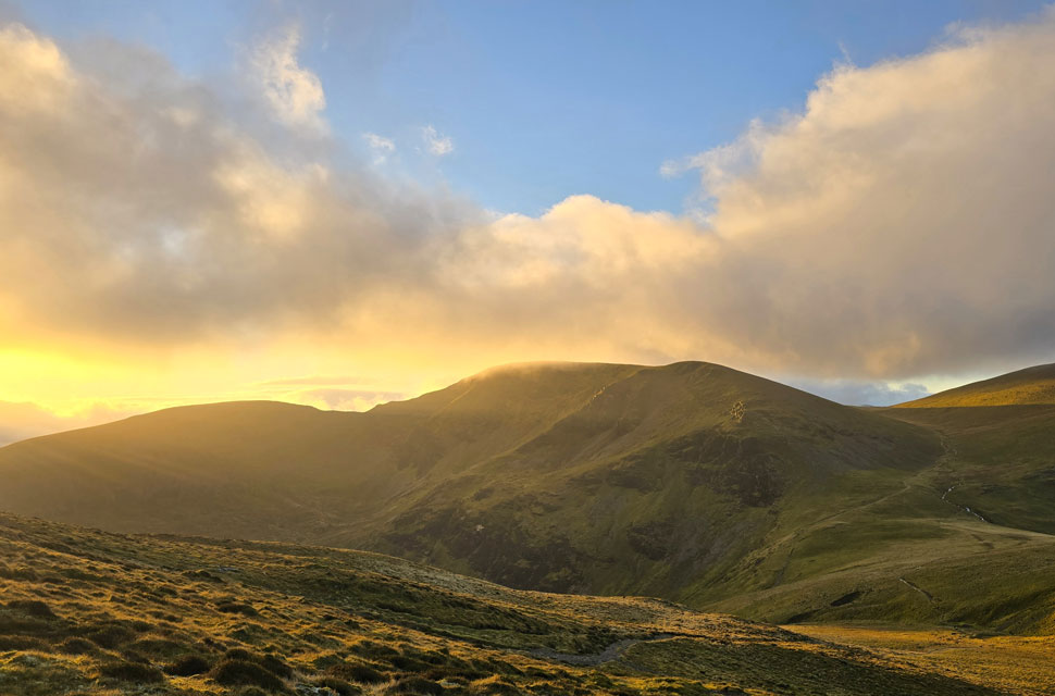
| The view towards Eel Crag (Crag Hill) Grasmoor, Hobcarton Head, Sand Hill, Hopegill Head and the Whiteside Ridge. |
| I was feeling pleased that I might get my sunrise after all, soon feeling how much I must have been sheltered from the wind during my ascent which by now was cutting through me and standing upright especially on wet rock was becoming difficult. |
 |
| Bloody fabulous. |
| It's amazing to think how cloudy it was looking east but if I turned my head slightly towards the left I had cloudless skies and all the colours of a beautiful sunrise. |
 |
| Those special few moments directly after sunrise. |
| First light breaking through cloud over Eel Crag. |
 |
| Looking back on Grisedale Pike from Hobcarton Head. |
| Just when I thought I was going to be in cloud all day this happens, talk about special moments. |
 |
| Looking back on Grisedale Pike from Hobcarton Head. |
| The light changed sporadically and was never the same for more than a few seconds due to the strengthening winds. |
 |
| Sand Hill and Hopegill Head. |
| So it was best to capture the light whilst I could because 'first light' can fade just as quickly as it arrived. |
 |
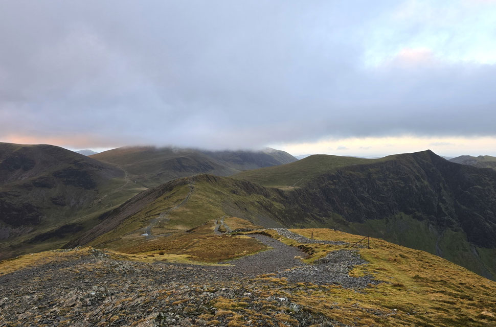
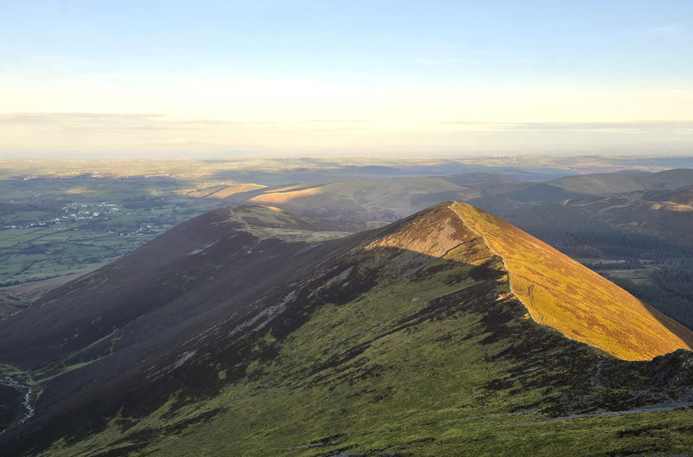
| Scar Crags, Sail and Eel Crag (Crag Hill) |
| It was fantastic to see all the grey cloud that had been there just twenty minutes earlier was breaking up allowing large swathes of sunlight to pass through. |
 |
| Sand Hill, Hopegill Head and Ladyside Pike. |
| Not in any rush I descend Hobacarton Head, crossed the col before beginning the ascent on Hopegill Head. |
 |
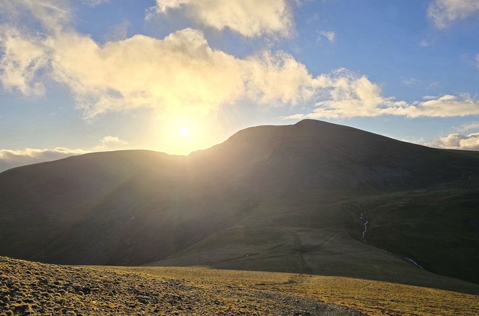
| Eel Crag (Crag Hill) Coledale Hause and Grasmoor. |
| With the southern slope of Sand Hill taking a full burst of sunlight. |
 |
| Looking back on Hobcarton Head and Grisedale Pike. |
| |
 |
| Hobcarton Head. |
| I really need to stop being so distracted by the sunrise. |
 |
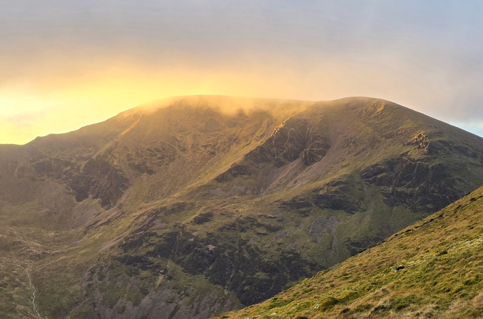
| Whiteside seen beyond Gasgale Crags from Hopegill Head summit. |
| I had ascended once again into strengthening summit winds, the kind of winds that can strip the contents of your nose, almost make you lose your balance and give you brainfreeze all in one go. Despite the panoramic views and brilliant sunshine, Hopegill Head was no place to hang around this morning. |
 |
| Ladyside Pike and Swinside. |
| But before I left here's a photo of Ladyside Pike with Swinside beyond. |
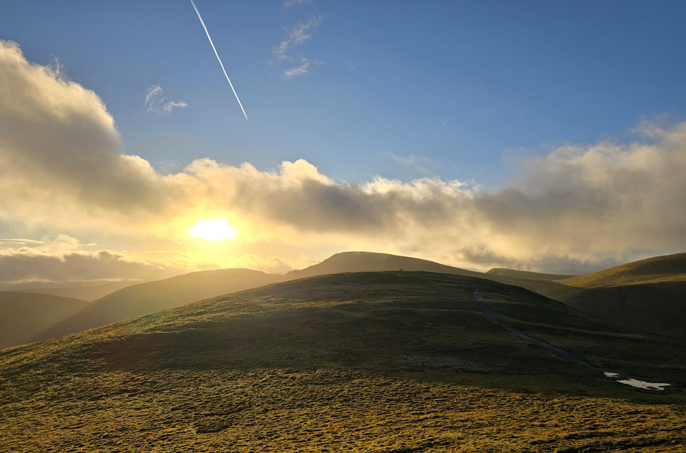 |
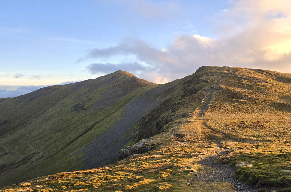
| Heading for Sand Hill. |
| With Scar Crags, Sail, Eel Crag and Wandope beyond. |
 |
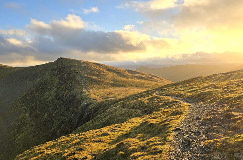
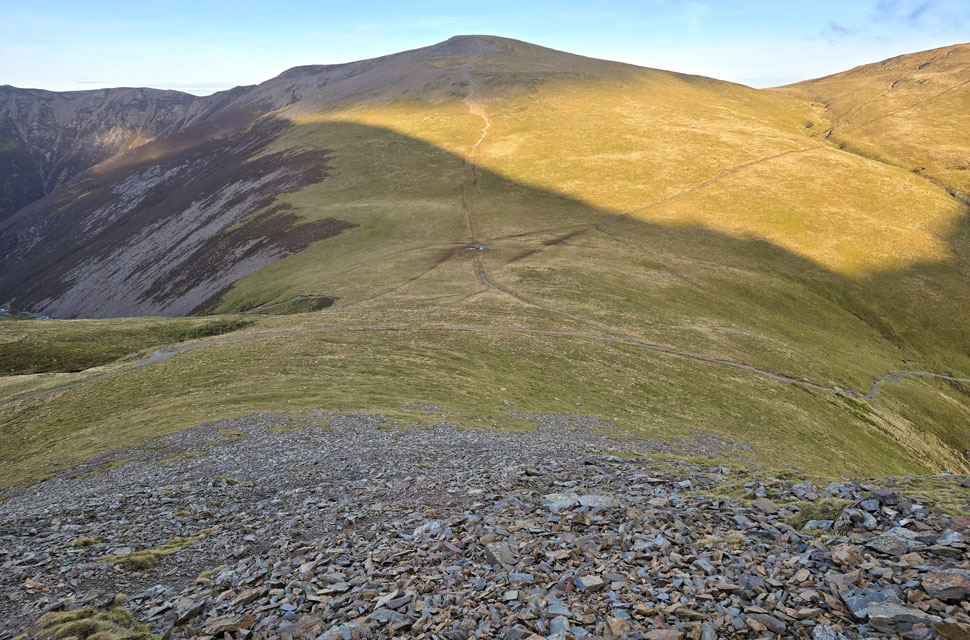
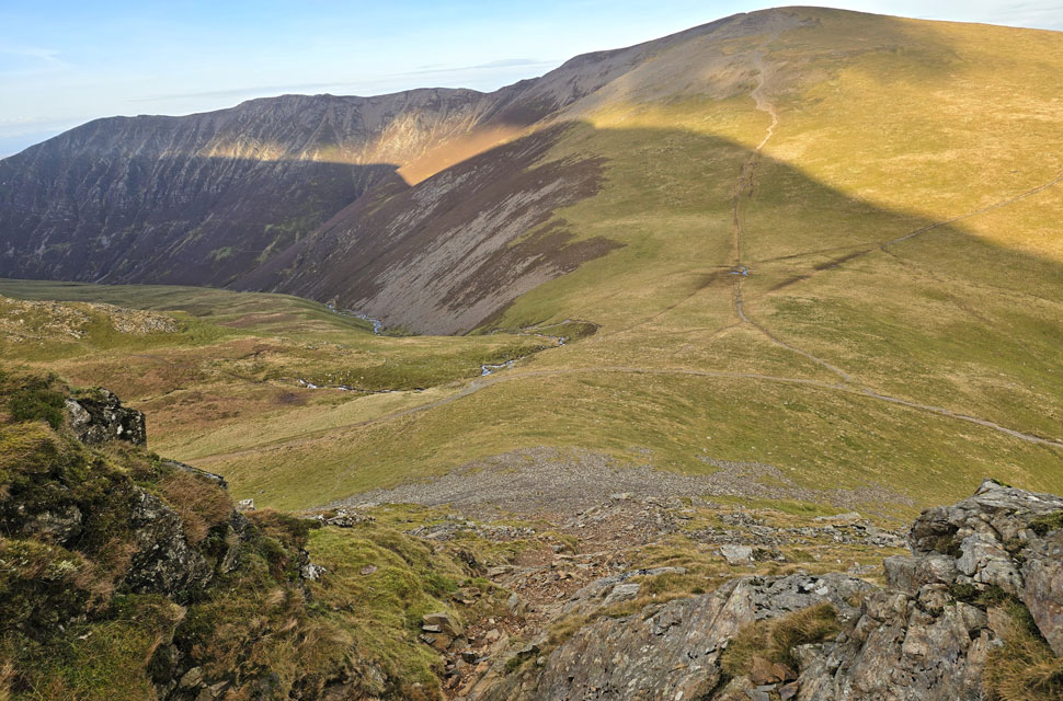
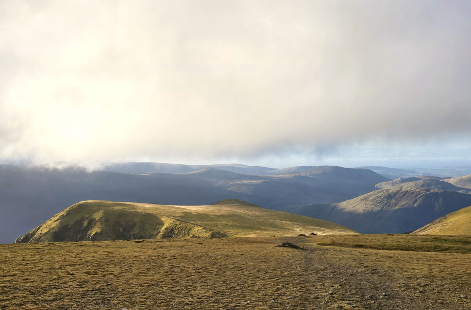
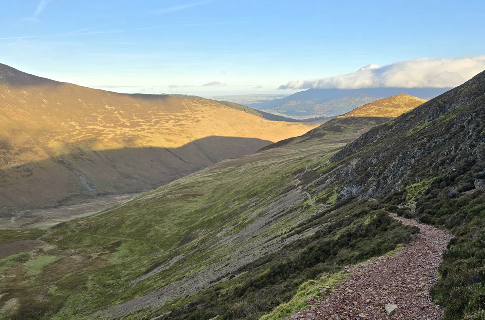
| Descending Sand Hill with views over Coledale Hause towards Eel Crag (Crag Hill) and Sail. |
| It was around this point that I had a 'light bulb' moment. |
 |
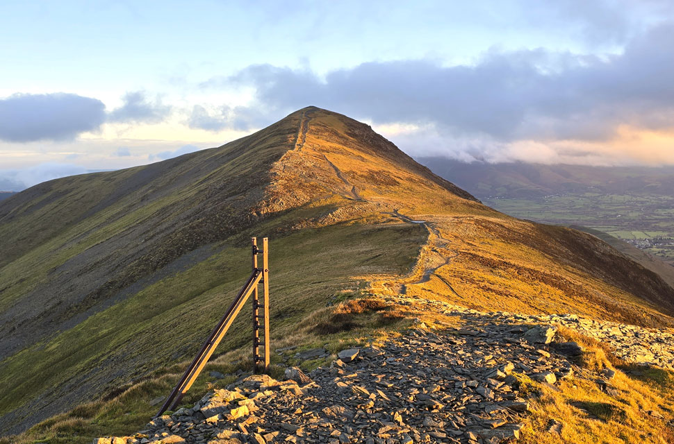
| Eel Crag (Crag Hill) over Coledale Hause. |
| I was undecided whether to make an ascent on Grasmoor directly from Coledale Hause or leave Grasmoor out altogether and head straight towards Wandope and that's when it hit me, why not make a direct ascent on Crag Hill via Eel Crag seen centre. I last climbed Eel Crag back in November 2013 when walking the Coledale Horseshoe on a snowy blue sky day but I had an accident with the memory card and ended up loosing all the photos I'd taken so I went back the following day and repeated the route but the weather didn't turn out as nice as was on the original walk. Twelve years on I can say for certain if that happened again I don't think Id be able to walk the Coledale Horseshoe two days on the bounce!! |
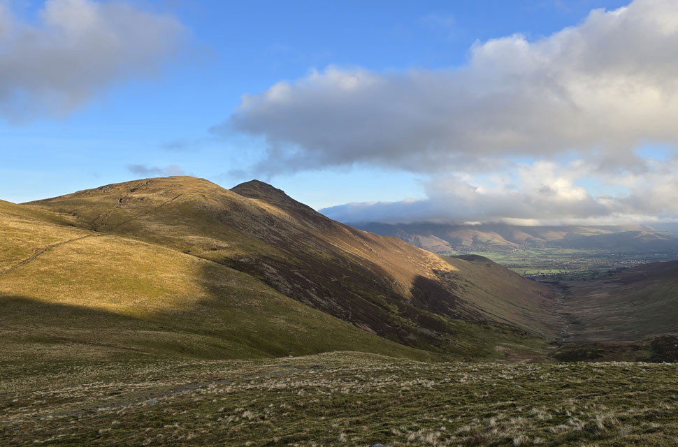 |
| Hobcarton Head, Grisedale Pike and Coledale from Coledale Hause. |
| My mind was made up, direct ascent on Eel Crag it is. |
 |
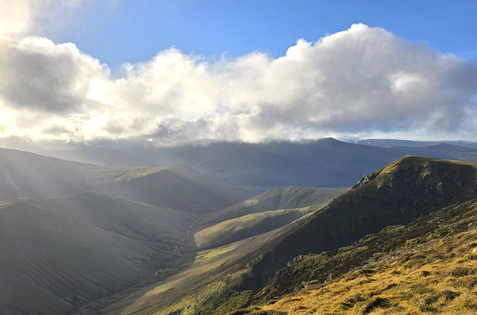
| Gasgale Crags and the Whiteside Ridge from Coledale Hause. |
| After crossing Coledale Hause I made my way towards the scree slope at the base of Eel Crag. |
 |
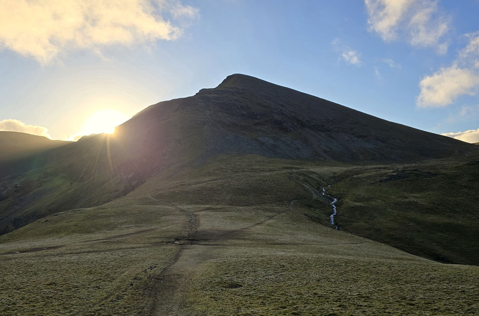
| Sand Hill, Hobcarton Head and Grisedale Pike from the ascent of Eel Crag. |
| There is actually a good path to follow all be it narrow from Coledale Hause that leads the walker over steep grass to the base of the scree slope. |
 |
| Looking down on Coledale Hause from the scree slope. |
| From the grass I picked one of two paths that ziggzagged through the scree before arriving at a large rock step. |
 |
| Looking down from the top of the rock step. |
| I ascend up the gully seen left (right when ascending) taking care over any damp rock I encountered. |
 |
| There's still quite a bit of ascent left before the summit is reached. |
| I arrived at the top of Eel Crag but not before de-shouldering my pack to enjoy a quick break whilst enjoying the views, leaning against a boulder with a hot cup of summer fruits in my hand. |
 |
| Looking down Eel Crag (Crag Hill) North Ridge. |
| I ascend as close to my left as I could noting that it felt like the wind had dropped leaving me able to view the Shelf Route which Rod had recommended to me over Tower Ridge having ascended both routes last summer. |
 |
| Looking back across the summit plateau. |
| With the top of Tower Ridge coming into view over on the right. |
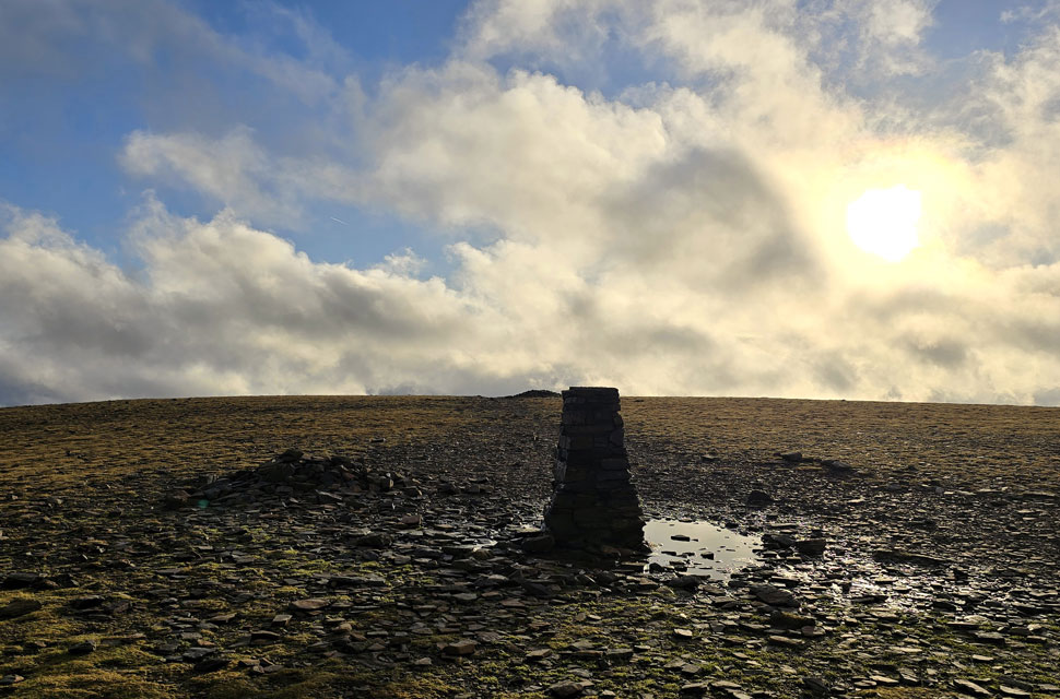 |
| Eel Crag (Crag Hill) summit trig point. |
| Eel Crag north ridge curved and shallowed so I swerved right and skirted the shallow ground before arriving at a deserted summit trig point. |
 |
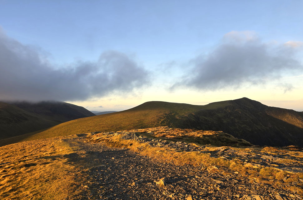
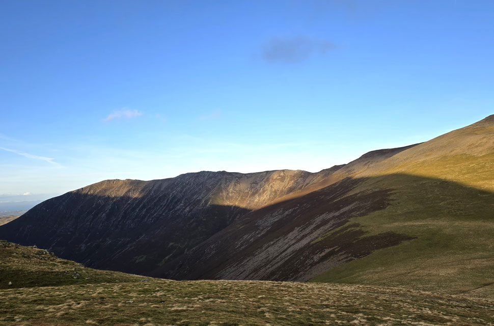
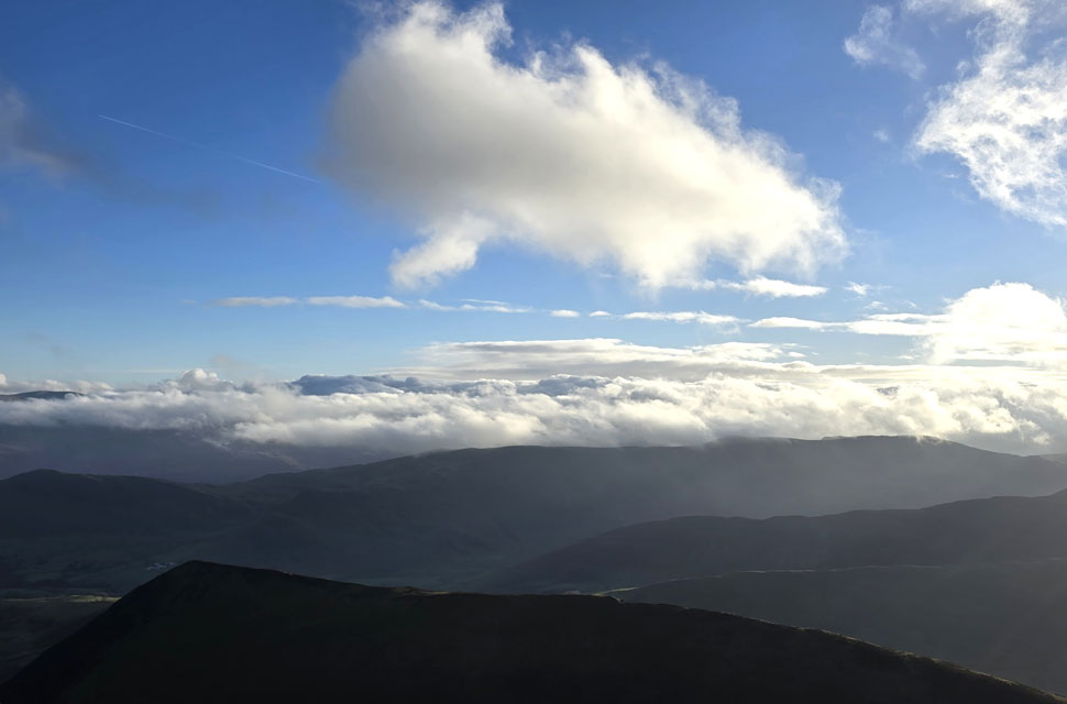
| Looking South West towards Wandope, Thirdgill Head Man, Red Pike (Buttermere) Starling Dodd, Great Borne and Mellbreak beyond. |
| It's looking like the cloud is starting to build especially over the High Stile Ridge towards the left. |
 |
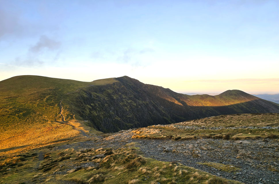
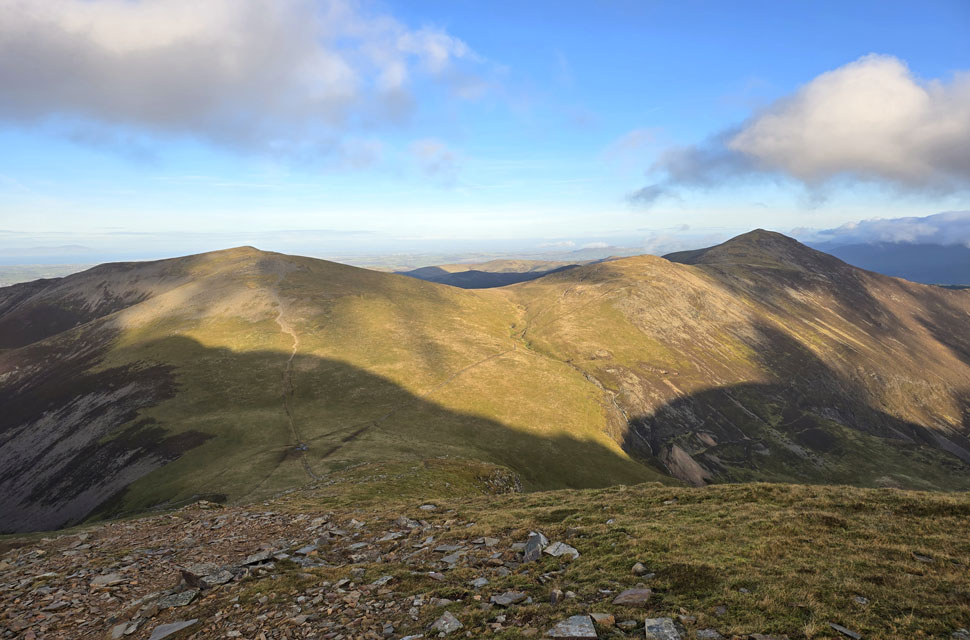
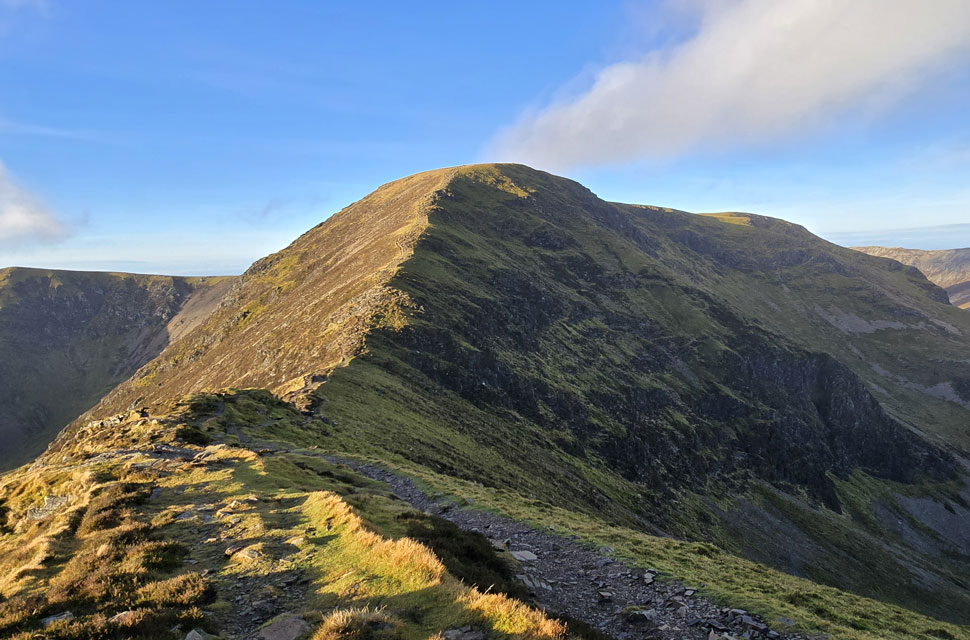
| Descending Eel Crag (Crag Hill) |
| With views of Sail, Scar Crags, Causey Pike, Outerside, Stile End and Barrow. |
 |
| Looking back on Addacomb Hole, Wandope, Knott Rigg Whiteless Breast and High Snockrigg. |
| Besides the fell runner I had passed earlier, I hadn't passed anyone all morning, but that all changed when I passed two young girls while crossing The Scar, both in festive spirits wearing Santa hats. It suddenly dawned on me that they were only the third people I'd seen in over four hours. |
 |
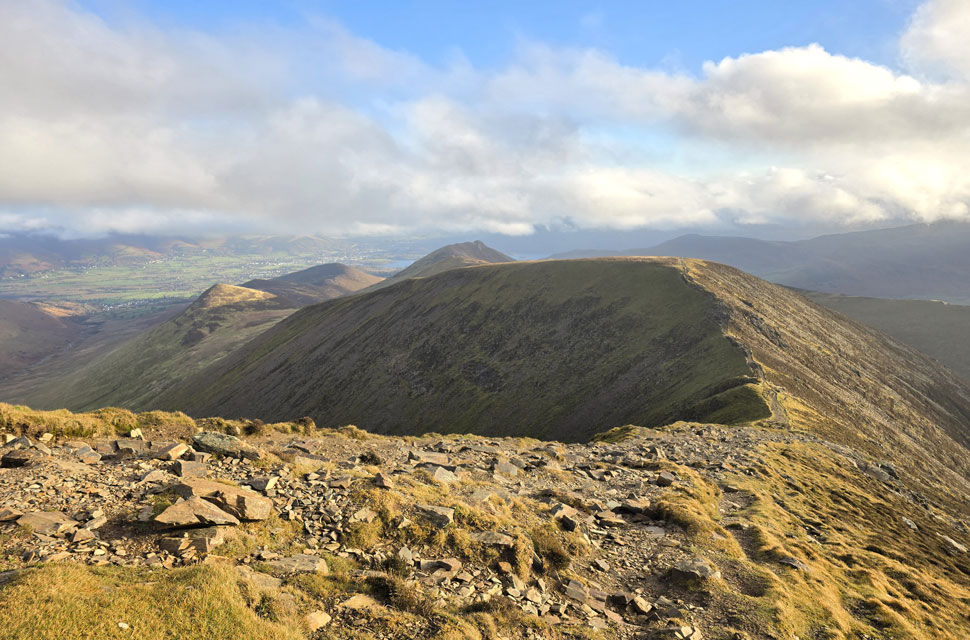
| Looking back on The Scar and Eel Crag (Crag Hill) |
| I was back with the mercy of the wind all be it milder as I approached late morning. |
 |
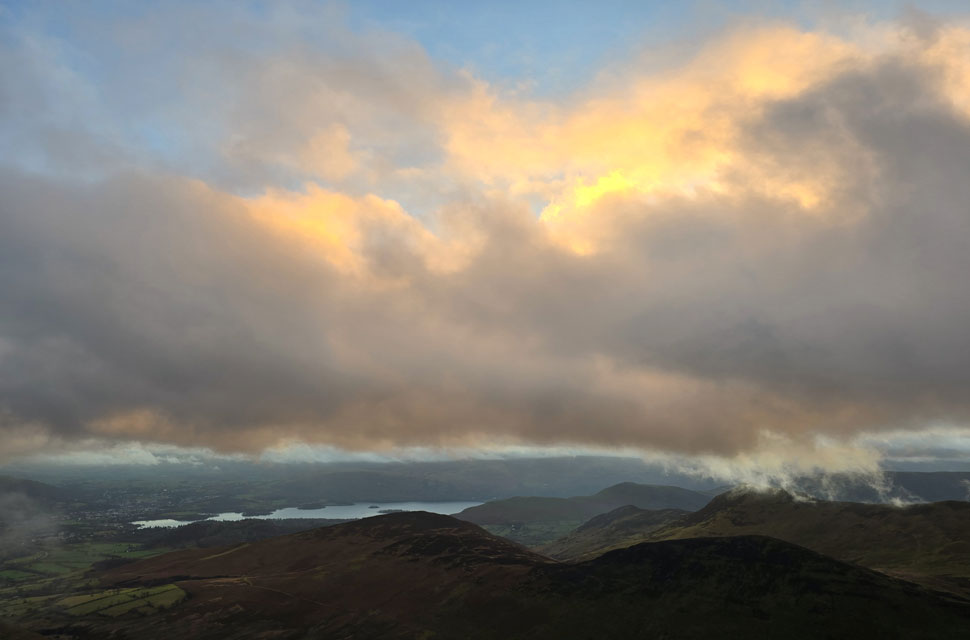
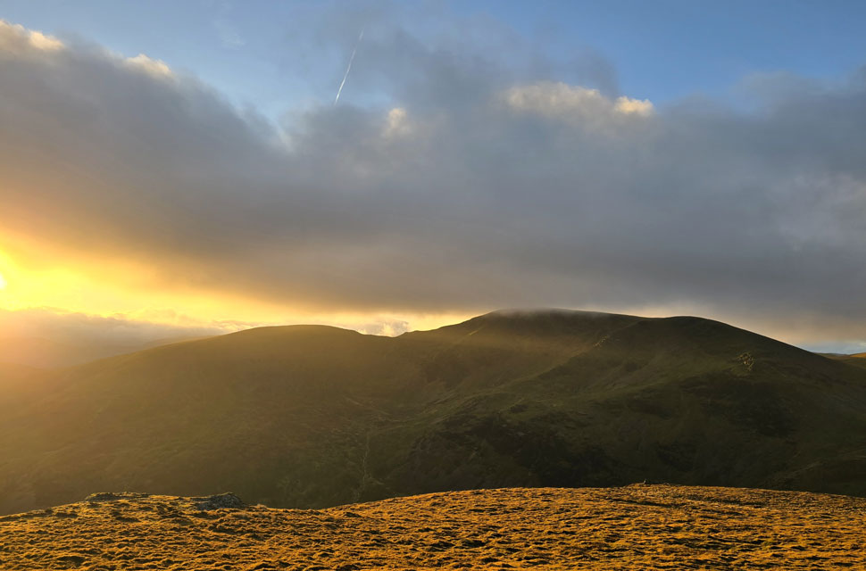
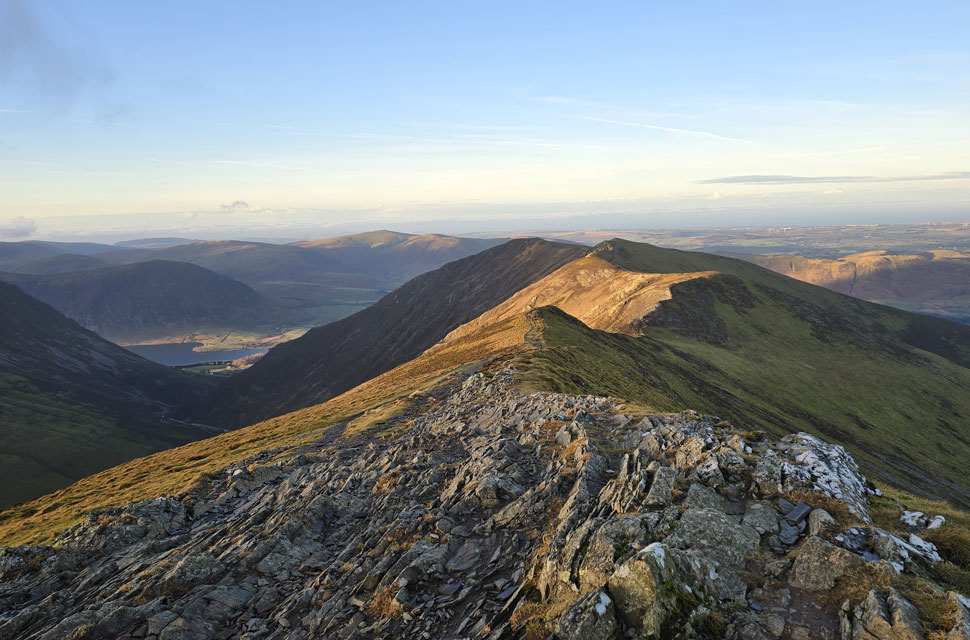
| A distant cloud topped Skiddaw and Blencathra from Sail summit. |
| Sail marked the last ascent of the morning, arriving in pleasant sunshine and somewhat less wind too. |
 |
| The Eastern fells from Clough Head through to Nab Scar are below a sea of cloud that hasn't broke all morning. |
| Just in case you were wondering that's Ard Crags in the foreground. |
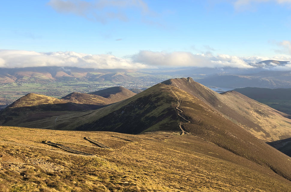 |
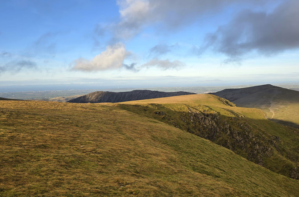
| Descending Sail. |
| With Views of Scar Crags, Causey Pike, Outerside, Stile End and Barrow. That's Sail Pass below where I'll hook a left and begin my descent into Coledale. |
 |
| Cloud Topped Skidda. |
| |
 |
| Descending Sail Pass with views of Outerside. |
| It's been ages since I last used Sail Pass which goes on to to join the top of Stoneycroft Gill but I fork left onto a grassy trod at the base of the crags seen right. |
 |
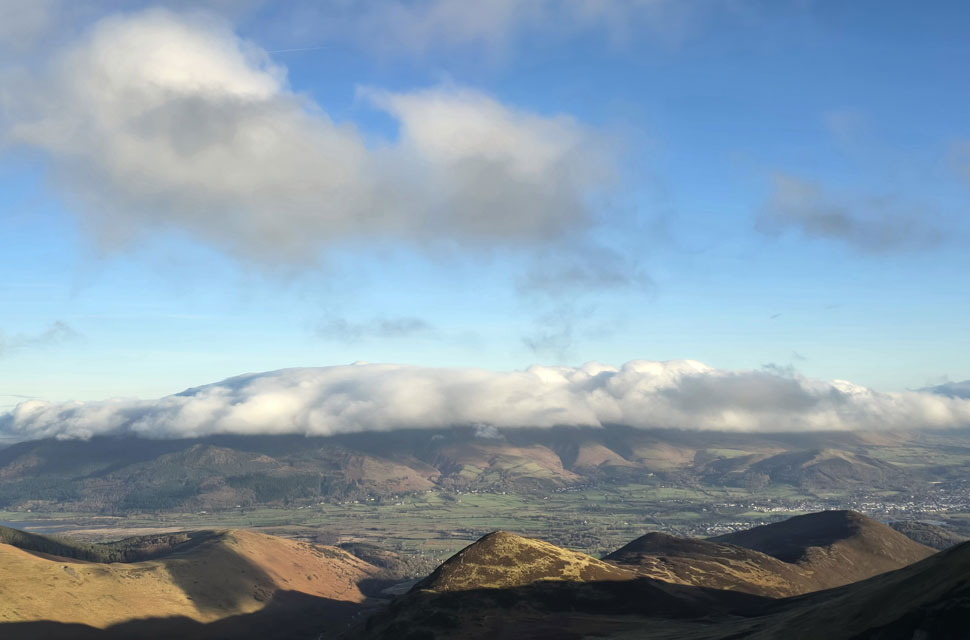
| Skiddaw and Latrigg from Coledale. |
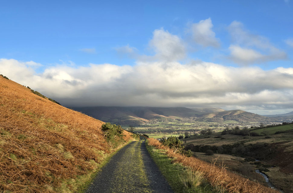
The moment I began my descent on Sail Pass, all went quiet, and for the first time, my gloved hands felt clammy, so I removed them to reveal hands like they'd been in the bath too long. The cool air did a great job of returning them to normal, gripping my pole handles over what can only be described as a fabulous descent. I soon arrived at the fork in the path where I turned left and began my descent into Coledale, the silence now overpowered by Low Force falls below Force Crag. I was descending into shade, and the temperature drop was felt before arriving at Coledale Beck, which I crossed to the amusement of three onlookers via four stepping stones, all but one, submerged.
The path rose onto the old mine track, my calves felt the strain easing in line with my lungs as I arrived at the track, knowing full well what a pleasant two-mile walk I had ahead of me. Two of the onlookers from Coledale Beck tailed me, but I broke away, bridging some distance between us, and it felt like I had Coledale to myself. Accompanied by the sound of Coledale Beck to my right, I took in those two miles at my own pace before spotting a pair of Kestrels one hundred yards apart and sixty feet above the dead bracken heads fixed on their next meal, but after several minutes watching I lost sight of them as the track swerved north towards the car park. |
|
| |
| Back to top |
 |
|