|
Fairfield from Patterdale |
 |
 |
14th February 2026 |
 |
|
|
| |
|
Overview |
|
|
| Ascent: |
3,256 Feet - 992 Metres |
| Wainwrights: |
4, Arnison Crag - Birks - St Sunday Crag - Fairfield |
| Visiting: |
Cofa Pike |
| Weather: |
Extensive Sunshine With Moderate Winds Across The Summits. Highs of 4°C Lows of -3°C Feels Like -7°C |
| Parking: |
Patterdale Village |
| Area: |
Eastern |
| Miles: |
9.5 |
| Walking With: |
On My Own |
| Ordnance Survey: |
OL5 |
| Time Taken: |
6 Hours 40 Minutes |
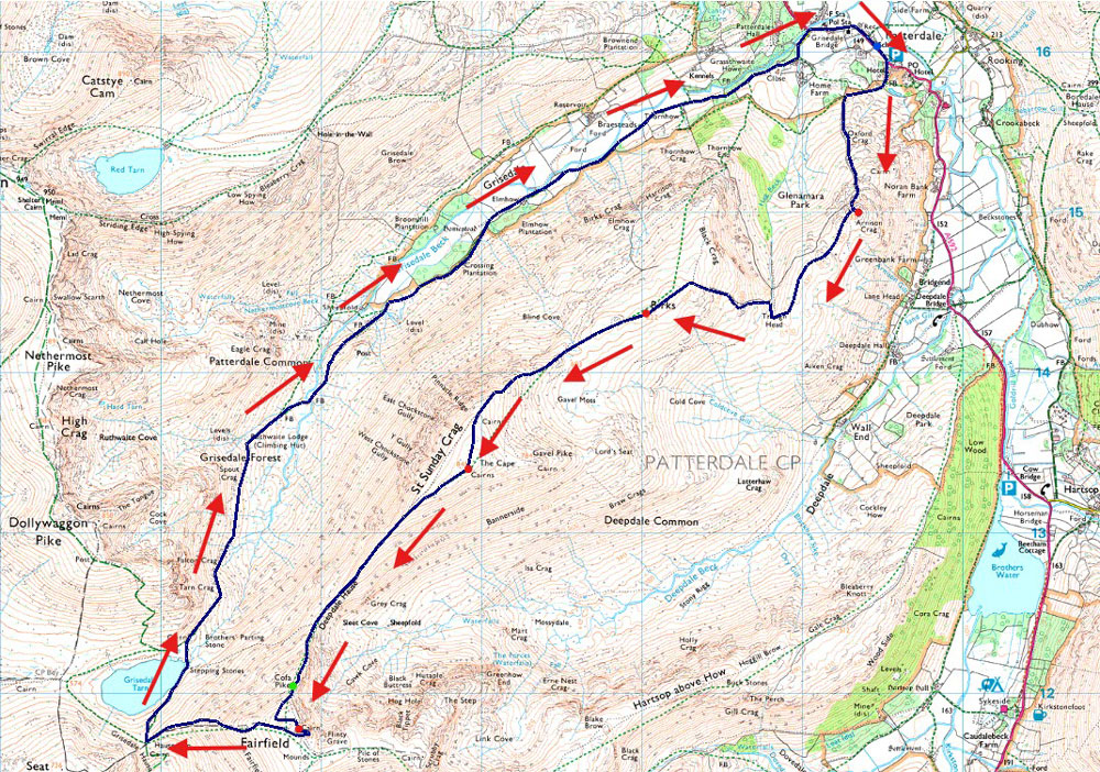
| Route: |
Patterdale - Arnison Crag - Trough Head - Birks - St Sunday Crag - Deepdale Hause - Cofa Pike - Fairfield - Hause Gap - Grisedale Tarn - Grisedale - Ruthwaite Lodge - Elmhow - Patterdale |
|
| |
|
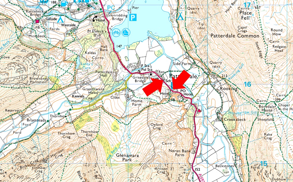
Parking Details and Map |
|
|
| Nearest Post Code: |
CA11 0NW |
| Grid Reference: |
White Lion Hotel - NY 395 315 - Patterdale Primary School NY 394 516 |
|
| |
|
Map and Photo Gallery |
|
|
 |
| |
 |
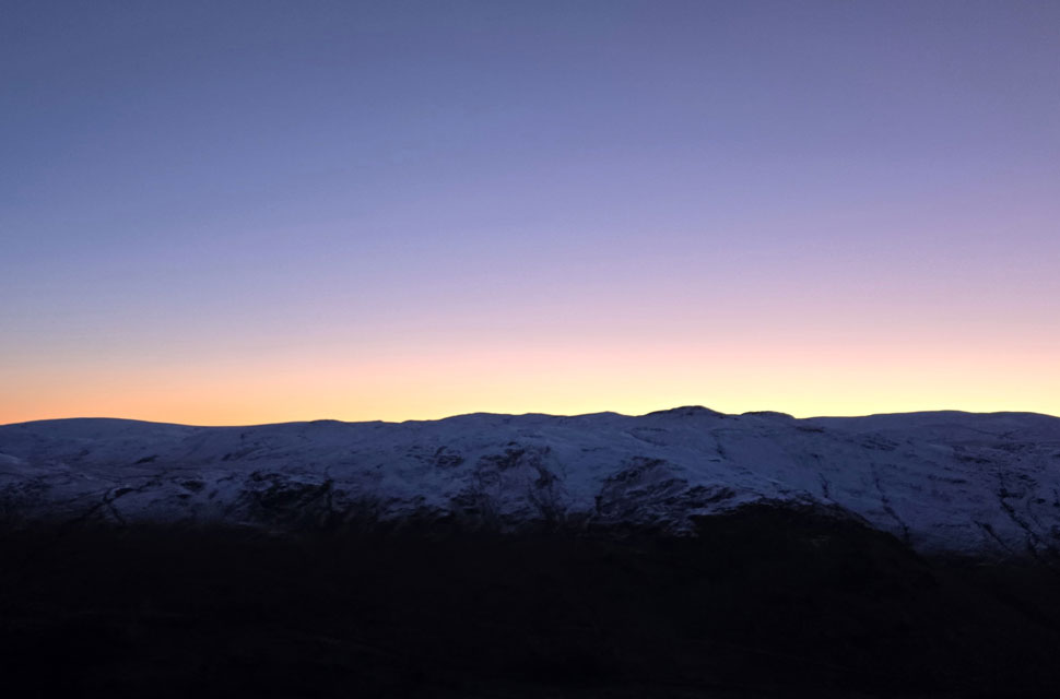
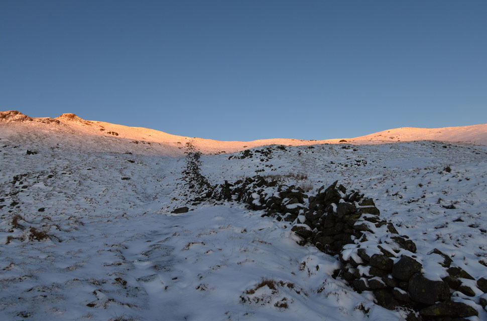
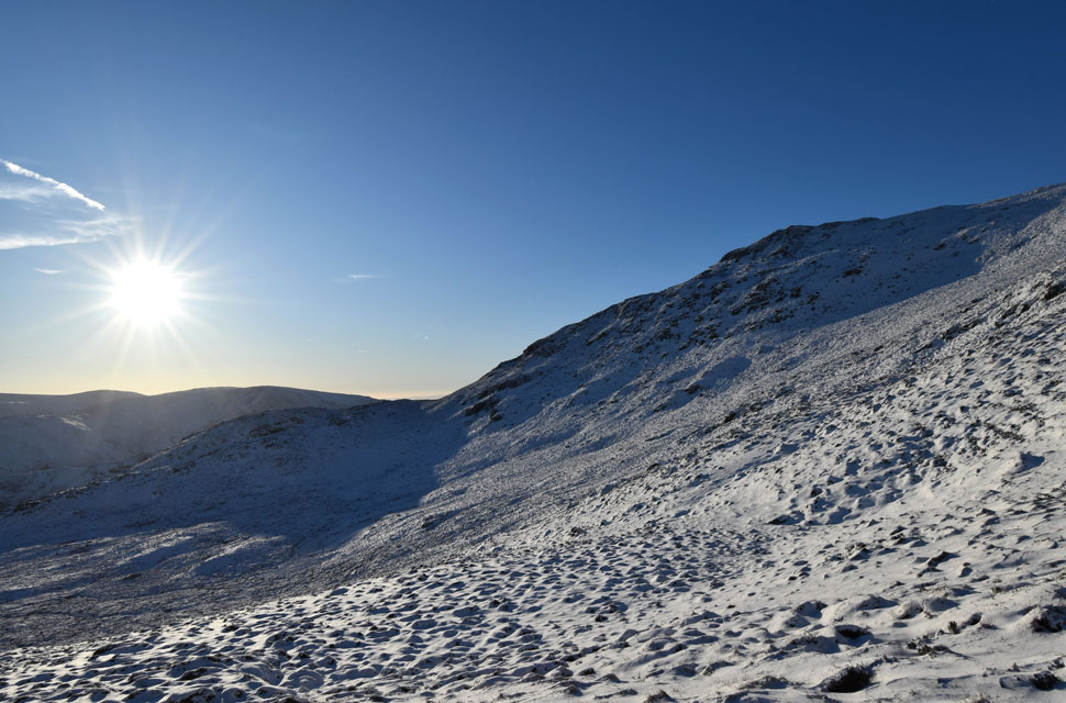
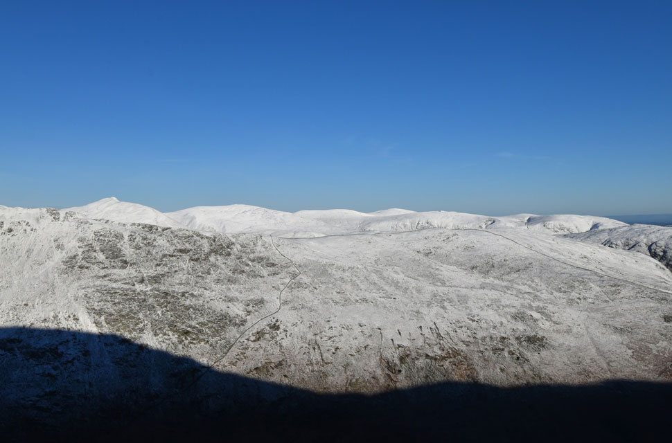
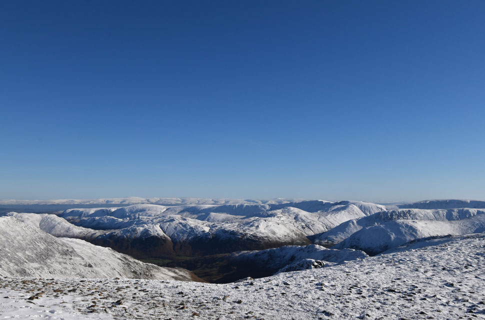
| Views over Patterdale towards Glenridding and Ullswater from the ascent of Arnison Crag -3°C 6:50am |
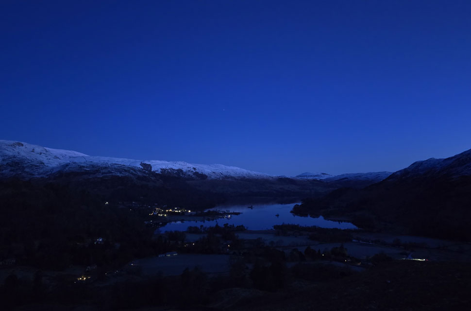
| It had been a solid three weeks since I last walked in Lakeland, a mix of bad weather and a weekend out with friends keeping me away and in that time the fells had endured day after day of low cloud and rain falling as snow over high ground. A brief rise in summit temperatures brought a short-lived thaw, only for another cold snap to sweep in, dropping fresh snow as low as 1,000 ft and down to ground level further east. Then, at last, a band of high pressure arrived for Saturday. After weeks of gloom, we were finally promised a day of winter sunshine before the window closed again. Opportunities like that are rare, and I grabbed this one with both hands. Rod would be following my route later with Michael, though it was doubtful our paths would cross. Still, I told him to keep an eye out for a bright red jacket moving somewhere across the skyline. With sunrise creeping earlier each week, my dawn walks are coming to an end, and I've drawn the line at setting my alarm any earlier than 3:00am It wouldn't have been quite so punishing had Kirkstone Pass not been closed due to a landslip forcing a detour to Penrith before dropping south to Patterdale but that's by-the-by now. I left home after defrosting the car and arrived in Patterdale under starry skies and a hard frost. It was 6:10am The plan was to set off by 6:30am so I lingered in the warmth of the car for a few minutes a decision that, in hindsight, cost me the sunrise from Birks summit, but more on that later.
With snow and ice forecast over high ground, I kitted up in full winter gear, adding micro-spikes, crampons, and my ice axe to the pack, which landed on my back with a thud. My Osprey pack does a fine job of distributing weight, but it still felt like carrying a six year old on my shoulders. At exactly 6:20am I locked the car and set off. Not a sound stirred as I walked the white lines toward Patterdale Hotel, its gable lit by a single floodlight. The guests were no doubt still asleep as I passed through the grounds to the gate at the rear which opened onto the frozen track leading into Glenamara Park. Within minutes I'd stepped into the darkness, the kind that takes a moment to settle into so I stopped, switched off my head torch, and let my eyes adjust. Boredale Hause stood silhouetted to the east and the lights of Glenridding glowed brightly to the north. After a minute I flicked the torch back on and continued along the track, dodging frozen puddles where I could. Soon I reached a wall broken by a gated stile, the point where the ascent of Arnison Crag began. |
 |
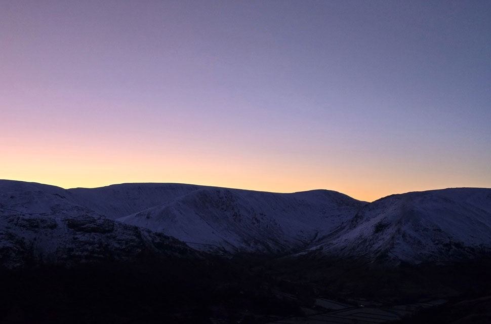
| Place Fell from Arnison Crag summit 7:07am |
| A hard frost crunched beneath my feet, the perfect soundtrack to my return. Beyond the wall I caught sight of the higher stretch of stonework above Trough Head on the east flank of Birks. That wall climbs steeply onto Birks grassy summit plateau - a route I've often descended, but today would be my first time tackling it in reverse. I wasn't dreading it, exactly, but I knew it would be a lung-buster all the more so after the recent heavy snowfall. |
 |
| Dawn unfolds. |
| With Angletarn Pikes seen foreground. |
 |
| Dawn views towards Caudale Moor, Gray Crag, Thornthwaite Crag, Red Screes and Middle Dodd from Arnison Crag summit. |
| By leaving Patterdale at 6:20am I'd given myself a bit of a dilemma. If I left Arnison Crag now, I'd have just over half an hour to reach the summit of Birks, a neon-impossible task, yet lingering here felt like I was wasting time on what was already a big day ahead. |
 |
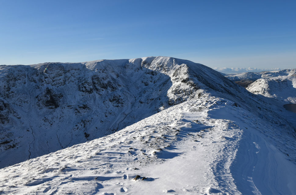
| Lord's Seat, Gavel Pike, St Sunday Crag and Birks seen beyond Trough Head 7:09am |
| The stone wall I was referring to can be seen on the left side of the photo rising right onto Birks summit but first I traverse left before descending over Trough Head. |
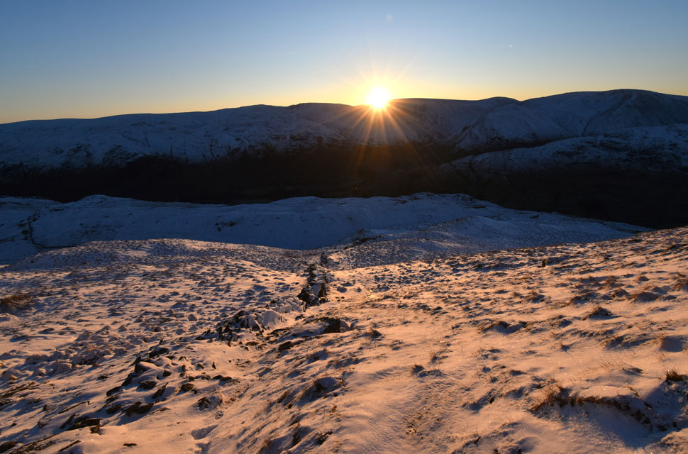 |
| Sun rising over Gray Crag 7:57am |
| I knew it was a race against time to be at Birks summit by sunrise, beginning my ascent from the depths of Trough Head at 7:37am. By the time golden hour arrived, I was less than a hundred and fifty feet from the summit plateau but totally knackered after I'd given the ascent everything I had whilst blazing trail through soft snow and drift. |
 |
| Golden hour arrives. |
| By the time the sun finally crested the far eastern fells behind me, I was still on the incline, the summit plateau holding its place on the horizon while at the same time I was overcome with deflation. |
 |
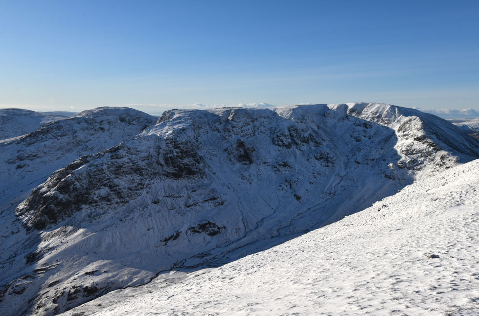
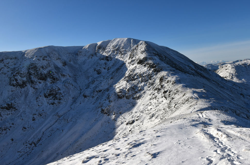
| Birks, Hart Crag, Lord's Seat, Gavel Pike, St Sunday Crag and Dollywaggon Pike from the cairn atop Trough Head on Birks. |
| To my dismay I had watched the pink hue of the sunrise douse Hart Crag and Gavel Pike from my ascent, but by the time I had arrived at the cairn marking the Trough Head path, the hue had been replaced by direct sunlight. Damn and blast my bad timing, but I drew a line under it straight away and got on with enjoying the walk. |
 |
| Gavel Pike, St Sunday Crag, Dollywaggon Pike and Nethermost Pike from just below Birks summit. |
| I gathered myself as best I could before breaking trail through soft snow that shifted from just a dusting to drifts that swallowed my legs below the knee. |
 |
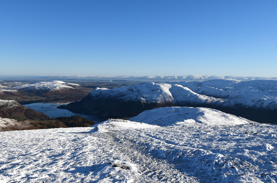
| Looking back on Birks with Ullswater and Place Fell seen left. |
| There was more substantial snow drift as I descended Birks and crossed the col above Blind Cove where I expected the frozen bog to give way but the hard snow held firm before I began my ascent on St Sunday Crag proper. |
 |
| Views towards Caudale Moor, Thornthwaite Crag, Lord's Seat and Gavel Pike. |
| Despite a glaring sun, where exposed I was met with a biting wind and sudden drop in temperature. |
 |
| Looking back on a winter wonderland. |
| The biggest question of all was, where was everyone? Not that I'm complaining mind. |
 |
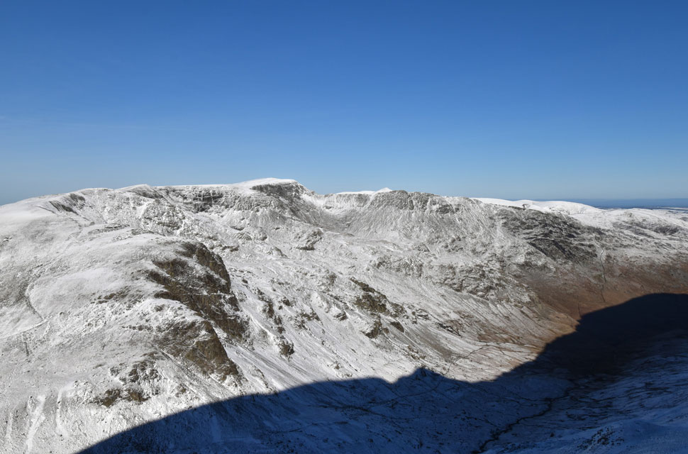
| Views over the Grisedale Valley towards Dollwaggon Pike, Nethermost Pike, Helvellyn, Striding Edge, Catstye Cam and White Side. |
| By now I was not only wading through deep drifts on the ascent but encountering rime ice as well, so for the first time since buying them over three years ago, I stopped beside a large boulder to fit my Grivel micro-spikes. |
 |
| Snow, blue sky and sunshine. |
| |
 |
| More winter wonderland views towards... |
| ...Catstye Cam, White Side, Raise, Stybarrow Dodd, White Stones, Great Dodd and Hart Side. |
 |
| From the summit shoulder I stopped to look back on the view. |
| It's incredible to think that there hasn't been a dry day somewhere in the whole of the UK since 2026 began and tomorrow, the rain is set to return. |
 |
| I left the path and walked off-piste towards the summit. |
| |
 |
| The Far Eastern Fells from St Sunday Crag summit. |
| Having blazed trail through fresh snow from Trough Head through to St Sunday Crag summit I still hadn't encountered, or seen anyone on the fells which was bloody bonkers given the perfect conditions. |
 |
| A wide angle view over the Deepdale Valley towards Dove Crag, Hart Crag and Fairfield from St Sunday Crag summit. |
| With Link Cove, Greenhow End, The Step, Gawk Cove and Cofa Pike seen foreground. |
 |
| Looking back on St Sunday Crag summit. |
| As I begin my descent towards Deepdale Hause. |
 |
| Views towards Deepdale Hause, Fairfield, Cofa Pike, Seat Sandal and Grisedale Tarn. |
| I had encountered more soft, deep powdery snow during my descent, the good news was I no longer blazing trail and instead ploughing through it. |
 |
| Views over Grisedale towards Seat Sandal, Grisedale Tarn, Dollywaggon Pike and High Crag above Ruthwaite Cove. |
| The vast crags on the east flanks of Dollywagon Pike are Tarn Crag and Falcon Crag with The Tongue ridge in sunshine towards the right. |
 |
| Approaching Deepdale Hause. |
| It was around this point that my nerves stirred, awakened by the looming ascent of Cofa Pike ahead. |
 |
| Cofa Pike and Fairfield seen above Deepdale Hause. |
| Stunning winter mountain scenery - above all else, it does a person good to stop for a moment and take it all in. |
 |
| Looking across Deepdale Hause towards St Sunday Crag. |
| I knew at some point that I would have to trade my walking poles for the ice axe some time soon. |
 |
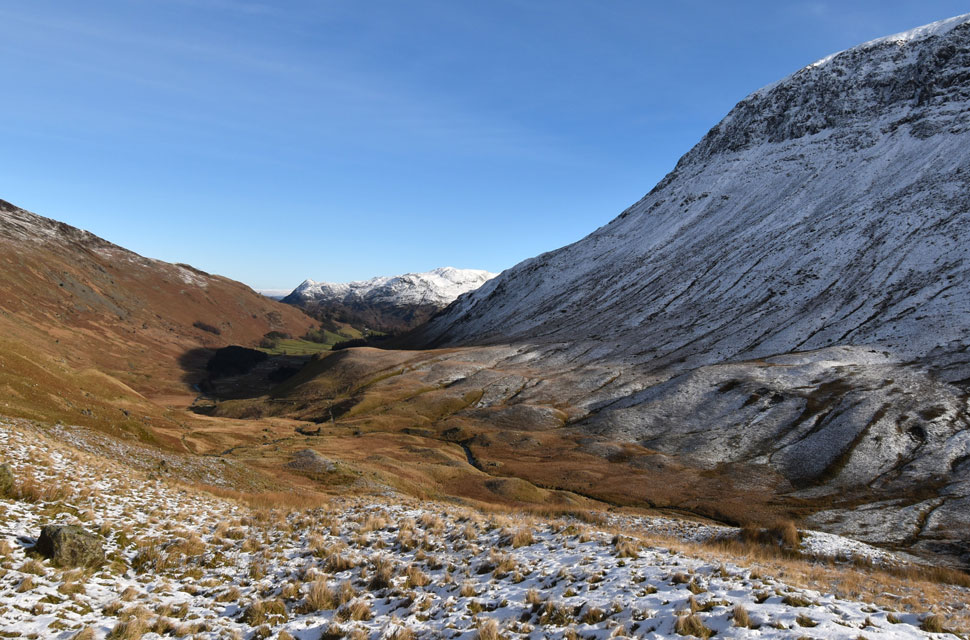
| Glorious Deepdale. |
| With the Far Eastern Fells in the distance. |
 |
| Time to get the ice axe out. |
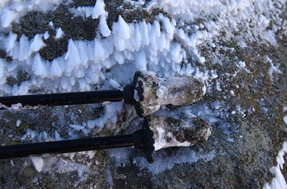
| If ever I needed the hint to get my ice axe out it was the moment the tips of my walking poles had balled-up so hard the ice had set like concrete. |
 |
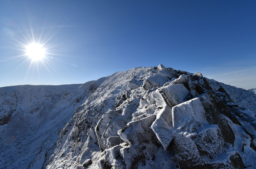
| Onwards and upwards. |
| Just like Striding Edge and Swirral Edge on Helvellyn would be; the ascent on Cofa Pike had to be treated with care, confidence and the ability to know when to turn back should the conditions turn against me. Cofa Pike was in full winter condition. |
 |
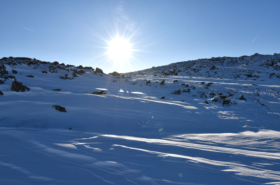
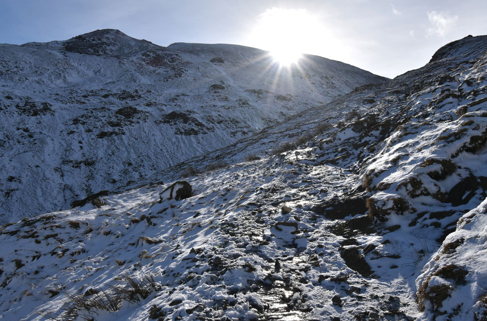
| Views down from my ascent. |
| I did consider swapping my micro-spikes for full crampons, but they were handling the rime covered rock well enough, so I stuck with them. |
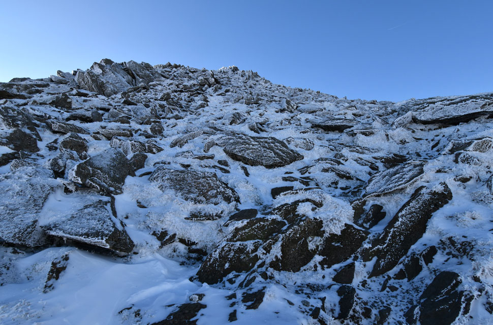 |
| Full winter terrain. |
| |
 |
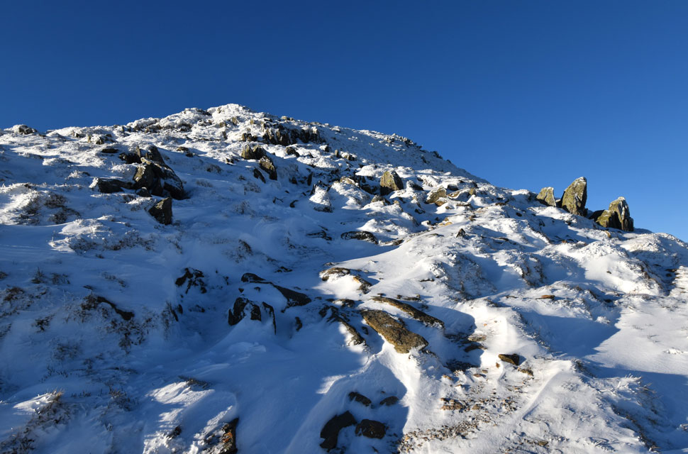
| Almost there. |
| It was from here I spotted the first walker I'd seen all morning having ascended from Grisedale Tarn to Deepdale Hause before beginning his ascent on Cofa Pike. |
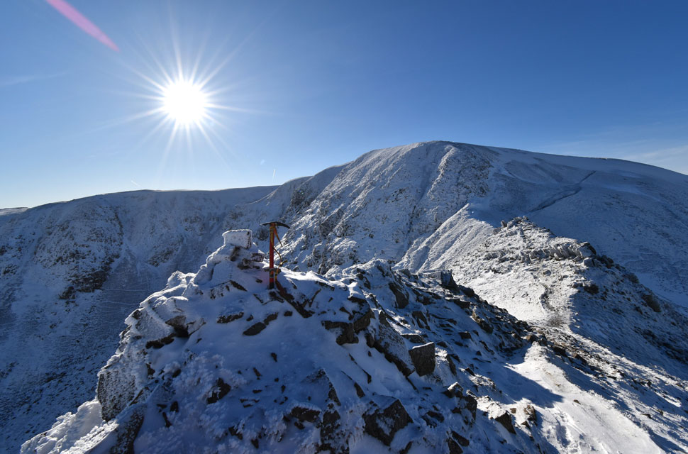 |
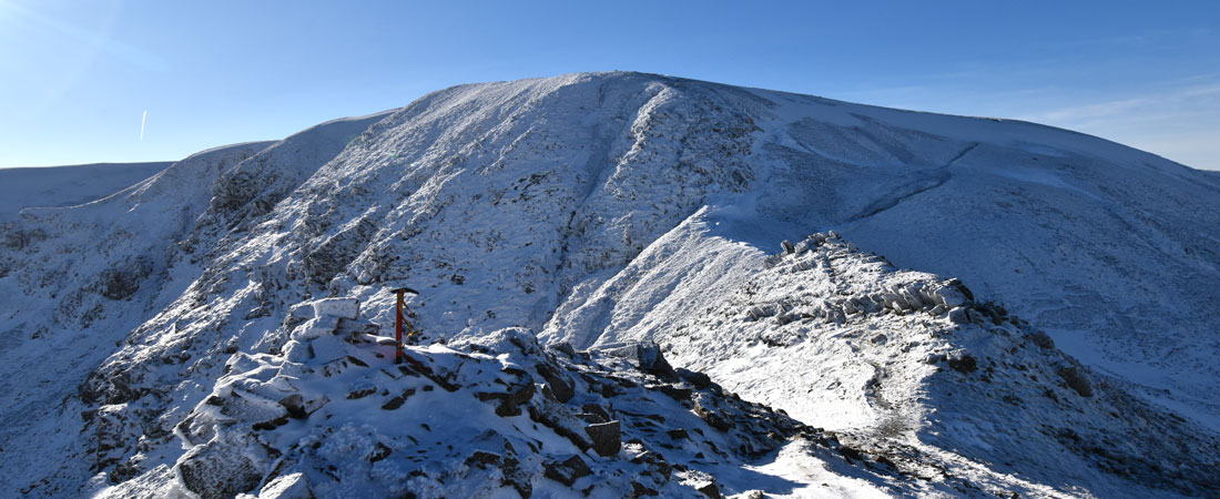
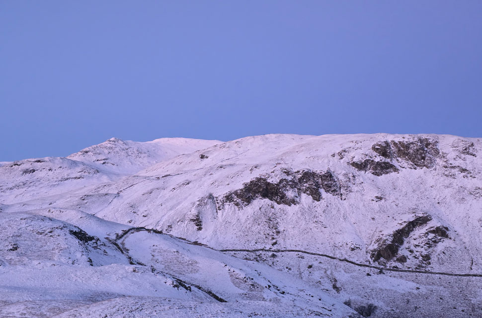
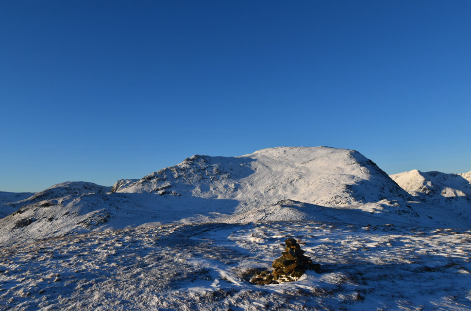
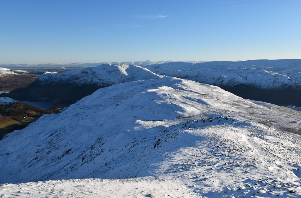
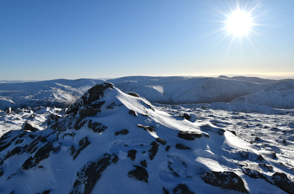
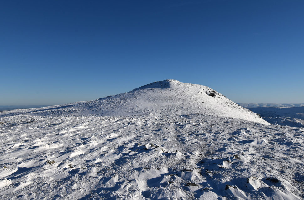
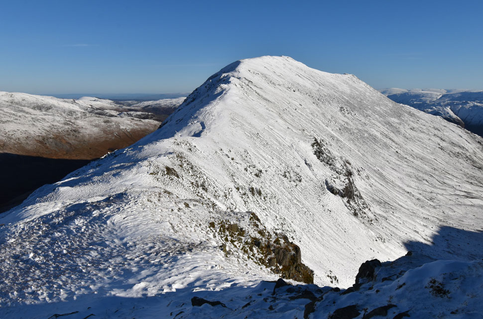
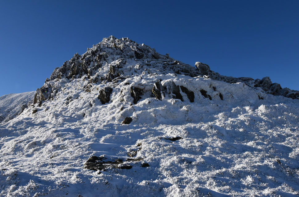
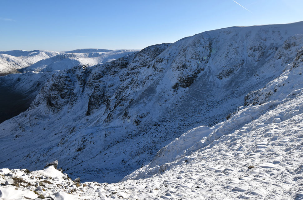
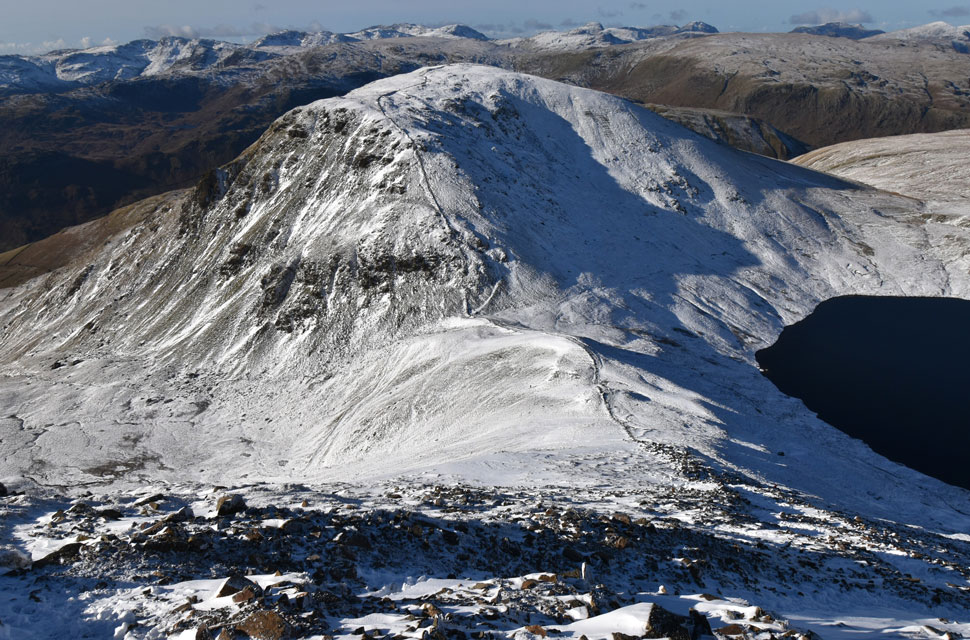
| Fairfield from Cofa Pike summit. |
| I soon topped out on Cofa Pike, slid my ice axe into a handy gap in the summit cairn and rewarded myself with a quick summit photo. Axe retrieved, I stepped back to the spot from the previous shot and let myself take it all in until the sound of spikes on rock made me turn. A young girl in a down jacket was picking her way up, reaching out with her axe to tap the summit. "Hello," I nodded. She offered a quiet "morning," and I sensed she wanted her own moment up there. Fair enough. I left her to it. |
 |
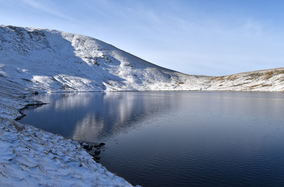
| Looking down on Grisedale Tarn and Seat Sandal from Cofa Pike. |
| |
 |
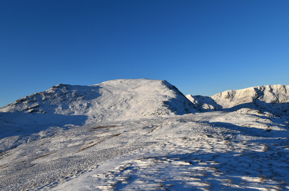
| Fairfield ahead. |
| There is a path that winds its way through the summit crags directly ahead, but I'll be using the much safer path seen towards the right. The path passes below the shoulder, then heads directly onto the summit passing over the frozen patch of snow you can see where my micro-spikes and ice axe definitely came in handy. |
 |
| 'Life in the old dog yet' |
| It reminded me of the time David and I came up through Cawk Cove, topping out at this very spot back in July 2024. That was the day he found his sweet spot and left me for dead, powering up to the col like he had two jet engines strapped to his back. "Life in the old dog yet," was all I got when I finally hauled myself onto the col. |
 |
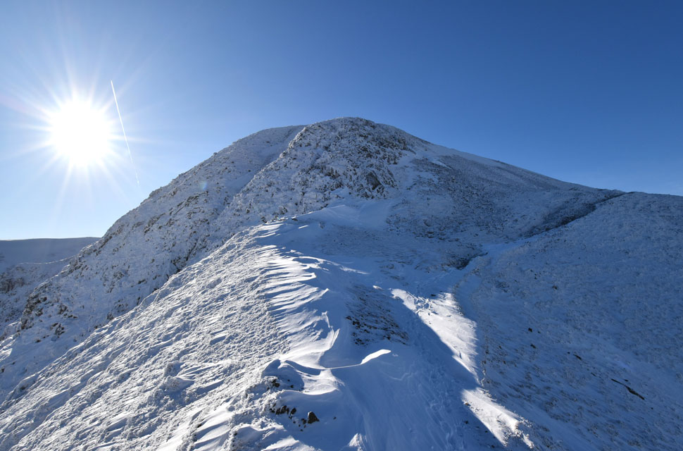
| Almost at Fairfield summit. |
| Time for a few moments to enjoy my surroundings before I join the crowds at Fairfield summit. |
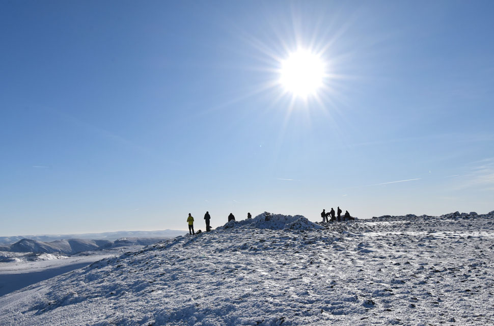 |
| Fairfield summit. |
| Leaving Cofa Pike behind, I took the right fork and followed the path as it swung left, soon arriving at the patch of frozen snow I'd spotted earlier from Cofa. The slope sat at an awkward angle, so before committing I gave the ice a sharp blow with my axe, the pick biting a solid inch into the pack. Beyond the frozen section I could see where the path re-emerged, so I went for it moving with purpose yet feeling as if I were walking a tightrope. It was one of those moments when you put full trust in your experience and your gear.
I reached the far side of the ice without issue and continued onto the summit plateau, passing a couple with a Cairn Terrier trotting between them. The sight of it made me think of Brad and Holly back home, probably on their sixth nap of the morning, waiting for Dad to get home so they could drag him out for a walk later. |
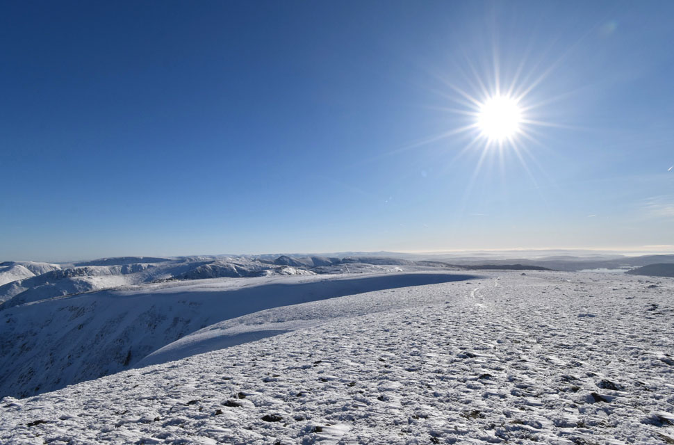 |
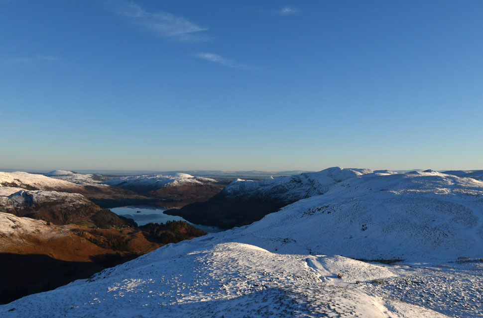
| Superb views South. |
| It was a tad windy at the summit but still comfortable to sit around in, which is what most folk were doing, including a group of Norwegians I passed at the summit shelter. |
 |
| Views East from Fairfield summit. |
| Too many fells to mention but I'll let you guess which direction my eyes were aimed at. |
 |
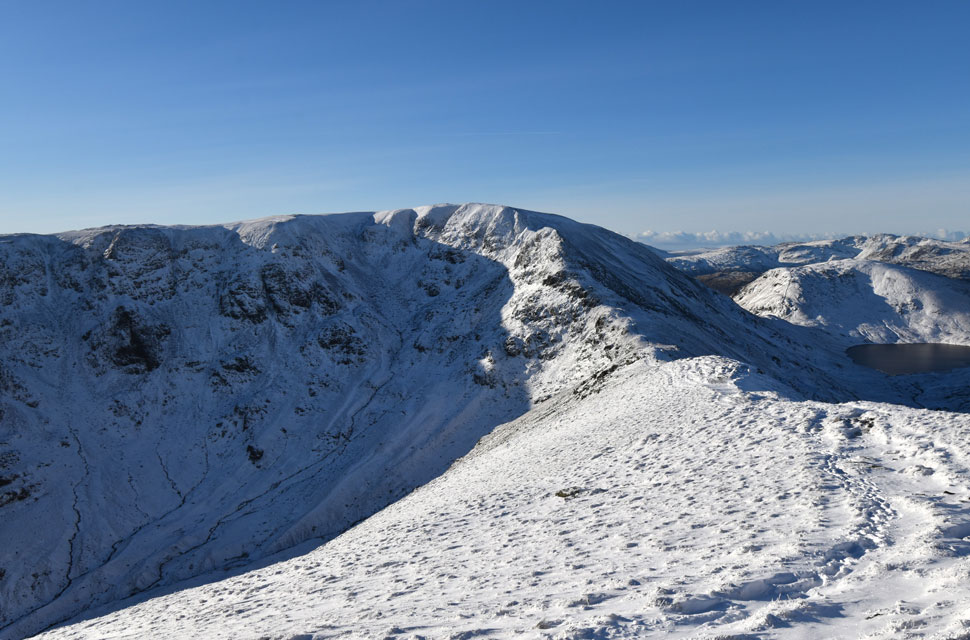
| Dollywaggon Pike, High Crag, Nethermost Pike, Helvellyn and Striding Edge from the descent of Fairfield. |
| |
 |
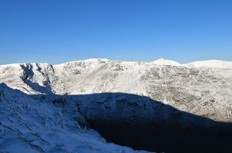
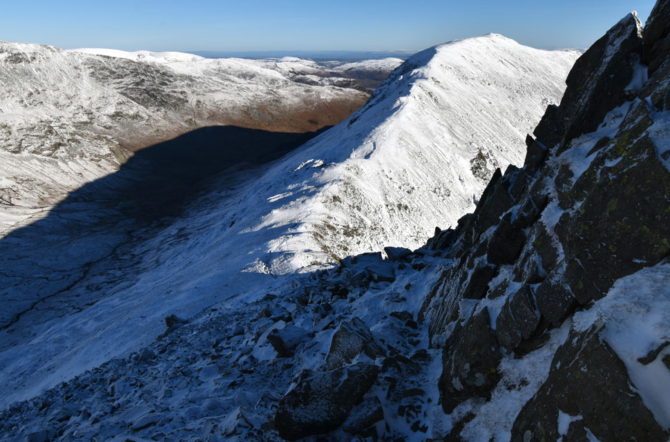
| Seat Sandal and Grisedale Tarn from the descent of Fairfield. |
| I was still encountering drifts during the upper part of my descent, which again varied between knee-deep and just a couple of centimetres in depth. By now I was passing quite a few folk in ascent, including one woman who told me she'd set off from Dunmail Raise and didn't really want to come down the same way, so I suggested that she descend partially to Cofa Pike, then head south to link back up with this path, soon after which she said she may give it a try. |
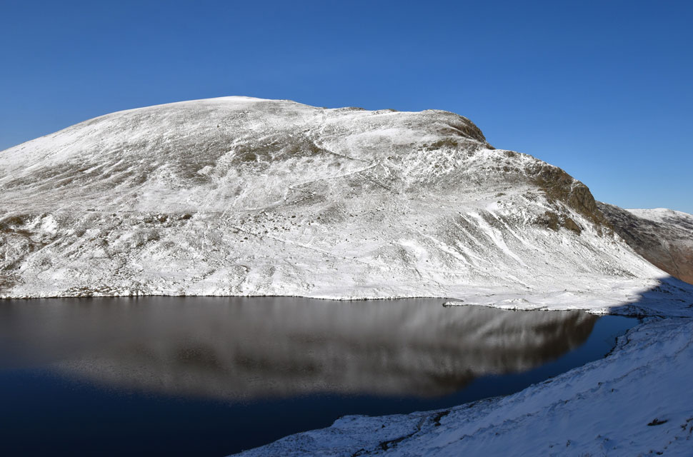 |
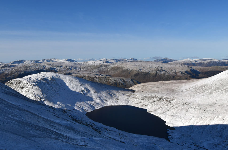
| Dollywaggon Pike reflecting in Grisedale Tarn. |
| |
 |
| Grisedale Tarn. |
| With Seat Sandal beyond. |
 |
| Beginning my descent through the Grisedale Valley. |
| |
 |
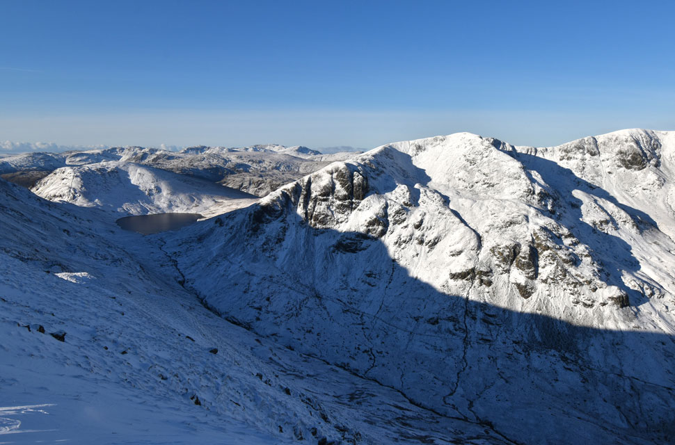
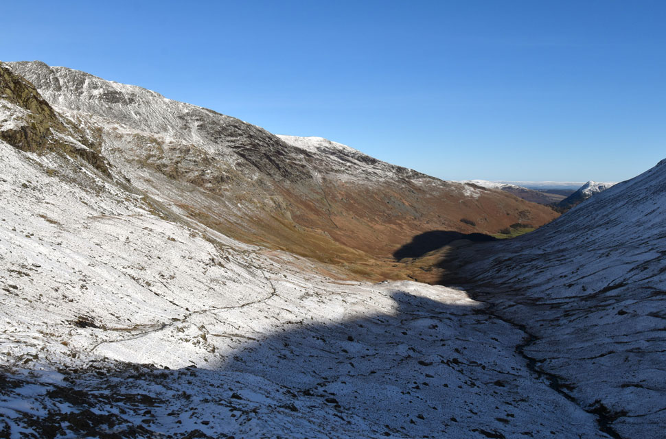
| Looking back in Cofa Pike and St Sunday Crag from the Grisedale Valley. |
| Despite a severe drop in height the path was still glazed in verglas and remained that way until Ruthwaite Lodge was reached. |
 |
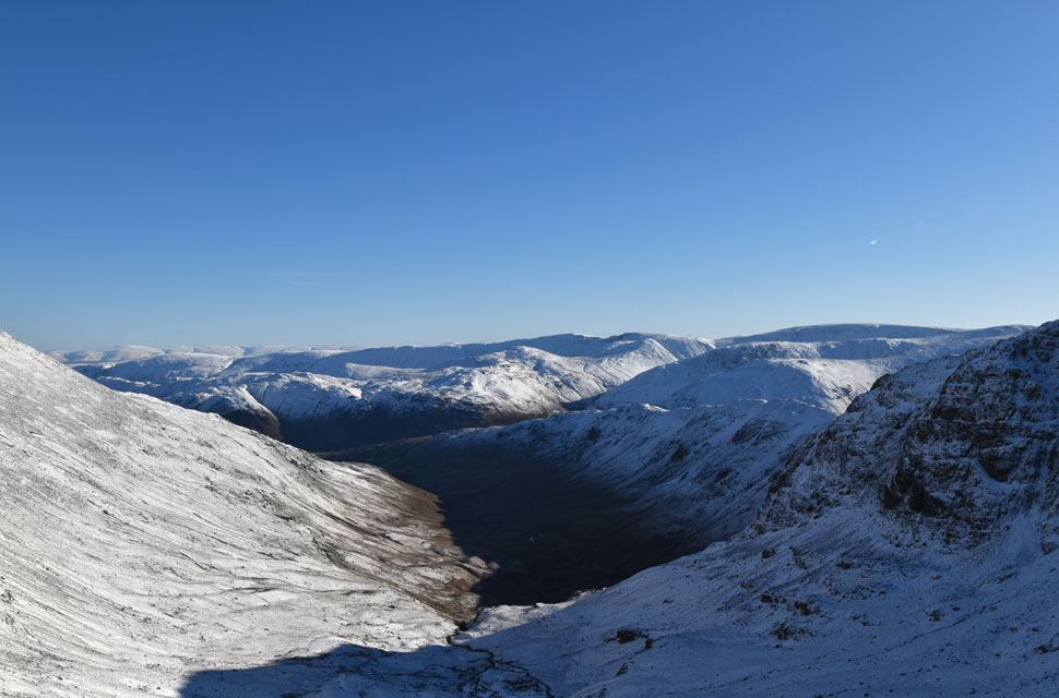
| Views through the Grisedale Valley. |
The descent from Fairfield had been relatively quick, and once I reached the stone staircase I hooked a right and began to flank Grisedale Tarn, still amazed at how quiet the place was. The path along the eastern shore was coated in thick ice and there was no let-up until I reached the outflow, where I dipped the tips of my poles into the water in a half-hearted attempt to free them from the ice. It would take a while. I'd followed a solo walker around the tarn, and by now she'd settled among a cluster of boulders, sipping from a flask in the midday sun. For a moment I wondered if I should stop too, if only to take on some fuel, but when I'm walking solo I prefer to keep moving. So I left the outflow behind and began the long descent toward Ruthwaite Lodge, encountering what felt like miles of of ice, bare rock, and repeat. I was still wearing the micro-spikes and told myself I'd only take them off once I reached the lodge, but the pain in the balls of my feet was becoming less than comfortable and the lodge couldn't come soon enough. I passed a couple who looked like they'd stepped straight off the front cover of a mountaineering magazine. They asked about my route, explained they were doing the same in reverse, and I spent the next five minutes answering questions about conditions in rapid fire fashion.
The couple thanked me warmly before continuing. Ruthwaite Lodge was deserted when I arrived, and I chose my throne, a good sized boulder on the gable end where I dropped my pack and finally removed the spikes. Left first, then right. The right calf tensed as I pulled but I managed to control it and tried again. No pain the second time. I stood to unclip my DSLR, only to lose my grip on it and Instinct kicked in: I flicked out my right foot like a footballer controlling a pass, the camera bouncing off my boot before dropping to the ground. The lens was caked in grassy dew, but the hood had taken the hit and a quick wipe with my neck gaiter had it gleaming again. I still had three miles to go, but at least the ice was behind me and I could curl my toes into the tips of my boots as I walked. In those three miles I passed two young lads near the footbridge over Grisedale Beck, and after that it felt like I had the whole valley to myself. The blue skies were fading, replaced by high white cloud that kept the temperature up as I made my way through the valley. When Grisedale Lane finally came into view, I turned around for a final look at Eagle Crag below Nethermost Cove, and above it, the last pale patch of blue sky lingering above Nethermost Pike. |
|
| |
| Back to top |
 |
|