|
A Mardale Head Circuit |
 |
 |
28th February 2026 |
 |
|
|
| |
|
Overview |
|
|
| Ascent: |
2,620 Feet - 799 Metres |
| Wainwrights: |
3, High Street - Mardale III Bell - Harter Fell (Mardale) |
| Visiting: |
Rough Crag |
| Weather: |
Calm & Overcast Throughout. Highs of 6°C Lows of 3°C Feels Like -2°C |
| Parking: |
Car Park, Mardale Head |
| Area: |
Far Eastern |
| Miles: |
7 |
| Walking With: |
Rod Hepplewhite |
| Ordnance Survey: |
OL5 |
| Time Taken: |
4 Hours 55 Minutes |
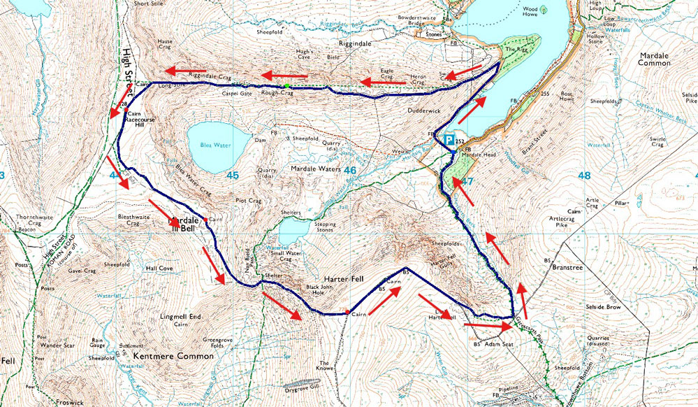
| Route: |
Mardale Head - The Rigg - Rough Crag - Caspel Gate - Long Stile - High Street - Mardale III Bell - Top of Nan Bield Pass - Harter Fell (Mardale) - Little Harter Fell - Top of Gatescarth Pass - Mardale Head |
|
| |
|
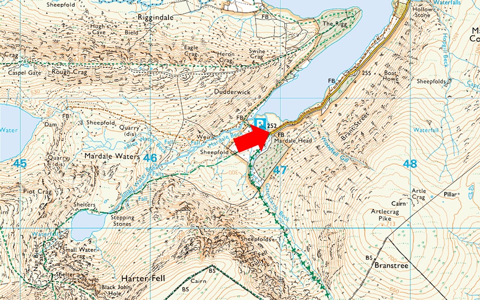
Parking Details and Map |
|
|
| Nearest Post Code: |
CA10 2QT |
| Grid Reference: |
NY 469 310 |
| Notes: |
Probably one of the most scenic car parks in Lakeland found at the head of the Mardale Valley offering easy access onto the High Street fells plus many more. The car park during Summer can fill up quickly but with most car parks in Lakeland if you time your arrival early enough you're always guaranteed a parking place. Parking is free. |
|
| |
|
Map and Photo Gallery |
|
|
 |
| |
| |
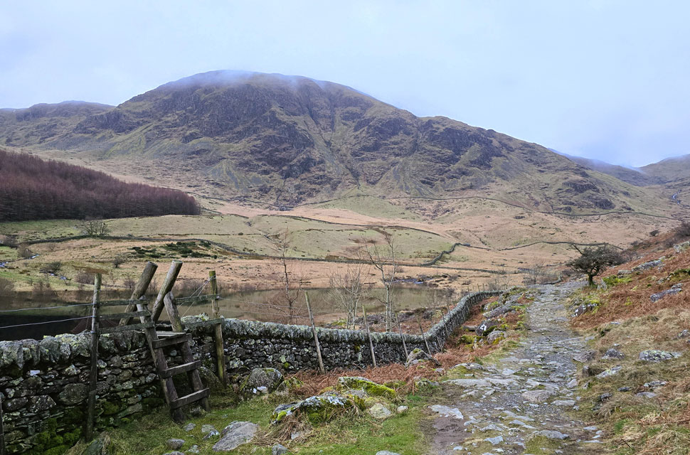 |
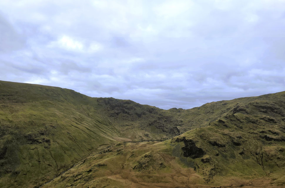
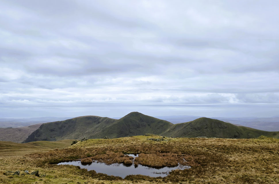
| Looking back on Harter Fell (Mardale) 3°C 6:55am |
It had been a reliable forecast all week promising intermittent sunshine on Saturday so it felt right to return to Haweswater for a circuit of Mardale Head. But by Saturday morning the outlook had shifted after a band of overnight rain had left a ceiling of high grey cloud, its density drifting between shades of dullness what photographers would call flat light. It wouldn't trouble the walk, but it certainly would the camera. With David walking with Kayleigh, Rod asked if I'd mind him joining me, and of course I didn't.
We arranged to meet at Mardale Head car park, which was still in darkness when I rolled up at around 6:25am. I cursed myself for leaving my headtorch at home, especially with sunrise not due until just after seven; I'd underestimated how dark it would be on arrival. After parking beside a 4x4 whose owner had just set off, I laced up at the side of the car, extended my poles and rested them against the side of the car before climbing back into the driver's seat to wait for Rod. Ten minutes later a pair of headlamps appeared on the road, and a few moments after that Rod pulled in beside me. It was around 6:40am, and by 6:50am both cars were locked and we were ready to set off. |
 |
| A distant Hare Shaw as we make our way towards The Rigg. |
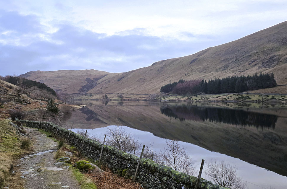
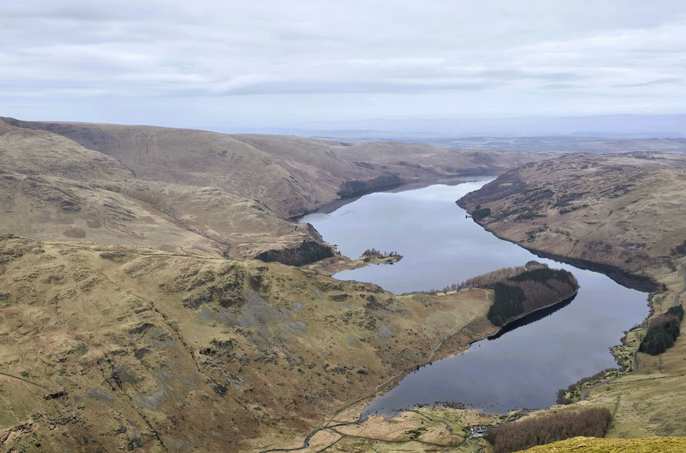
| It was an incredibly still morning, the air carrying just the faintest nip as we crossed Mardale Beck and joined the track along the western shore of Haweswater. In the half-light we could see the water level had returned to normal for the first time in a long while giving the reservoir a brooding, moody presence. |
 |
| Views into the Riggindale Valley. |
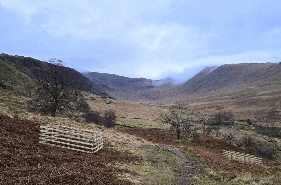
| We stuck to the main path avoiding the muddy short cut as far as The Rigg, where an incredible view opened into the Riggindale valley, the newly erected box-fencing visible in the foreground giving shelter to the freshly planted saplings. |
 |
| Looking back on The Rigg, Haweswater Rowantreethwaite Beck and Hare Shaw. |
| Taken from the stepped wall just below Heron Pike. |
 |
| Haweswater Reservoir from Eagle Crag summit. |
| We pushed on into the ascent and soon found ourselves standing atop Eagle Crag, pausing for a quick breather while taking in the calming views over Haweswater below. |
 |
| Views towards Small Water and the top of Nan Bield Pass. |
| We'll be over there later. |
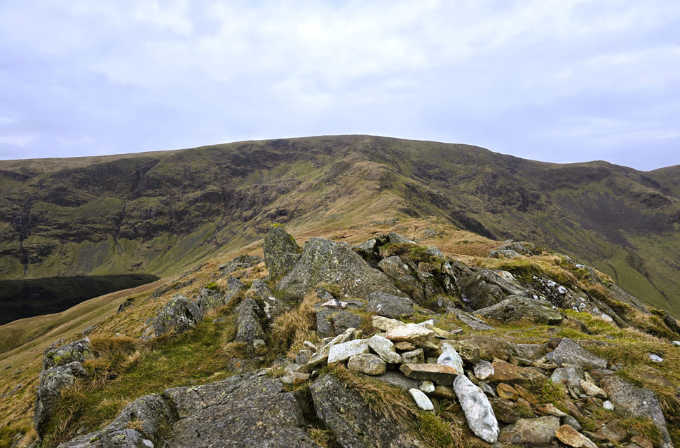 |
| High Street, Riggindale Crag and Long Stile from Rough Crag summit. |
| With Blea Water seen left and Short Stile at the head of the Riggindale Valley over on the right. |
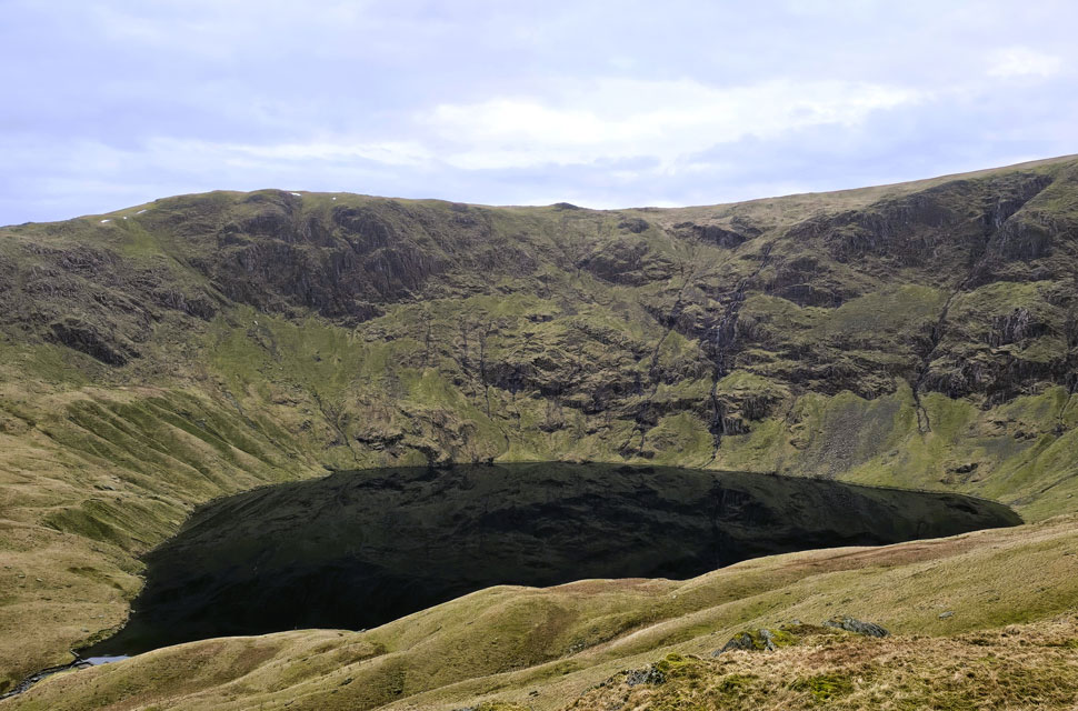 |
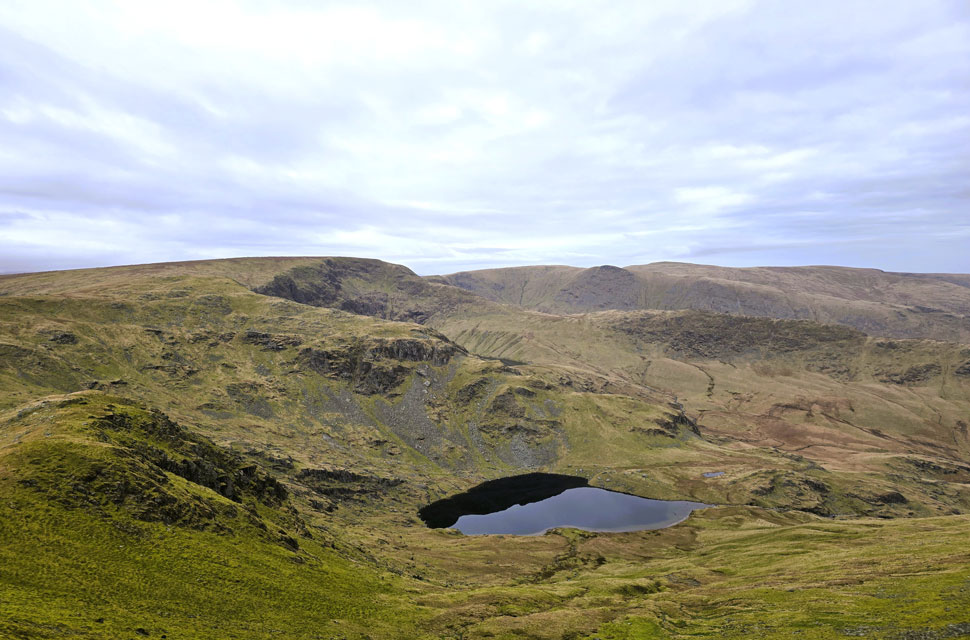
| A completely calm Blea Water. |
| Looking more like a mirror this morning rather than a high mountain tarn. |
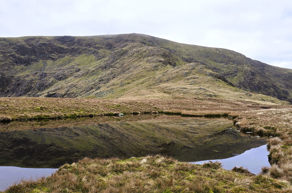 |
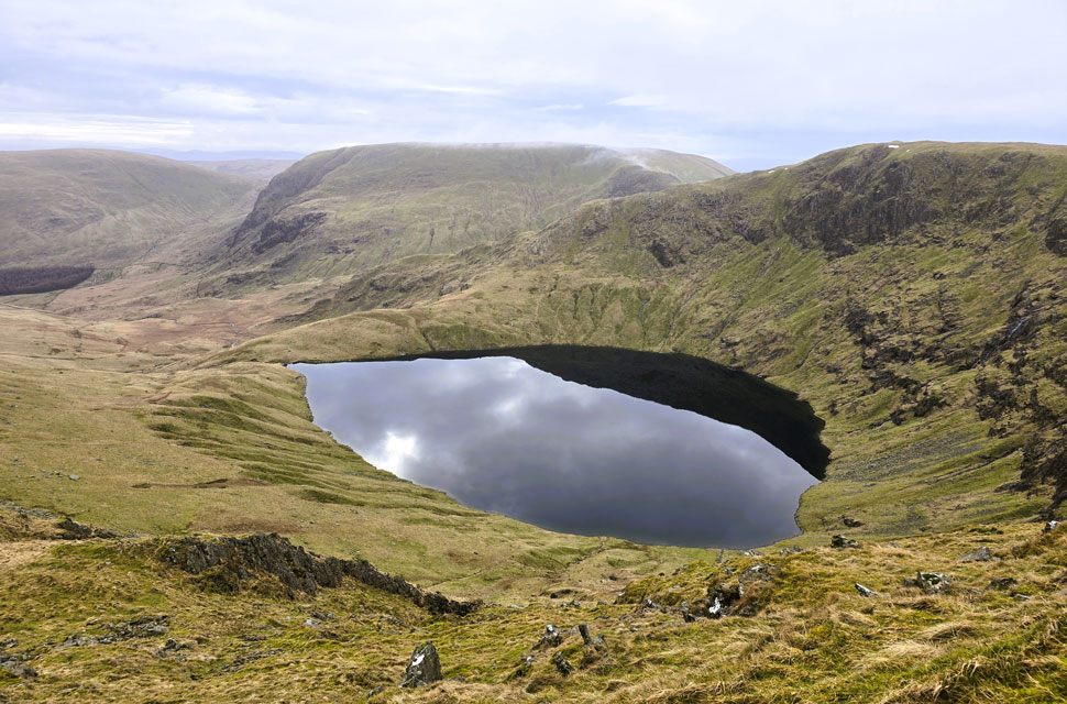
| Riggindale Crag and Long Stile reflections. |
| We descended towards Caspel Gate and soon reached the small, unnamed tarn better known as Caspel Gate Tarn. Here we paused to take in the still water and the reflections of Riggindale Crag across its surface. |
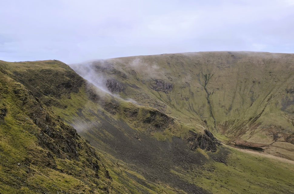 |
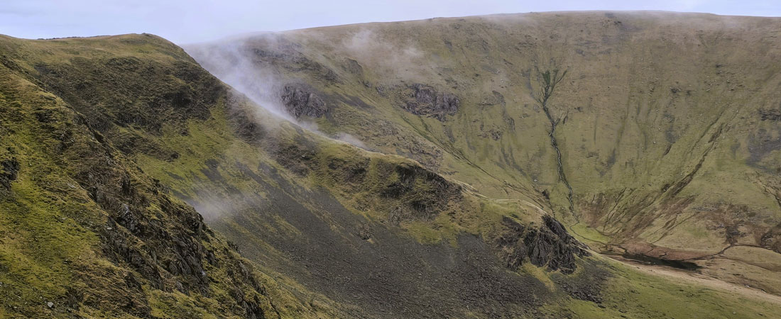
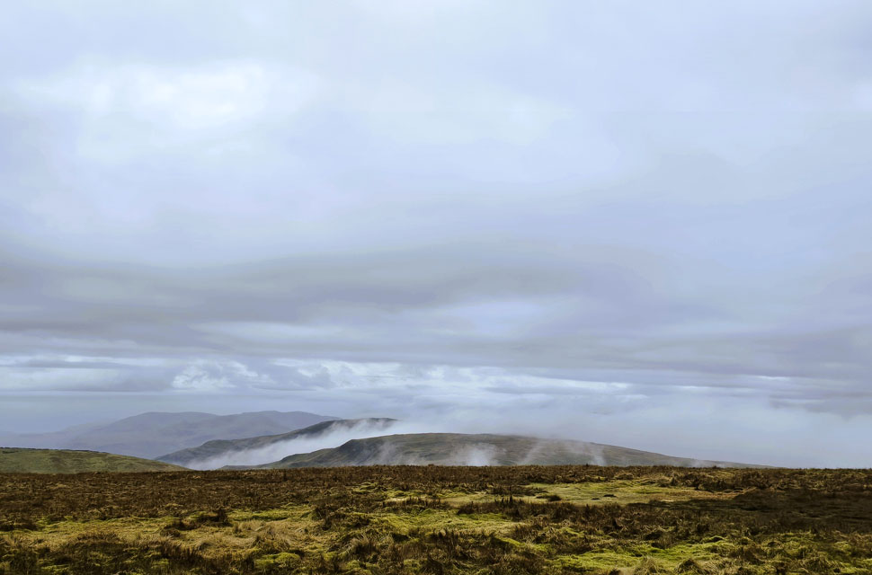
| Mist forming over Short Stile. |
| With more height gained we noticed mist was beginning to form over Short Stile - at first we thought this was just localised but a quick scan south confirmed mist was also forming over Harter Fell and indeed Kidsty Pike too. |
 |
| Views over Blea Water towards Mardale III Bell, Piot Crag and Harter Fell (Mardale) |
| As we climbed higher fresh banks of mist gathered over Kidsty Pike and Harter Fell in the distance too. |
 |
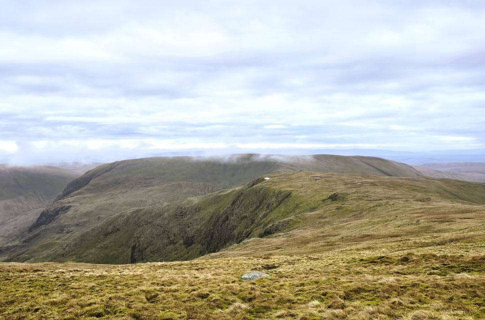
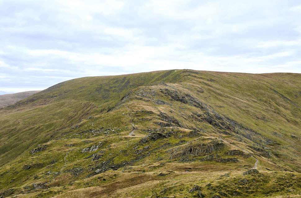
| Views back along the Rough Crag Ridge. |
| You can see the mist / low cloud drifting from the head of the valley. |
 |
| Two walkers at the summit of Kidsty Pike. |
| For all its atmosphere, the mist threatened to steal our visibility, yet as quickly as it formed it started to thin away. |
 |
| Rod reaching the top of Long Stile. |
| Rod probably won't thank me for revealing that he turns 65 at the end of March and although he claims he's lost a yard or two he can still keep up with the best of us. I only hope I'm in the same nick when I reach his age. |
 |
| High Street summit trig point comes into view. |
| Since leaving Mardale Head just over two and a half hours ago, we've yet to see another walker, aside from the two we spotted from afar on Kidsty Pike. It looks as though we're going to have High Street summit to ourselves as well - splendid. |
 |
| Misty views west towards Stony Cove Pike, Caudale Moor and Red Screes. |
| Divided by a band of mist creeping up from the Troutbeck valley |
 |
| Making our way South towards Mardale III Bell. |
| With Harter Fell seen beyond. |
 |
| Yoke, III Bell and Froswick from Mardale III Bell. |
| Still not quite believing how quiet it was, we left High Street and headed south down the long grassy ridge, scanning the Rough Crag ridge for any sign of walkers but finding none. We joined the stony track towards Mardale Ill Bell and soon reached the summit, where we spotted two walkers across the Kentmere valley beginning their descent from Ill Bell. |
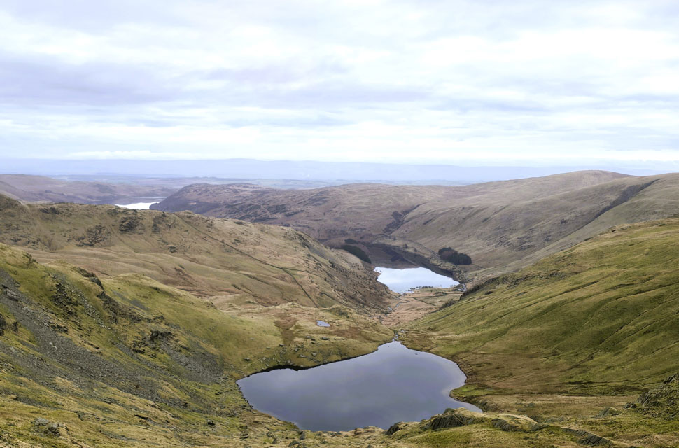 |
| Views over Small Water towards Hawswater. |
| The descent from Mardale Ill Bell towards Nan Bield Pass brought our first oncoming traffic of the day, most memorably a young lass being towed uphill by a gorgeous male Doberman Pinscher. |
 |
| Harter Fell (Mardale) seen beyond the top of Nan Bield Pass. |
| With Black John Hole (cove) seen to the left of the summit. |
 |
| Views towards Small Water, Piot Crag. Mardale III Bell, High Street, Rough Crag, Kidsty Pike, Rampsgill Head and High Raise (Martindale) |
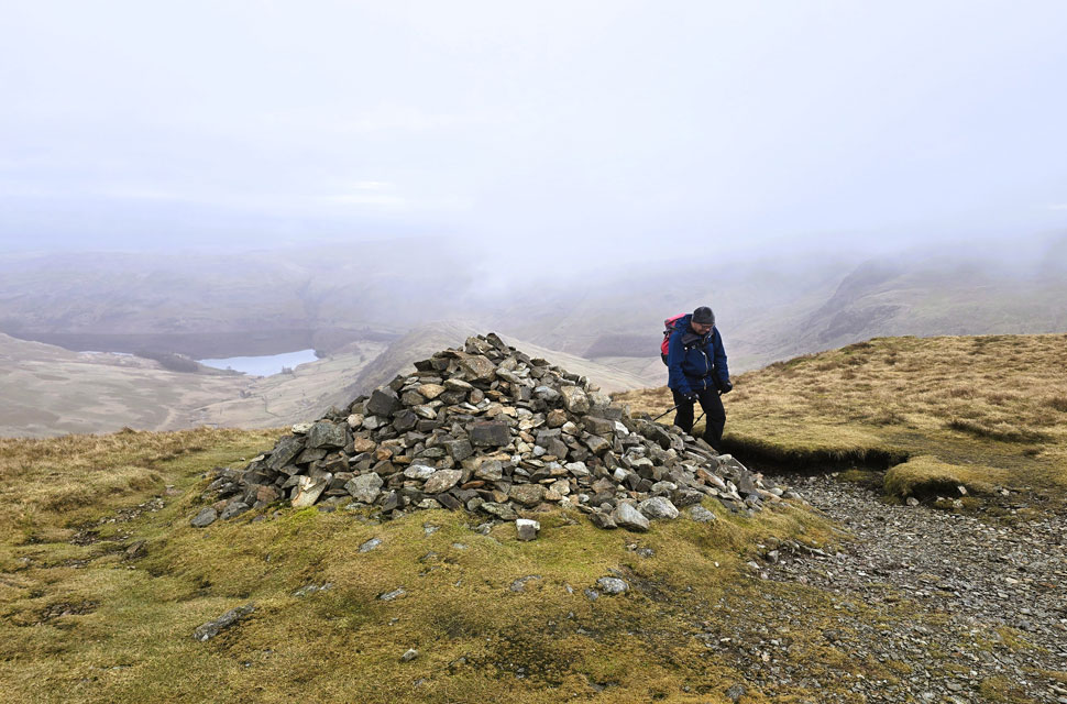
| After passing two local girls on their way up Mardale Ill Bell, we began our own descent towards the top of Nan Bield Pass, spotting walkers heading up from Small Water in the corrie below and others decending from Harter Fell. If we'd needed any clues about where everyone had been the top of Nan Bield Pass provided the answer.
The shelter was empty when we arrived, and it was good to see the two large rocks still in place with the words Mardale and Kentmere neatly painted and arrowed towards their respective valleys. About half a dozen walkers were now descending Harter Fell, among them a young lass who clearly had her exploration head on. She was descending mostly off-path, zig-zagging across the slopes simply to take in different angles and views, and she kept at it until she finally drifted out of sight |
 |
| High Street, Rampsgill Head and Kidsty Pike from Harter Fell (Mardale) summit. |
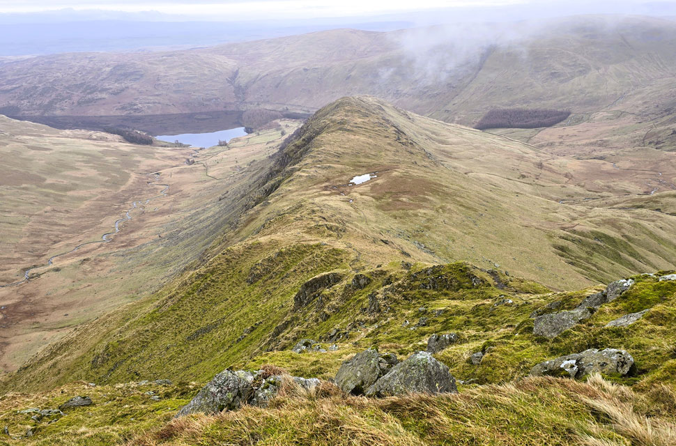
| I've always been a big fan of the climb up Harter Fell from the top of Nan Bield Pass, and today was no different. The views were wonderfully atmospheric: the Kentmere valley opening out below, the Ill Bell ridge rising beyond it, and, with each bit of height gained, the quiet bowl of Small Water coming into sight beneath us. We soon reached the point where the path splits left and right. We hooked left and traversed the slightly longer yet more diagonal path giving the calves a welcome breather before the final pull to the summit cairn. |
 |
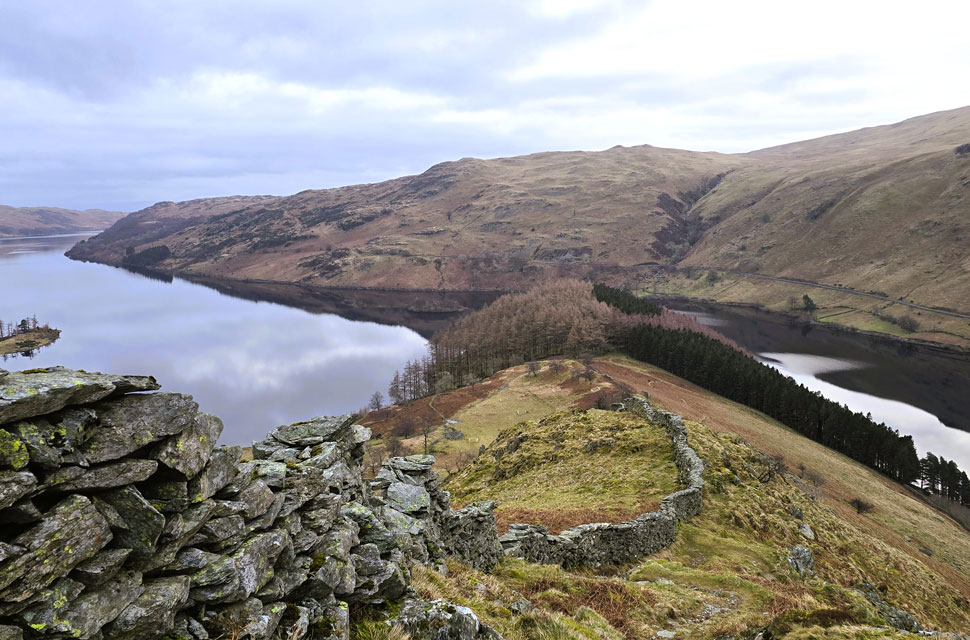
| Looking down on Haweswater from the fence corner. |
| |
 |
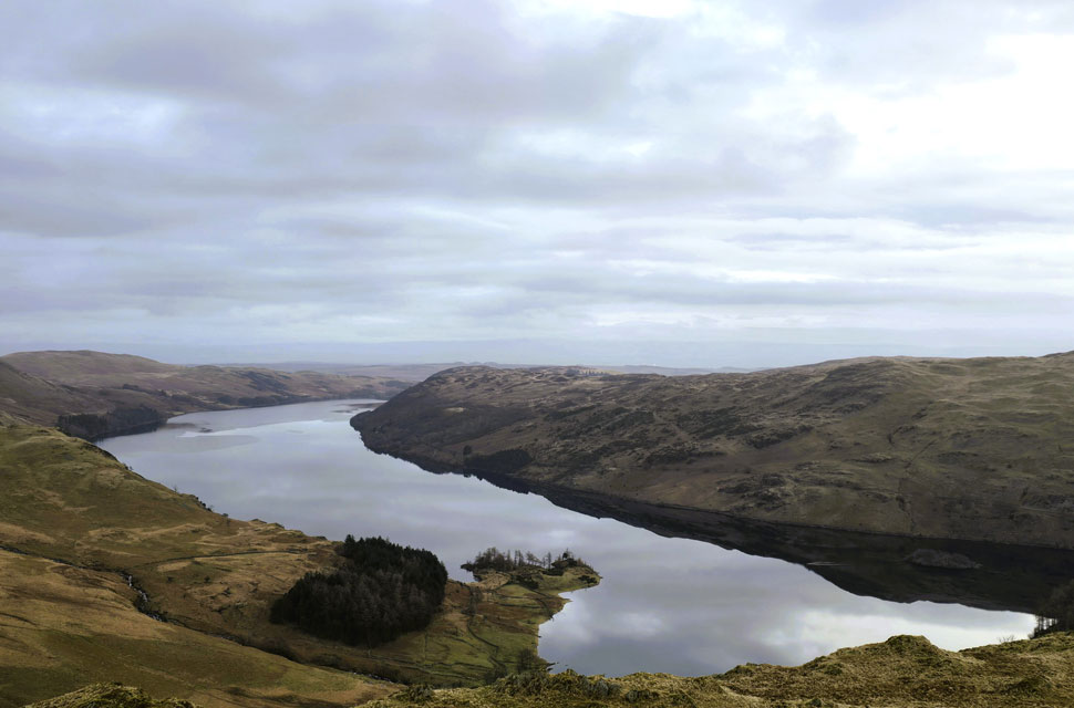
| Views over Mardale Waters towards Mardale Beck, Rough Crag, Long Stile and High Street. |
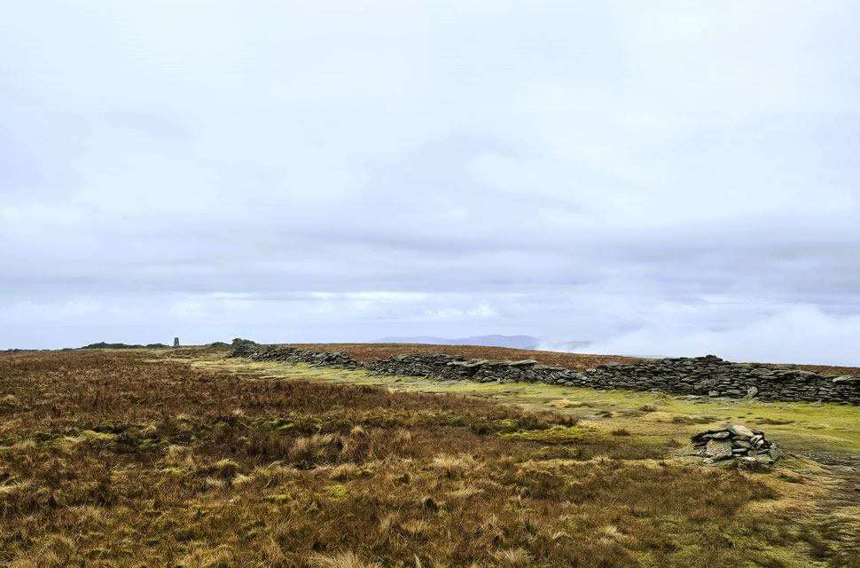
We were soon joined at the summit by a young girl who had come up from the direction of Kentmere Pike. Before we moved on, I asked in passing, "You ok?" She smiled, nodded a polite "yes, thank you," and immediately dropped her eyes back to her phone. Skirting the scattered summit rock we carried on, joking about the last time we were here, when it took both me and Rod to wrestle the gate shut against the force of the wind. We made our way to the viewing platform where the fence swings south-east towards Little Harter Fell and Adam Seat. A chap came towards us carrying a pack with a sapling, plastic netting and a fold-down spade poking out of it. He was clearly heading off to plant the sapling, perhaps in memory of someone, and I liked that thought. More walkers were heading up now; we must have passed half a dozen including a fell runner literally tethered to his dog by the waist, the dog galloping ahead. "Cheating, that, mate!" Rod laughed as they came past. The runner shouted something back, but he was covering ground so quickly we didn't catch it, perhaps just as well, I joked.
At the top of Gatescarth Pass, Rod paused to take a photo of the signpost for Mardale and Longsleddale before we began our descent. Another half-dozen were on their way up, including a woman in shorts and a sports vest who was absolutely hammering her poles relishing the climb. Despite being over half a mile away, Blea Water Beck provided the soundtrack to our descent, acompanied now and then by Gatescarth Beck - out of sight but certainly not out of earshot. We stopped to take in the view towards Harter Fell Gully, where many moons ago I'd been asked by the late author Ron Black to make an ascent. I'd joked, "Are you trying to get me killed, Ron?" The gully, from every angle, looked formidable, greasy, dark, and uninviting. "I wouldn't go up that with a rope and harness," I laughed to Rod. We passed a large group before arriving back at a bustling Mardale Head car park. Rod remarked how far back the cars were parked, and I confirmed it seconds later. "Jesus," I muttered to myself. We hadn't had a hint of sunshine all morning, the cloud was far too dense for any light to break through but the cloud and drifting mist had given the walk an atmosphere I simply wouldn't have got on a blue-sky day. |
|
| |
| Back to top |
 |
|