|
Blencathra via Hall's Fell Ridge |
 |
 |
7th March 2026 |
 |
|
|
| |
|
Overview |
|
|
| Ascent: |
2,391 Feet - 728 Metres |
| Wainwrights: |
Blencathra (Hall's Fell Top) |
| Visiting: |
3, Gategill Fell Top - Knowe Crags - Blease Fell |
| Weather: |
Bright & Sunny Freezing Level Above The Summits. Highs of 8°C Lows of 2°C Feels Like -2°C |
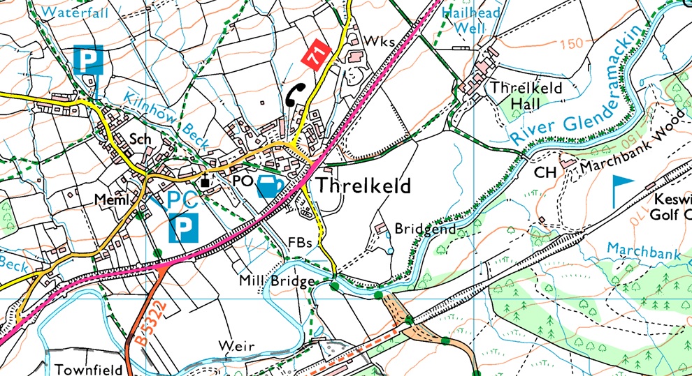
| Parking: |
Threlkeld Village |
| Area: |
Northern |
| Miles: |
5 |
| Walking With: |
David Hall |
| Ordnance Survey: |
OL4 |
| Time Taken: |
4 Hours |
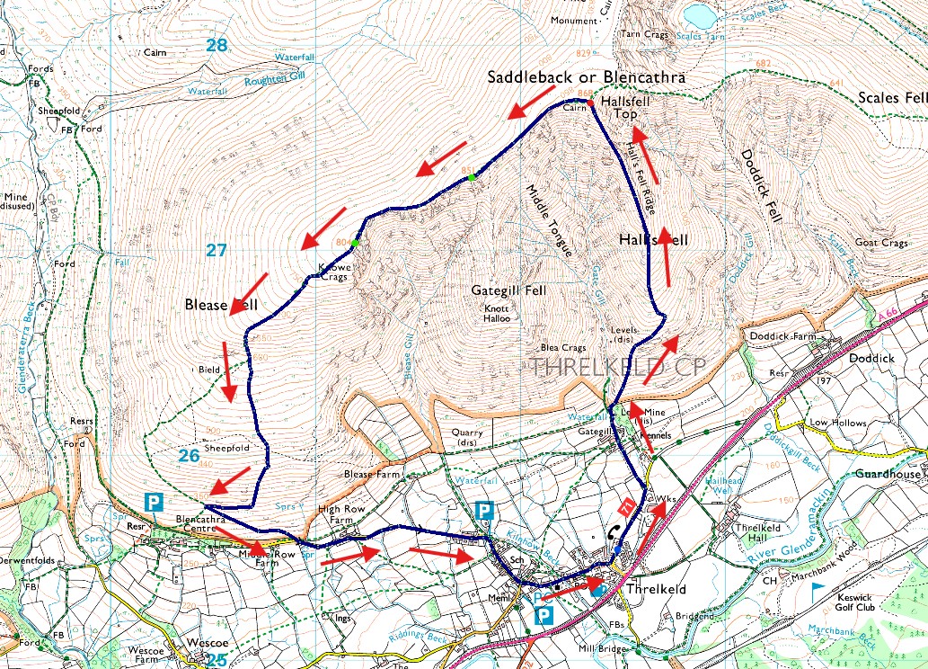
| Route: |
Threlkeld - Gategill Farm - Hall's Fell Ridge - Blencathra - Gategill Fell Top - Knowe Crags - Blease Fell - Blencathra Centre - Blease Road - Threlkeld |
|
| |
|
Parking Details and Map |
|
|
| Nearest Post Code: |
CA12 4RY |
| Grid Reference: |
NY 321 825 |
|
| |
|
Map and Photo Gallery |
|
|
 |
| |
| |
 |
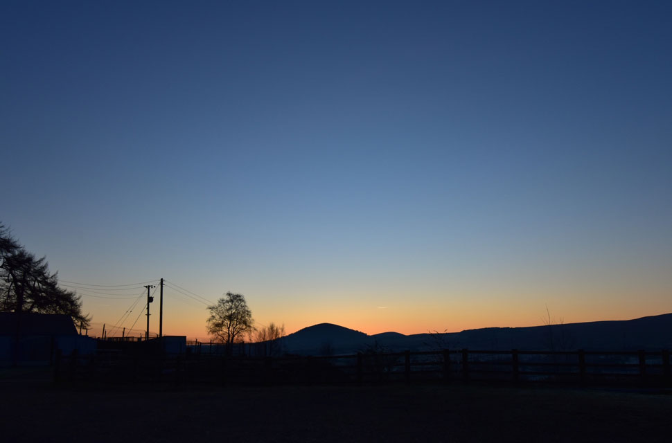
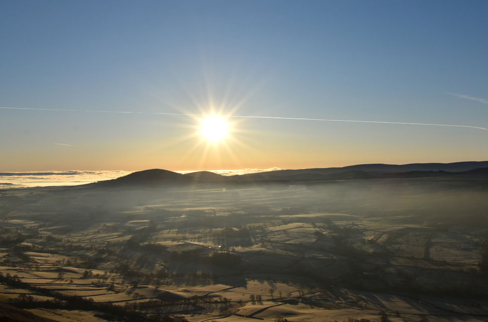
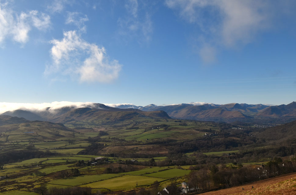
| Bleaberry Fell from Gategill Farm 6:45am -2°C |
| With Rod off car-hunting, David had suggested a rather epic walk from Burnbanks, taking in Swindale and the Mosedale valleys but I had to turn it down due to being full of a head cold and instead opted for a quick scoot up Blencathra. David replied asking if I'd mind him joining, as he'd been looking across to Blencathra from Walla Crag on one of his mid-week walks and fancied the walk himself. We arranged to meet in Threlkeld at 6:45am. I arrived around 6:30, laced my boots in the freezing air, then retreated to the car when I started to shiver. David arrived minutes later.
I was still shivering when I passed on my "morning" to David explaining that I'd driven through thick fog from Preston onwards. It only cleared on the A66 somewhere between the Penruddock and Scales - the contrast couldn't have been greater. Now we were looking at clear skies brushed with the mellow colours of dawn, sunrise only ten minutes away. After my Meindl Bhutans had started letting in water, I'd treated myself to a new pair of AKU Superalp boots, and I was proudly showing them off to David. Like me, he was impressed by the wide rubber band encasing the boot. Rod has owned a pair of Superalp's for an incredible five years, and after weeks of reading reviews I finally decided to treat myself. |
 |
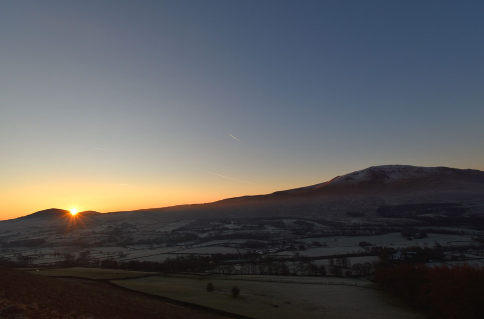
| Great Mell Fell and Little Mell Fell from Gategill Farm. |
| Accompanied by what sounded like dozens of squawking Rooks, we left Threlkeld behind and headed up the lane, turning left towards Gategill Farm. Barely ten minutes into the walk my head and chest were already feeling the effort of the incline. At first I kept quiet, but a few minutes later I admitted that my chest was starting to feel a bit tight. I began to purposely control my breathing and, inbetween, I drew in as much air into my lungs as I could. |
 |
| Sunrise over the Mell Fells with White Pike and Clough Head seen to the right 7:01am |
| After passing through Gategill Farm we passed through the gate at its rear and followed the rising path, Gate Gill ravined away to our right. By the time we reached the second gate I was starting to feel slightly better. We paused to take in the impressive views into Gate Gill, the silence broken only by the sound of cascading water both from the gill itself and from where it dropped into the ravine behind us. With Hall's Fell directly ahead, I baptised my new boots in Gate Gill before joining the path, each step forward offering wider views of the unfolding sunrise in the eastern sky |
 |
| First light over Gategill Fell. |
| With Gategill Fell Top seen to the left and Hall's Fell Top (Blencathra summit) to the right. |
 |
| Views over Gategill and Threlkeld towards Clough Head, High Rigg and Bleaberry Fell. |
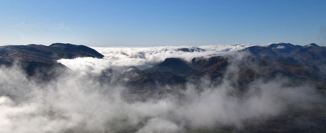
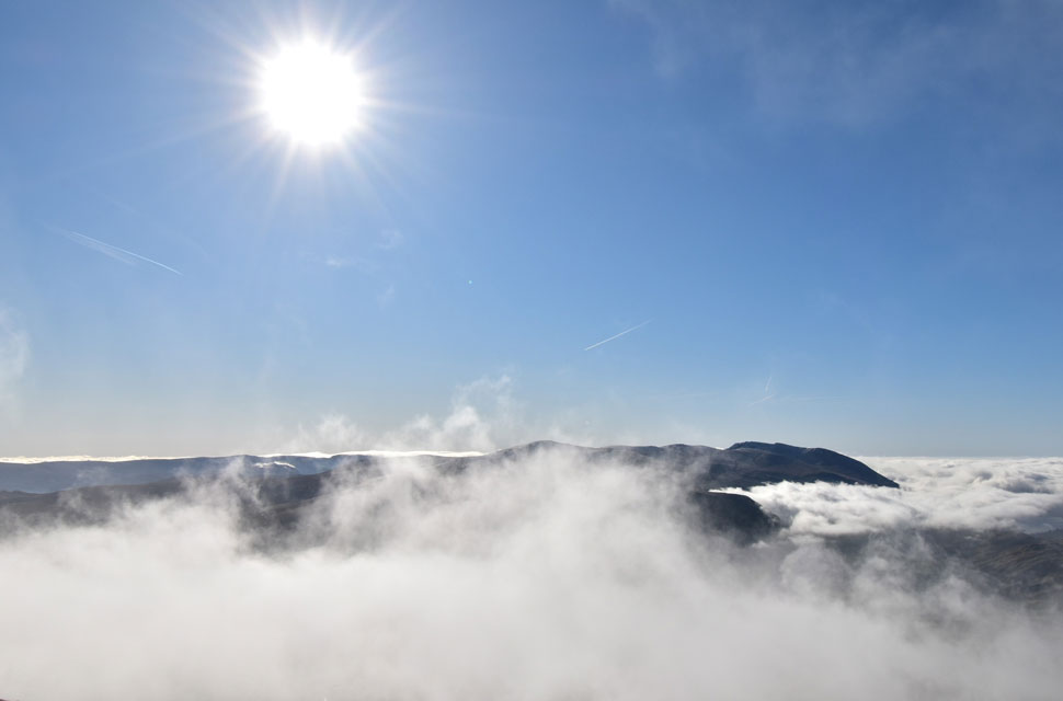
| We were being treated ten-fold to the incredible light of those first few minutes of sunrise, a horizontal beam shining between the Mell Fells and the snow‑covered slopes of Clough Head. Beyond that, we could already see a temperature inversion settling over St John's-in-the-Vale, though to understand its full extent we'd have to climb higher for a better view. |
 |
| Mist and shadows. |
| |
 |
| At the tip of the inversion. |
| With more height gained we had a much better view of the inversion, which was spreading from the south-west and pushing northwards. As soon as it caught the westerly breeze it began to drift eastwards. |
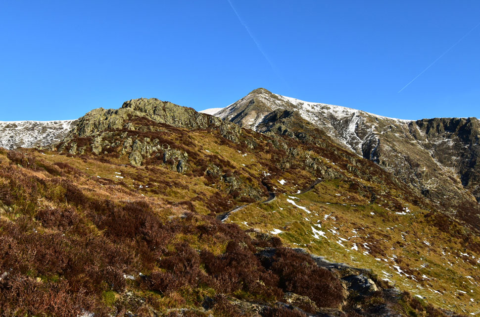 |
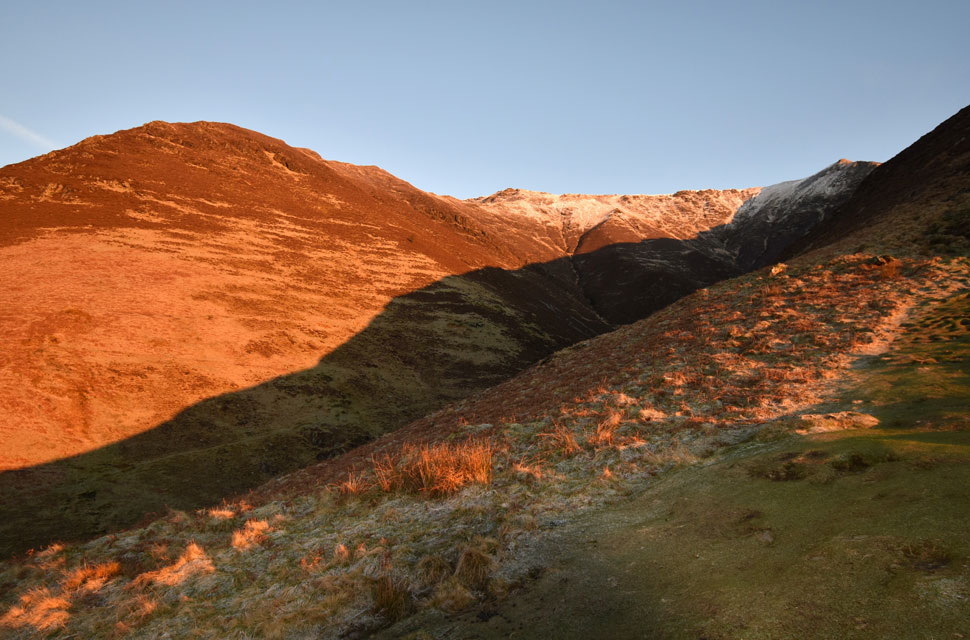
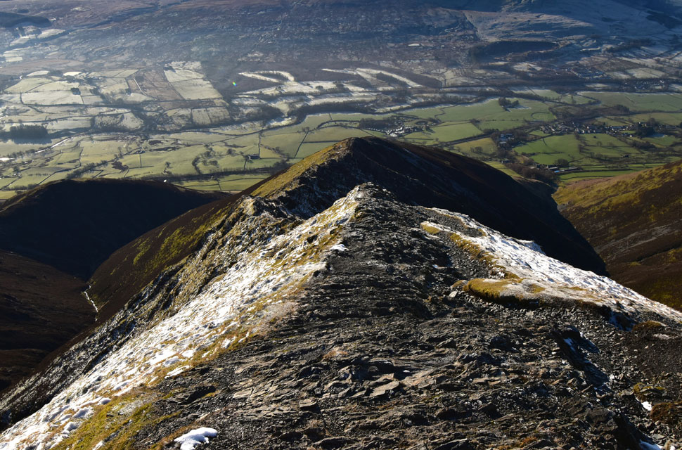
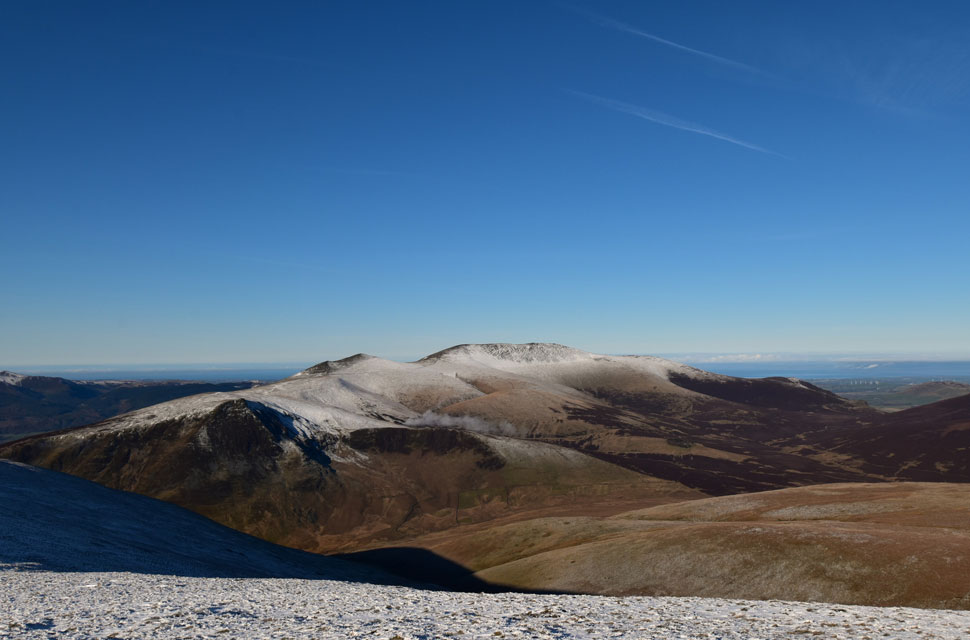
| Hall's Fell Ridge from Hall's Fell. |
| Over the last week due to a slight rise in tempreatures any snow above 850 metres was thawing and only the odd patches remained, that was until Thursday which brought rain and a drop in temperature falling as snow above 600 metres so David and I agreed to bring our spikes along just in case. |
 |
| The Hall's Fell Ridge. |
| Because of Blencathra's aspect, any sunshine it gets tends to thaw and ice or snow as the day wears on, but it was far too early for that yet. Even in the bright light we were already meeting patches of verglas, thin, glassy black ice on the bare rock, especially in the shaded crevices where the sun never quite reaches. |
 |
| Views over Doddick Gill towards Doddick Fell Top. |
| |
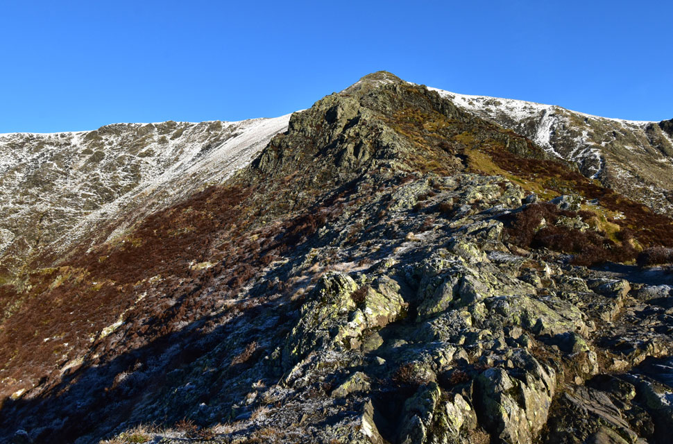 |
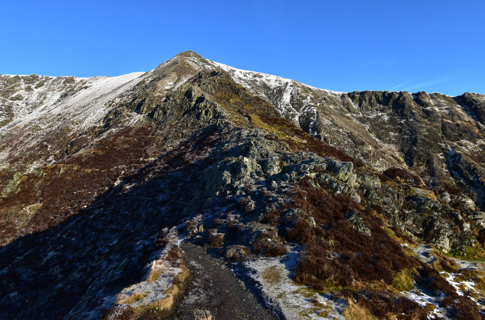
| We join the ridge proper. |
| After a lengthy discussion whether to take the side path or ascend the ridge proper we decided for now to walk the spine of the ridge where the rock was fully exposed to sunlight offering plenty of grip underfoot. |
 |
| Views across Gate Gill towards Gategill Fell and Knott Halloo. |
| The views were so crisp and clear they almost didn't look real. |
 |
| The view East over the Doddick Ridge and Scales Fell. |
| Towards a sea of cloud encroaching the North Pennines. |
 |
| Rock Turret, Hall's Fell Ridge. |
| Continuing to ascend via the spine of the ridge we arrived at the head of the rock turret where we found verglas covering rock on all aspects. We decided to descend right (your left) into the narrow rock gully which due to a lack of sunlight was also covered in verglas.
Putting our thinking caps on we back-tracked to a rocky platform where it was agreed to put our spikes on. I descended first quickly realising that I couldn't ascend the gully without removing my pack so I de-shouldered and pushed it up towards the top the gully soon followed by my walking poles before squeezing through - an action that David repeated after passing me his pack. Had we not had our spikes with us today I honestly don't think we would have been able to continue safely. |
 |
| Looking back on the Rock Turret. |
| After deciding to keep our spikes on for the duration of the climb I continued up the spine of the ridge encountering bare rock underfoot. |
 |
| Looking back on Hall's Fell Ridge. |
| We're almost at the top now and my chest is telling me to take a rest once we reach the summit. |
 |
| Looking down into Doddick Gill. |
| With Doddick Fell Top, Scales Fell and Souther Fell beyond. |
 |
| Glorious views from Blencathra summit. |
| We soon arrived at what was, for the moment, a deserted Blencathra summit. I finally had a chance to catch my breath, and the tightness in my chest eased until I felt normal again. It's remarkable how a simple head cold can sap your energy, but there was no way I was missing conditions like these after being cooped up in work all week.
We only had the summit to ourselves for a minute or so before two women appeared. After exchanging pleasantries, it quickly became clear what a comical pair they were. I probably shouldn't repeat what one of them accidentally said while wrestling with her gloves, but it certainly broke the ice, and soon we were laughing together as if we'd known each other for years. |
 |
| Gategill Fell Top and Skiddaw from Blencathra summit. |
| Admittedly it's still early but aside from the two women stood at the summit circular trig point we had the whole place to ourselves. |
 |
| Epic views towards Skiddaw |
| With Burnt Horse, Lonscale Pike (East Top) Lonscale Fell, Jenkin Hill, Lesser Man, Little Man, Skiddaw, Bakestall and finally a distant Binsey. |
 |
| Looking East towards... |
| ...Atkinson Pike Bowscale Fell, Carrock Fell, High Pike (Caldbeck) and Coomb Height. |
 |
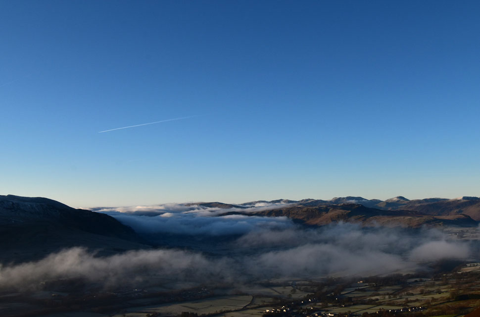
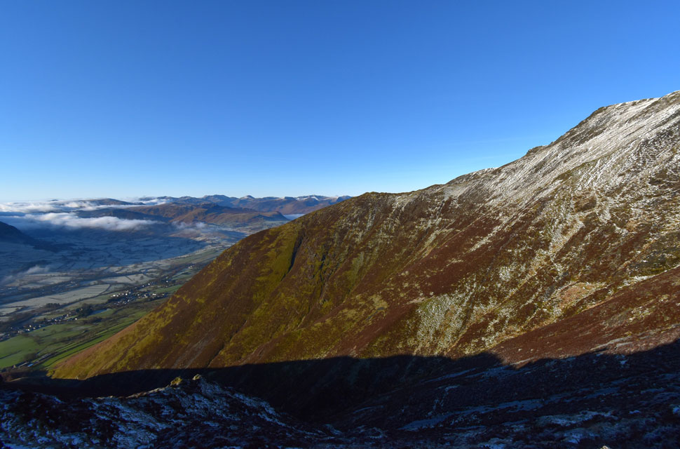
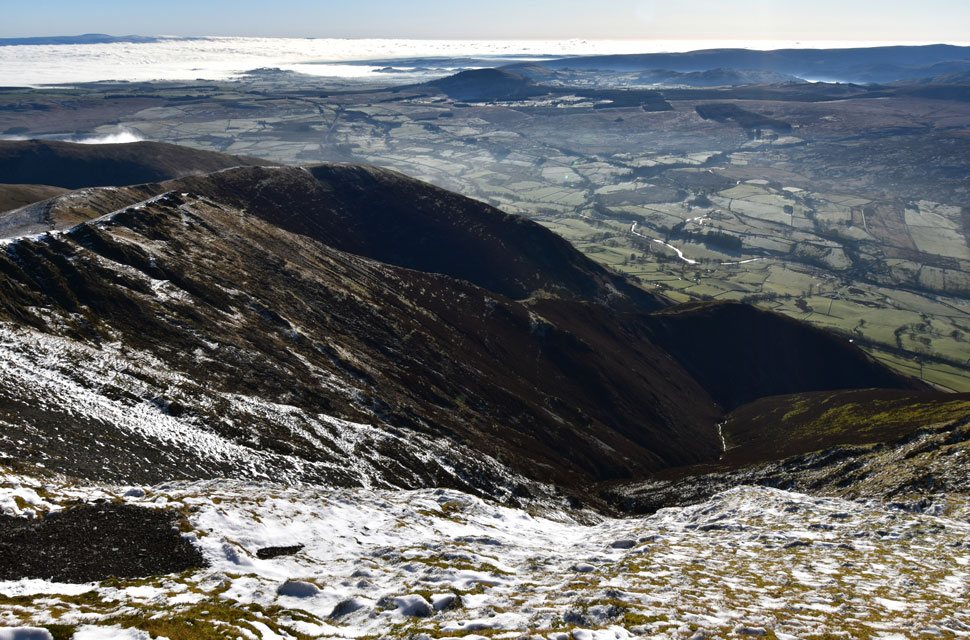
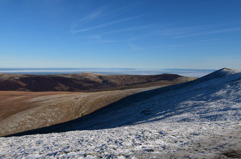
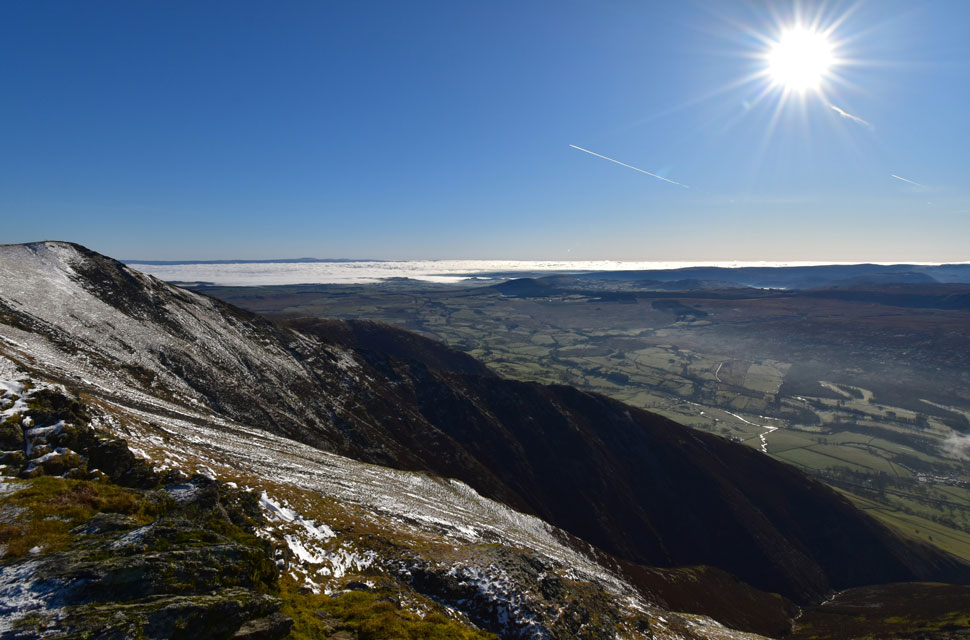
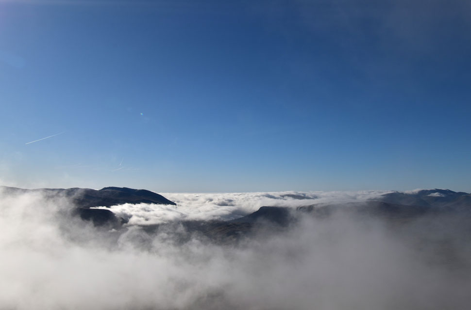
| Views over Gate Gill towards the cloud inversion over the East, Central and Southern fells. |
| Anyone climbing above 400–500 metres would have had a superb view looking down on the inversion, particularly walkers between Clough Head, Helvellyn and Fairfield. Sadly, anyone below that height would have been buried in the clag. |
 |
| A fine view looking down on Knott Halloo and Gategill Fell. |
| With Gate Gll and The Tongue seen to the left and Blease Gill to the right. |
 |
| A wide-angle view over Gate Gill towards The Hall's Fell Ridge and Hall's Fell Top (Blencathra summit) |
| |
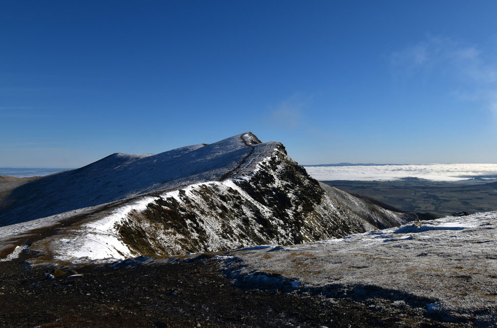 |
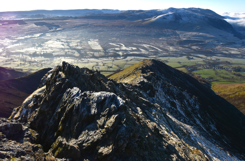
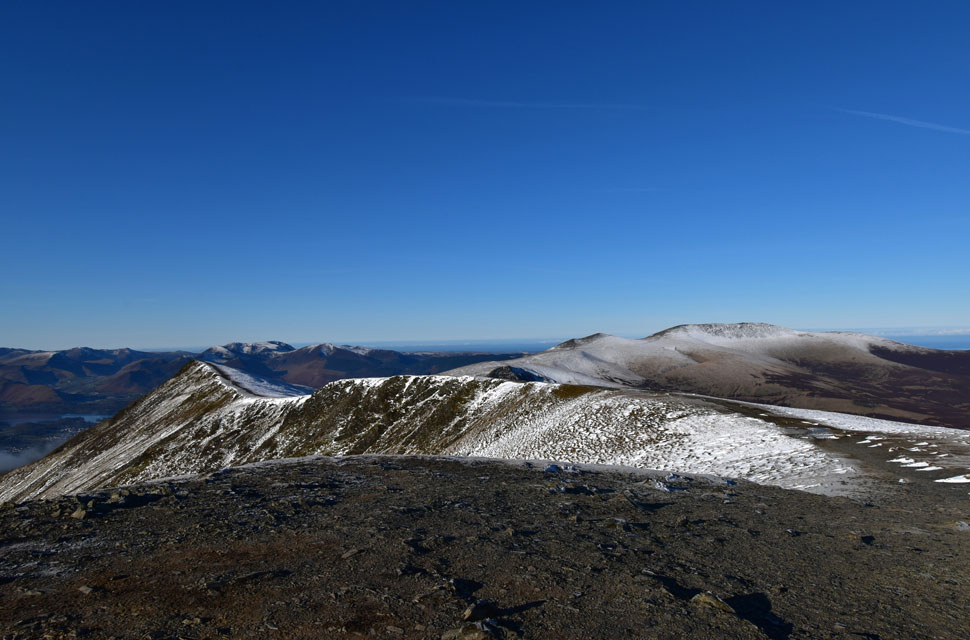
| Looking back on Gategill Fell Top and Blencathra. |
| Seen as we take in the gentle ascent on Knowe Crags. |
 |
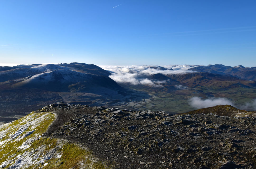
| Cloud begins to build. |
| As we begin our descent from Blease Fell. |
 |
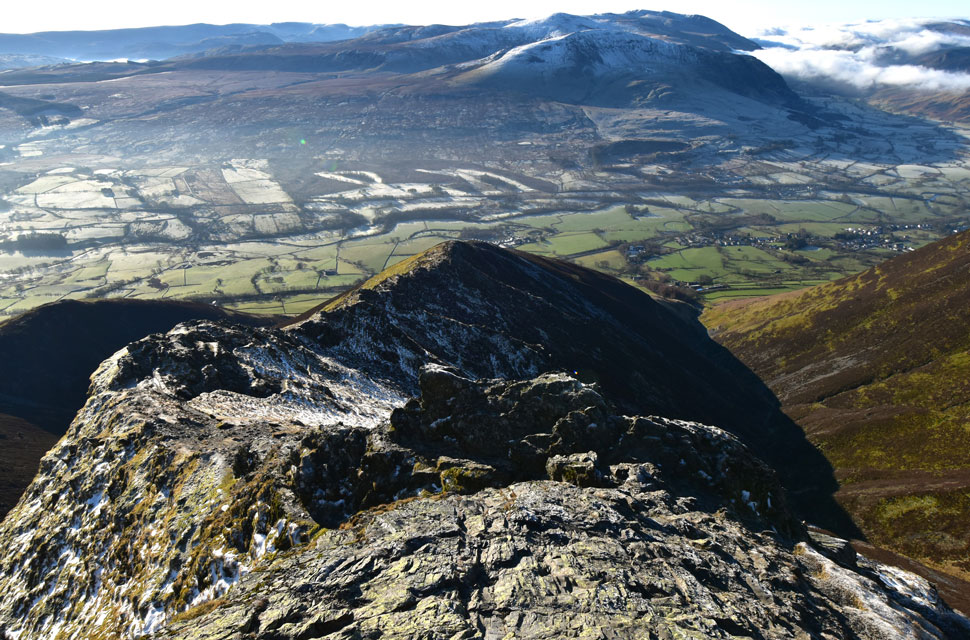
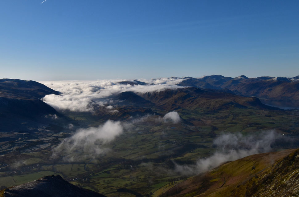
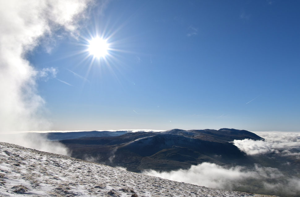
| The cloud inversion pushes North. |
| After leaving the summit and reaching Knowe Crags we noticed that not only was the inversion pushing northwards but it was advancing on the slopes of Blencathra too. |
 |
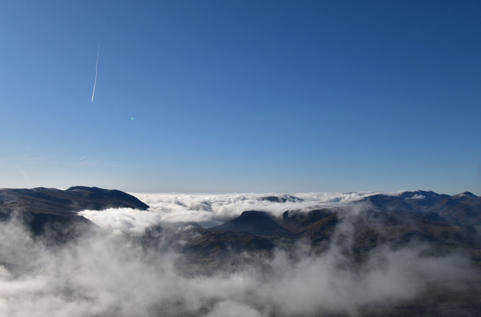
| What a spectacle! |
| The question now was whether we were about to be engulfed, or if the inversion would lose momentum. |
 |
| Who knows... |
| ...but the views were spectacular. |
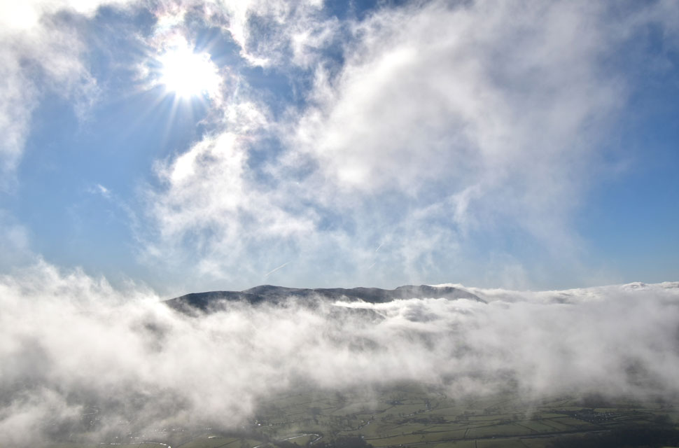 |
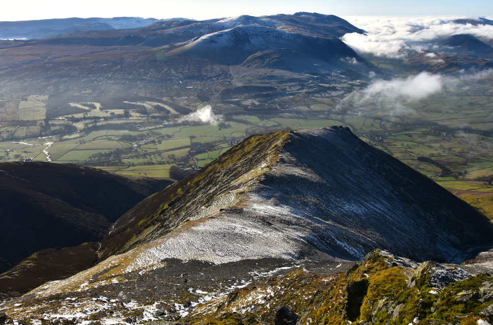
| Descending Blease Fell. |
| Although we seemed to be descending into cloud, it would often break or scatter, with the main concentration drifting towards Hall's Fell ridge and Blencathra's summit, both of which were now lost in cloud. |
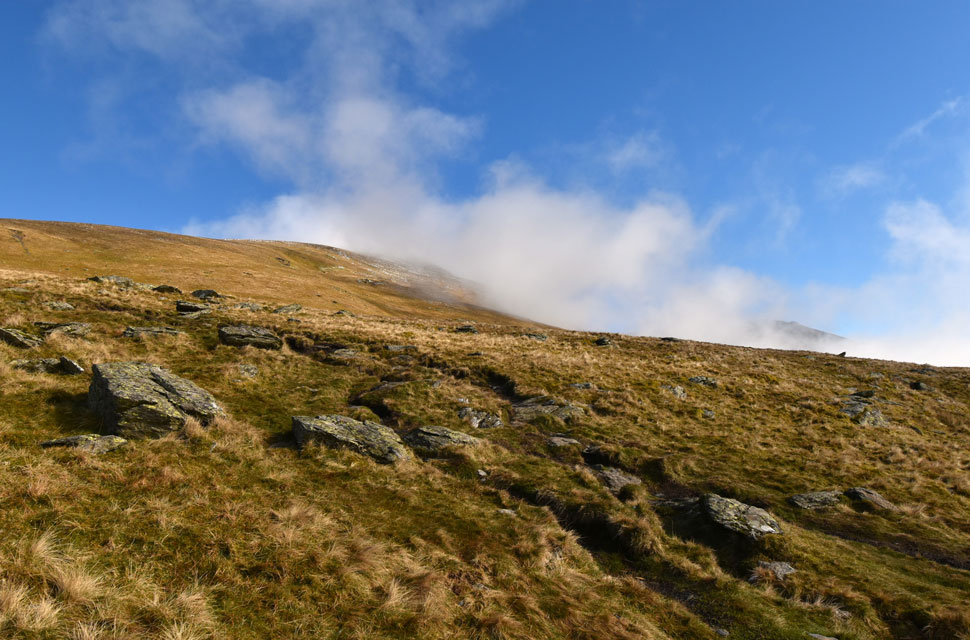 |
| Looking back on Blease Fell. |
| |
 |
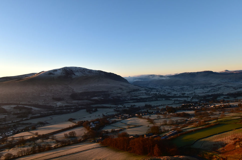
| Views towards Tewit Tarn, Raven Crag, Walla Crag, Bleaberry Fell, High Seat, Cat Bells, Maiden Moor and High Spy and the N-W fells. |
| With the Blencathra Centre seen below. |
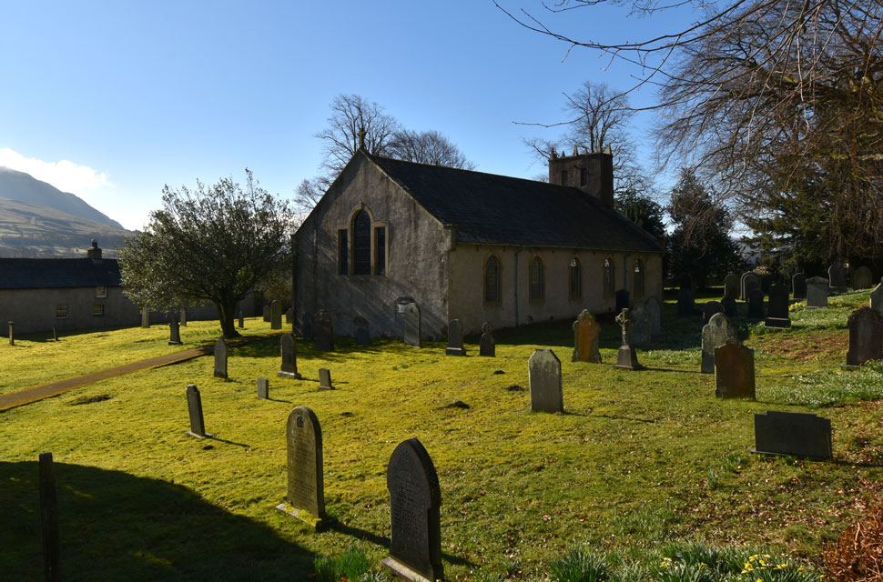 |
| St Mary's Church, Threlkeld. |
With the top of the Blease Fell zigzags reached, we began our descent, drifting in and out of cloud but predominantly in sunshine. We'd only passed three or four walkers on the zigzags, spotting two more on the fellside below, taking the steep incline in their stride along with their dog. We exchanged a quick "morning" and continued commenting on how we'd forgotten just how steep Blease Fell can feel at times, though the sense of descending in warm spring sunshine somehow made me forget the gradient. We soon reached Blease Road, where we passed two large walking groups - one in ascent while the other waited by a nearby gate. It had been ages since I'd seen anyone wearing a sun hat, but one of the walkers had one on, a fair reflection of the warmth we were now enjoying.
We joined Blease Road, often stepping aside to let cars pass, drivers who were soon to be disappointed, as the car park was full. Oddly, none of them came back past us. Sunlight filtered through the tree canopy, and for the first time in a year it genuinely felt like spring had arrived. Warm sunshine, Lapwings, and Lambs accompanied us, along with one local gent sitting on the front step of his cottage in a T-shirt, taking in an uninterrupted view of Clough Head and the cloud inversion. We didn't disturb him with a "morning" and instead passed quietly.The village of Threlkeld was soon reached, its roadsides flanked by daffodils and snowdrops and it was nowhere near as busy as we'd anticipated. After passing the Primary School, we took one last look back over the rooftops towards Blencathra, its summit now buried beneath cloud that thinned as it lowered down the lower ridges - and beyond that, deep blue sky. |
|
| |
| Back to top |
 |
|