|
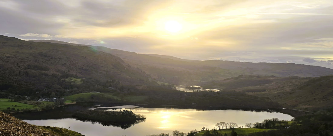
Silver How & Loughrigg Fell from Grasmere |
 |
 |
4th April 2026 |
 |
|
|
| |
|
Overview |
|
|
| Ascent: |
2,340 Feet - 713 Metres |
| Wainwrights: |
2, Silver How - Loughrigg Fell |
| Visiting: |
3, Spedding Crag - Dow Bank - Black Mire |
| Weather: |
Some Early Sun, Predominantly Cloudy. Rain On & Off Turning Heavy By Late Morning. Highs of 7°C Lows of 4°C |
| Parking: |
Parking Spaces A591 Grasmere |
| Area: |
Central |
| Miles: |
10.1 |
| Walking With: |
David Hall |
| Ordnance Survey: |
OL7 |
| Time Taken: |
5 Hours 10 Minutes |
| Route: |
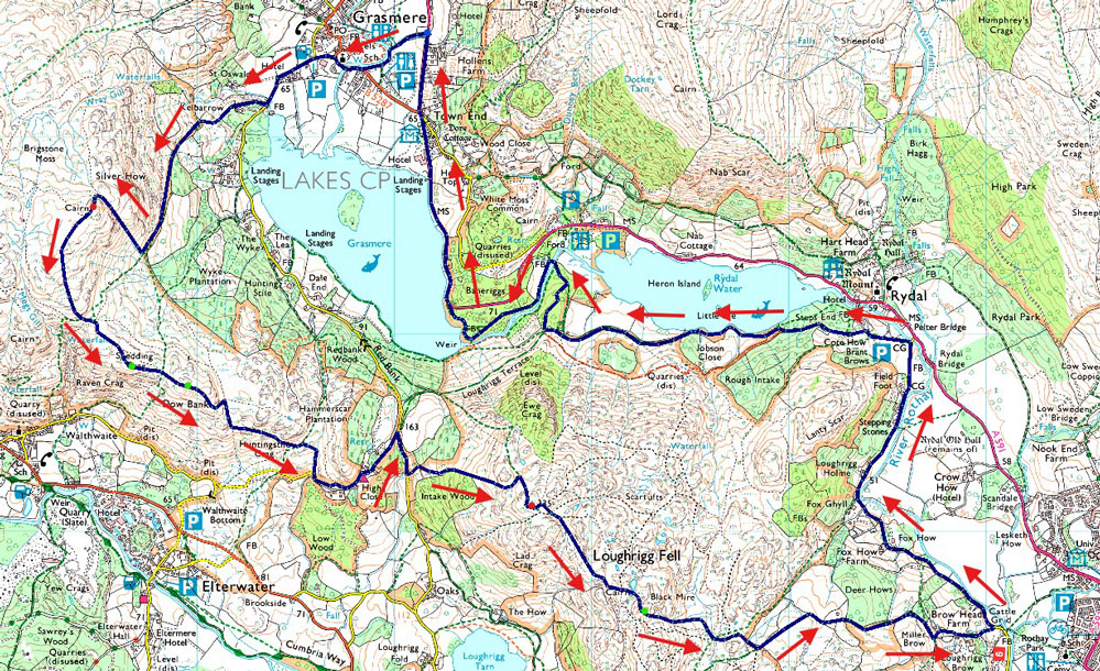
Lay-by A591 - Stock Lane - Red Bank Road - Kelbarrow - Silver How - Spedding Crag - Dow Bank - Traverse Path Below Huntingstile Crag - High Close YHA - Footpath by Intake Wood - Loughrigg Fell - Black Mire - Loughrigg Brow - Miller Bridge - River Rothay - Pelter Bridge - Coat How - Rydal Water - White Moss Common Woods - Footbridge over River Rothay - Penny Rock Woods - Grasmere Lake Weir - Daffodil Hotel - Lay-by A591 |
|
| |
|
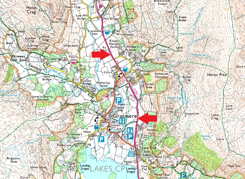
Parking Details and Map |
|
|
| Nearest Post Code: |
LA22 9RF |
| Grid Reference: |
Lay-by A591 North of Grasmere - A591 Central Grasmere NY 337 408 & NY 341 079 |
|
| |
|
Map and Photo Gallery |
|
|
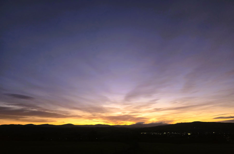 |
| Sunrise over Kendal 6:04am |
| With Storm David due later this afternoon I wasn't expecting such a nice sunrise so I stopped for a quick photo not far from Plumgarths roundabout. |
 |
| Views towards Helm Crag and Steel Fell seen shortly after leaving the lay-by just outside of Grasmere 6:45am 4°C |
| Its the Easter Bank Holiday and, true to form the weather wasn't playing ball. Storm David was on its way promising gale force winds and rain that would turn to sleet and snow across the higher fells. Even so, we decided to make the most of a small weather window early in the morning with no real plan beyond "Loughrigg Fell from Grasmere."
I threw in a suggestion: why not start with Silver How, then wander over to Loughrigg via Dow Bank? By the time we were locking the cars, we'd sketched out a rough route that felt which we'd make up as we went along. The morning turned out calmer than expected with barely a breath of wind and even the odd break in the cloud showing hints of blue. Hardly the conditions we'd been been expecting.
There was no need, at least for now, to don the waterproofs, so I attempted to fold my jacket neatly into my pack the way they do in clothes shops. Predictably, I made a complete hash of it, lost my rag, and stuffed the thing into my pack which in turn, triggered a quiet little OCD episode in my head which, unbeknown to David, went ignored. |
 |
| Views back towards Seat Sandal, Grisedale Hause, Fairfield, Great Rigg, Stone Arthur and Heron Pike from Kelbarrow. |
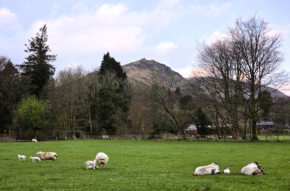
| For the first Bank Holiday of the year we were treated to a sleepy Grasmere. We passed through the village via Stock Lane and out onto Red Bank Road, where the fields on either side were alive with the sound of bleating lambs. In one of the fields a farmer was hand feeding them from a bucket, a quiet scene that matched the start to our walk. From Red Bank Road we turned right and joined the walled incline towards Kelbarrow. |
 |
| Sunrise reflections over Grasmere Lake. |
| The walled track soon gave way to open fellside, and we continued the steady climb. By this point the path had taken on the look of a stream bed, our ears having spent the last twenty minutes adjusting to the constant trickle of water running beneath our boots. The gradient eased as we reached the base of a wide, steep grassy gully, the start of the grooved staircase that rises almost all the way to Silver How's summit. |
 |
| Brief sunshine over Dow Bank. |
| Bringing with it a little welcome warmth too. |
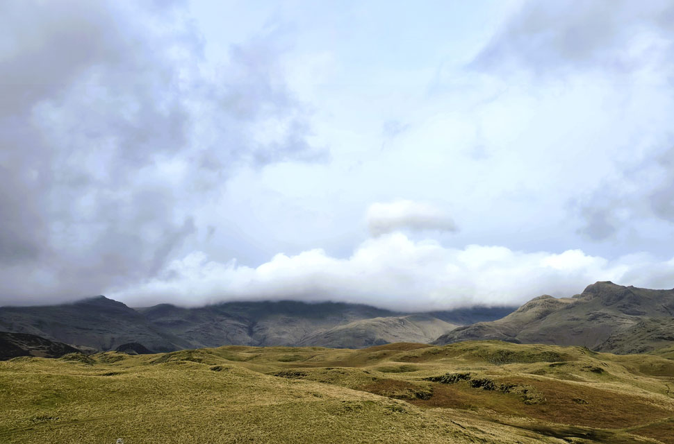 |
| Views towards Pike O'Blisco, Crinkle Crags, Bow Fell, Loft Crag and Harrison Stickle. |
| After plenty of huffing and puffing we reached the top of the stone staircase, Silver How summit now just a stone's throw over our left shoulders. We paused to take in the view: the Langdale Pikes stretching out ahead while beyond, cloud topped a Bow Fell and Crinkle Crags. |
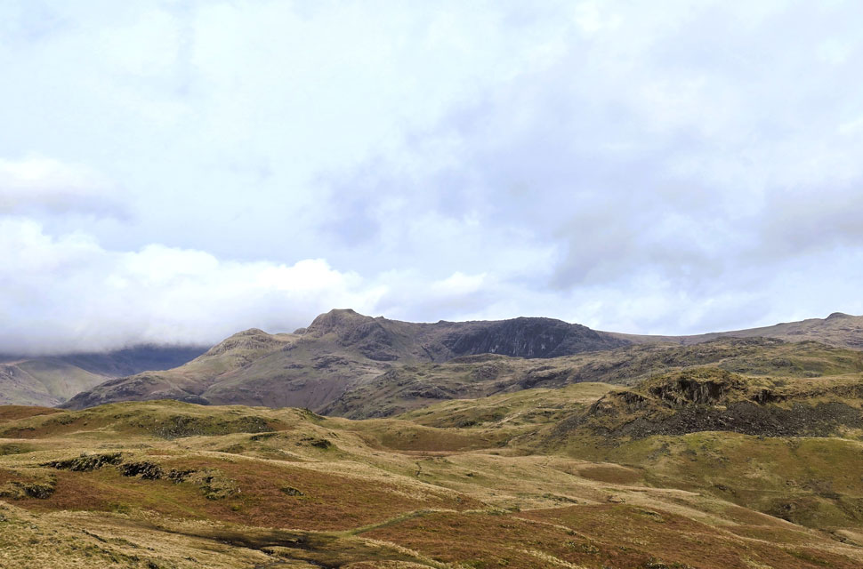 |
| A closer view of the Langdale Pikes. |
| With Pavey Ark and Sergeant Man appearing centre and left with Lang How in the foreground. |
 |
| Descending Silver How for Dow Bank. |
| It almost felt like a lottery win to arrive at Silver How summit in such a peaceful setting: not a breath of wind, and even the faintest hints of sunshine trying to poke through the hazy, multilayered cloud. David glanced at his watch and announced it was only 7:55am. I pulled out my phone to check the forecast, which informed me we had about an hour before the rain might catch us up. |
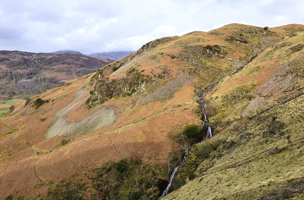 |
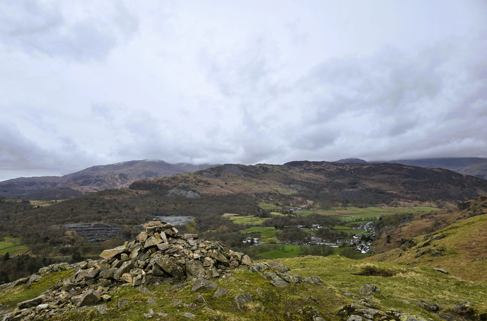
| Views into Meg Gill from Spedding Crag. |
| Which took us back to last July, when the trio descended Meg Gill from the top right of the view down to the section just above the waterfalls. It's a precarious descent better suited to ghyll scramblers than three middle aged blokes but it was undeniably exciting all the same. |
 |
| Views into Tongue Gill and Grisedale Hause from Spedding Crag. |
| With our route of ascent onto Silver How also coming into view over on the left. Admittedly, it's a steep pull, but it remains my preferred way of reaching the summit. |
 |
| Wetherlam and Lingmoor Fell from Dow Bank. |
| It took us a delightful twenty minutes or so to wander across to Dow Bank summit, but in that short time we could already feel the atmosphere changing; the cloud thickening, the wind picking up, and the first faint hints of drizzle drifting in the air |
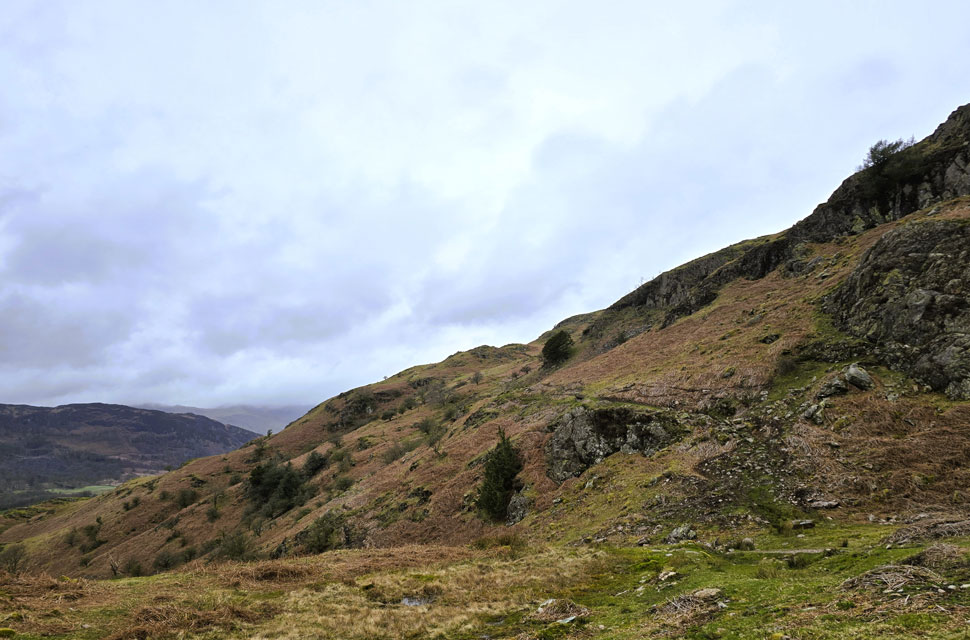 |
| Looking back on the traverse path (trod) below Huntingstile Crag. |
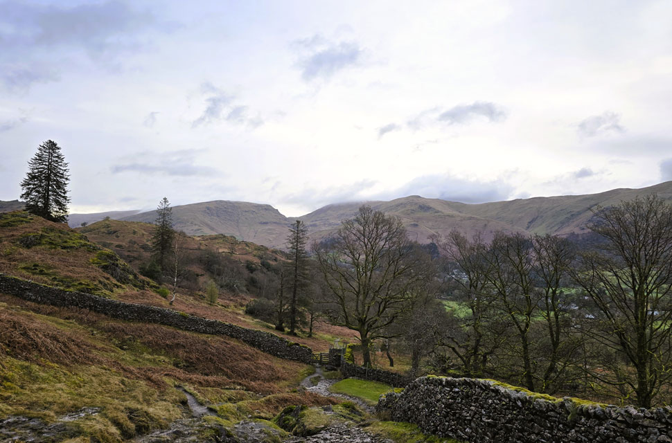
| We descended Dow Bank in good spirits, spotting the narrow strip of tarmac below linking Chapel Stile with Grasmere. Rather than drop straight to it, we agreed to keep as much height as we could, which led us onto a narrow trod beneath Huntingstile Crag. |
 |
| Advancing cloud as the finally rain arrives. |
| From the narrow trod we joined the tarmac lane and took in the views towards Elterwater and Chapel Stile, both looking quiet with only the odd car parked on the outskirts of the hamlets. The lane began to climb towards High Close YHA, where we passed a couple walking a Westie. I watched him trot ahead, knowing that Holly and Brad were probably on their fifth snooze of the morning rather than trudging up a drizzly hillside. Good lad, I muttered as the Westie strolled away.
The treelined lane offered some shelter from the rain, and after passing the hostel the road junctioned sharp right and through the trees we caught sight of the steep path leading up onto Loughrigg Fell. |
 |
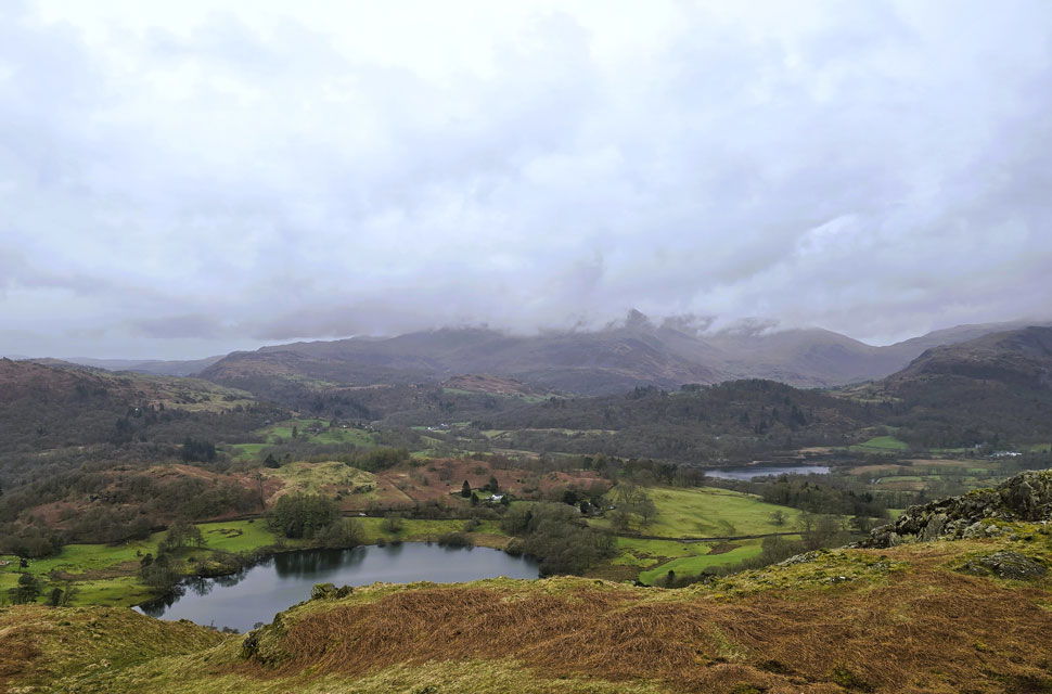
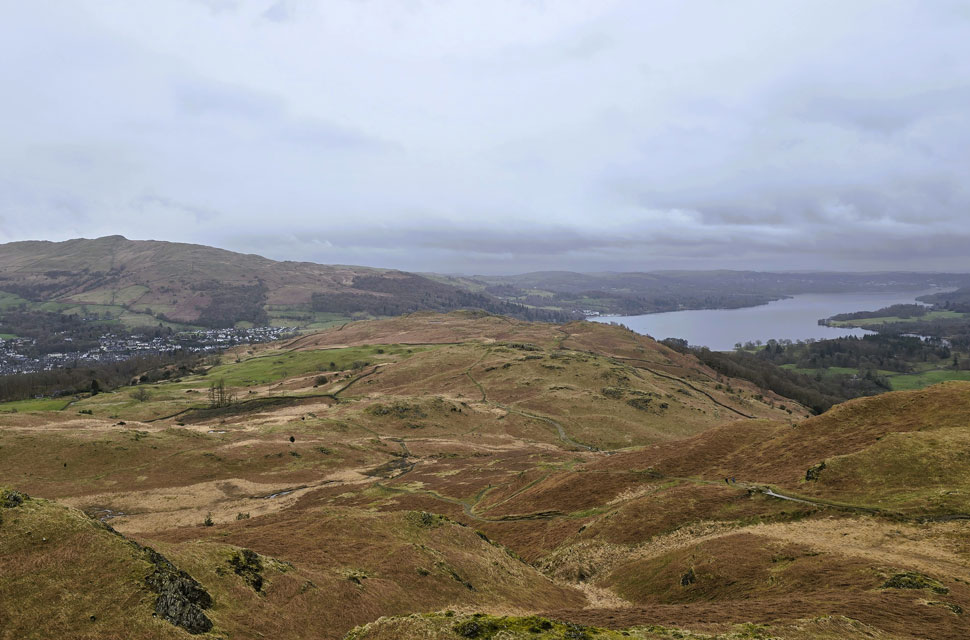
| Silver How and the Langdale Pikes from Loughrigg Fell summit. |
| We swapped the tarmac lane for the steep fellside beside Intake Wood, the slope so steep in places it dropped out of sight, The good news was that the ascent was over relatively quickly. We'd only seen one fell runner on Dow Bank, the couple with the Westie, and another runner descending during our Loughrigg ascent and somehow we even managed to have the ever popular summit to ourselves.
That said, two couples had just set off and another wasn't far behind us. We'd stopped earlier to pull on our waterproof jackets, which turned out to be perfect timing as the drizzle turned heavier and the views, murkier. |
 |
| Views towards a cloud topped Wetherlam with Loughrigg Tarn and Elter Water seen foreground. |
| Within minutes of arriving we were joined by more people arriving at the summit most of whom were not prepared for conditions made a tad more uncomfortable by the breeze which was building in strenght. We left via the steep grassy rampart and veered south where we passed fell and dog walkers better prepared. |
 |
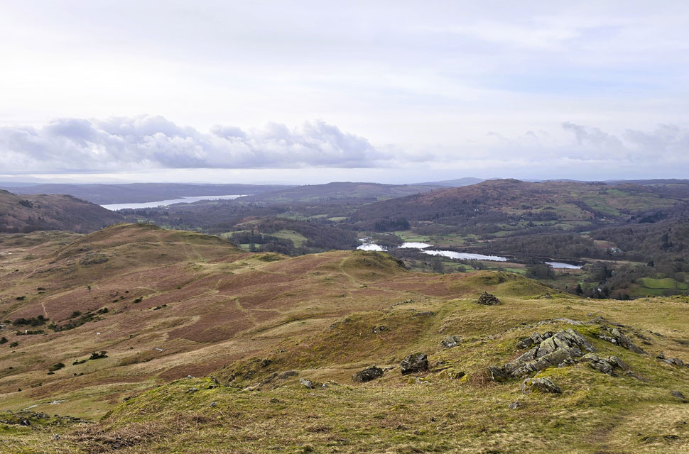
| Views of Wansfell and Windermere from Black Mire. |
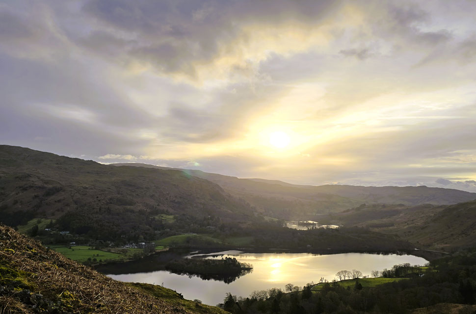
Finding solid ground was scarce, and we had to weave around the boggier sections, sometimes gaining a little extra height over the humps and hillocks one of which was Black Mire at the southern end of the fell. From there we had a fine view of our final descent via Loughrigg Brow, and beyond it the long sweep of Windermere.
Continuing our descent, David mentioned a walk we'd done back in December 2019 the one where he celebrated his 2,000th outing. "Well Paul," he went on, "just over a week ago I surpassed my 3,000th walk. Today is walk 3,004." I tried to reply, but first I had to pick my jaw up off the floor. Joking aside, as I've said before, just because we don't have Walkthefells anymore doesn't mean David has stopped walking the Lakeland fells. If anything, he's getting out more. |
 |
| Descending towards Miller Bridge from Loughrigg Brow. |
| The rain persisted in that typical vertical Lakeland fashion, soaking us through as we made our descent. It was good to see it hadn't put most folk off passing dozens heading up, mainly day trippers making their way from Ambleside. |
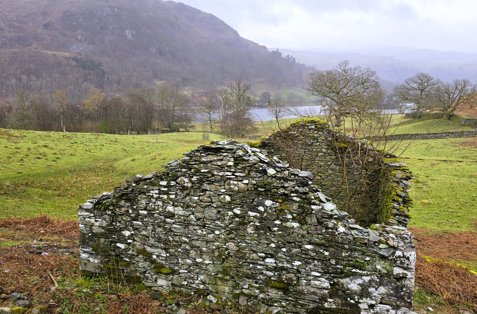 |
| Looking back on Nab Scar and Rydal Water from the ruined building close to White Moss Common Woods. |
| |
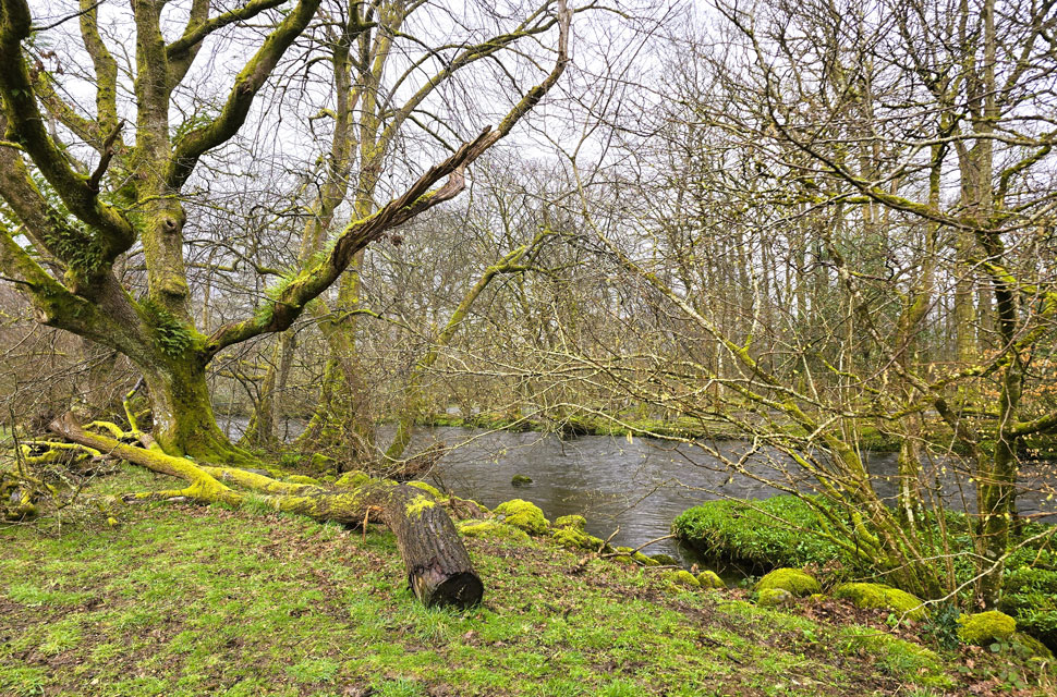 |
| River Rathay. |
| The rain was unrelenting as we reached Miller Bridge and turned left to follow the Rothay as far as Pelter Bridge, where the crowds continued in their droves cyclists, day-trippers, and folk looking for somewhere to park. Sadly, some had found it, selfishly dumping cars on the edge of the woodland, and I couldn't help wondering what went through people's minds. A mile further on we passed the infamous stepping stones, now completely submerged, though that didn't stop one couple attempting a crossing. At least the young girl had the sense to remove her socks and shoes, unlike her partner, whose soggy trainers were hailed as a triumph by an onlooker shouting "good effort." We failed to see it.
The A591 at Pelter Bridge came into view the rain still pouring but the crowds came, jostling for space in the car park while others looked on. The incline that followed was steady and pulled at my calves, but we kept the pace up, if only to escape the crowds. Through the woodland, Rydal Water appeared, and David and I were the only two who dropped down to the lakeshore path; everyone else continued towards Loughrigg Cave and Loughrigg Terrace. Silver How was now cloaked in a mix of murk and cloud, and through the drizzle I don't mind admitting it made for a dismal scene. I felt quietly thankful we'd reached its summit during those brief gaps of sunshine five hours earlier.
We headed through White Moss Common Wood, where a polite young girl stopped to ask how to get onto Loughrigg Fell and then to the caves. We told her it was a good four hour round trip, and with conditions deteriorating we advised she just visit the cave. She thanked us warmly before we crossed the new bridge over the River Rothay. A right turn would have taken us back to the A591 via White Moss car park, but we turned left and followed the river towards Penny Rock Woods and on to the weir at Grasmere. I'd hoped to stop for a photo, but with folk on the bridge I thought better of it. Leaving the Weir and woodland behind, we joined the A591 and walked single file with Grasmere on our left and heavy traffic a foot away to our right. We passed the Daffodil Hotel, crossed the mini-roundabout, and soon the lay-by came into view now emptied of the half dozen campervans that had been there this morning now replaced by cars. Kit-down took a while: laces wet, fingers chilled, jackets soaked. But in those last few minutes before heading off, we both agreed how good it felt to have stayed ahead of Storm David and squeezed five great hours on the hill |
|
| |
| Back to top |
 |
|