|
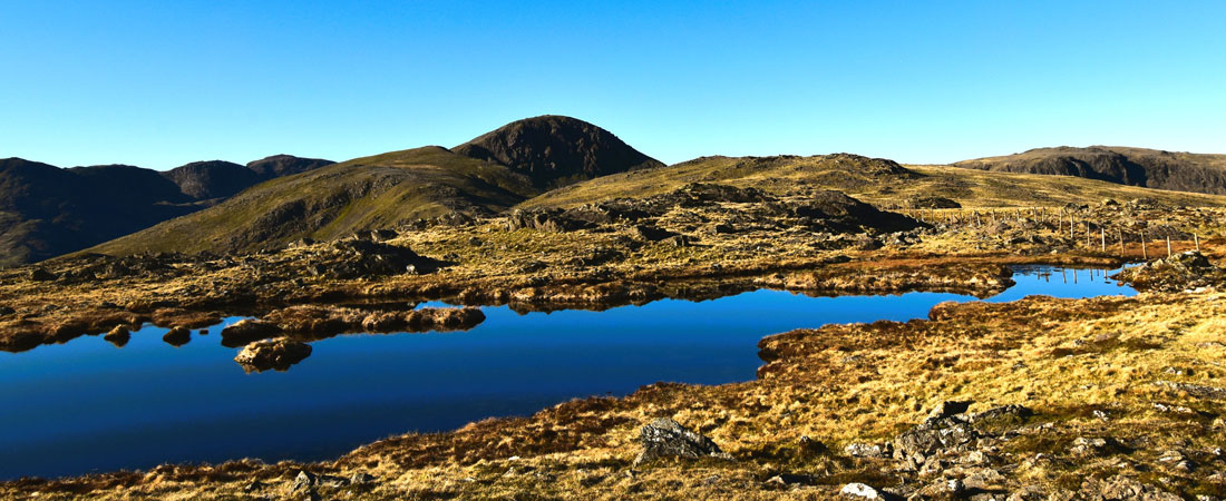
Great Gable & Kirk Fell from Honister Mine |
 |
 |
24th April 2026 |
 |
|
|
| |
|
Overview |
|
|
| Ascent: |
3,397 Feet - 1,036 Metres |
| Wainwrights: |
5, Grey Knotts - Brandreth - Green Gable - Great Gable - Kirk Fell |
| Visiting: |
Kirk Fell North Top |
| Weather: |
Warm Dry & Sunny. Highs of 23°C Lows of 3°C |
| Parking: |
Car Park, Top of Honister Pass |
| Area: |
Western |
| Miles: |
8 |
| Walking With: |
On My Own |
| Ordnance Survey: |
OL4 |
| Time Taken: |
6 Hours |
| Route: |
Honister Hause - Grey Knotts - Brandreth - Gillercomb Head - Green Gable - Windy Gap - Great Gable - Beck Head - Rib End - Kirk Fell - Kirk Fell North Top - Rib End - Beck Head - Stone Gove - Moses Trod - Drum House - Honister Hause |
|
| |
|
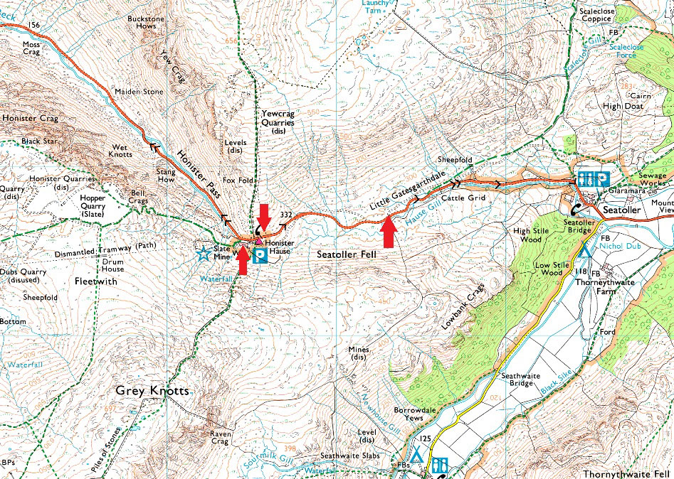
Parking Details and Map |
|
|
| Nearest Post Code: |
CA12 5XN |
| Grid Reference: |
NY 225 313 |
|
| |
|
Map and Photo Gallery |
|
|
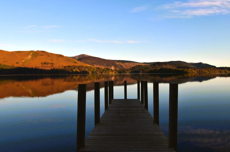 |
| Cat Bells and Barrow from Ashness Jetty 6:35am |
| Driving along the Borrowdale Road Derwent Water looked like a mill pond so I stopped off at Ashness Jetty for a few photos. |
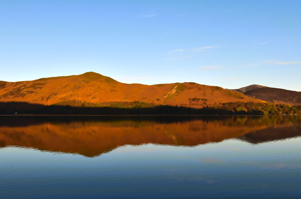 |
| Cat Bells reflections. |
| |
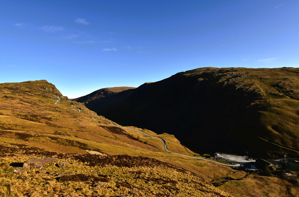 |
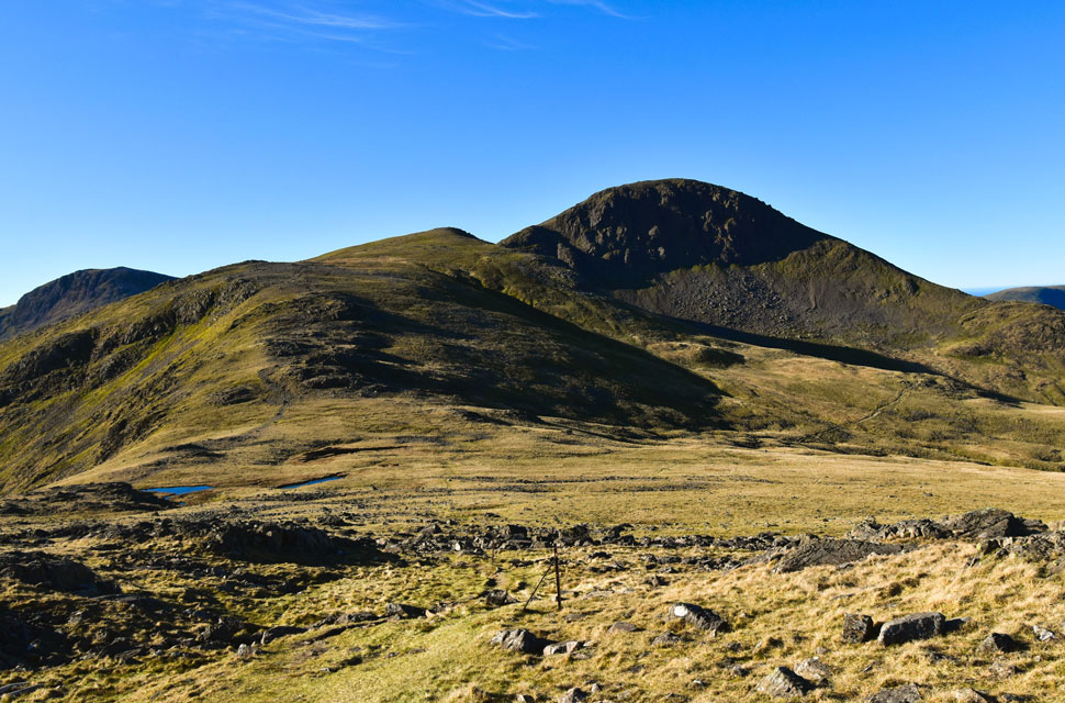
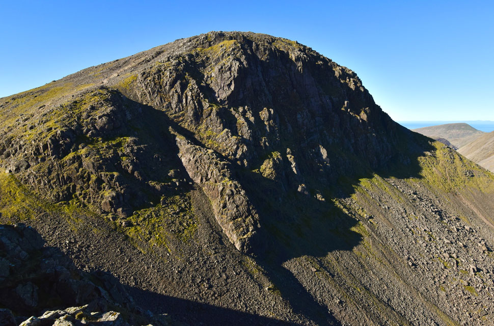
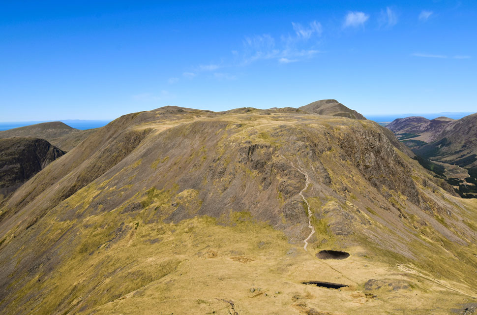
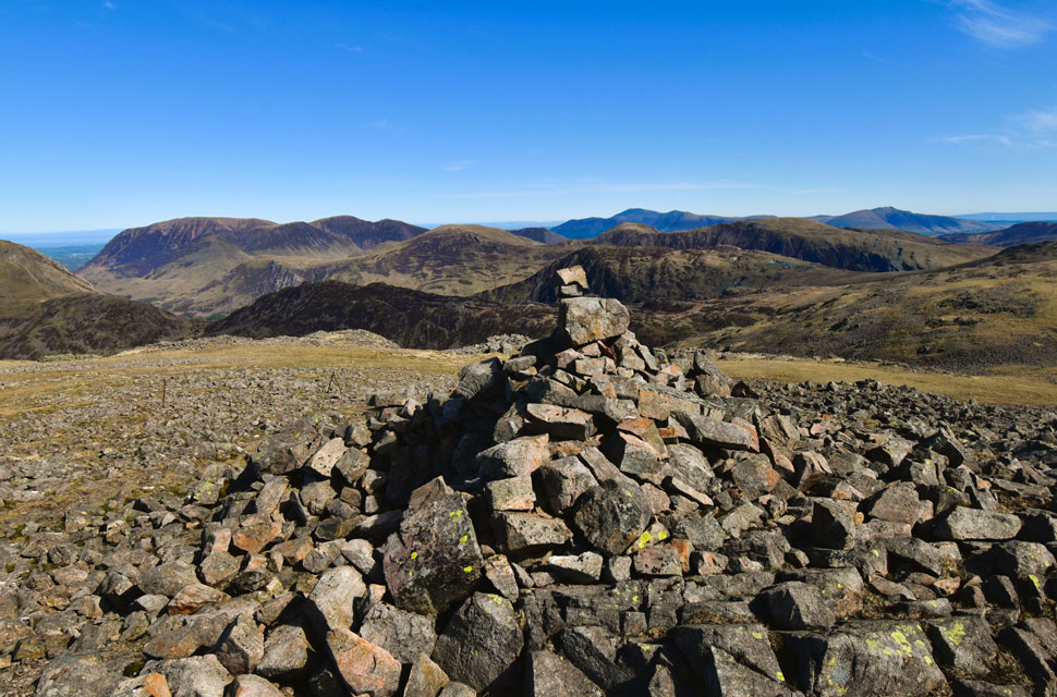
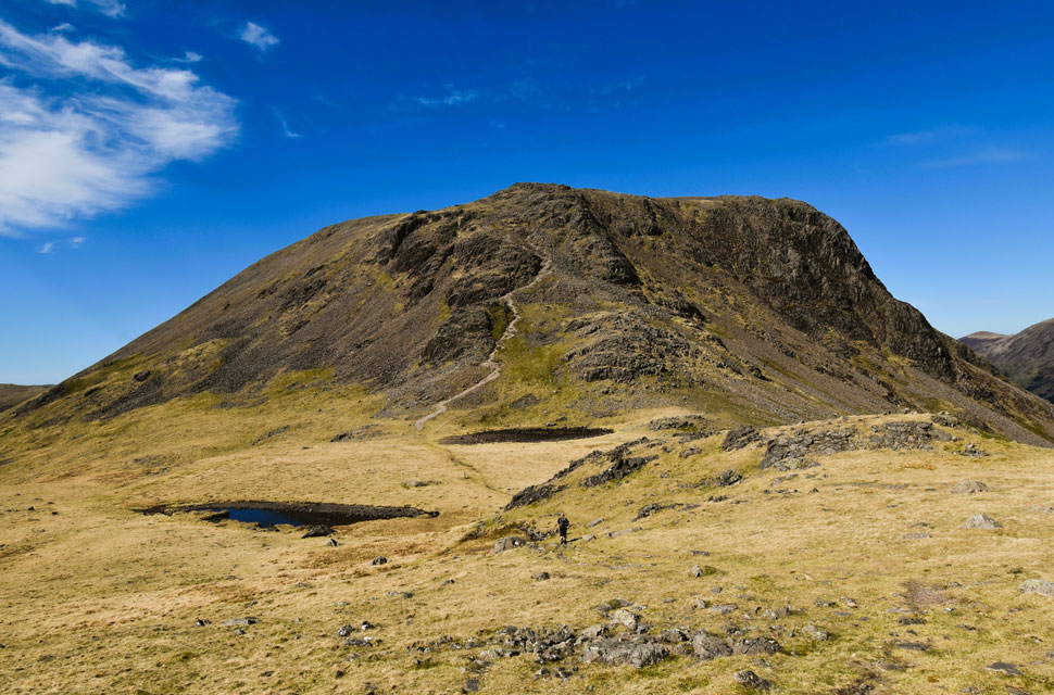
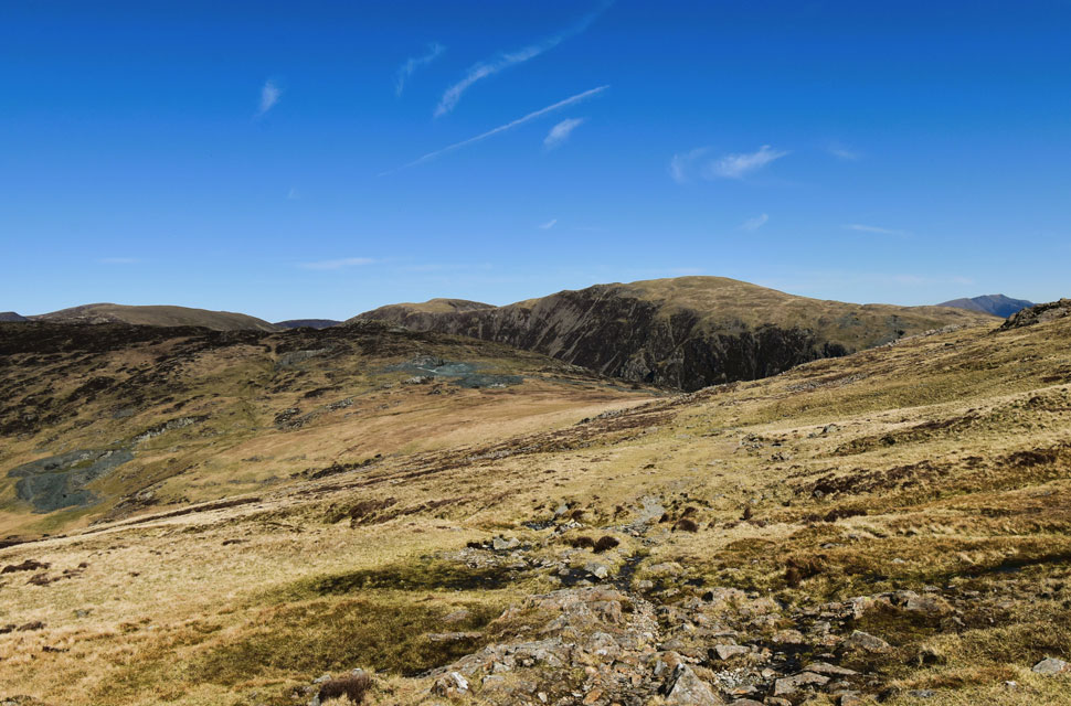
| Views towards Black Star on Fleetwith Pike, Dale Head, Hindscarth, Robinson and Honister Mine from the ascent of Grey Knotts 7:02am 3°C |
| Other than a slightly blocked nose, I'm pleased to report that I'm back to full health after my rather epic four month run of cold and flu. And what better way to celebrate than by planning a walk over the Gables and Kirk Fell - a route I haven't repeated since July 2021 and was eager to return to. I arrived at Honister Mine around 6:45am after my brief stop at Derwent Water. Other than one car whose occupants were nowhere to be seen, I had the place to myself and began kitting up to the hum of a nearby generator.
Despite the glorious sunshine there was a nip in the air, so I added my fleece lined softshell to take the edge off and was already regretting choosing long walking trousers. It was due to get quite warm later so I filled my water bladder with 3.5 litres of summer fruits and emptied my pack of a few non-essentials to lighten the load though it still landed against my back with a thud once shouldered. I left the dusty car park squinting into the low sun and picked out the fence line I'd be ascending by beyond the overspill car park and made my way towards it. |
 |
| Kirk Fell, Haystacks and Pillar from Grey Knotts summit 8:01am |
| After crossing a rickety wooden stile I began the steep ascent of Grey Knotts north-east flank, encountering cracked peat and grass so dry it almost crunched underfoot. A great start to the walk. The steep incline is instant, but ground is gained quickly as the path weaves up the hillside, with views back over Honister Mine and Dale Head. Barely ten minutes into the climb I was overheating thanks to the softshell I'd stubbornly refused to remove. I told myself to put up with it until I reached the summit, but another ten minutes later I felt like I was about to boil over so I had to stop.
By now I'd reached the stone slabs, around 1,100ft into the ascent, and despite knowing the ground eased beyond still questioning my stubbornness as I stood there in a sweat soaked T-shirt. Recovered, I got stuck back into the climb and noticed the fence I'd been following was leaning directly over the slabs most likely the result of folk hauling themselves up using the fence wire. The fence was half collapsed, held together by rusted strands and I was grateful there was no barbed wire involved. Once over the slabs the gradient did ease, and I continued following the fence across occasionally swollen ground until it steered right towards the summit. Not like I was counting but I'd managed to make it from car park to summit in one hour and one minute - my OCD quietly cursing the fact that I didn't make it exactly on the hour. |
 |
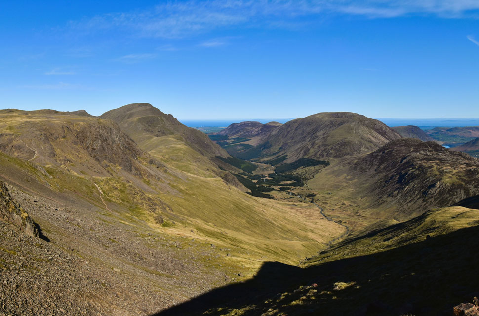
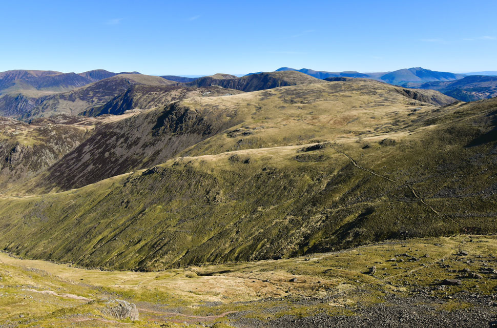
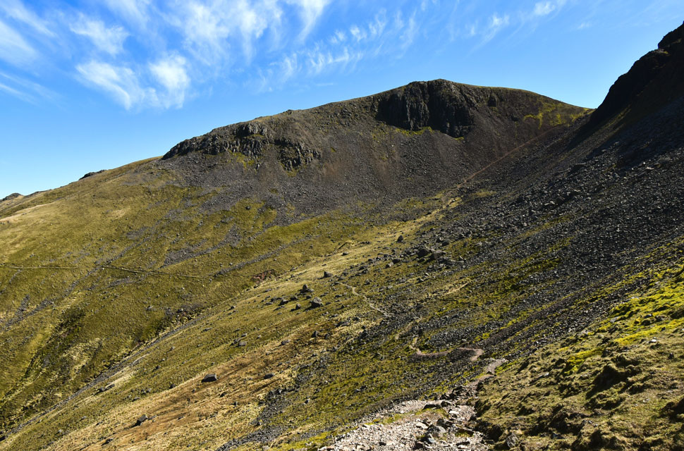
| Brandreth, Green Gable, Great End, Great Gable and Kirk Fell from Grey Knotts. |
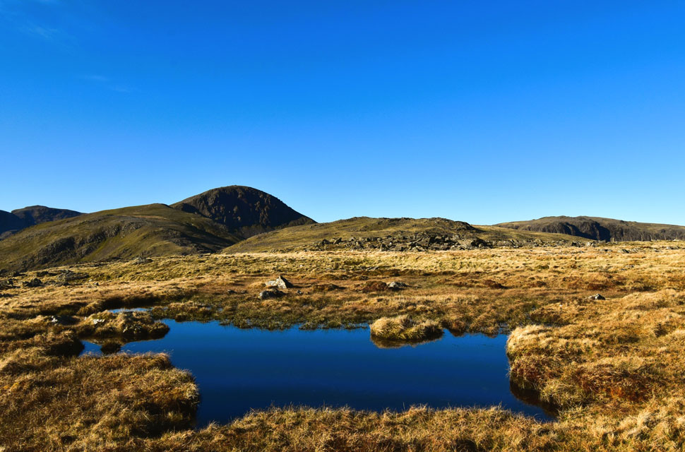
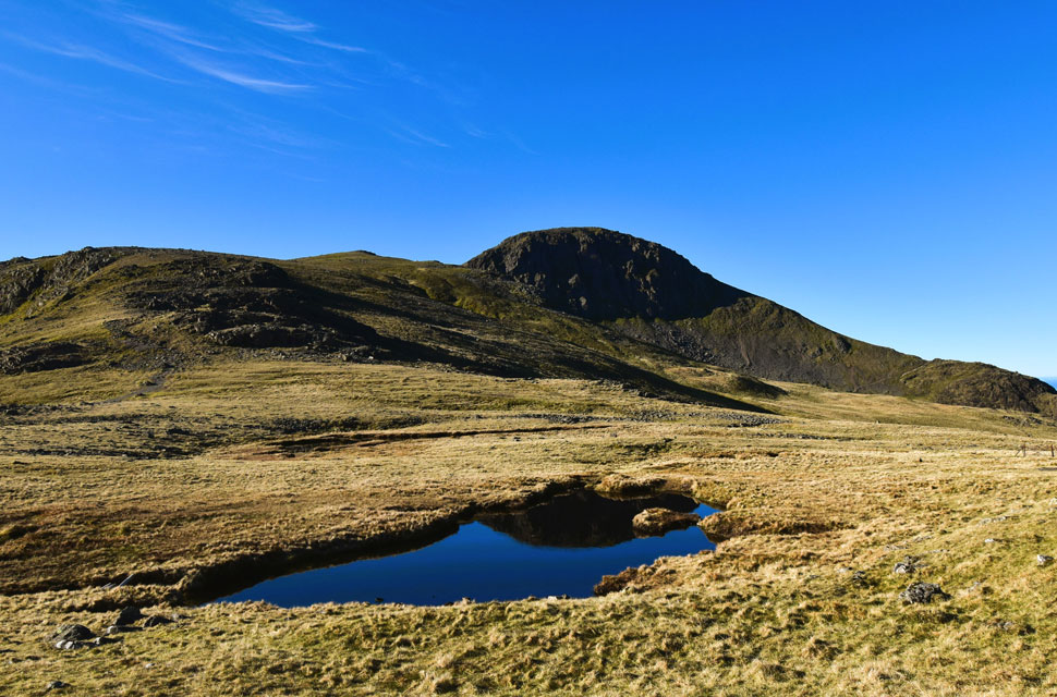
| There are three unnamed tarns on Brandreth. This one sits not far from the summit, with a second lying just beyond the fence you see on the right of the photo. The third is tucked just past the dip in an area known as Pile of Stone an image of which I have used as the banner at the top of this page. |
 |
| Green Gable and Great Gable from Brandreth. |
| With IIIgill Head and Whin Rigg appearing beyond Beck Head on the right. |
 |
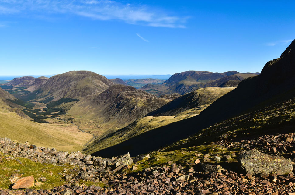
| Descending Brandreth. |
| The path naturally descends from right to left, picking its way over the boulders towards the two other unnamed tarns visible on the left of the photo. Off to the right lies Stone Cove beneath Great Gable, with Moses Trod cutting through the cove, a route I'll be using later on my return to Honister. |
 |
| Green Gable and Great Gable from one of the two unamed tarns. |
| Green Gable is next. |
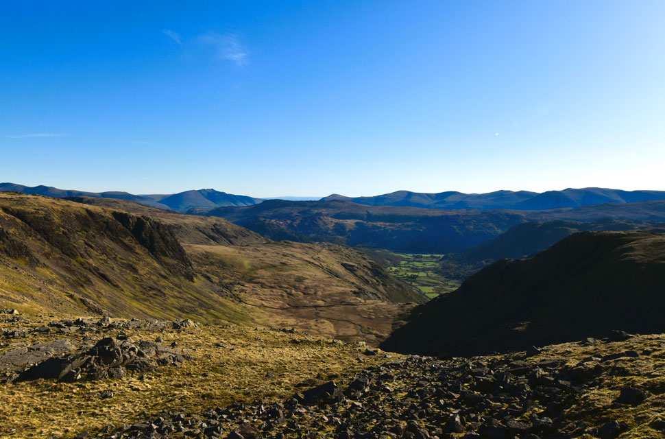 |
| The view from the top of Gillercomb Head into the Gillercomb, and Seathwaite Valleys below. |
| The forecasters mentioned there might be a slight haze in the forecast but all I can see are clear views all the way towards Skiddaw, Blencathra, The Dodds and the Helevllyn range. |
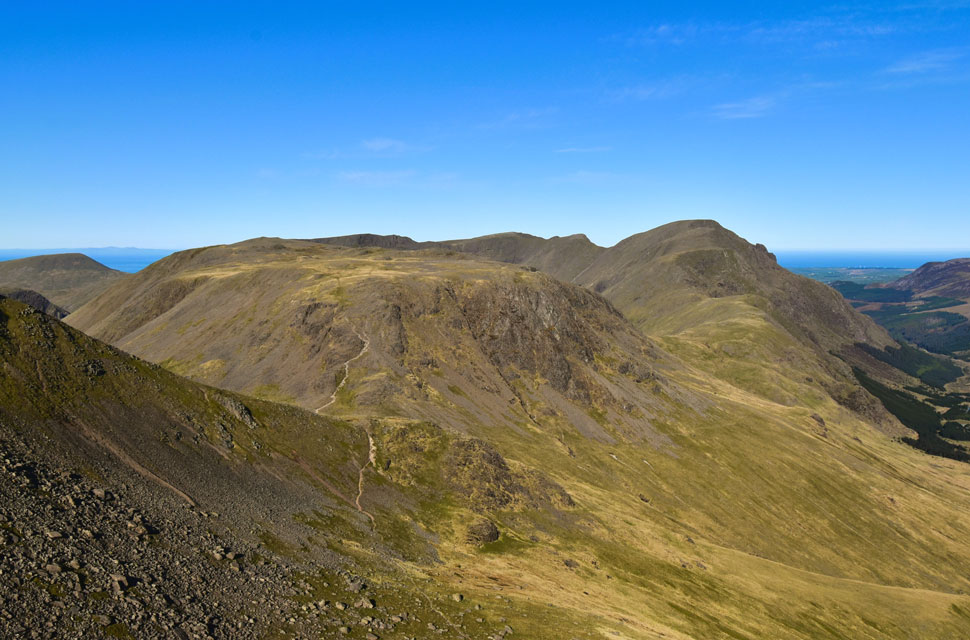 |
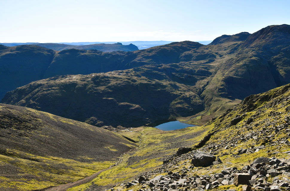
| The view over Stone Cove towards Kirk Fell, Pillar, Wind Gap, Black Crag, Scoat Fell, Red Pike (Wasdale) and Seatallan from Green Gable. |
| From the unnamed tarns I began my ascent of Green Gable, its stony, moderate gradient always taking me back to June 2019 and my round of the Ennerdale Horseshoe. Back then I'd tackled the outward leg from Bleach Green, Ennerdale in low cloud and strong winds, certainly not the best conditions for that kind of undertaking.
With Windy Gap just beyond Green Gable, my stomach was churning into knots knowing that once I decended into Windy Gap there'd be no turning back. Even now, every time I'm ascending Green Gable, my stomach still does a little loop the loop at the memory. Good stuff. |
 |
| Great Gable and Gable Crags from Green Gable summit. |
| I arrived on Green Gable's summit at 9:00am, exactly one hour after leaving Grey Knotts, good timing, I thought. I'd spotted a tent further down the north ridge but there was no sign of its occupants; perhaps it belonged to the owner of one of the cars back at Honister. Anyone's guess. As I made my way back towards the summit cairn, a walker appeared from the direction of Windy Gap.
He told me he was on a three day wild-camping trip on the hill. He'd started from Buttermere and spent a night on the High Stile ridge, but after that he kind of lost me pointing at places rather than naming them. He did mention he'd been up Scafell Pike yesterday, so I figured he must have camped at Sty Head and then come up Green Gable via Aaron Slack, especially after saying he'd only been on the go for about an hour. |
 |
| Stunning views into the Ennerdale Valley. |
| With Kirk Fell and Pillar seen to the left. |
 |
| The High Stile ridge, Haystacks and the Grasmoor Group from Windy Gap. |
| |
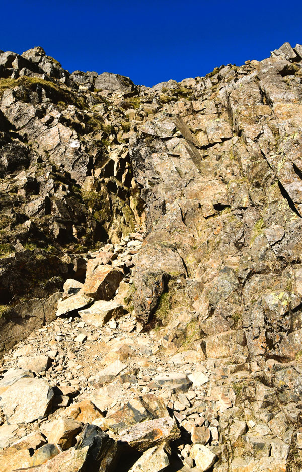 |
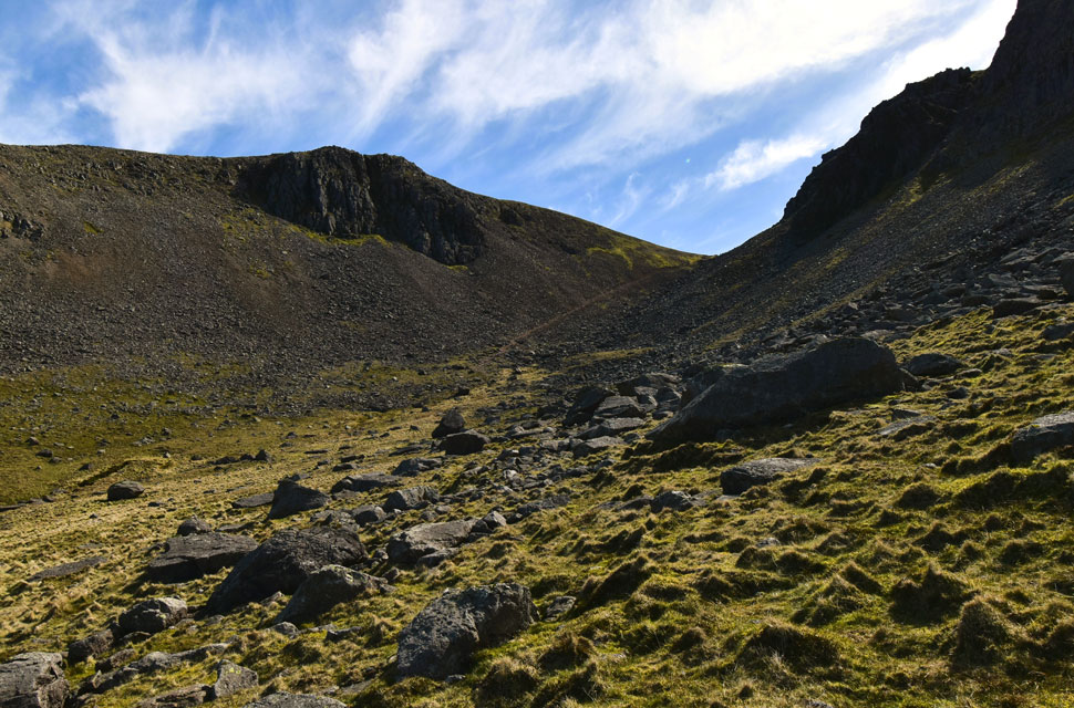
| The scrambly bit, Great Gable. |
| I bid the lad to enjoy the rest of his day and began my descent into Windy Gap boots rolling under dusty loose scree underfoot all enjoyable stuff which I'd missed duirng the winter months.
From Windy Gap I got stuck into the ascent of Great Gable first by the almost horitzontal path that ended below a patchwork of boulder followed by the odd scramble. |
 |
| The view down Aaron Slack towards Styhead Tarn. |
| With Seathwaite Fell and Allen Crags to the left, and Great End and Esk Pike rising to the right. |
 |
| Looking back on Green Gable, Base Brown, Brandreth, Dale Head, High Spy, Maiden Moor and Cat Bells. |
| With the scramble behind me, I reached the summit shoulder where a welcome cool breeze met me. From here a line of cairns guides the way over the shoulder and on towards the summit. |
 |
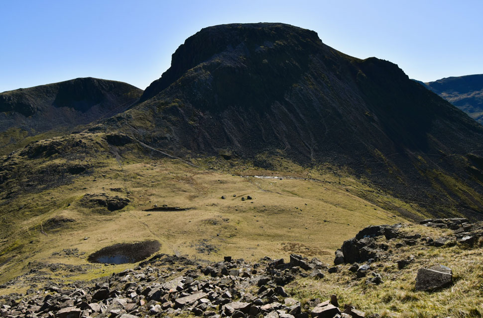
| Great Gable summit. |
| After picking my way over the boulders I reached Great Gable's summit shortly before 9:30am where I found a chap sitting down pulling on a pair of socks followed by his boots. I've no idea why he'd taken them off, but the thought of letting some cool air reach my own sweaty feet didn't seem like a bad idea. Instead, I sat down nearby, gave him a nod, and enjoyed a five-minute breather, something I wouldn't normally do, but with Great Gable virtually to myself I figured, why not. |
 |
| Descending Great Gable with views into the Ennerdale Valley and beyond. |
| I watched the chap get up and head off, following the three or four cairns that lead towards the top of Great Gable's steep north ridge, a mix of loose gravel, rock steps, and the odd scramble thrown in for good measure. |
 |
| Kirk Fell over Beck Head. |
| Five minutes after the chap had left, I began my own descent, following the line of cairns north over the summit shoulder. I expected to see him somewhere below, but he was nowhere in sight though I could hear the clatter of displaced rock from below.
The descent is slow going, steep and loose in places, and it's essential to stick to the path, even more so in descent. Eventually the chap came back into view as he reached the top of the zigzags, before disappearing from view again. |
 |
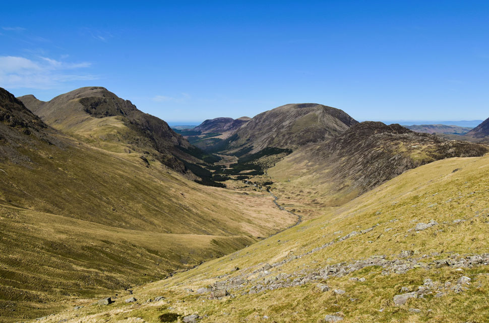
| Stone Cove and Moses Trod. |
| With Brandreth Fleetwith Pike, Dale Head, Hindscarth and Robinson beyond. |
 |
| The view over Beck Head towards Great Gable and Green Gable from Kirk Fell. |
| The chap reappeared as he began to cross Beck Head towards Kirk Fell where I figured I was only five minutes behind him. He hit the scree slope on Kirk Fell and began picking his way up the zigzagged path and minutes later I joined him. I got stuck into the ascent entering pockets of heat the cooler air now confined to the summits. I spotted the chap taking a break sat off path and I quickly caught up with him and stopped for a quick chat while gathering my own breath.
As it turns out the chap was from Carlisle and had set off from Seathwaite this morning and by now was second guessing why he'd included Kirk Fell in his walk which would mean he would have to re-ascend Windy Gap via Stone Cove which was quite a task I agreed. I left the chap and continued my ascent - the guy just minutes behind me until I steered right towards Kirk Fell's north top where my boots thanked me for its easy grassy gradient. Turning around I spotted the guy following me but then he stopped, turned back and rejoined the path, he either didn't want to summit the north top or thought I was heading the wrong way. |
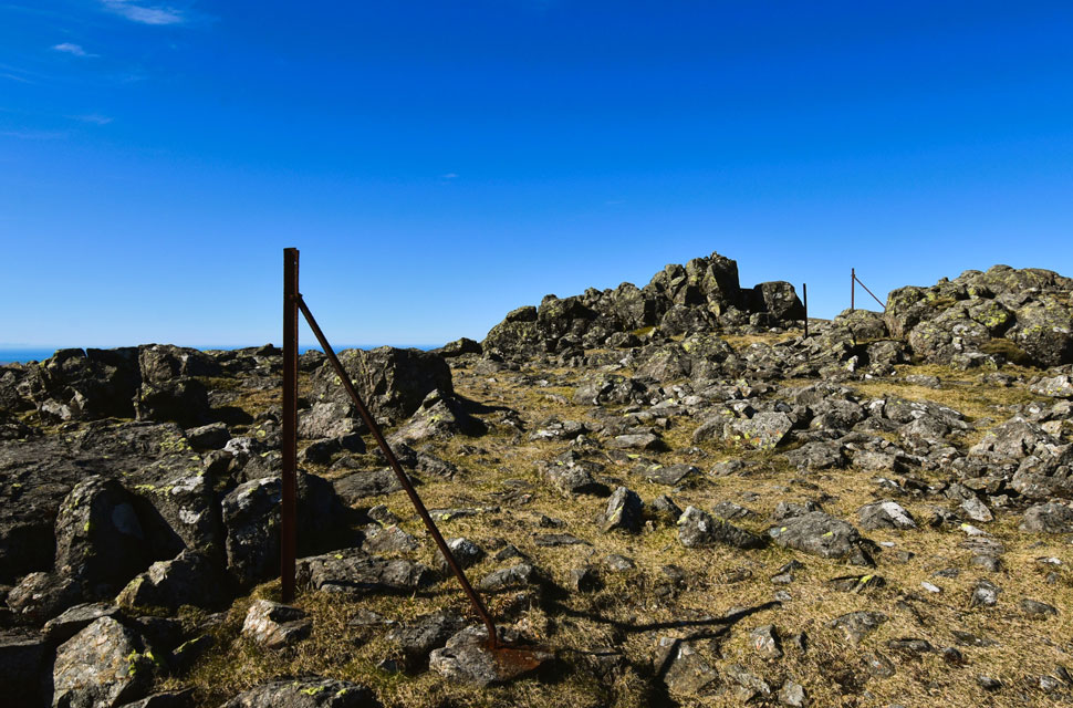 |
| Kirk Fell North Top. |
| Kirk Fell north top was soon reached from where I spotted the chap just below Kirk Fell's main summit. |
 |
| Kirk Fell from from Kirk Fell North Top. |
| |
 |
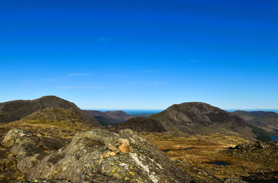
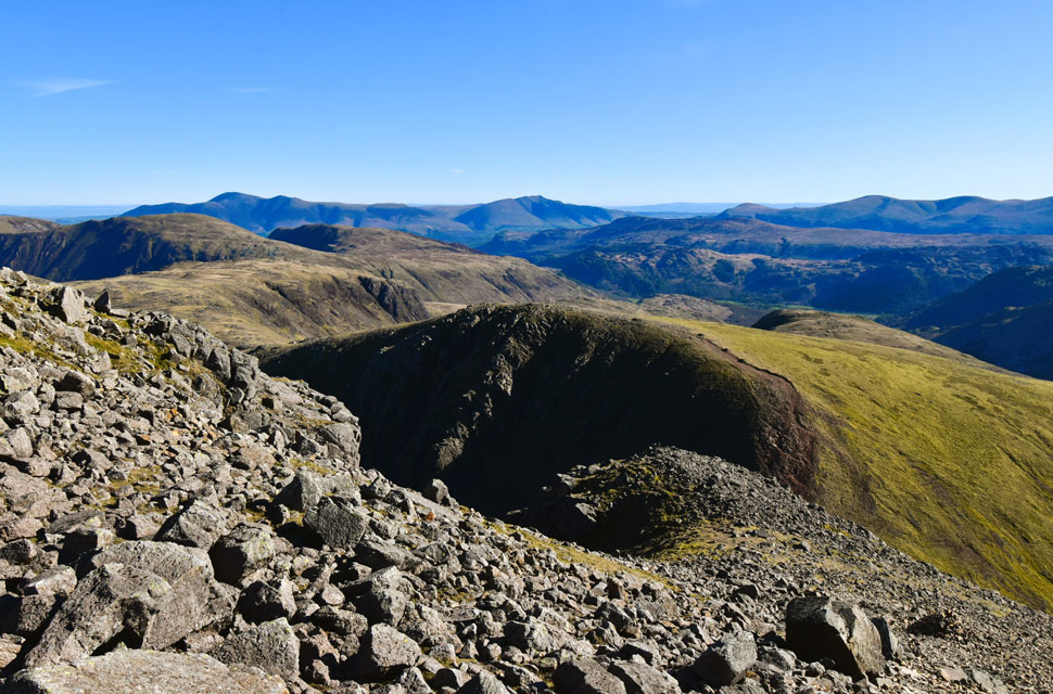
| The North, and North Western fells from Kirk Fell summit. |
| I soon arrived at the summit where I spotted the chap sitting just below the cairn. We exchanged another nod before I wandered over to the summit shelter for a quick breather. The sun was at eleven o'clock and still climbing into a cloudless sky, and it was at that moment I decided to treat myself to a proper sit down.
Positioned directly opposite the shelter's entrance, I eased myself down and instantly felt the warm sunshine on my face while the stone wall kept the wind out. I stretched my legs, unclipped my waist strap, and used my pack as a giant pillow, my body sinking back as my shoulder straps lifted away. I must have looked ridiculous had anyone wandered in, but I was unbelievably comfy. |
 |
| Views towards Allen Crags, Great End, Broad Crag, Scafell Pike, Sca Fell and Lingmell. |
| |
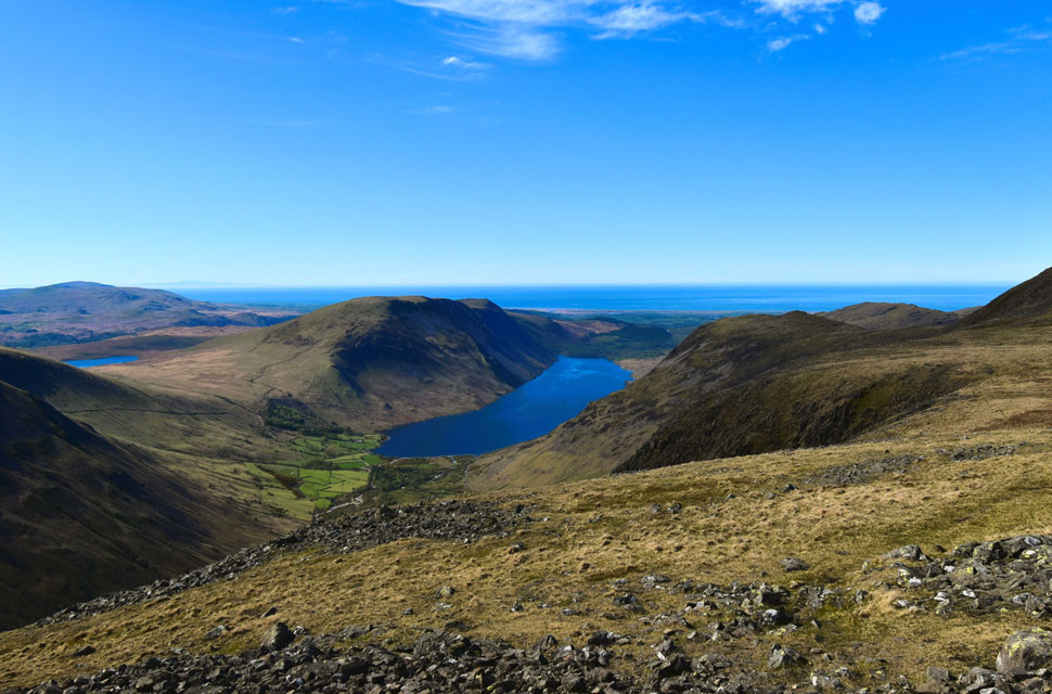 |
| Looking back on Wast Water, IIIgill Head, Yewbarrow, Burnmoor Tarn and a distant Irish Sea. |
| |
 |
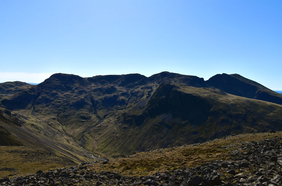
| The Gables over Beck Head from my descent of Kirk Fell. |
| Blinking away the sunlight, I let my eyes adjust and began my descent from Kirk Fell, my body taking its time to fall back into the rhythm of the hill after the rest. The chap from Carlisle was some way ahead, and below him I spotted a woman in ascent. We soon passed one another and, over a distance of five metres we sparked up a conversation.
She told me she'd be completing her Wainwrights today on Great Gable pointing at to Kirk Fell as number 213 before spinning around to Gable for 214. I was genuinely taken aback and absolutely delighted for her. What started as a quick exchange turned into a twenty-minute yarn about all things Lakeland. My one piece of advice being after today, lose the numbers, forget them, and walk at free will. |
 |
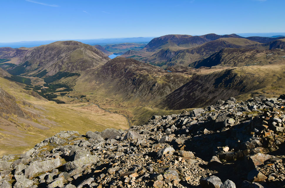
| One last look at Kirk Fell from Beck Head. |
| I left the woman to her ascent and continued my own descent, dropping into more pockets of warm air while taking long sips from my bite valve. I passed between the tarns at Beck Head already thinking about the short but steep pull needed to reach the path that leads through Stone Cove. It's always these little meaningless ascents that draw on your reserves, and this one dug deep. I picked my way over the grassy hillock and, with the north ridge towering above to my right, headed left and began my descent into Stone Cove. |
 |
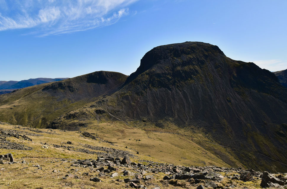
| Green Gable above Stone Cove. |
| It was from here that I spotted the chap from Carlisle, just about to start his ascent back up to Windy Gap. It wouldn't be half as difficult, I thought, if the path wasn't as loose as it was - two steps up, three steps down sprang to mind. |
 |
| Green Gable, Greengable Crag, Windy Gap and Gable Crag from Stone Cove. |
| |
 |
| Epic views into the Ennerdale Valley. |
| The walk through Stone Cove was delightful and always feels over too soon, made that bit more perfect when the views are as good as this. |
 |
| Fleetwith Pike, Dale Head and Robinson come into view. |
| Seen as I near Drum House. |
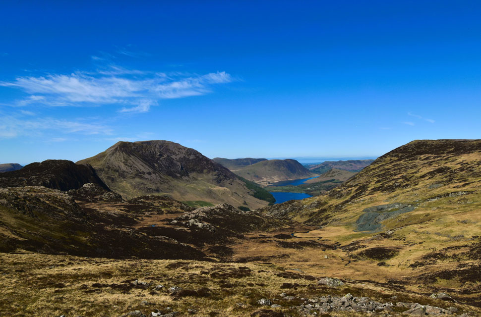 |
| Views over Dubs Bottom towards... |
| ...Haystacks, High Crag, Fleetwith Pike, Buttermere, Mellbreak, Crummock Water and the Loweswater Fells. |
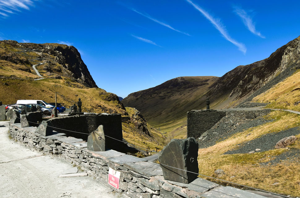 |
| Back at Honister Mine. |
| With Stone Cove behind me I followed Moses Trod until the path veered right across the west flank of Brandreth, where I spotted two walkers in descent. More pockets of heat, dried gooey lips, and a forehead so hot you could have boiled an egg on it accompanied me over the rock strewn path. The views more than made up for it. I passed a total of eight along this stretch: two solo walkers and half a dozen gents who each wished me a "good morning" even though midday had already passed, but I returned the gesture anyway. Hot and dusty now the long winter months felt a distant memory as the path ended at Drum House, where I passed a trio tucking into lunch.
My mobile phone rang, and I figured it would be one of two callers: work, or more serious my wife Paula, who would only to call if it's urgent when I'm out on the fells. I let it ring off, but when it started again I downed pack and rummaged through the lid to retrieve my phone. A missed call from Paula. I couldn't ring her back straight away as the signal was dipping in and out, so I descended a little further until the signal returned and the call connected. Paula answered immediately with, "Are you on your way home yet? I'm in Sainsbury's, the traffic's bad, what do you fancy for tea."
My signal held for a few minutes, long enough to report that the walk hadn't burned me out, a positive sign that my fitness was returning. I turned right and began my descent towards Honister Mine, glints of sunlight bouncing off half a dozen car windscreens on the car park below. I'd left Kirk Fell nearly two hours earlier, and it was close to 1pm by the time I arrived back at the car park, where I passed a Honister Land Rover Defender idling keys in the ignition, just chilling there on the dusty gravel followed by a single decker bright orange Honister bus with its battery on charge. A layer of dust had settled over the paintwork of my own car, thick enough to write your name in. Car unlocked I began my to load my gear into the boot not notcing the elderly couple parked alongside who were reading news papers. I removed my creased Softshell from my pack, placed it on a hanger then hung on the hook on the passenger rear. Easing myself down I began to untie myshoe laces as little dust clouds escaped the laces, a sure sign of a great day on the hill. |
|
| |
| Back to top |
 |
|