|
Foel-fras, Carnedd Gwenllian, Foel Grach, Carnedd Llewelyn & Yr Elen from Bethesda |
 |
 |
24th May 2026 |
 |
|
|
| |
|
Overview |
|
|
| Ascent: |
3,495 Feet - 1,066 Metres |
| Summits Over 3,000ft : |
5, Foel-fras - Carnedd Gwenllian - Foel Grach - Carnedd Llewelyn - Yr Elen |
| Visiting: |
3, Gyrn Wigau - Bera Bach - Foel Ganol |
| Weather: |
Sunshine Throughout With Cool Breeze Across The Summits Highs of 26°C Lows of 13°C Feels Like 14°C |
| Parking: |
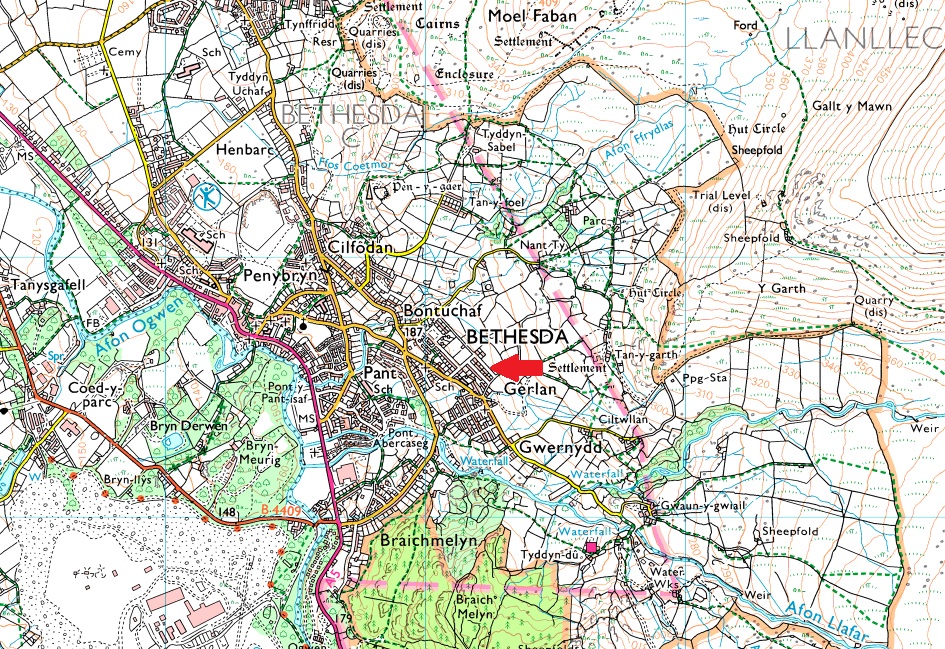
Upper Hill Street, Bethesda |
| Area: |
Carneddau Range, Snowdonia |
| Miles: |
11.4 |
| Walking With: |
On My Own |
| Ordnance Survey: |
OL17 Snowdon & Conwy Valley |
| Time Taken: |
6 Hours 20 Minutes |
| Route: |
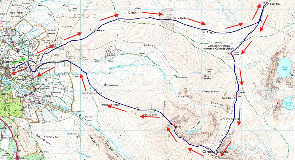
Bethesda - Tan-y-garth - Y Garth - Gyrn Wigau - Drosgl - Bera Bach - Yr Aryg - Foel-fras - Carnedd Gwenllian (Garnedd Uchaf) - Foel Grach - Gwaun y Garnedd - Carnedd Llewelyn - Yr Elen - Foel Ganol - Braich y Brysgyll - Cors Gwaun Gwiail - Afon Caseg - Tan-y-garth - Bethesda |
|
| |
|
Parking Details and Map |
|
|
| Nearest Post Code: |
LL57 3TE |
| Grid Reference: |
SH 5632 665 |
|
| |
|
Map and Photo Gallery |
|
|
 |
| |
| |
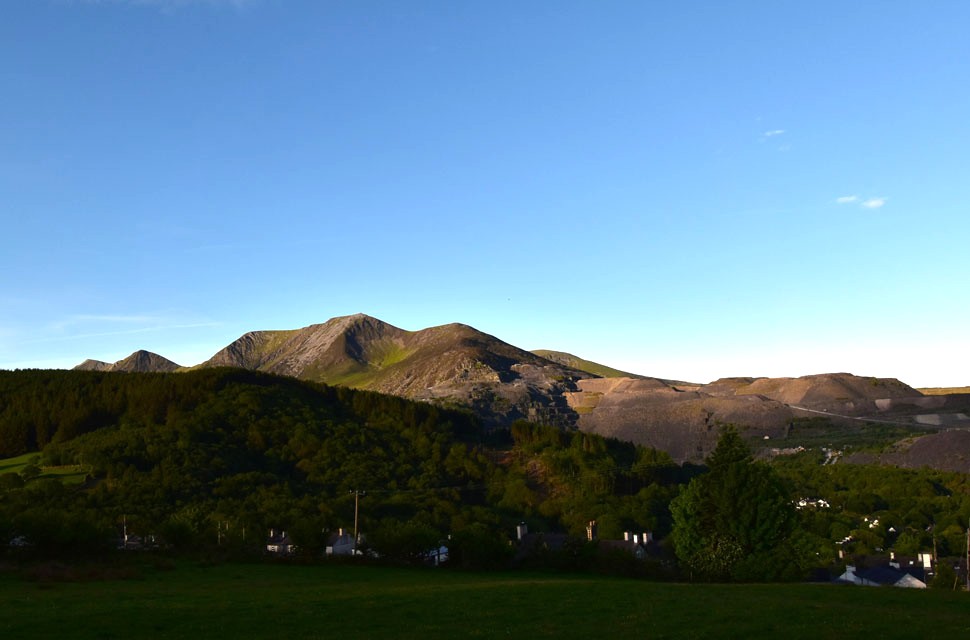 |
| Views towards Y Garn, Foel-goch, Mynydd Perfedd, Carnedd Filiast and Y Fronllwyd from Bethesda 6:32am 12°C |
I was undecided on where to walk this weekend, knowing the Lakes would be packed with Bank Holiday visitors. I took a gamble on a brand new walk on the Carneddau, collecting four new summits over 3,000 feet and leaving just four of the fifteen to do. The remaining four are Tryfan, Yr Wyddfa / Snowdon, Carnedd Ugain and, finally, Crib Goch. I'm in no rush to complete them, but it will be nice to have stood on all fifteen peaks over 3,000 feet one day. Today's plan was to start bright and early, leaving my car at the rear of residential housing on the outskirts of Bethesda. The village sits west of the Carneddau range and, geographically, it's the obvious starting point for visiting Carnedd Gwenllian or Yr Elen. But Bethesda is small, with narrow lanes, and it goes without saying to park respectfully and be considerate to residents.
I left home around 4:30am and arrived in Bethesda at 6:15am. Having already laced up at home, I'd driven in my boots ready for the off. It was a fairly mild start with no direct warmth yet, but the sky was cloudless and the heat would come soon. Nevertheless, I still threw on a softshell to take the edge off, although I must admit it was more through habit than necessity. With the car locked, I threw my pack over my shoulder not quite believing how heavy my pack felt thanks to the reservoir of hydration I was carrying. The last thing I needed was to run dry in searing heat while out on the hill. I turned left onto a narrow walled lane, then left again following a permissive footpath through two farmers fields before arriving at Tan-y-garth Farm. |
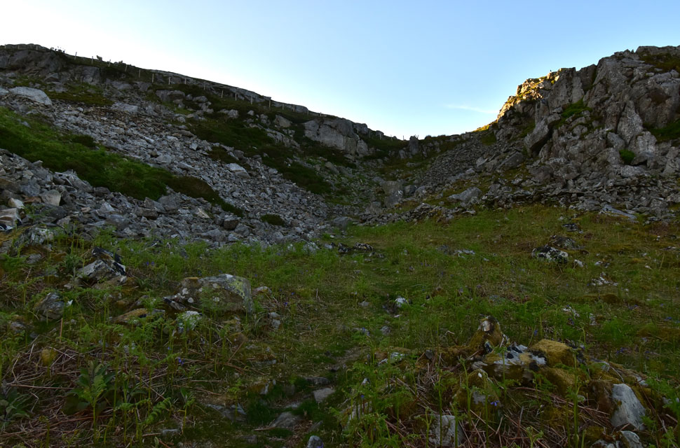 |
| Heading through Tan-y-garth. |
| Leaving Tan-y-garth Farm on my right, I climbed a grass bank and picked up a narrow trod through an old spoil heap ascending steeply over rough boulder until I reached the fence at the head of the old quarry. |
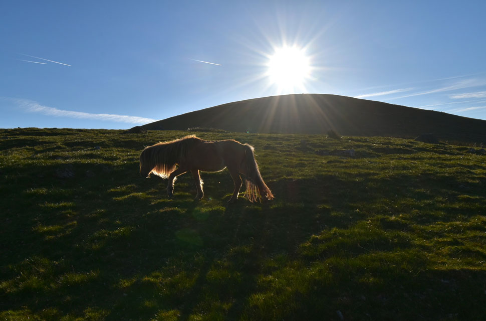 |
| Looking ahead towards Gyrn Wigau. |
I crossed over a wooden stile and bore slightly right rounding the side of the slope until I found myself looking down on a modern barn with extensive views towards Y Garn, Foel-goch, Mynydd Perfedd and Carnedd Filiast above the Ogwen Valley. The trouble was, I couldn't see a thing as the sun was shining directly into my eyes.
I de-shouldered and packed away my softshell jacket, instantly feeling a cool breeze blowing over my sweat-covered head and arms, which was blissful. Re-shouldered, and with a pair of sunglasses now donning my face, I continued towards my next objective of Gyrn Wigau where I passed herds of wild ponies grazing in the morning sunshine. |
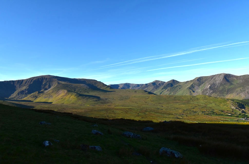 |
| Carnedd Dydfdd (left) and Pen yr Ole Wen (centre left) from the slopes of Gyrn Wigau. |
| It took a few minutes to get my bearings, with the Atlantic Slab on Carnedd Filiast seen far right which was once part of the Atlantic floor. Despite numerous visits, that huge slab of seabed perched almost vertically on the side of a mountain still blows my mind, which also made a great reference point throughout today's walk. |
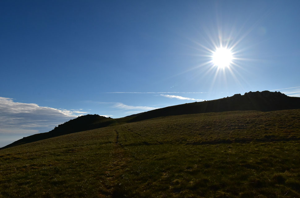 |
| Gyrn Wigau twin summits appears. |
| The direct sunlight was becoming a minor problem; despite wearing sunglasses, the glare and heat were so intense I struggled to lift my head as I climbed the grassy slopes of Gyrn Wigau. At one point I felt like a rasher of bacon under the full heat of the grill. Thankfully, on reaching the summits of Gyrn Wigau the ridge changed direction and I was finally out of the direct sunlight. |
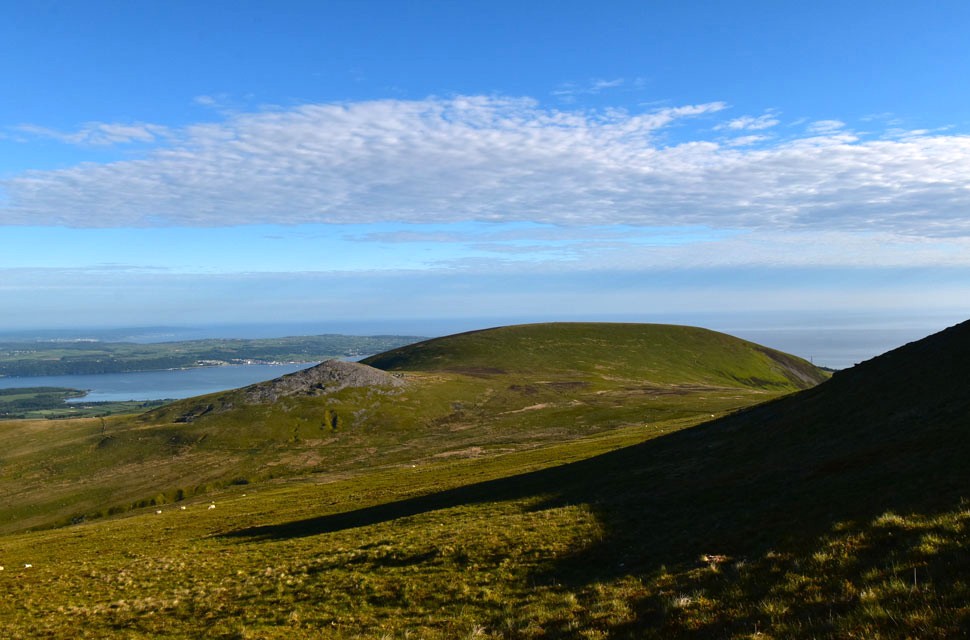 |
| Looking west towards Llefn (left) and Gyrn (right) |
| With the Menai Straight and Conwy Bay beyond. |
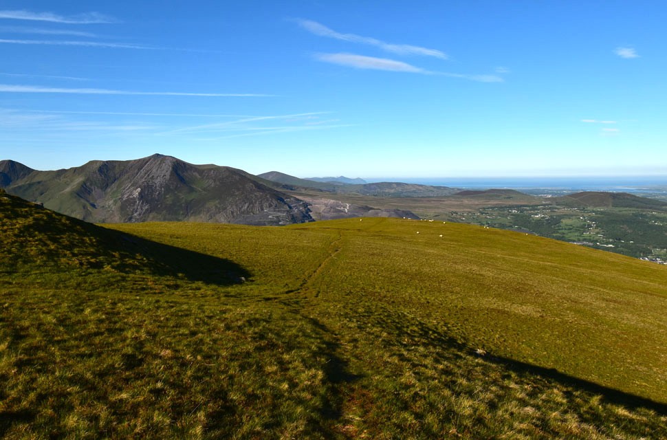 |
| Looking back along the grassy ridge. |
| Towards Elidir Fawr, Carnedd Filiast, Mynydd Perfedd and Foel-goch to the left. |
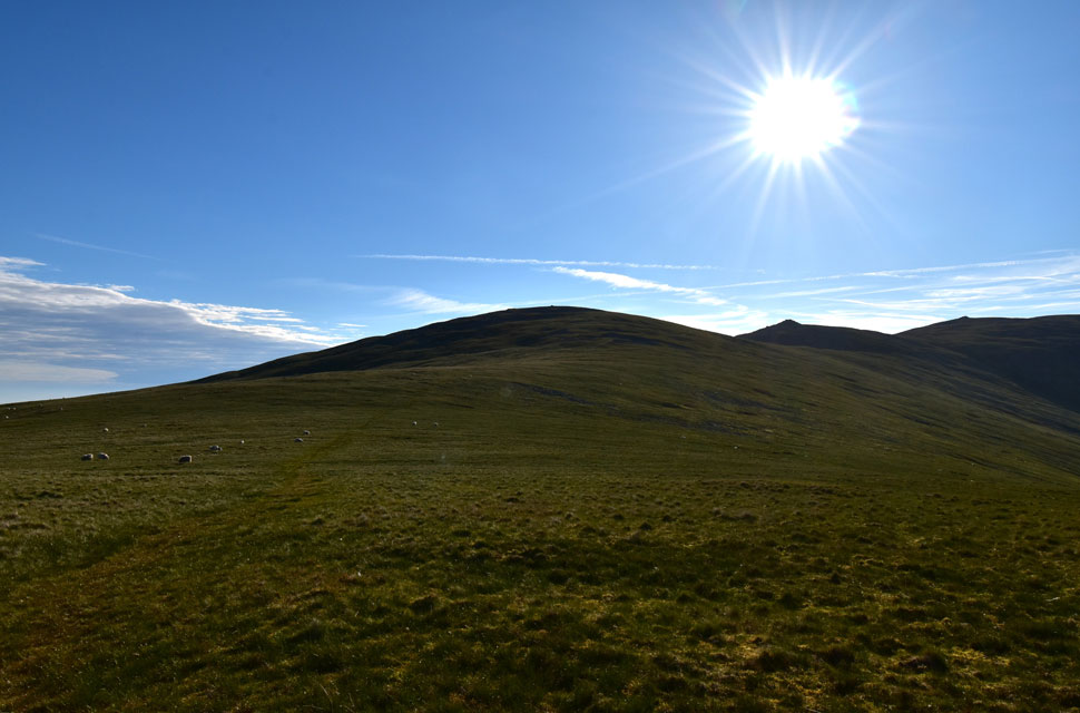 |
| Ahead, Drosgl, Bera Bach and Yr Aryg. |
| I took in the slight descent from Gyrn Wigau and rejoined the grassy path with views of Drosgl directly ahead. My plan had been to summit Drosgl, but I changed my mind and decided to flank it in favour of an out-and-back to Foel-fras instead. Both Foel-fras and what would have been my first three-thousander of the walk, Carnedd Gwenllian, were still out of sight, but they would appear once Bera Bach is reached. |
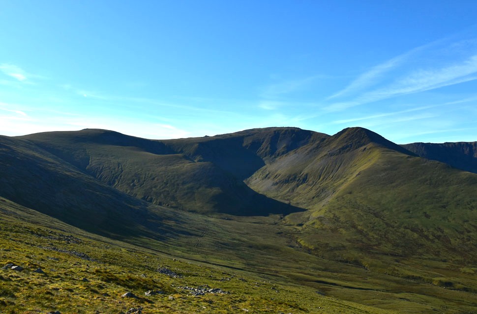 |
| Views towards Carnedd Grach, Clogwyn yr Heliwr, Carnedd Llewelyn and Yr Ellen. |
| Not clearly seen is Yr Elen's north-east ridge on the right, a popular steep route known locally as the Dragon's Teeth Ridge - you'll see why later. |
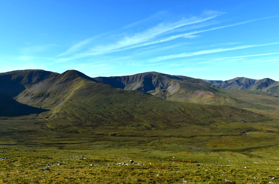 |
| Carnedd Llewelyn, Yr Elen and Carnedd Dafydd from the south flank of Drosgl. |
| With Y Garn and Foel-goch seen in the distance. |
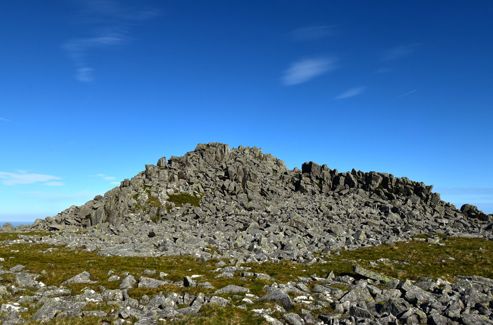 |
| Bera Bach summit. |
| With the south flank of Drosgl behind me, the rock-strewn slopes of Bera Bach appeared. Here I could either flank Bera Bach just as I had Drosgl, or head straight up the slope. I chose the latter, knowing that from the top I'd finally get my first views of Foel-fras and Carnedd Gwenllian. |
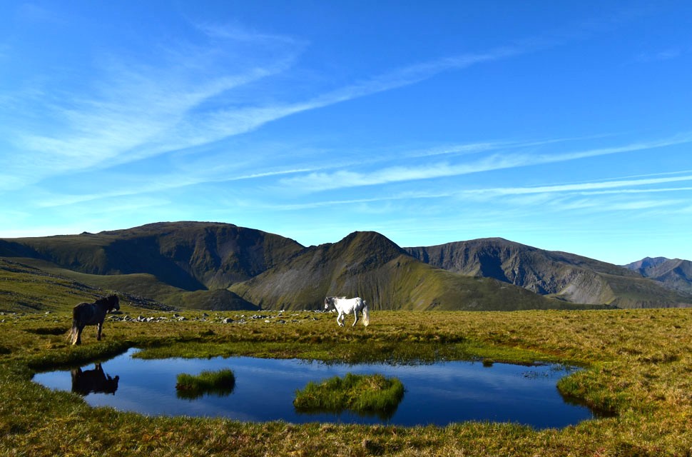 |
| Carnedd Llewelyn, Yr Elen and Carnedd Dafydd from Bera Bach. |
| Yr Elen north-east ridge is begining to take shape now as I pass Bera Bach summit. |
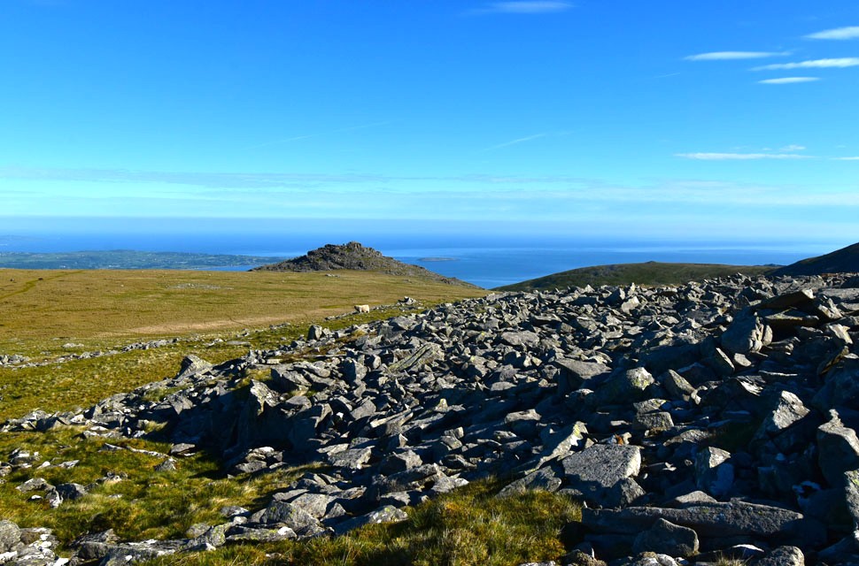 |
| Bera Mawr and Llwytmor Bach from Bera Bach summit. |
| With Conwy Bay and the Irish Sea beyond. |
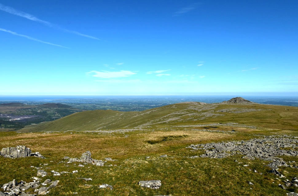 |
| Looking back on Bera Bach, Drosgl and Gwyn Wigau. |
| The miles are really starting to show now. |
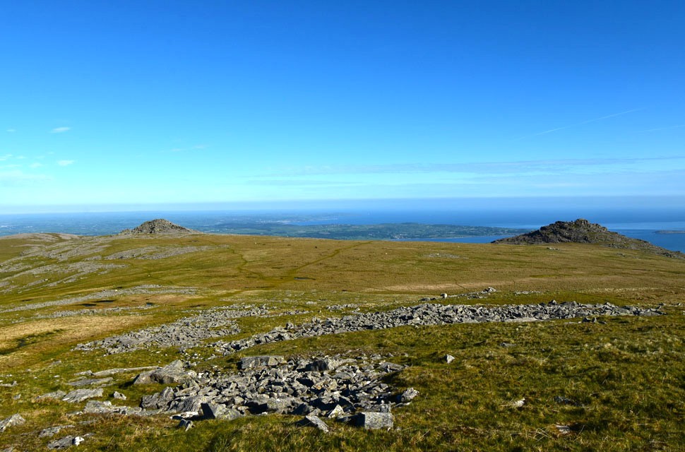 |
| Bera Bach and Bera Mawr. |
| |
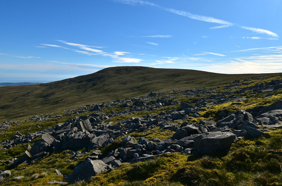 |
| Foel-fras across the head of the valley. |
| With Bera Bach behind me, I left the trod while flanking the mid slopes of Yr Aryg, not wanting to lose too much height that I'd only have to regain. After crossing two or three boulder fields I continued along the contour and crossed the head of the valley towards Foel-fras. |
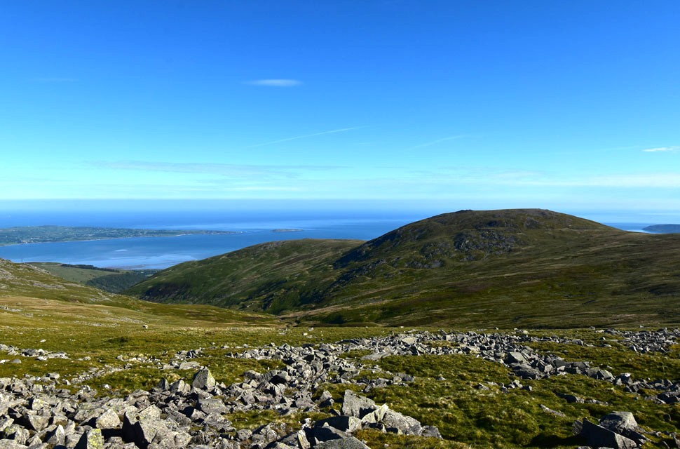 |
| Looking back Llwytmor and Llwytmor Bach. |
| With Colwy Bay beyond. |
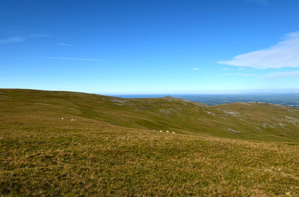 |
| From the head of the valley... |
| ...I look back on Bera Bach not quite believing how smooth conditions were underfoot. |
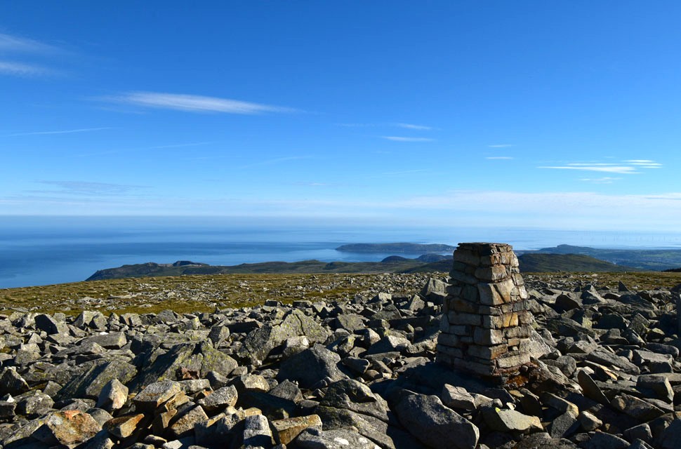 |
| Conwy Bay from Foel-fras summit. |
I left the head of the valley behind and began gaining ground on the ridge linking Foel-fras with Carnedd Gwenllian. I was surrounded by the unfamiliar sound of dozens of seagulls squawking noisily overhead, though I suppose it's only right being just four miles from the coast. I linked up with the path and, despite boasting about how good the crossing of the valley head had been, it was nice to have a proper path underfoot again. I swapped grass for boulder as I gained height towards the summit, where the path flanks a stone wall. At times the wall was shoulder-height, and the thought of walking in shade was tempting - but I was put off by thousands of daddy-long-legs protesting my presence.
At one point I swear my vision turned black; there were just so many of them. I made a hasty retreat and headed instead for the summit trig point, where I found a chap with his dog taking in the coastal views. This was the same walker I'd seen ahead of me earlier, who had headed straight for Carnedd Gwenllian rather than crossing the head of the valley before making the out-and-back to Foel-fras. It turned out he was walking the same route as me and, like me, had decided to add Foel-fras on as an afterthought, seeing as it was so close. I didn't say owt, but it felt like we'd read each other's minds. After a quick chat, the chap got up and left me with the summit to myself. |
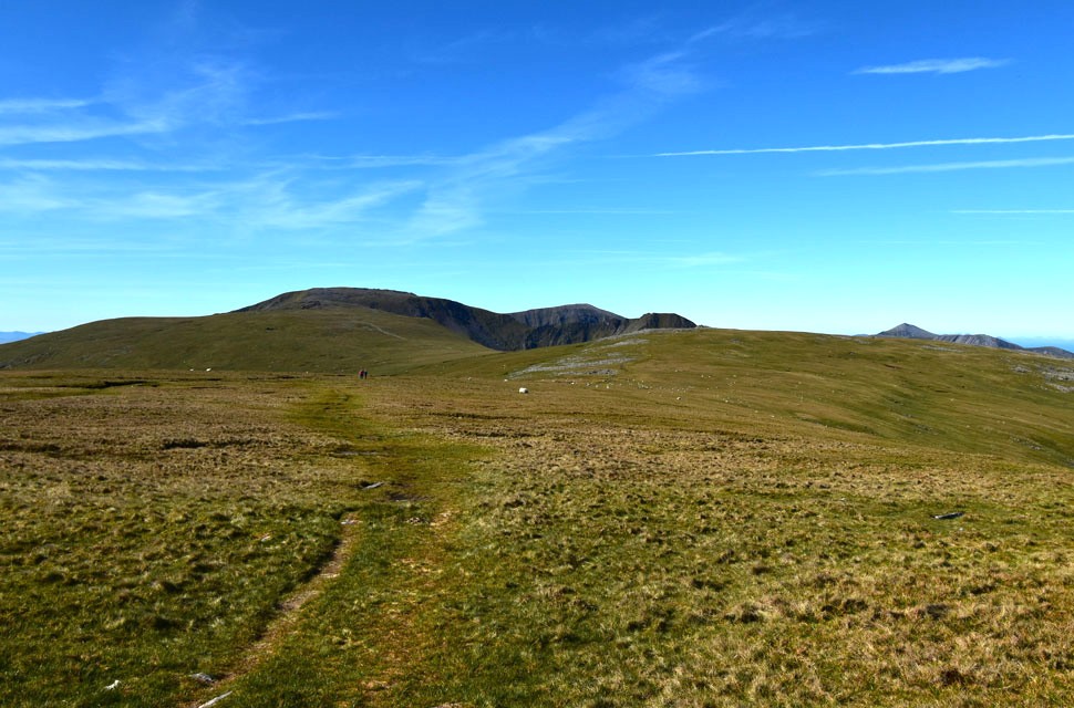 |
| Views towards Carnedd Gwenllian, Carnedd Grach, Carnedd Llewelyn, Carnedd Dafydd and Yr Elen. |
While enjoying the coastal views I was joined by a group of five young walkers, four lads and a girl - all dressed in the latest walking fashion: bright yellows, blues and oranges, lightweight hoodies pulled over baseball caps, and top-of-the-range outdoor sunglasses. They looked like they'd just stepped off the front cover of a walking magazine, tapping the trig in silence as they passed.
I got the feeling we were on the mountain for different reasons. |
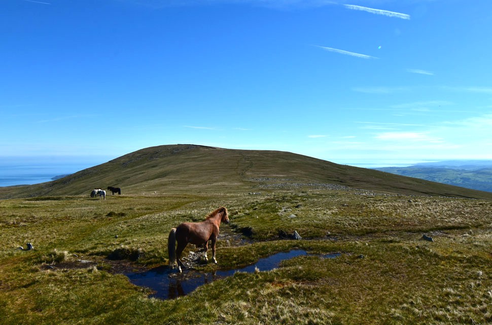 |
| Looking back on Foel-fras. |
| It wasn't so strange seeing wild ponies lower down the hill, but here I was over three thousand feet, the equivalent of the Helvellyn or Bowfell range and there were dozens of them, all enjoying the morning sunshine. |
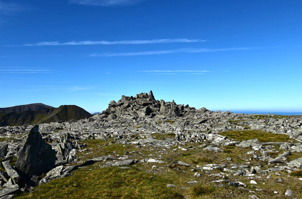 |
| Carnedd Gwenllian summit with Carnedd Dafyyd and Yr Elen beyond. |
The young group had left before me and I allowed a good five minutes before I left Foel-flas sighting the group as they joined the slopes of Carnedd Gwenllian. I crossed the grassy ridge and began the steady slog up Carnedd Gwenllian where I found I had the summit to myself. The group where nowhere to be seen so I presumed they descended west towards Bera Bach.
Carnedd Gwenllian was formally known as Carnedd Uschaf until September 2009 in an effort to rename the summit Gwenllian who was the only daughter of Llywelyn ap Gruffudd, the last Prince of Wales. The campaign sought to place Gwenillian alongside her family, as nearby peaks are already named after her father (Carnedd Llewelyn), her mother (Yr Elen), and her uncle (Carnedd Dafydd) |
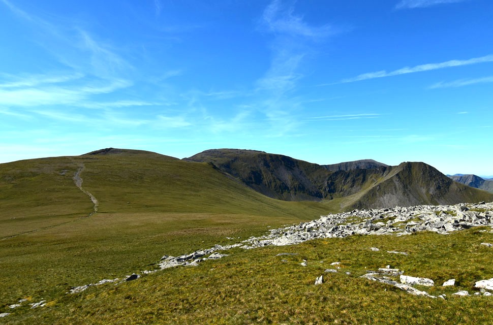 |
| Carnedd Grach, Carnedd Llewelyn, Carnedd Dafydd and Yr Elen from Carnedd Gwenllian. |
| After a few moments spent on Carnedd Gwenllian, I crossed the rock strewn summit and began my descent, where I passed a young girl in ascent and a quick "morning" was shared. I was still wondering where the group had gone when, halfway across the ridge, I glanced back and spotted them taking a break on the south slope of Carnedd Gwenllian. |
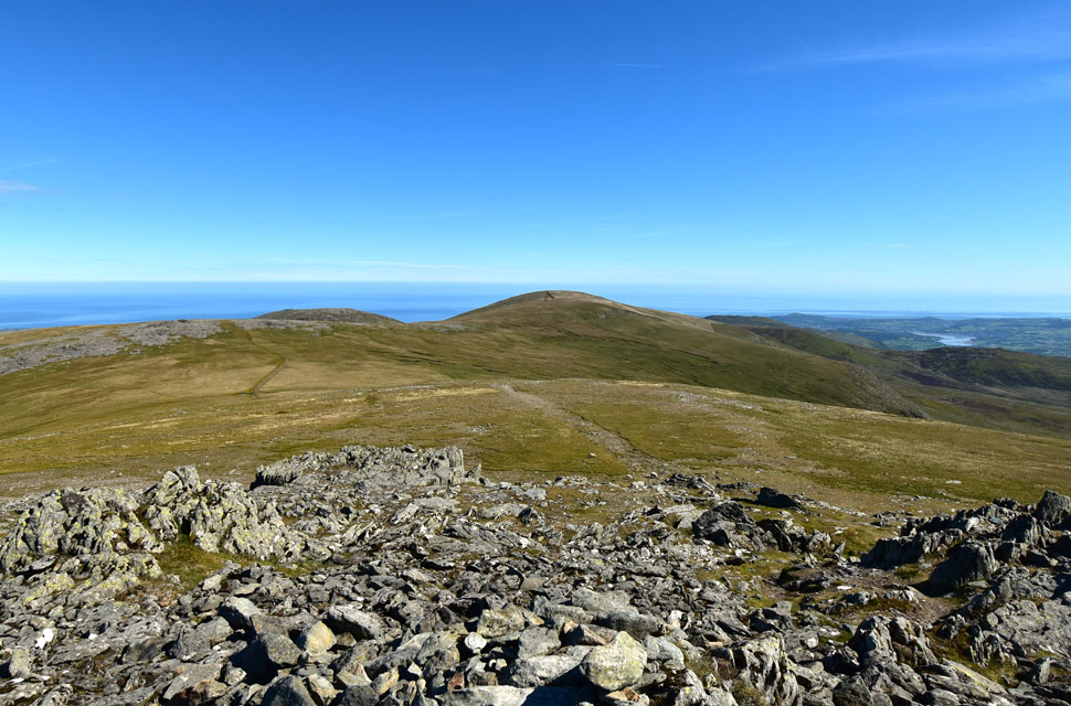 |
| Looking back on Carnedd Gwenllian and Foel-fras from Carnedd Grach. |
| Crossing the ridge was blissful in the mid-morning sunshine, and I hit the slopes of Carnedd Grach in good stead, passing a solo walker who told me he'd spent the night wild camping on Foel-fras. He'd seen a cracking sunset last night followed by an equally cracking sunrise this morning. I mentioned how quiet it was for a Bank Holiday weekend the chap replied "They've all gone to the Lake District!" |
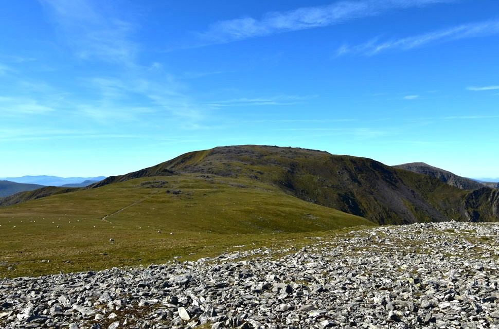 |
| Carnedd Llewelyn and Carnedd Dafydd from Carnedd Grach. |
| At 3,491 ft (1,064 metres), Carnedd Llewelyn is Wales's third‑highest mountain and the highest peak on the Carneddau range. |
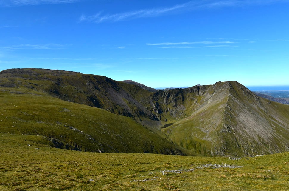 |
| Carnedd Llewelyn, Carnedd Dafydd and Yr Elen. |
| Yr Elen's north-east ridge came into view for the first time and I was blown away. It's a four-mile walk through the valley on mostly boggy, grassy trods from Bethesda, but what staggered me most was how bluntly steep the base of the ridge is - a wall of ground that has to be gained before the ridge properly even begins. It looks a difficult but very enjoyable and popular route onto the mountain. |
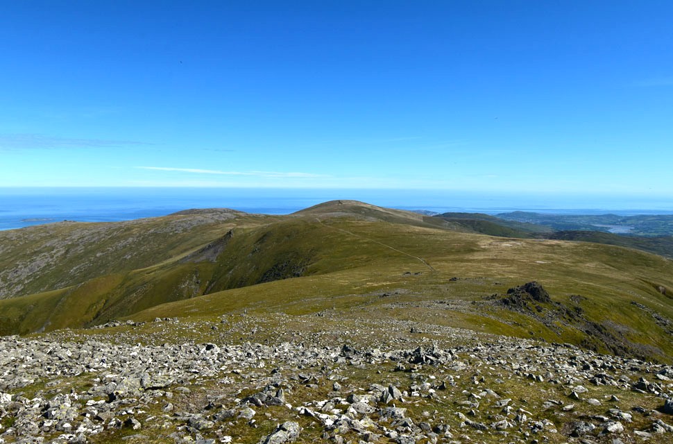 |
| Looking back on Carnedd Grach, Carnedd Gwenllian and Foel-fras from the slopes of Carnedd Llewelyn. |
| |
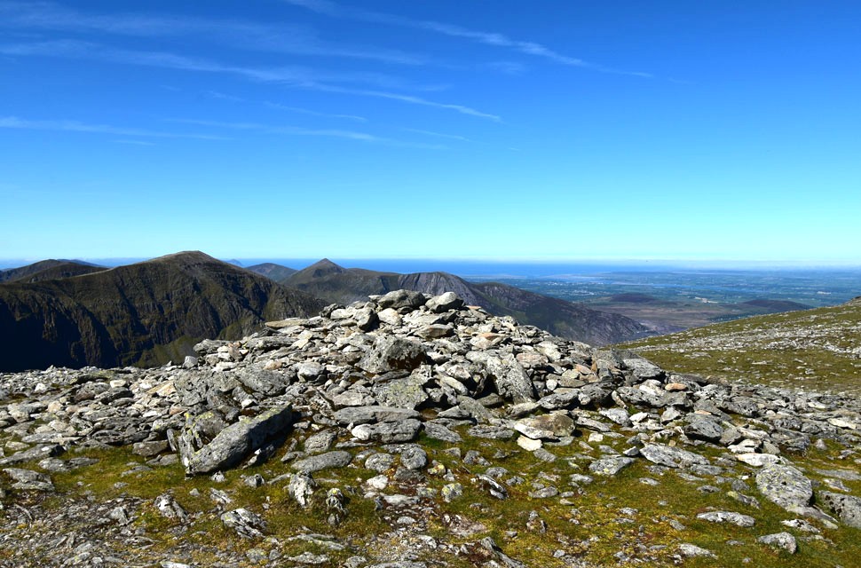 |
| Carnedd Dafydd and Elidir Fawr from Carnedd Llewelyn. |
I swapped the smooth grassy ridge for rough boulder and a narrow trod that weaved its way over the summit shoulder, where I passed another solo walker and a quick "hi" was shared across thirty feet of rock. Looking back, the group I'd left on Carnedd Gwenllian were gaining on me, possibly only a hundred yards away now. I crossed over the shoulder and spotted the summit cairn about eighty yards ahead. By now the mid-morning heat was pushing into the low twenties, and I don't mind admitting my breathing was laboured through combination of heat and exertion.
By the time I reached the cairn I was more composed, arriving at the same time as a young lad who had ascended via the Ffynnon Llugwy Reservoir. I was distracted by the sound of what was clearly a mountain rescue helicopter somewhere over the Ogwen Valley, the noise from the rotors punctured the silence but I couldn't see it. I noticed the young lad was looking too and when it finally came into view over Tryfan I walked over. He seemed genuinely concerned as we both watched the helicopter descend from Tryfan into the valley, the thump of the rotor blades sounded like the helicopter was much closer than it actually was. |
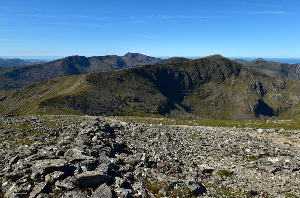 |
| Looking South towards Tryfan, The Glyders, Y Garn, Foel-goch and Elidir Fawr from Carnedd Llewelyn. |
| A few minutes later I glanced around to find the group had reached the summit but instead of heading straight for the cairn they veered right and instantly I knew where they were heading - Yr Elen. |
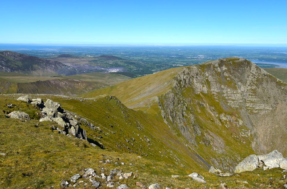 |
| Yr Elen. |
With the noise of the helicopter still carrying across the range, I left the summit cairn, taking long gulps from my bite-valve when I noticed pockets of air seeping through, a sign my hydration was running low, I de-shouldered, unclipped the lid straps and pushed my hand into the bladder pocket. There was still a good handful of summer fruits left probably close to a litre. Panic over, I muttered. I'll be fine.
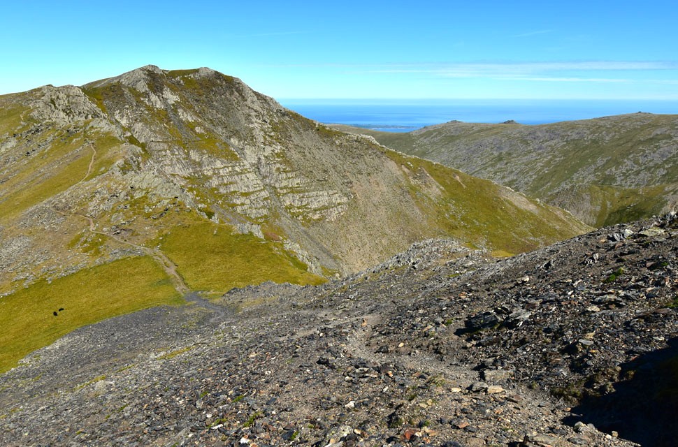
By now the group had stopped behind a large boulder and were taking their packs off. Blimey, I thought, these young 'uns like their breaks! I re-shouldered my pack and began my descent before crossing a grassy plateau to the very edge of the escarpment, from where I'd get the best view of the ridge. |
 |
| Yr Elen North-East Ridge. |
| With Ffynnon Caseg below. |
 |
| Descending the ridge towards Yr Elen. |
| I began my descent from the top of the escarpment and joined a narrow path zig-zagging through staggered boulder and stone. I heard the sound of sliding rock behind me and noticed the group were about fifty yards back. Having left their packs on the summit, they were lighter on their feet and closing in fast. |
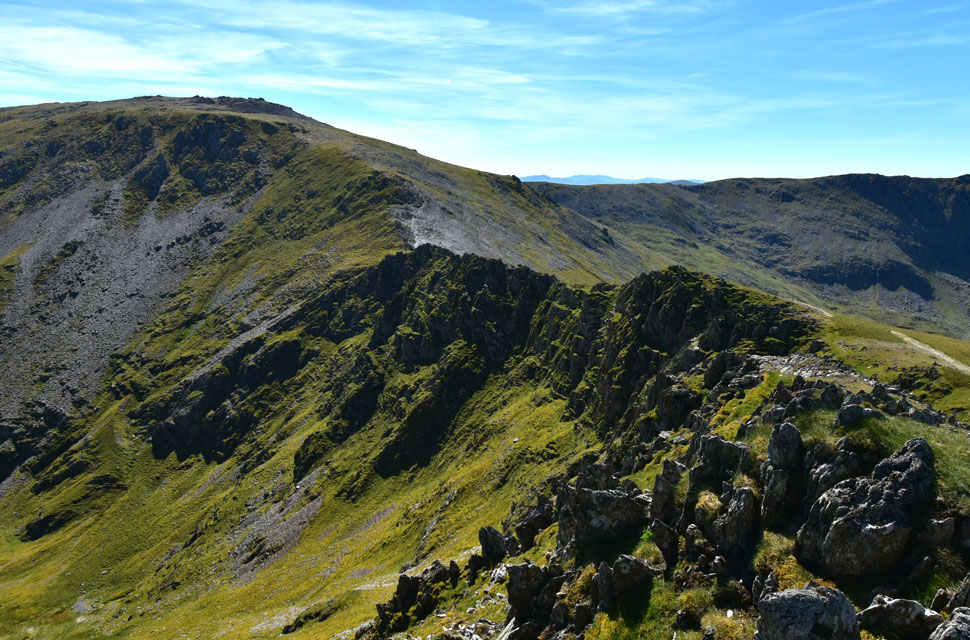 |
| Looking back at Carnedd Llewelyn from Yr Elen. |
I managed to keep ahead of the group, but instead of heading straight for the summit cairn I climbed a grassy knoll that I knew marked the head of the north-east ridge and in doing so managed to reopen the two healed blisters on my feet, the very same ones my new work shoes had caused. The same two I'd felt last weekend walking with David and Rod above the Swindale Valley. The same two I'd chosen to ignore. Damn and blast.
The group followed me onto the knoll, thinking I assume it was the summit, even though the actual cairn lay about fifty yards to the west. I tried to save their embarrassment by saying, "What a view this is from the top of the north-east ridge," but it didn't quite click. After a few minutes they headed off. |
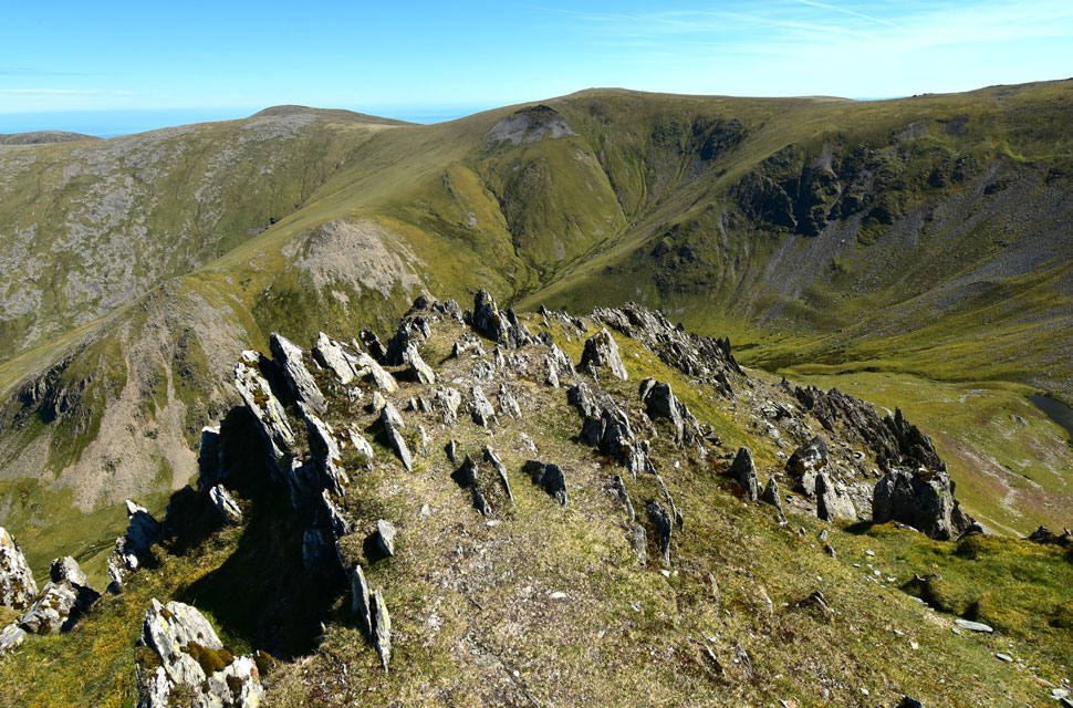 |
| The Dragons Teeth Ridge (Yr Elen North-East Ridge) |
| With Foel-fras, Carnedd Llewllyn and Carnedd Grach beyond. |
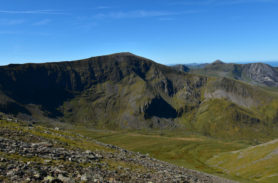 |
| Carnedd Dafydd. |
| With Foel-goch, Elidir Fawr, Mynydd Perfedd and Carneed Filiast beyond. |
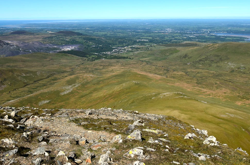 |
| Descending Yr Elen with distant views of Bethesda. |
| |
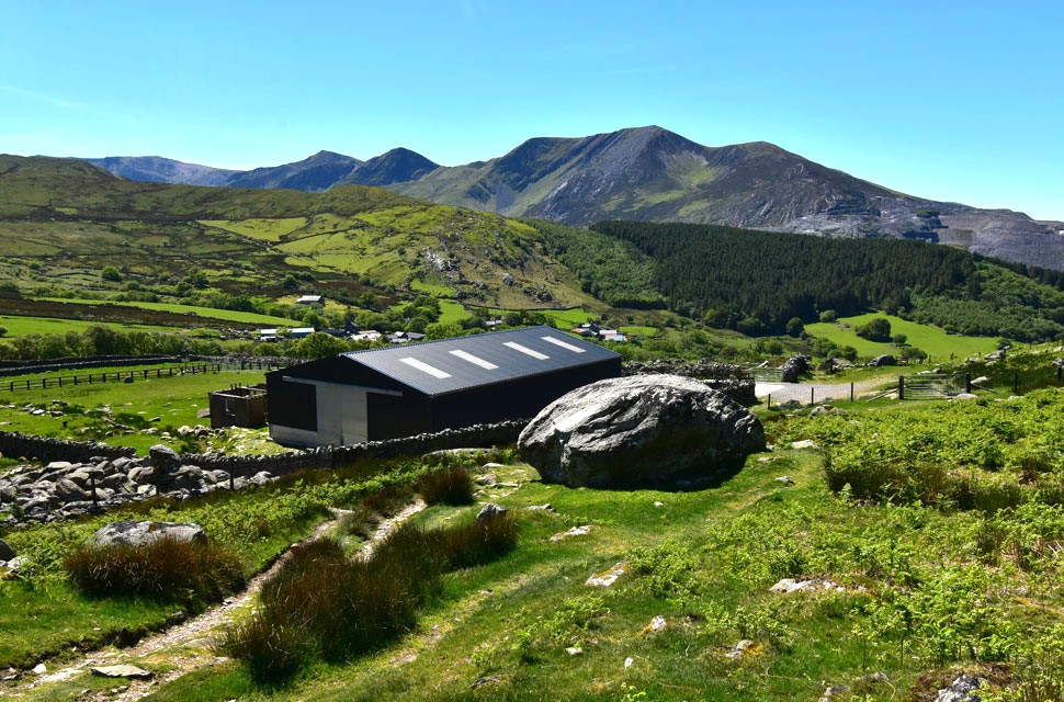 |
| Y Garn, Foel-goch, Mynydd Perfedd, Carnedd Filiast and Y Fronllwyd from Tan-y-Garth, Bethesda. |
I eventually left the top of the north-east ridge, crossed the summit plateau and tapped the tip of my walking pole on Yr Elen's summit cairn. It was 11:10am and although I only had a three mile walk back to Bethesda, I still had to descend Yr Elen which during my research I'd read that it was "a bit tricky" A narrow trod leaves the summit cairn down the side of a scree slope where, although the path is easy to follow, it is incredibly steep and eroded. I was in good stead during the first part but after continuous descent I needed to stop and kick my feet into the backs of my boots which had been pressed hard against the toe-cap but I'd forgotten about the blisters. The moment I did it I winced, followed by a quiet "holy fuckerty fuck" under my breath, before composing myself on a level section.
I continued my descent, sighting the new barn at Tan-y-Garth over three miles away. Eventually I swapped rock for the steep grassy slopes of Braich y Brysgyll where I considered breaking into a trot which isn't uncommon on solo walks but with the combination of rough, uneven ground and the blisters, I thought it best not to do myself any more damage. At some point the noise from helicopter faded, replaced by gulls, ravens, and eventually lapwings. The heat was searing as I continued down, walking in and out of heat-pockets that felt like opening a giant oven door, only for the heat to fade as quickly as it came. On the opposite side of the valley I spotted the path that would lead me back to Tan-y-Garth Farm but first I had to cross Afon Caseg (River Caseg). Nearing the end of the ridge I veered right and descended over grass and boulder onto dried marshland.
Persevering through the marshland, I reached the river about a hundred yards short of the weir marked on the map and decided that if anywhere was good to cross, it was here. Unbelievably, I stumbled across a woman with her two Collies having just crossed from the opposite bank. One dog was still in the water, and we shared a wave before I sighted what appeared to be stepping stones - their tops proud of the water and covered in sun-dried weed. I crossed Afon Caseg and joined the opposite bank, where I was faced with a short but steep climb up to the valley path, and I don't mind admitting I wasn't looking forward to it. I more or less stumbled onto the path, expecting it to be further up the slope for some unknown reason and joy was instantly restored. The new barn was less than a mile away, Bethesda a little further. With the sun beating down, I passed the barn which had been in my periscope since leaving Yr Elen summit before passing through a metal gate into pasture, then a second gate onto Tan-y-Garth Farm. Overhead, a glider caught my eye as it soared above Y Garth, but as quickly as I'd spotted it I'd turned my back on it to pass through the two fields that would, within minutes, lead me back to the village of Bethesda. |
|
| |
| Back to top |
 |
|