|
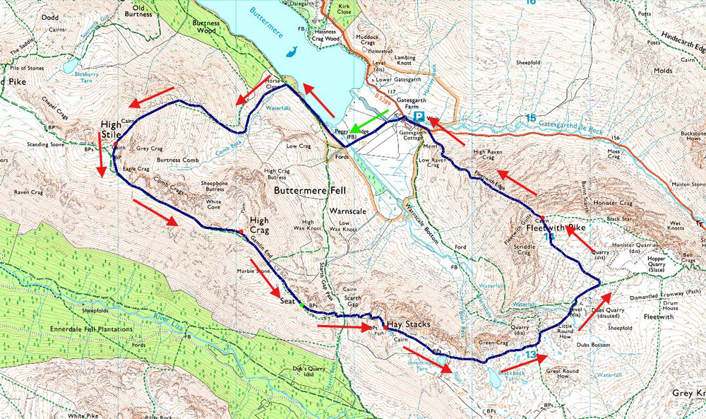
High Stile to Fleetwith Pike from Gatescarth |
 |
 |
21st June 2026 |
 |
|
|
| |
|
Overview |
|
|
| Ascent: |
3,705 Feet - 1,129 Metres |
| Wainwrights: |
4, High Stile - High Crag - Haystacks - Fleetwith Pike |
| Visiting: |
Seat |
| Weather: |
Hot & Sunny Throughout. Highs of 27°C Lows of 8°C |
| Parking: |
Car Park, Gatescarth Buttermere |
| Area: |
Western |
| Miles: |
6.8 |
| Walking With: |
On My Own |
| Ordnance Survey: |
OL4 |
| Time Taken: |
5 Hours |
| Route: |
Gatesgarth - Peggy's Bridge - Buttermere - Comb Beck - High Stile North-East Ridge - High Stile - High Crag - Gamlin End - Seat - Scarth Gap - Haystacks - Innominate Tarn - Blackbeck Tarn - Dubs Quarry - Fleetwith Pike - Fleetwith Edge - Gatesgarth |
|
| |
|
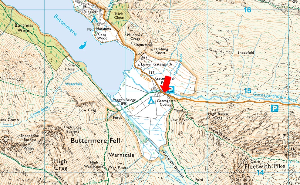
Parking Details and Map |
|
|
| Nearest Post Code: |
CA13 9XA |
| Grid Reference: |
NY 195 014 |
|
| |
|
Map and Photo Gallery |
|
|
 |
| |
| |
 |
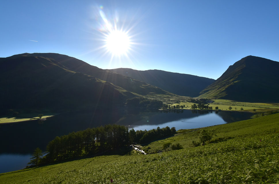
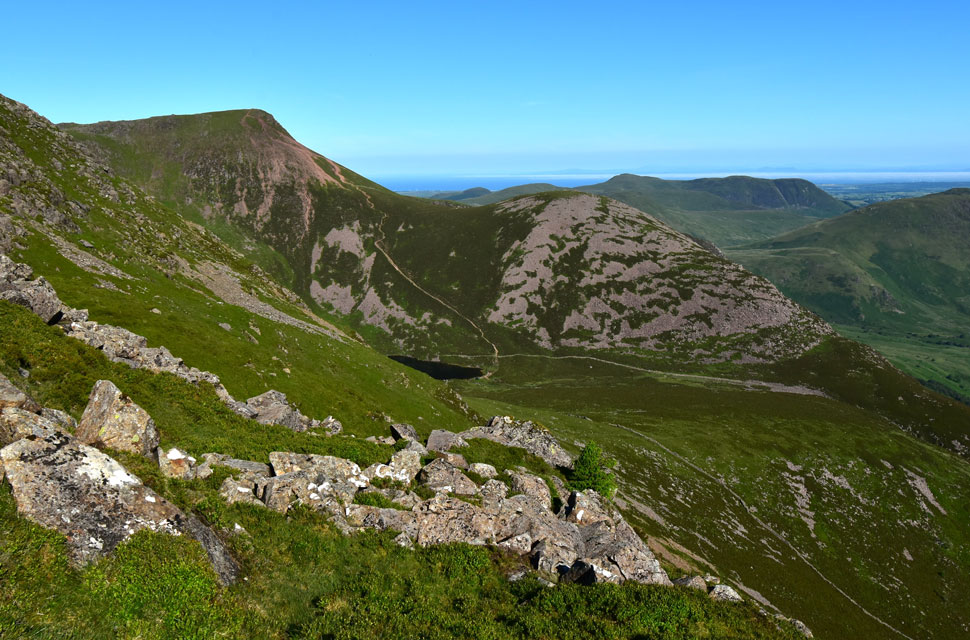
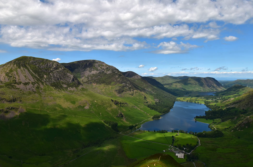
| Views from Peggy's Bridge towards Warnscale Bottom, Haystacks and Green Crag 6:50am 8°C |
There were no fells for me last weekend, which seemed a good decision at the time as I needed the rest, but as usual, come Sunday evening I was already making plans for the forthcoming weekend. I was meant to walk this particular route when I was on leave at the beginning of June, but it was a mixed week weather-wise and, this walk deserved the better forecast. I'd been keeping my eye on the weather all week, with Sunday looking the clearer, brighter day which, as it turned out, was the first day of a week long heatwave. I'm not a big fan of walking in heat; my body finds it hard to adjust. But with the higher temperatures yet to come, I couldn't miss the opportunity.
I left home at 4am and arrived at a half full Gatescarth car park around 6:30am. It was 8°C and, despite a cloudless blue sky there was the slightest nip in the air, so I added my windproof to take the edge off. Gatescarth Beck gurgled away on the opposite side of the car park where a couple were making a hot drink on a gas stove beside their car which looked like they might have spent the night in it. It was 6:40am by the time I dropped £7.00 into the parking meter for all day parking, and it was useful to know I could have paid by tap-and-pay too. I returned to my car and placed the parking ticket on the dashboard. Eager to get underway, I left the car park and made my way towards Gatescarth Farm. |
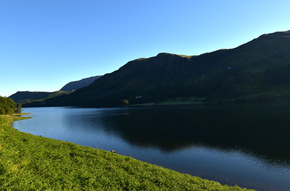 |
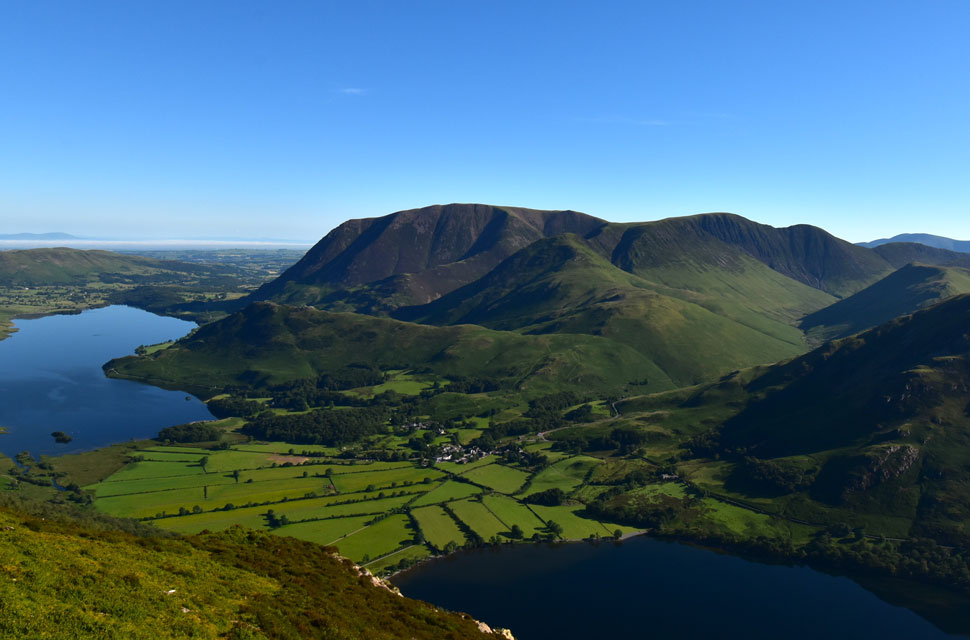
| Views over Buttermere towards High Snockrigg, Rannerdale Knotts and Grasmoor. |
| After crossing the road, I entered Gatescarth Farm, forking right to pass through two gates which had seen better days the latter holding on for dear life with the amount of footfall that passes through. Half a dozen tents were pitched in a field to the rear of the farm, the dew-covered grass reflecting the morning sunlight that looked spectacular but chilly at the same time. After taking in the views into Warnscale Bottom and Haystacks, I crossed Peggy's Bridge and joined the lake path towards Comb Beck. |
 |
| Looking back on Fleetwith Pike. |
| Fleetwith Pike is perfectly positioned for today's route, standing directly above Gatescarth Farm, but in the same breath it always feels a little disconcerting when a walk begins by heading away from the final fell of the day. |
 |
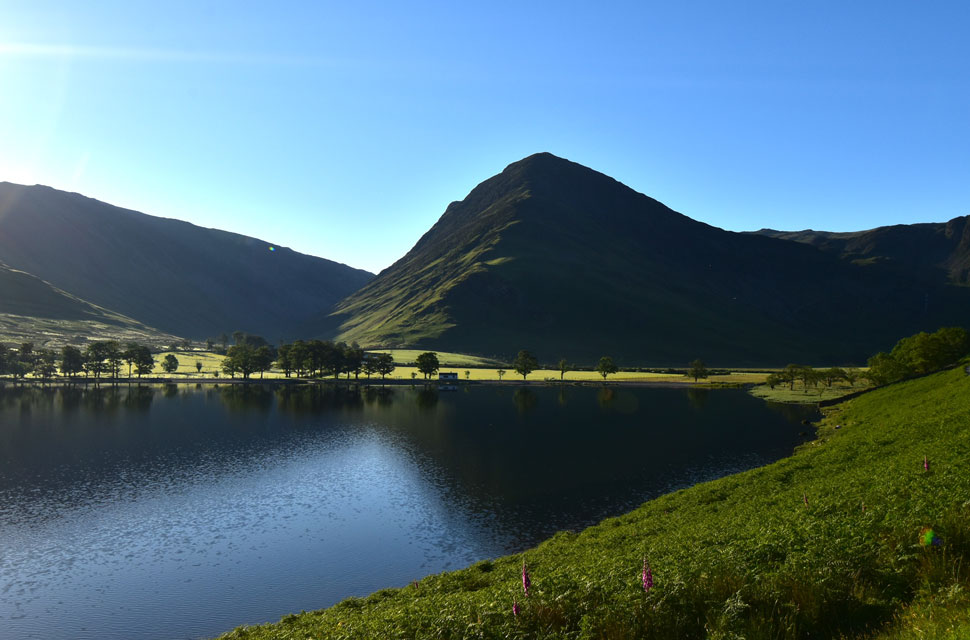
| Sun rising over Buttermere. |
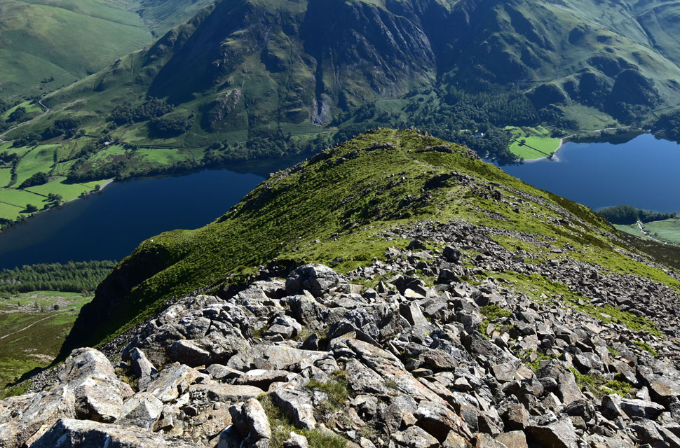
| I'd only been walking for ten or fifteen minutes when I arrived at Comb Beck (pictured below) at Horse Close. It's at Comb Beck where I leave the lake path and join the fellside for the steep ascent towards Burtness Comb. Here I was presented with two paths: one running alongside Comb Beck, barely visible between the bracken, and a second more obvious trod that climbs towards a stone wall higher up the fellside. |
 |
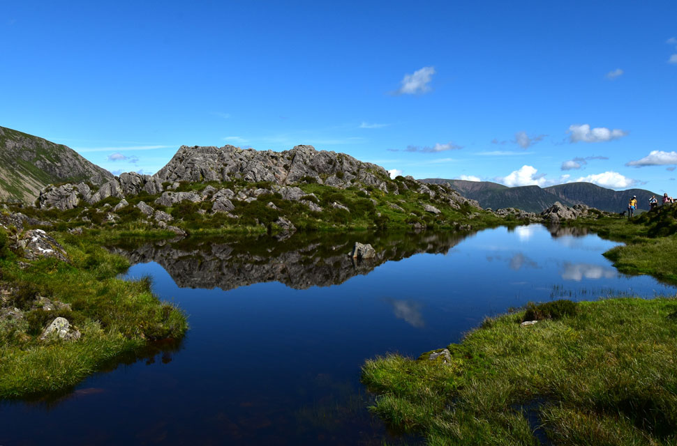
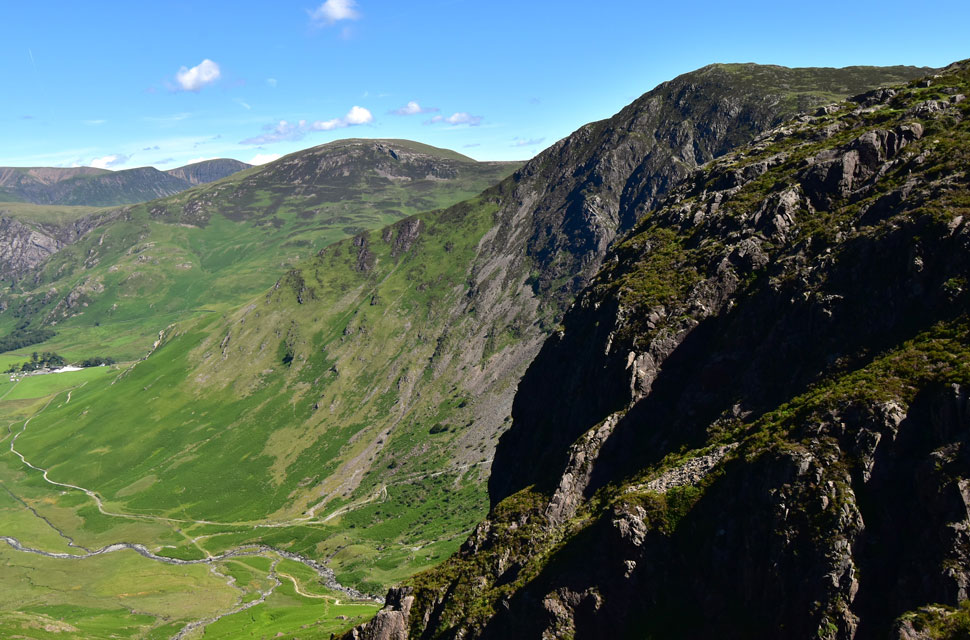
| Sheepbone Butress, White Cove and Comb Crags above Burtness Comb. |
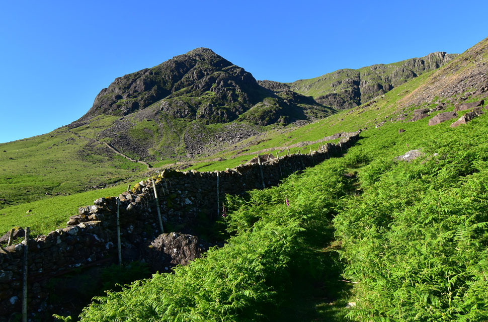
I took the obvious trod and aimed for the stone wall, the path narrowing at times between the bracken and only just visible. I lost count of the number of times I told myself, give it two more weeks and this path will be lost to the bracken. It was a fair old slog up the fellside, but within half an hour I'd arrived at the stone wall, which I crossed by a slanted stile with two rungs missing on the opposite side.
From the stile, the path became less obvious than the one you see in the photo, so I climbed a crag directly behind for a better look. I had two options: follow the stone wall, which looked "doable" but awkward underfoot, or try to pick out a clearer line through the bracken. As I scanned the swathes of green below, I spotted a faint but definite path a few yards ahead of the crag I was standing on. |
 |
| Sheepbone Butress and Comb Crags above Burtness Comb. |
| It was a few years ago when Tim and I climbed Sheepbone Rake, seen slanting horizontally from this angle, seemingly splitting the butress in two. What I don't remember from that day is just how steep the ascent was to reach the bottom of the rake. I'll have to ask Tim when I see him in a couple of weeks for an over-due fell walk. |
 |
| The lower summit crags appear. |
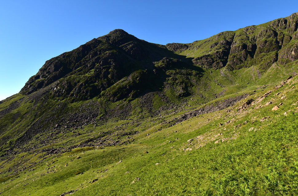
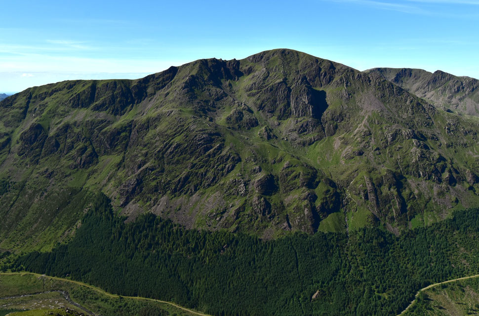
| After arriving at the corner of the stone wall, I found myself on the edge of Burtness Comb, where I don't mind admitting that another ascent of Sheepbone Rake did cross my mind, but I resisted and continued towards the comb, and soon reached the point where the path forked: left into the comb, or right for High Stile. Tempting as it was to head for the rake, I forked right and got stuck into the ascent of High Stile's north-east ridge. |
 |
| Views towards Rannerdale Knotts, Whiteless Pike, Grasmoor, Wandope, Eel Crag, Sail, Scar Crags, Knott Rigg and Ard Crags. |
| The ascent might be steep and tiring in the heat of the morning but the views are more than worth it. |
 |
| Looking east towards High Snockrigg, Causey Pike, Robinson and Hindscarth. |
| With Skiddaw and Blencathra seen beyond. |
 |
| The view over Bleaberry Tarn towards Red Pike (Buttermere) and Dodd (Buttermere) |
| The steep ascent never eased until I reached the tip of the north east ridge where I was treated to views of Red Pike and Bleaberry Tarn where I spotted two tents on south bank but no movement other than two walkers in ascent and two sillouettes stood at Red Pike's summit. |
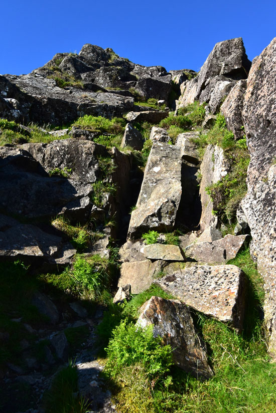 |
| The scrambly bit before I reach the top edge of the North-East ridge. |
| The photo makes the scramble look more dramatic than it actually was, with an alternative grassy ascent to the right of the gully that added a slight twist to the ascent. |
 |
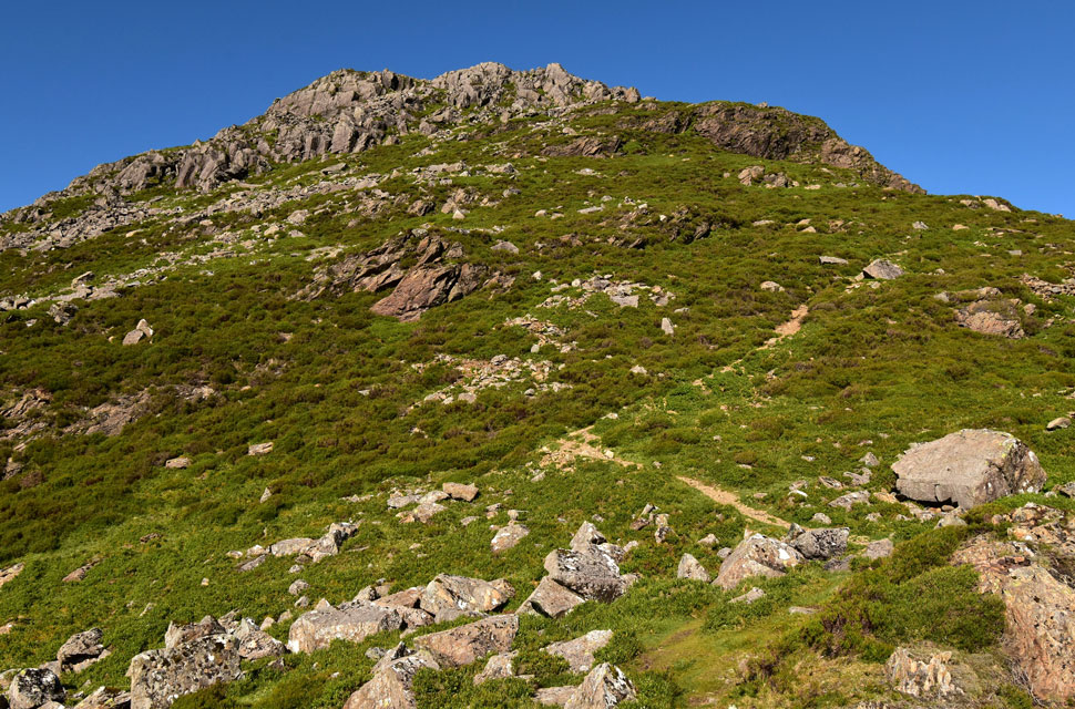
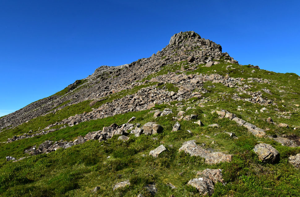
| A clearer view of the summit crags from the top of the gully. |
| Not long to go now. |
 |
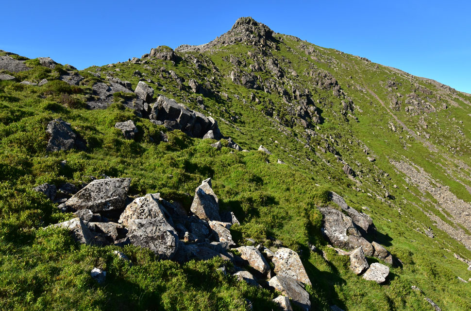
| Summit crags dead ahead. |
| I continued ascending the ridge by following an obvious path, soon sighting two rock buttresses ahead, divided by what can only be described as a mini arête. |
 |
| Looking back on the North-East Ridge. |
| The path led me over grass and steep boulder before I crossed between the two rock buttresses, only realising afterwards that they seemed to form a short arête I'd completely missed while passing between them. The summit was close, and I shouldered it over more grass and boulder, only to catch sight of the top half of a solo walker wandering about on the summit. |
 |
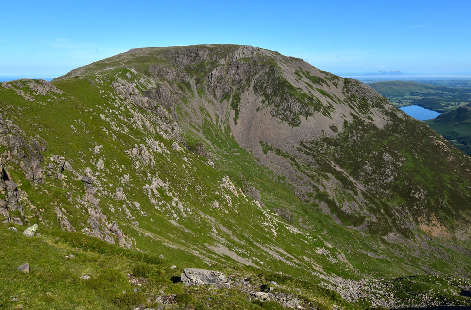
| Broad Crag, The Scafells, Kirk Fell, Pillar and Red Pike (Wasdale) from High Stile summit. |
I shouldered the summit and, in doing so, passed the solo walker who was heading in the direction of the north-east ridge. It crossed my mind whether he knew where he was going not wanting to judge a book by its cover and all that so I left him to it. After making my way towards the summit cairn, the chap reappeared, now walking in line with me but about fifty yards to my left.
By the time I'd descended to join the ridge over Burtness Comb, our paths crossed again. This time I asked if he was okay and, after removing a set of wireless headphones, he replied, "Yeah… got a bit lost there." Not wanting to embarrass him, I made light of it: "Aye, it's easy to get disorientated up here." |
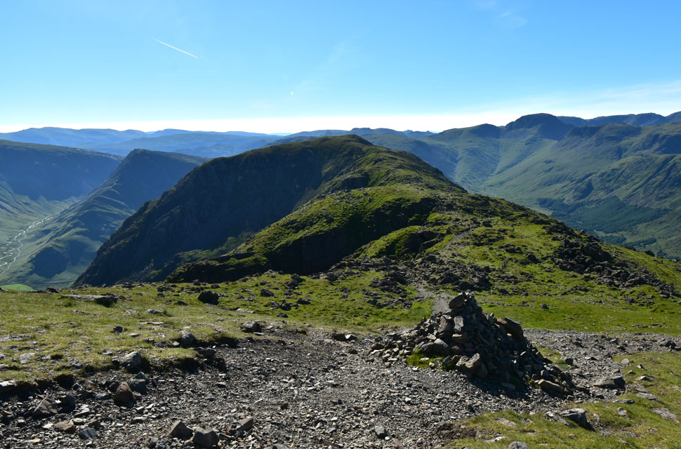 |
| High Crag over Burtness Comb. |
| With Fleetwith Pike seen left, Brandreth, Green Gable, Great Gable and the Ennerdale valley seen right. |
 |
| Looking back over Burtness Comb and Burtness Crags towards High Stile. |
| With the north-east ridge seen right and the reason my legs still feel like jelly. |
 |
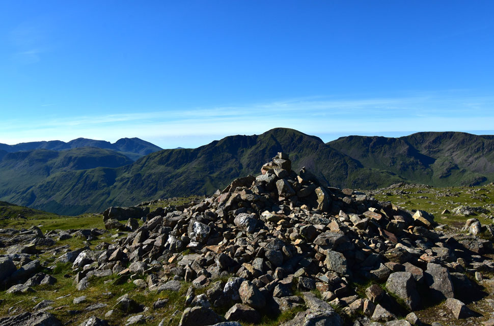
| Pillar and Pillar Rock from High Crag summit. |
| With Looking Stead seen towards the left and Scoat Fell and Steeple over on the right. |
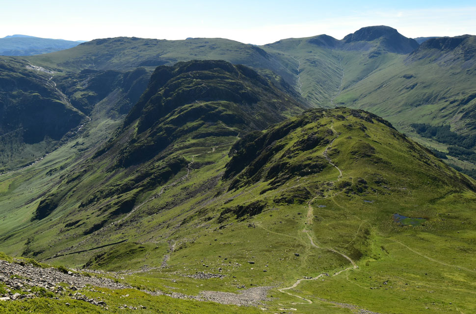 |
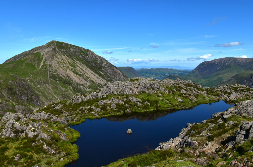
| Descending Gamlin End with views of Seat, Haystacks, Grey Knotts, Brandreth the Gables and Kirk Fell. |
I left High Crag at the same time as the solo walker I'd seen back on High Stile, who I hadn't realised was wearing trainers. I gave him a two minute start and he disappeared from view, so I began my own descent down the notoriously steep Gamlin End, only to find him perched beside the stone finger, off path and about sixty feet below me. I could see how he'd ended up there he'd followed a grassy trod that led straight towards the top of a scree slope (seen left) I caught his eye and nodded, "You okay?" "I lost the path again," he said. "It's over here," I replied, "but it's a tad loose, so just take your time."
I made good progress, first on the loose upper section, then joining the stone steps further down. I kept looking back, expecting to see him, but there was no sign. With most of the descent behind me, the gradient eased and I reached the grassy slopes below. Another look back and I finally spotted him on the stone steps; minutes later I lost sight of him again before he reappeared making his way towards the stone wall seen below left. |
 |
| Looking back on Gamlin End on High Crag. |
| |
 |
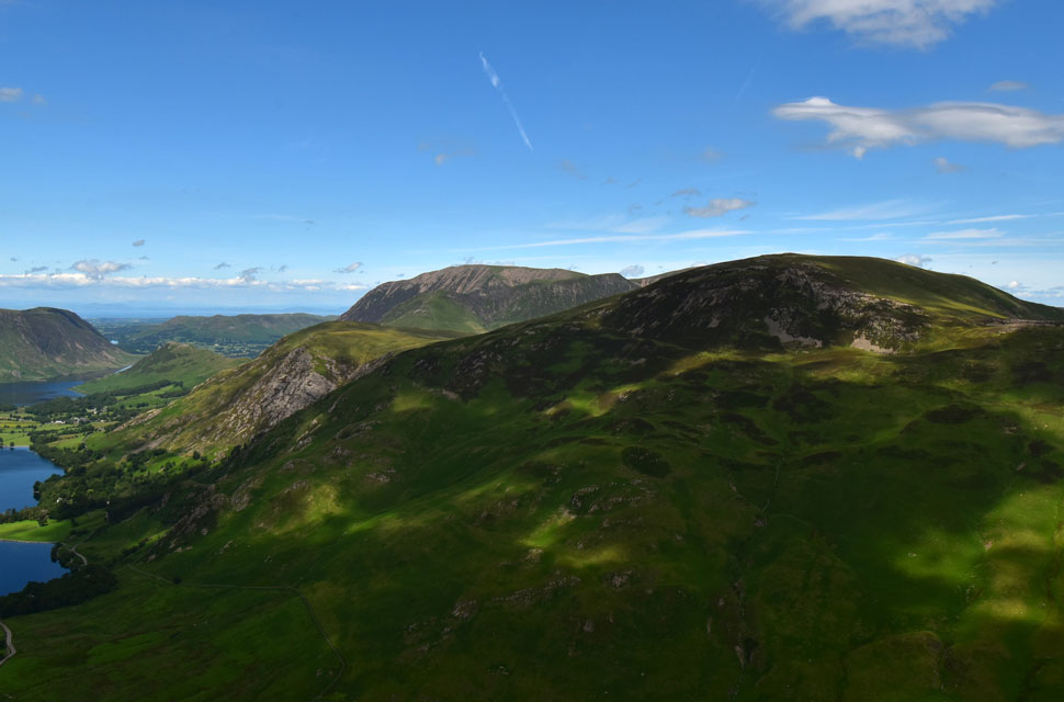
| Views towards Gatescarth Farm, Buttermere, Robinson, High Snockrigg, Grasmoor, Eel Crag (Crag Hill) Sail and Scar Crags. |
| I began the easy ascent on Seat easy in terms of gradient, not so much underfoot and soon found myself kicking stones because I wasn't lifting my boots high enough to clear them. A sure sign of early fatigue creeping in, not because I was done, but because the heat was already sapping my energy levels. Like I said earlier, I'm not good in heat. |
 |
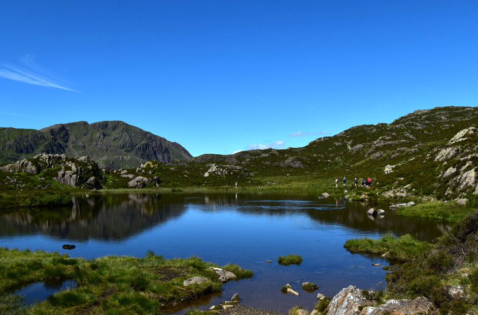
| Nameless Tarn found below Haystacks summit. |
I crossed Scarth Gap and began my ascent on Haystacks much the same time as the family seen at the far end of the tarn, along with a Scottish chap who I got talking to about football and fell walking. He explained that, in his senior years, he doesn't bother with the longer walks anymore and instead gets the same enjoyment from the shorter routes like the one he was doing today over Haystacks and Fleetwith Pike.
By now I'd deshouldered to take a buff out of my pack so I could wipe my head down, and he'd joined the rear of the family. By the time I reached the summit, he was nowhere to be seen which I found slightly odd because I was only minutes behind him. |
 |
| High Crag from Haystacks summit. |
| With Mellbreak, Grasmoor and the Loweswater Fells seen in the distance. |
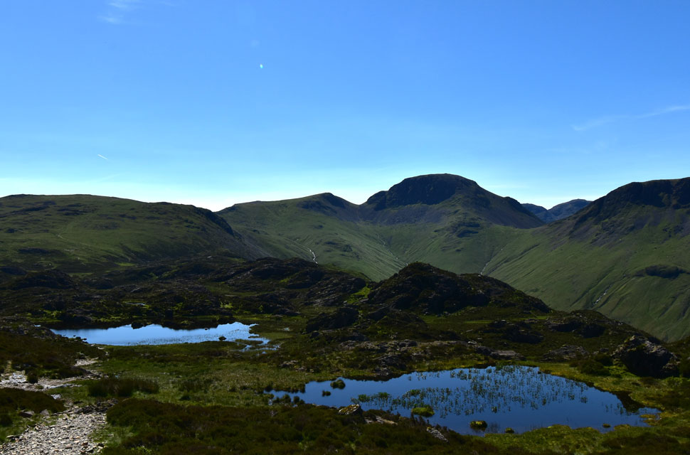 |
| Brandreth, Green Gable and Great Gable from Haystacks. |
| I'm heading for Innominate Tarn seen beyond the nameless tarn in the foreground. |
 |
| Pillar from Innominate Tarn. |
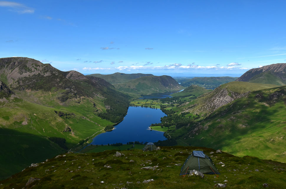
| Innominate Tarn seemed to be the go to place, with families flocking around the tarn and more walkers approaching from the direction of Warnscale Bottom. Even so, I managed a couple of quiet minutes at the water's edge before it was time to move on. |
 |
| Views over Warnscale Bottom towards Fleetwith Pike and Robinson. |
| With Wandope and Eel Crag (Crag Fell) in the distance. |
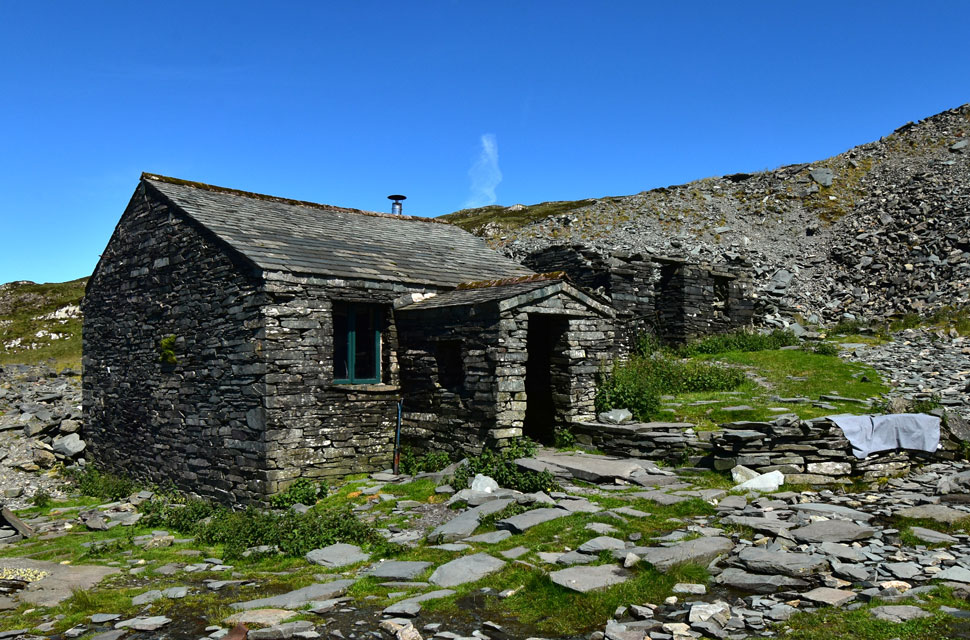 |
| Dubs Hut. |
I left Innominate Tarn behind and began the delightful descent towards Blackbeck Tarn, where a young family were paddling in the outflow. Had they not been there, I'd have stuck my head under the water, but I thought better of it and instead crossed the outflow by half a dozen bone dry stepping stones. A short pull then brought me onto the south flank of Green Crag which, at times, can feel desolate but today I was joined by a dozen walkers all heading towards Haystacks. It was feeling uncomfortably hot now. I was then joined by a fell runner who had descended from Great Round How; we met where the paths crossed before he took the left fork and dropped towards Warnscale Bottom.
I made the short descent towards Warnscale Beck and arrived at the same time as a young group of twenty somethings who were struggling to cross. Again, had they not been there, I'd have had my head in the water but thankfully I didn't, after noticing one male member of the group had wandered upstream to take a pee, seemingly unbothered by his female friends or the stranger watching him do it. I shrugged the thought away and sipped freely at my bite valve, the juice wasn't cold, but it was still cool enough to quench the thirst after keeping the bladder in the fridge overnight. |
 |
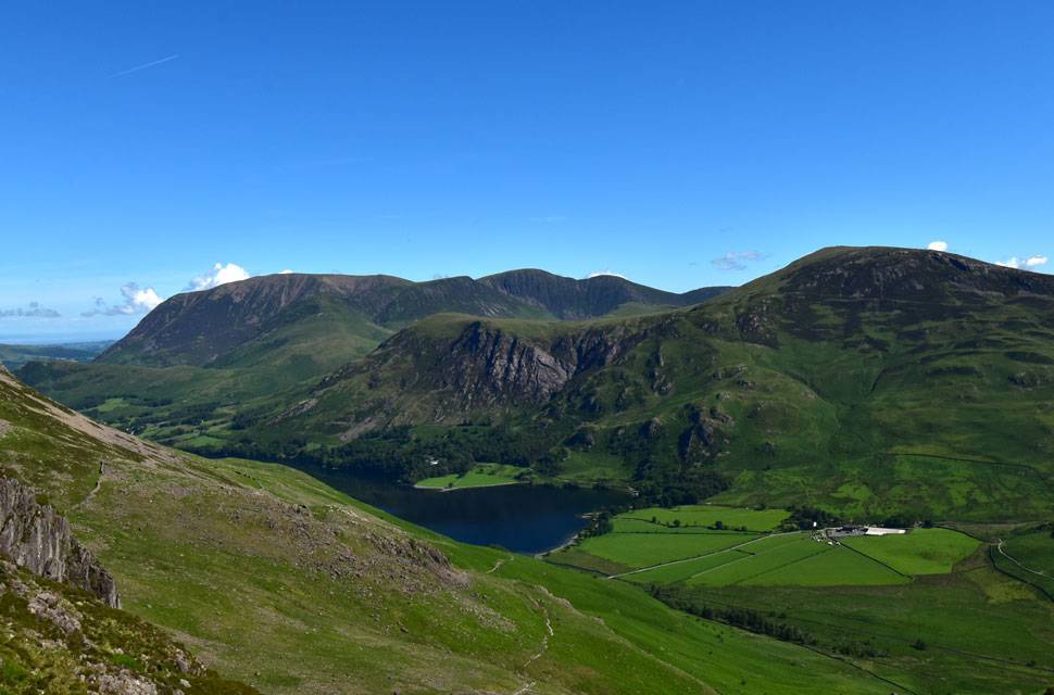
| High Stile, Red Pike (Buttermere), Mellbreak, the Loweswater Fells, Rannerdale Knotts, High Snockrigg and Grasmoor from Fleetwith Pike. |
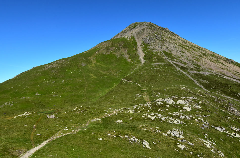
I joined a grassy trod directly behind Dubs Hut, which then linked up with a more prominent path leading to and from Fleetwith Pike's summit. It was around 11:30am and I was really feeling the heat as I made my way upwards disturbing hundreds of horseflies from the undergrowth. They took a liking to my legs and head, and slapping myself silly to shoo them away was never a good idea.
The path runs parallel to the summit for a while before a sudden jolt upwards onto the top, where I spotted a young couple eating lunch. I arrived at the summit at exactly 12pm, found myself the most awkward rock my backside could sit on, deshouldred my pack and tucked into lunch. |
 |
| Lunch with a view. |
| |
 |
| High Crag, High Stile and Red Pike (The High Stile Ridge) from the descent of Fleetwith Pike. |
There was the slightest breeze during my lunch stop and along with the young couple chatting behind me, the occupants of the two tents below were sat huddled shirtless a short distance away, playing cards. I re-shouldered my pack much lighter now leaving about half a litre for the descent of Fleetwith Edge. As I began descending the upper section, the cloud rolled in as forecast, and for once I was glad of it, with it came a slight breeze and a welcome drop in temperature.
I descended the rock steps, one or two on my backside, which is perfectly acceptable if you're over fifty. Halfway down Fleetwith Edge I spotted a figure also in descent who I don't remember seeing back on the summit. The sun kept coming and going, glinting across the surface of Buttermere not so much over Fleetwith Pike. I continued down countless rock steps, my eye-to-ground coordination on top form but tiring all the same. I reached the last grassy knoll before veering right, where Dale Head and Honister Pass came into view. The cars looked so close I could almost read their number plates.
The young lad descending behind me had gained some ground but couldn't close the gap, and I reached the base of the fell as he began the last hundred yards of his descent. I curled my toes into the soles of my boots as I strode along the smooth grass before joining the tarmac of Honister Pass. Stepping aside to let a car pass, I passed Gatescarth Cottage and was brought back to reality by a crowd queing at an ice-cream van. I'd taken nearly four litres of hydration on board, yet despite that my mouth was dry, my lips had formed an extra layer, and my head pulsed. Still, I told myself … it was hardly Ice Cold in Alex. |
|
| |
| Back to top |
 |
|