|
The Scafells via Piers Gill, Lord's Rake & Deep Gill |
 |
 |
19th July 2026 |
 |
|
|
| |
|
Overview |
|
|
| Ascent: |
3,805 Feet – 1,160 Metres |
| Wainwrights: |
2, Scafell Pike – Sca Fell |
| Weather: |
Sunny Intervals to Start, Turning Brighter Towards Midday. Light Winds Across The Summits. Highs of 26°C Lows of 11°C |
| Parking: |
Car Park, Wasdale Head |
| Area: |
Southern |
| Miles: |
7.5 |
| Walking With: |
On My Own |
| Ordnance Survey: |
OL6 |
| Time Taken: |
6 Hours |
| Route: |
Wasdale Head – Burnthwaite – Moses Trod – Lingmell Beck – Piers Gill – Corridor Route - Scree Path East of Dropping Crag – Scafell Pike – Broadcrag Tarn - Mickledore – Rakes Progress – Lord's Rake – West Wall Traverse – Deep Gill – Sca Fell – Green How – Rakehead Crag - Bracken Close – Lingmell Gill - Wasdale Head |
|
| |
|
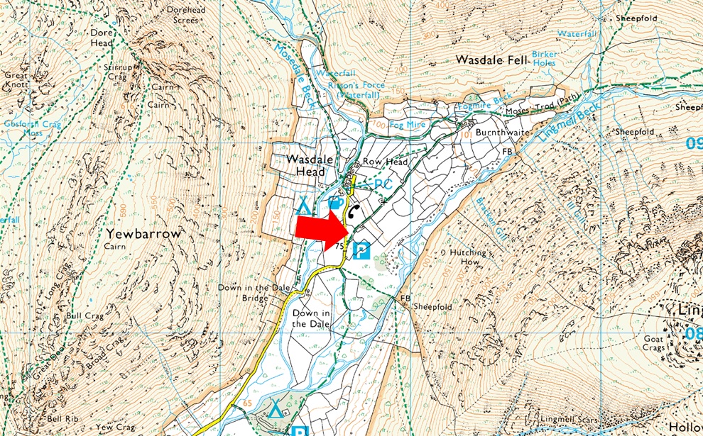
Parking Details and Map |
|
|
| Nearest Post Code: |
CA20 1EX |
| Grid Reference: |
NY 186 708 |
| Notes: |
Probably one of the more popular car parks in Lakeland due to proximity to Scafell Pike meaning that the car park at Wasdale Head is very popular all year around and is large enough to accommodate around forty cars and mini buses. Despite its popularity you may only struggle to park here during mid Summer or late into the afternoon. |
|
| |
|
Map and Photo Gallery |
|
|
 |
| |
| |
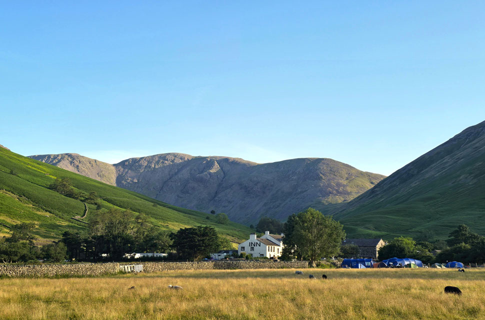 |
| Black Crag, Wind Gap, Pillar and Looking Stead from Wasdale Head 6:46am 11°C |
It isn't often a route gets the better of me, but this one has a way of slipping through my fingers. Back in June 2014 I climbed the Scafells by what I still consider the ultimate route; Piers Gill, Lord's Rake, the West Wall Traverse, and Deep Gill. Short of rope and harness, I don't know how you could improve on it. That was twelve years ago, before my prime, before the Harry Griffin two-thousand-footers, before the Wainwrights in 30 Walks. After that my walking returned to normal, but the vow remained: return to Sca Fell and repeat that route under better conditions. I never did. Not through lack of trying. I've climbed Piers Gill at least four times since, each time intending to commit to the route, each time finding a reason to divert or bottle it entirely. I even dodged writing about it in my walk reports. When I'm honest with myself, it wasn't just fitness or an age thing. From Piers Gill just look at the options, this is where my mind goes into overdrive just like a kid in a sweet shop. But I'm still gonna call it bottling it, because I'm hard on myself and it keeps me honest.
After three weeks of heatwave, conditions finally broke. I had a week's leave and three walks planned, and the first would be this one. I didn't break it into sections, the goal was simple: reach Sca Fell. And I can tell you those old demons rose the moment I began asecdning Piers Gill. But this time I didn't let them in. Even surrounded by some of the finest fell-walking territory in Lakeland, I shrugged them off. You might think I'm being dramatic I wouldn't disagree but I was having none of it. I set my alarm for 3am and by 4am I was driving west toward Wasdale Head, completely focused on what lay ahead. The sun was climbing into a cloudless sky as I passed Wast Water where normally I'd stop for photos, but not this morning. I drove straight on, barely taking in the scenery, head locked on task. The car park was already half full: tent boxes on car roofs, motorhomes with awnings out, all ignoring the "no camping" signs. I shook my head and began to kit up, choosing my Salomon GTX lightweight boots, this summer's regulars. Like last weekend in Snowdonia, I'd stripped my pack down to essentials to make room for extra hydration. There was a definite nip in the air; my fingers felt it as I laced up, so I pulled on a lightweight windproof to take the edge off. Across the car park two lads were boiling a kettle on a camping stove beside their car, looking like they'd slept in it. Despite the number of vehicles, Wasdale Head felt silent, just the sheep bleating beyond the stone wall, and above that nothing but blue sky. |
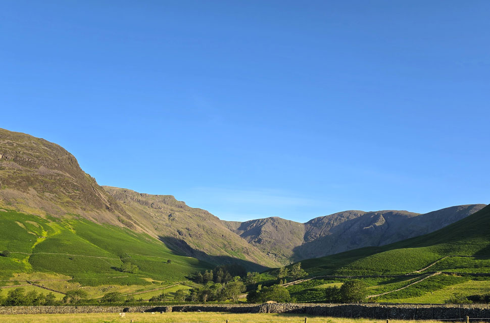 |
| Views into the Mosedale Valley looking towards Red Pike (Wasdale) Black Crag, Pillar and Looking Stead. |
| With Stirrup Crag on Yewbarrow on the left and the Kirk Fell's lower slopes to the right. |
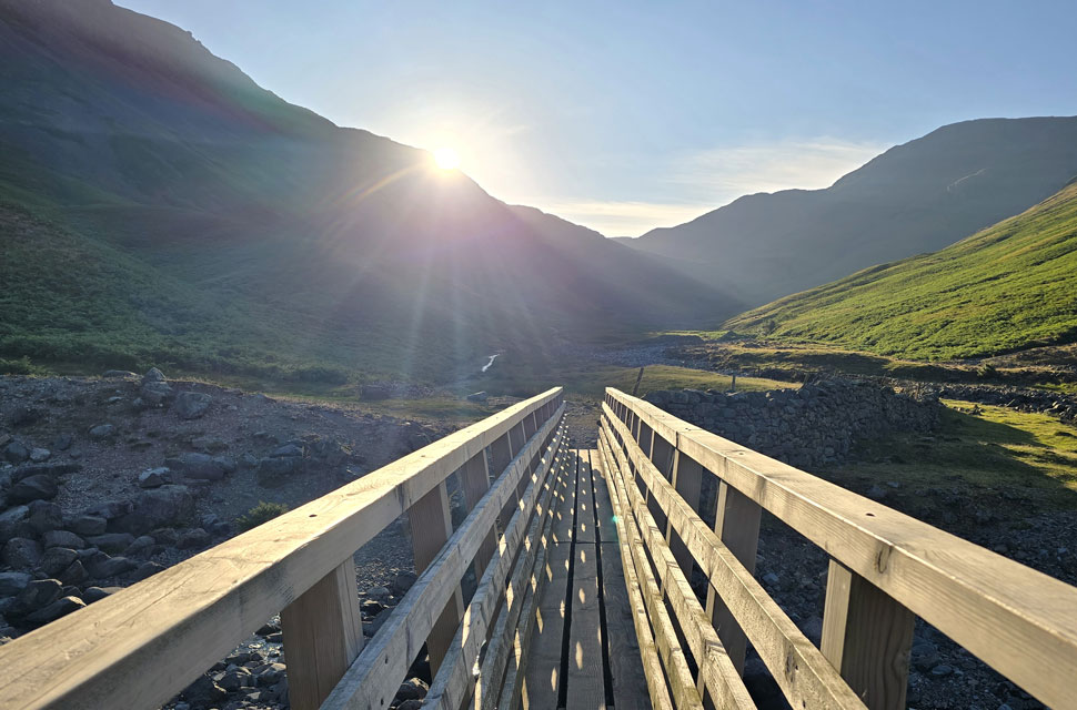 |
| Crossing Gable Beck with views of Sty Head, The Band and Great End. |
With Wasdale Head behind me, I joined the dusty track towards Burnthwaite Farm, taking in the glorious views into Mosedale, often having to shield my eyes from the low sun pointing directly down on me. I passed through the farmyard where the track was replaced by grass scarred with rock underfoot the very same rock your tired feet tend to kick on the way back from a hard day on the fells above Wasdale.
The sun was still shining down, but through the heat and haze I spotted a walker heading towards me, and we passed shortly after going through the familiar gate behind Burnthwaite Farm. Turns out he wasn't a walker but someone from the campsite, no pack, just a mobile phone in hand, out for an early-morning walk. |
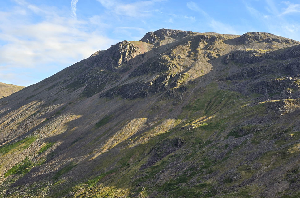 |
| A close up of Great Gable from Piers Gill lower ravine. |
I continued along Moses Trod, leaving the path for a grassy trod alongside an almost dry Lingmell Gill - ground that was probably wetter than the gill itself in places. I followed it until I crossed Lingmell Gill via half a dozen stepping stones surrounded by shallow pools of water, a reflection of how dry the gill had become after weeks without rain. I joined the bank on the opposite side, stopped to de-shoulder my pack, and tucked my jacket beneath the hood before strapping it down again. I'd worked up a bit of a sweat running from my forehead, the back of my neck, and down my forearms. The cool breeze created the opposite effect, chilling me instantly.
With Piers Gill's lower ravine still a way ahead, I continued along the riverbank. That's when I spotted a young chap washing what looked like his T-shirt in the beck. I was higher than him and I don't think he noticed me pass, but two of his mates bivvying close by certainly did they got the shock of their lives when I strolled past with a "morning lads." One stayed buried in his sleeping bag; the other looked up, eyes half-closed, hair everywhere, and managed a groggy "morning" in return. Happen he'll think he dreamt it. |
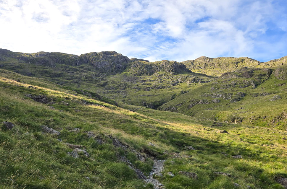 |
| Criscliffe Knotts and Middleboot Knotts above Piers Gill. |
| With views of Great Gable directly behind me, I joined the path, keeping left of the ravine. It's a steady slog with sections that level out, like this one, where I could have sworn I heard voices. I expected to see someone ahead of me, but spotted no one. I put it down to walkers ascending to Sty Head behind me and the sound of their voices carrying across the valley, but they seemed much closer than they should have been. |
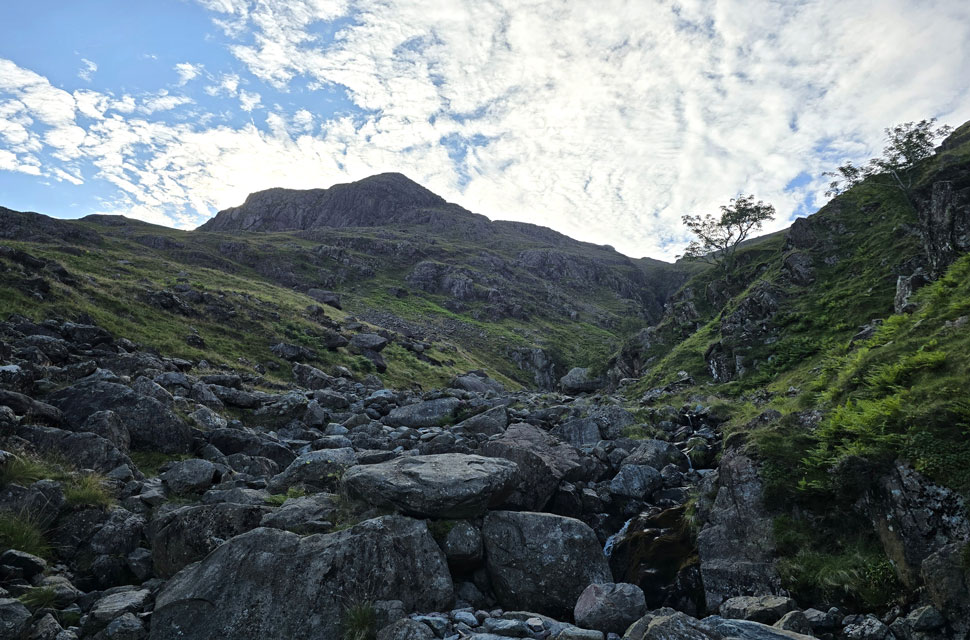 |
| Stand Crag from Greta Gill. |
| The path continued to ascend before the slight descent to cross Greta Gill, from where I heard the voices again. This time they were definitely above me, which left me thinking it must be walkers on the Corridor Route a good 800 feet above me. Surely it can't be… After crossing the gill I heard them again, so I spun around and spotted three walkers above Greta Gill ravine, which at first startled me. As far as I knew there was no path down the gill, but that wasn't to say there isn't one to follow; it just looked precarious and completely out of the ordinary. Rather them than me, I thought. |
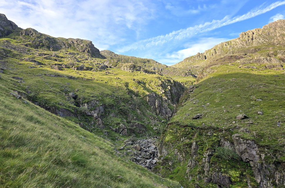 |
| Piers Gill ravine. |
| The ravine begins to take shape. |
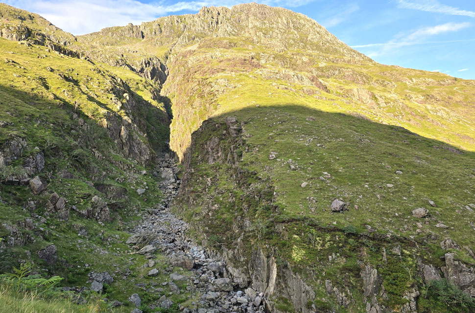 |
| Piers Gill. |
| The ravine itself is considered out of bounds to walkers, with steep vertical cliff faces and impassable waterfall pitches, and is still regarded as one of Lakeland's most notorious accident black spots with walkers descending the Corridor Route from Lingmell Col often mistaking the top of the steep, rocky ravine for a safe descent path. |
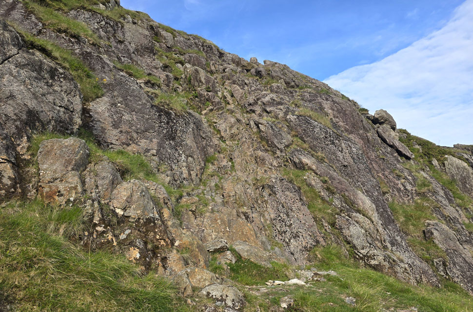 |
| The scrambly bit. |
| About halfway up I arrived at the familiar scramble, a ten metre wall of rock that offers plenty of hand and footholds and is quite an enjoyable climb. Just don't do what I did the last time I was here and drop your walking pole, which fell all the way to the bottom. I had to down-climb, then climb back up a second time. Quite a few expletives left my mouth that day. |
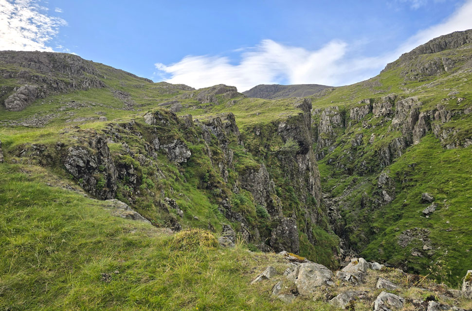 |
| Piers Gill upper ravine. |
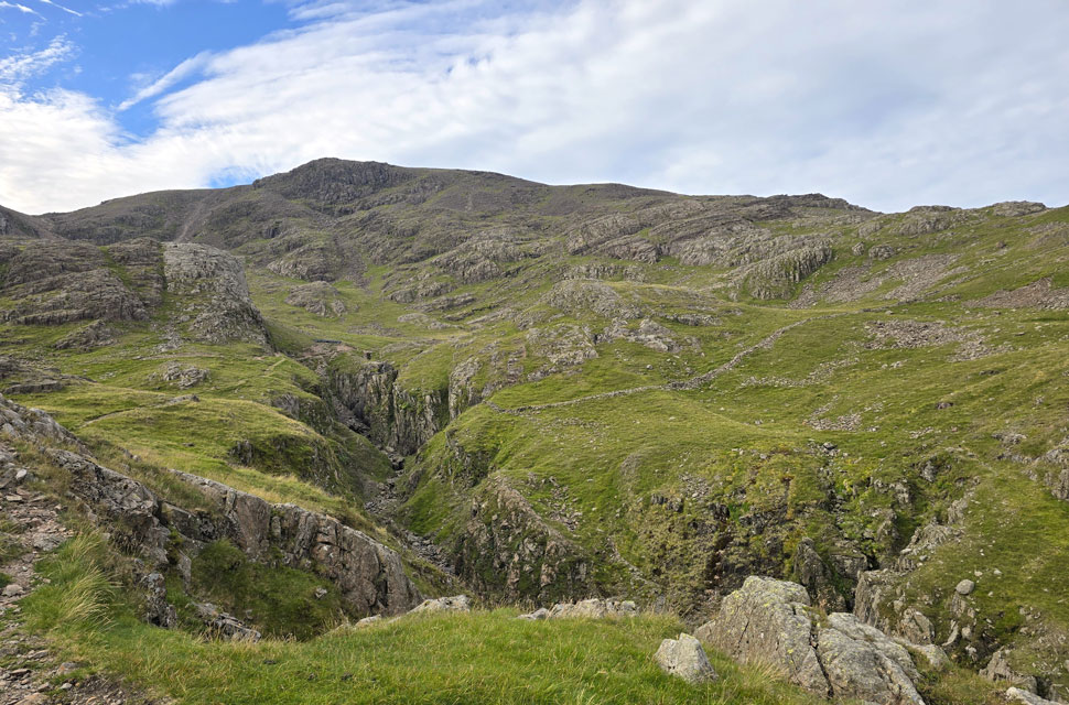
| With the crags of Middleboot Knotts seen left and Dropping Crag on Scafell Pike seen right. |
 |
| Broad Crag Col, Scafell Pike and the Corridor Route come into view. |
| That's the head of the ravine ahead where options opened to turn right onto the Corridor Route and ascend Scafell Pike via Lingmell Col or continue ahead towards Broad Crag Col. |
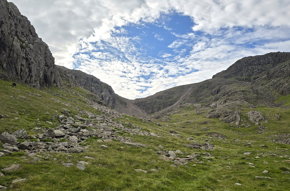 |
| Broad Crag, Broadcrag Col and Dropping Crag (Scafell Pike) |
| I find it odd that this cove doesn't have a name, but for naming's sake I'm going to refer to it as Broadcrag Cove. That's Broadcrag Col in the centre, which is the popular route onto Broad Crag or Scafell Pike, but I'm feeling adventurous, so I'll be taking the scree path seen to the right, which ascends directly onto Scafell Pike. |
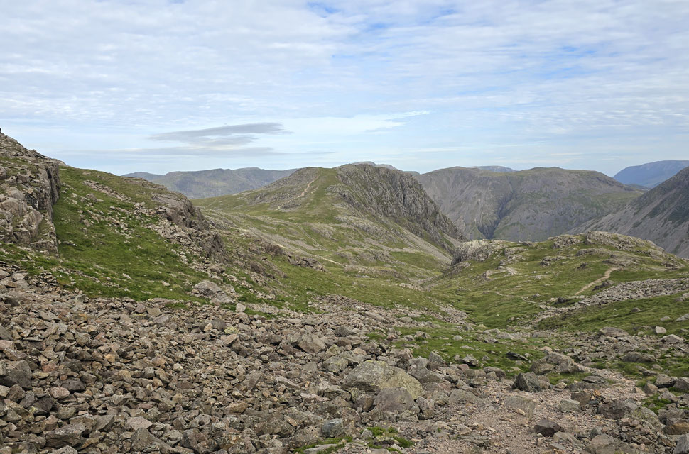 |
| Looking back on Lingmell and Kirk Fell from the cove. |
| |
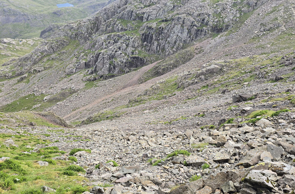 |
| Looking down the scree path with views of Sty Head and Styhead Tarn. |
| I always enjoy the ascent through the cove, and this morning was no different. However, should I ever feel adventurous again, I'll be giving myself a good slap across the face, because as you can see, it was anything but straightforward with one step forward, boots filling with scree, followed by two slides back down. You might say I asked for it and I completely agree. |
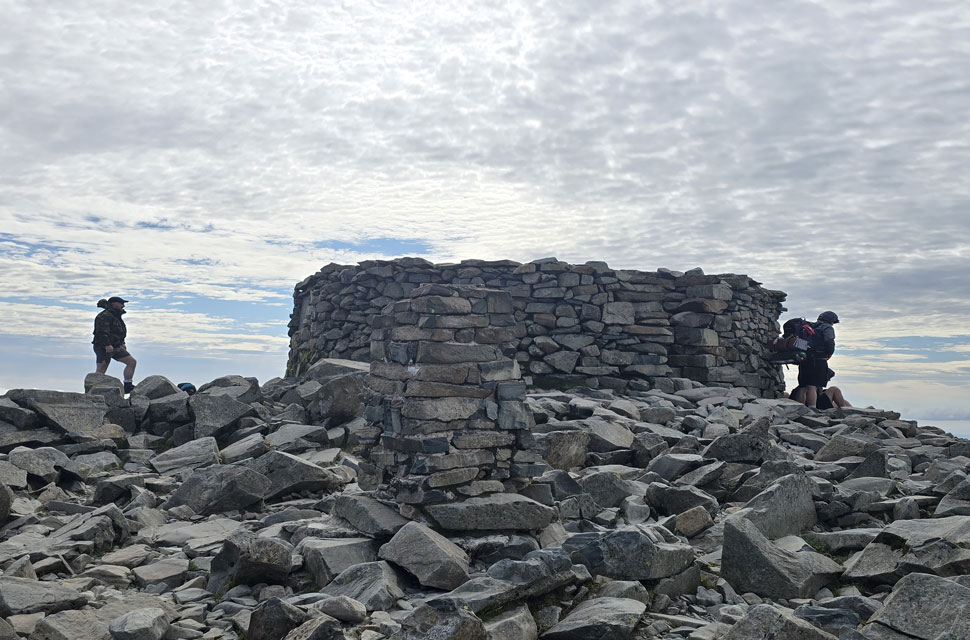 |
| Scafell Pike summit. |
| The scree path spat me out in sight of Scafell Pike summit where I expected to see it much busier than the three standing at the shelter and two girls out of shot. That said I didn't stay long leaving as soon as I'd tapped the trig point with the tip of my walking pole. |
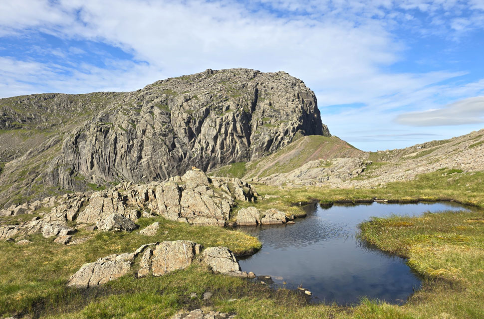 |
| Sca Fell, Broad Stand and Mickledore from Broadcrag Tarn. |
| The sun came back out as I began a pathless descent towards Broadcrag Tarn, which was completely out of view, hidden by crag until I was almost on top of it. The descent required care over boulder, scree and grass, something I wouldn't attempt if the cloud was down. Nevertheless, I arrived at the tarn to find an unoccupied tent, mirroring my last visit last July when I also found a wild camp pitched here. Good choice even if it's getting a tad popular. |
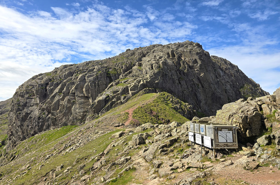 |
| Sca Fell and Broad Stand from the Mickledore Stretcher Box. |
| After a few moments spent admiring the views from Broadcrag Tarn, I made my way to the Mickledore ridge, following a narrow trod over grass and two short sections of boulder. I soon arrived at the stretcher box, realising I had the whole place to myself. So I climbed to the centre of the ridge, stuck both my poles into the ground, and thought about Wainwright's quote on Mickledore: "It does a man good to realise his own insignificance in the general scheme of things." |
 |
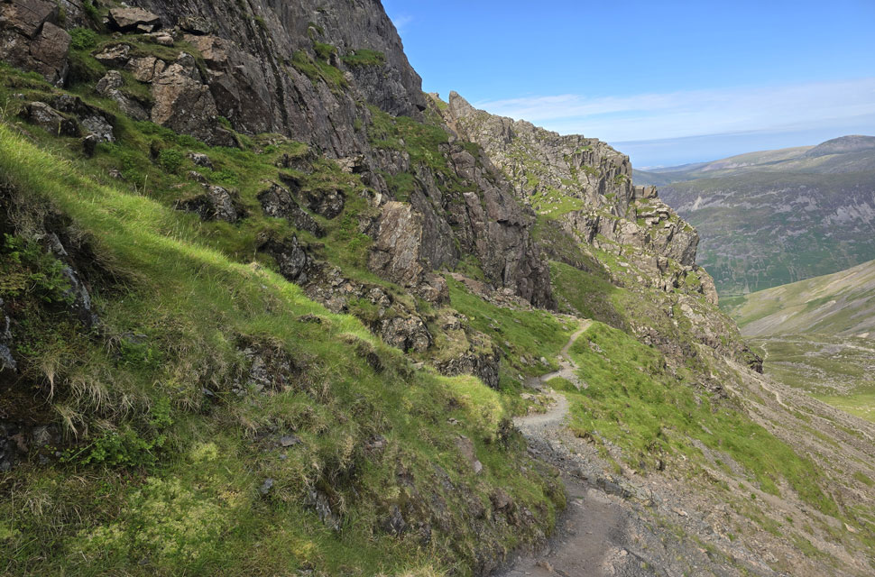
| The nostalgia was soon forgotton the moment I began the descent of Mickledore. |
Breath returning to normal, I looped my hands back into my walking pole handles and began the descent of Mickledore onto Rake's Progress. It's been six years since I was last on this section of the ridge, and even then the descent was not to be taken lightly.
Six years on, erosion has well and truly taken hold with loose scree, bare rock, and the need to make sure every foothold was sound before trusting it. |
 |
| Rake's Progress. |
| From the base of the Mickledore Ridge I joined Rake's Progess all the way to the base of Lord's Rake. |
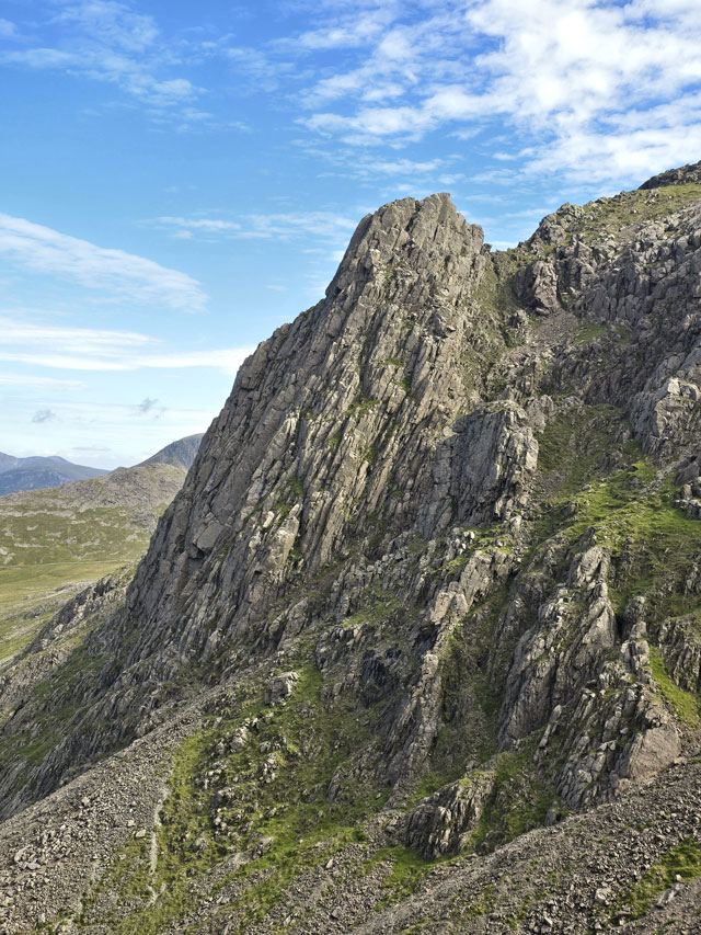 |
| Pulpit Rock from Rake's Progress. |
| |
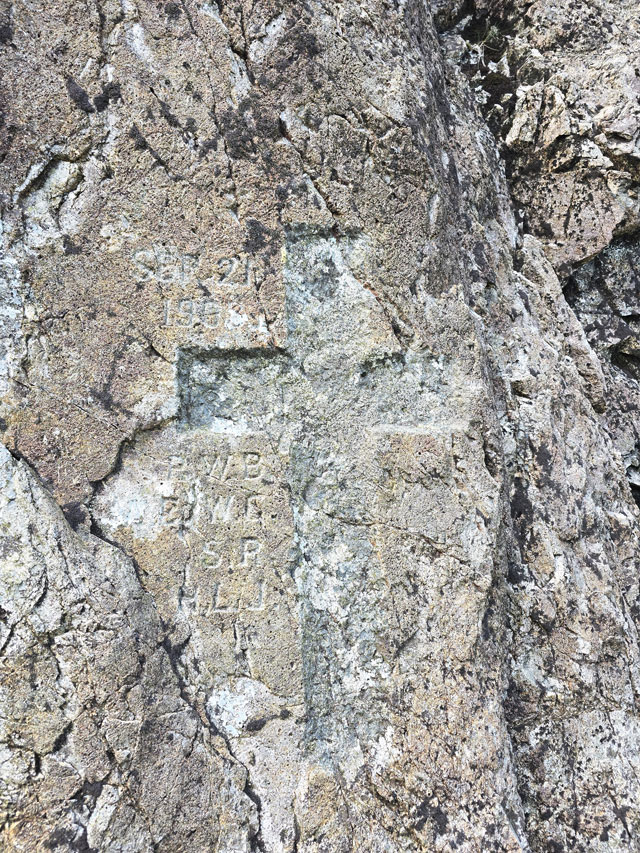 |
| The 1903 Memorial Cross calved into the base of Scafell Pinnacle. |
"It is not known exactly what happened to the four experienced climbers, they were found roped together in a scree run far below Lord's Rake three of whom were all ready deceased, the fourth member of the group died during the descent back to Wasdale Hotel"
I'm approached quite often by authors requesting photographs for their books, with the Memorial Cross being one of the most sought after. It's also nice to be sent copies of the books once they're published. |
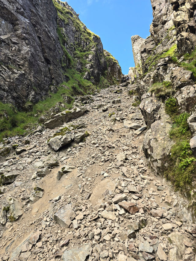 |
| Lord's Rake. |
| After passing the Memorial Cross, I began my ascent of Lord's Rake, first climbing on the left before switching to the right for the remainder of the ascent. Lord's Rake has always been eroded, and its popularity has only increased post‑Covid. This morning was no exception, and I found three pairs of walkers in ascent the last pair even warned me about any scree they'd dislodged, which was jolly nice of them. |
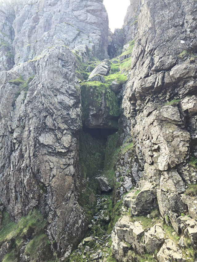 |
| The small cave at the foot of Deep Gill. |
| |
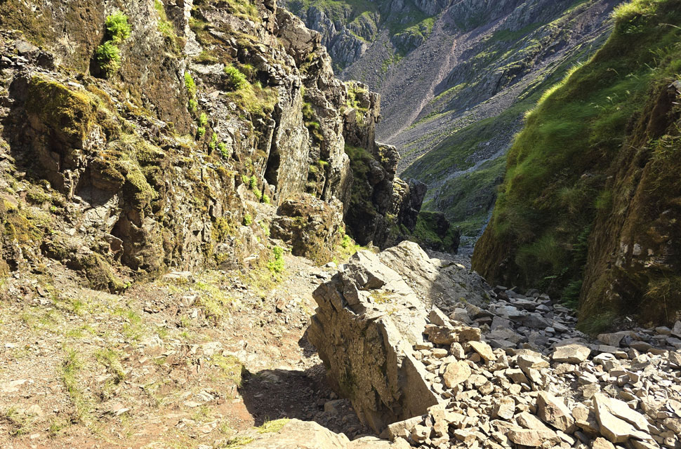 |
| Looking down Lord's Rake from the resting site of the chock stone. |
| It was between 2001 and 2002 when the rock pillar detached from the upper wall of the gully before wedging itself between the two upper walls of Lord's Rake. Fourteen years later the chock stone fractured and fell into the gully, after repeated warnings from Mountain Rescue advising walkers to avoid Lord's Rake altogether. Although the rake was never formally closed, I wouldn't have minded being a fly on the wall the day the chock stone came crashing down. |
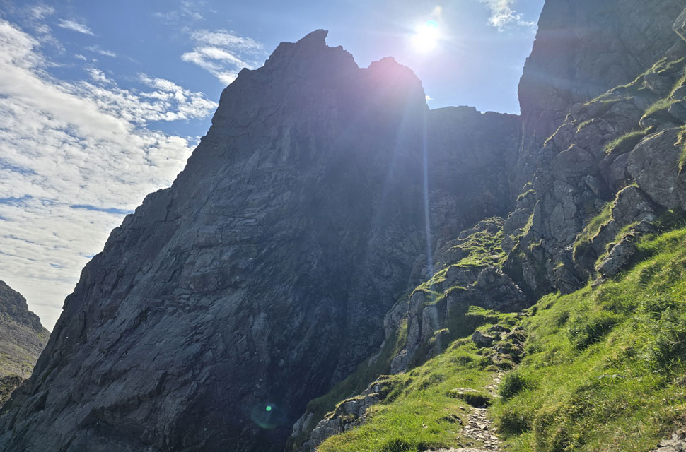 |
| Scafell Pinnacle from the West Wall Traverse. |
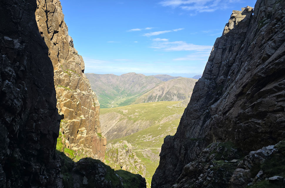
The chockstone lies at the very foot of the West Wall Traverse, where I was surprised to see that a section of the ravined wall which on my last visit you had to scale has now been replaced by a scree run, making it easier to join the traverse. I'm not sure if that's a good or a bad thing. I passed over the scree and joined the ledge, no wider than three or four feet in places, with the scale of Scafell Pinnacle looming ahead, the crag itself enough to cause a bit of a leg wobble.
I heard voices and the clink of metal on metal coming from two climbers at the base of the Pinnacle, about a hundred feet below. My heart wanted a closer look, but my head told me to stay on track. I continued along the traverse in awe as Scafell Crag came into view, the blue sky above keeping me in check with reality. |
 |
| Joining Deep Gill with the grassy ledges of the West Wall Traverse seen left. |
| |
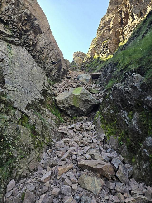 |
| Ascending Deep Gill. |
| Deep Gill felt light and airy, but still as steep and loose as I remembered. My ascent began on the right, but I switched left halfway up, following the larger boulders until I reached the big block that sits squarely in the gully. The boulder was about waist height and as fixed as it looked, and after a one-two-three, I pulled myself over and continued the ascent. |
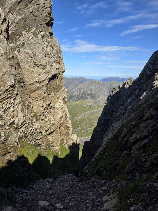 |
| Looking down Deep Gill. |
| Walled in by Deepgill Buttress to the left and Scafell Crag to the right. |
 |
| The head of Deep Gill with the Pinnacle beyond. |
| I remembered the exit from Deep Gill from my previous visit, a steep, narrow gully that climbs out to the left, no more than ten feet in height. I hauled myself up and out under laboured breath, both hands turned a red-brown and my fingernails bearing the remnants of a fine red dust, which felt like a reward for the effort if nothing else. |
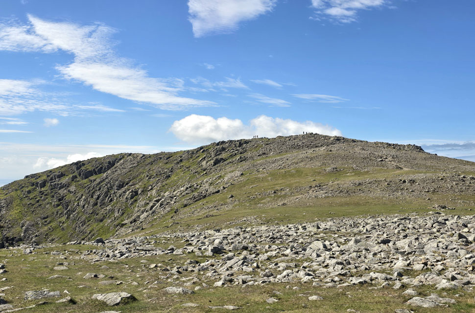 |
| Sca Fell comes into view. |
| |
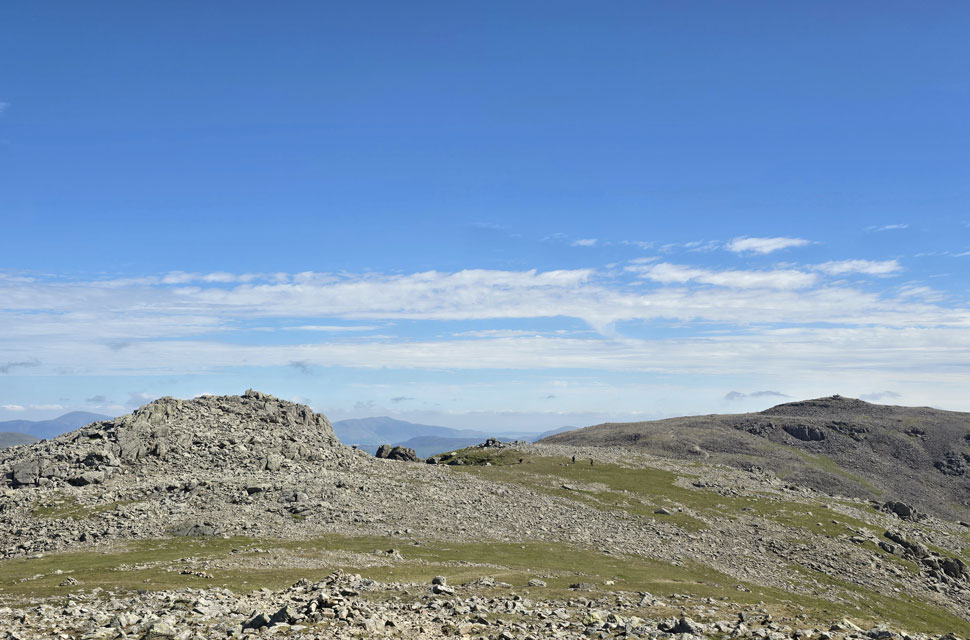 |
| Symonds Knott and Scafell Pike from Sca Fell. |
| I had a big D'oh moment here after realising that I should have paid a visit to Symonds Knott. |
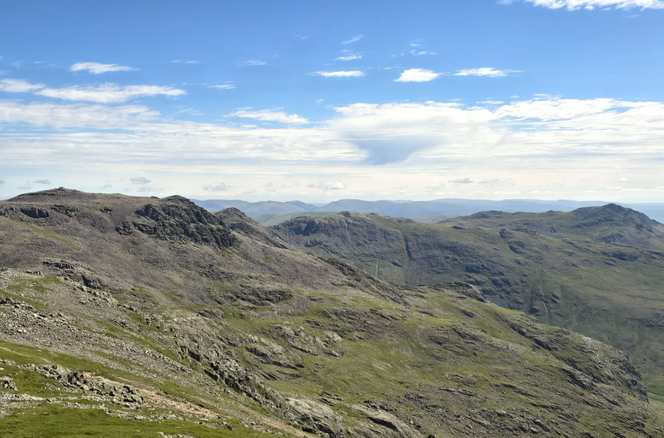 |
| Scafell Pike, III Crag, Esk Pike and Bowfell from Sca Fell. |
| |
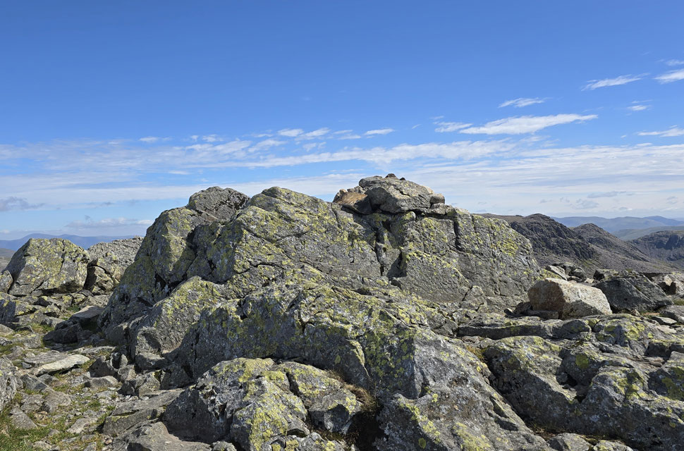 |
| Sca Fell summit cairn. |
| I soon reached the summit of Sca Fell around the same time as a young couple who had ascended via Green How. They decided to stand right on top of the summit taking selfies, while I waited patiently below. This went on for a few minutes, and I even took a photo of them with their backs to me before thinking it would be nice to get a clear shot of the summit myself. I asked if they wouldn't mind stepping down; the young lad replied, "Sure, no problem," but I got a dirty look from the girlfriend. We had all earned our minute here, and usually it wouldn't bother me but today was a bit of a personal goal if that makes sense. |
 |
| Descending Sca Fell with views of IIlgill Head, Wast Water, Yewbarrow, Middle Fell, Buckbarrow, Seatallan and Haycock. |
| |
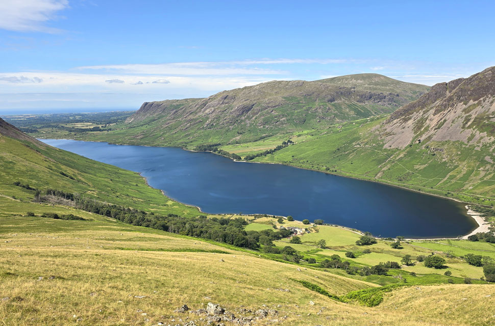 |
| Views over Wast Water towards Middle Fell, Buckbarrow, Seatallan and Haycock. |
| Not forgetting Yewbarrow seen right. |
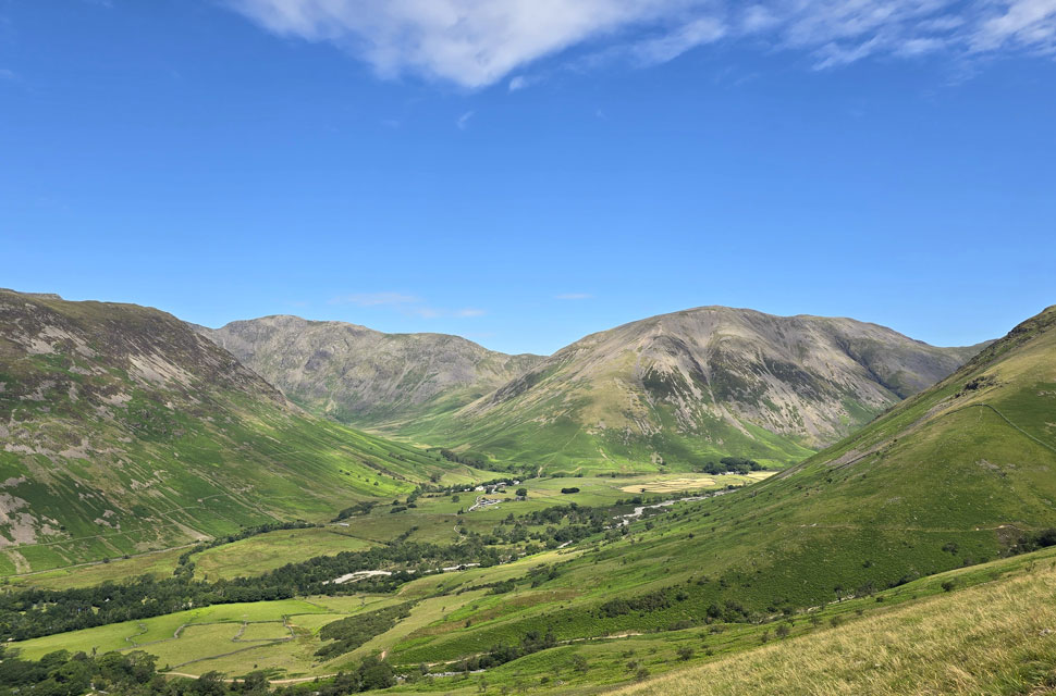 |
| The view towards Yewbarrow, Pillar and Kirk Fell from above Wasdale Head Hall Farm. |
I left the summit of Sca Fell behind, dropped down off the shoulder and headed west for the grassy slopes of Green How and Rakehead Crag. The first 400 feet of descent followed a zig-zagged path cutting through loose scree and boulder, where I passed an elderly chap who asked about my route. Impressed, I turned the conversation to how bright the late morning had become, agreeing we'd both started our walks wearing jackets. I left him and continued my descent, soon passing a father and his three children two teenagers and a lad of about ten who was kicking rocks down the slope. Both the father and brothers were tiring of this and made it known, In no uncertain terms, that he was to rejoin them and keep up. It was the kind of moment that made me want to laugh or just agree with the Dad but I understood why all the same. Just over six miles in, the ascent was showing in my tiring legs, the godsend being that I was now descending grassy slopes steep all the same.
The trod veered right and rounded the gully on Greathead Crag, after which the slope steepened further, but the path below was in sight. I had glorious views of Illgill Head and, to the south-west, Burnmoor Tarn shimmering in the late morning heat. Down below I could see paddle-boarders on Wast Water, its deep blue surface inviting and reflecting the sunlight. The sound of a car travelling over a cattle grid near the National Trust campsite exit brought me back to reality, but silence soon resumed. The fellside veered right again, where I stopped to take a photo before entering a sea of bracken and, beyond it, the path that would eventually lead me back to Brackenclose.
Although the bracken hadn't completely taken over the path hid rocks underfoot, and it was difficult not to curse when one sent me careering sideways though I managed to recover. It was hot now, and despite almost emptying four litres of hydration, I was constantly wiping goo from my lips. My boots looked just as they had after ascending the scree slope on Scafell Pike, like they'd never forgive me, and I told them I'd give them a good wipe-down once I got home either that or donate them to the charity shop. I reached the path below and kicked my feet into the backs of my boots, which did little to ease the discomfort, instead sending aches and groans up to my knees through aching calves. Christ, I'm not fit to be let out, I thought. All of this was soon forgotten the moment I joined the path proper, where a feeling of self-accomplishment rose and looped through my stomach. I was still over a mile from Wasdale Head, and after descending into Brackenclose I passed through the campsite, where the noise of a petrol lawnmower brought me back to reality but in a good way.
After crossing Lingmell Gill via the wooden footbridge, I turned right and walked through the campsite, impressed by the well kept grass and amenities, including EV chargers. I left the campsite behind and silence returned as the path crossed Lingmell Beck, which again was bone dry, its bed worn flat by visitors. It took me back to October 2008, when a friend and I attempted an unrecorded ascent of Great Gable during severe floods. We didn't make it as far as Sty Head, forced back by the adverse weather and advice from fell runners retreating from their race. The valley was flooding, Lingmell Gill was about to burst its banks, and Wasdale Head was under water. I can't remember how or why, but I ended up on the BBC News website and that's how I'll always remember Lingmell Gill. Kirk Fell and Great Gable dominated my view beyond fields of yellow daisies and blue skies. The car park wasn't as busy as I expected, gaps appearing between the madness. More cars were arriving, the gaps quickly taken up, as I slumped into my seat and sent the windows down. It's going to take a few days to sink in, but the next time I return to Wasdale Head, I won't be carrying the weight of this route ever again. |
|
| |
| Back to top |
 |
|