 |
Castle Crag |
 |
 |
Overview |
 |
|
| Height: |
951 Feet - 290 Metres |
| Grid Ref: |
NY 249 159 |
| Area: |
North Western |
| Ordnance Survey: |
OL4 |
| Wainwright Guidebook: |
Six |
 |
Even today one man in possession , armed with a stick, could prevent its occupation by others whatever their number, there being one strategic point, (the place of access to the top) where passage upward is restricted to single file traffic. Authorities agree that there was once a fort here, probably early British, but it needs a trained eye to trace any earthworks - which in any case, must of been serverely disturbed by an old quarry that has cut a big slice out of the summit and, be it noted, constitutes an unprotected danger. |
|
| |
|
Map and Photo Gallery |
|
|
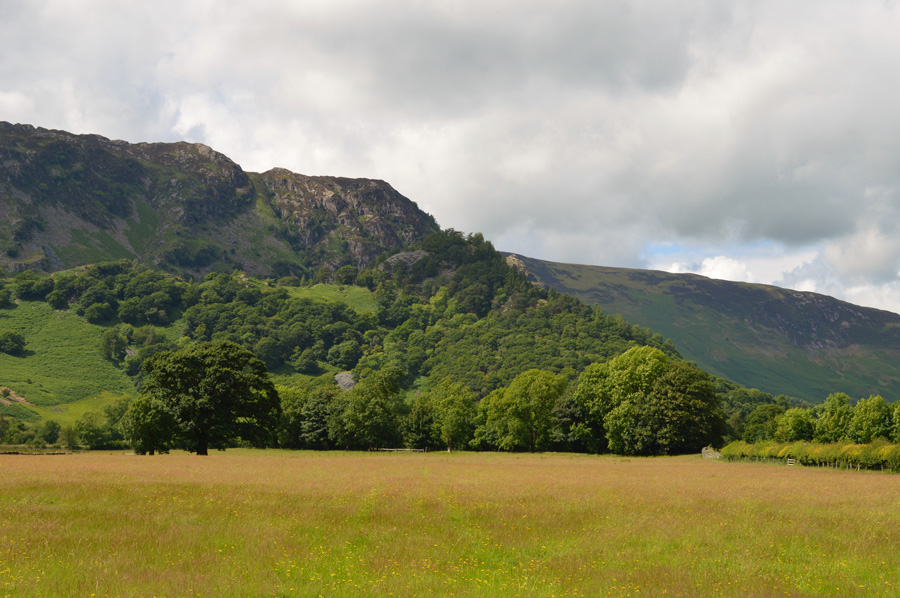 |
| Castle Crag from Rosthwaite. |
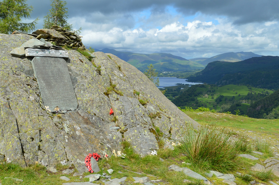 |
| Castle Crag summit together with World War One Memorial |
|
| |
|
There are 4 walks to choose from including Castle Crag |
|
|
High Dote and Castle Crag from Grange |
|
|
 |
|
28th December 2019 |
| ASCENT: |
1,400 Feet - 427 Metres |
| MILES: |
6.3 |
| WAINWRIGHTS: |
Castle Crag |
| ROUTE: |
Grange - Holmcrag Wood - Low Hows Wood - High Hows Wood - River Derwent - Longthwaite - Seatoller - High Dote - Tongue Gill - Castle Crag - Broadslack Gill - Grange |
|
| |
|
The Wainwrights in 30 Walks - Walk 22 Eagle Crag to Castle Crag via Greenup Edge |
|
|
|
|
8th July 2016 |
| ASCENT: |
3,643 Feet - 1,112 Meters |
| MILES: |
14.3 |
| WAINWRIGHTS: |
6, Eagle Crag - Sergeant's Crag - UIlscarf - Great Crag - Grange Fell - Eagle Crag |
| ROUTE: |
Stonethwaite - Greenup Gill - Eagle Crag - Sergeants Crag - Long Crag - Greenup Edge - Ullscarth - High Saddle - Low Saddle - Dock Tarn - Great Crag - Top of Puddingstone Bank - Grange Fell - Puddingstone Bank -Rosthwaite - River Derwent - New Bridge - Castle Crag Lingy Bank - River Derwent - Rosthwaite - B5289 - Stonethwaite |
|
| |
|
Cat Bells & Castle Crag from Portinscale |
|
|
|
|
6th August 2013 |
| ASCENT: |
2,753 Feet 839 Meters |
| MILES: |
14.2 |
| WAINWRIGHTS: |
2, Cat Bells – Castle Crag |
| ROUTE: |
Portinscale – Nichol End – Fawepark – Skelgill Bank – Cat Bells – Hause Gate – Manesty – Grange – Allerdale Ramble – Castle Crag – Cumbrian Way – Rosthwaite – Puddingstone Bank – Watendlath – Road to Ashness Bridge – Ashness Wood – Surprise View – Ashness Bridge – Ashness Jetty – Calfclose Bay – Friars Crag – Keswick – Moot Hall – Stormwater Bridge – Portinscale |
|
| |
|
Castle Crag |
|
|
|
|
5th March 2010 |
| ASCENT: |
951 Ft 290 Mtrs |
| MILES: |
2.5 |
| WAINWRIGHTS: |
1, Castle Crag |
| ROUTE: |
|
|
| |
| Back to top |
 |
|
