|
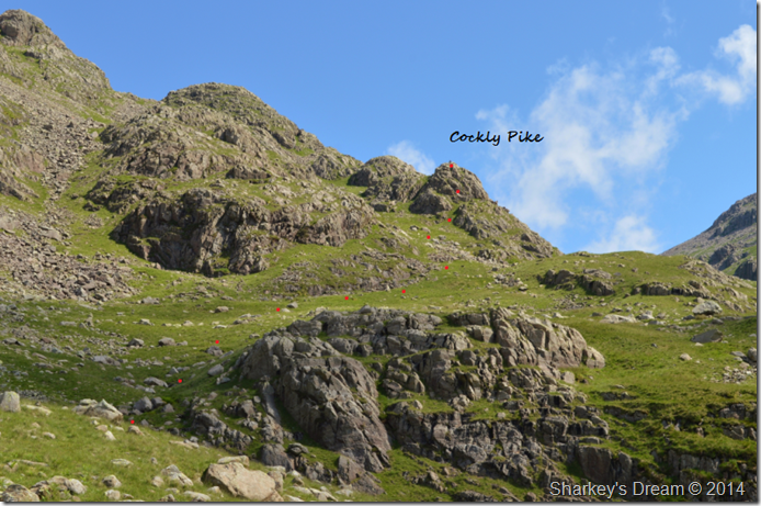
Cockly Pike |
 |
 |
Overview |
 |
|
| Height: |
1,794 Feet - 547 Metres |
| Grid Ref: |
NY 228 070 |
| Area: |
Southern |
| Ordnance Survey: |
OL6 |
| |
|
|
| |
|
Map and Photo Gallery |
|
|
|
| |
|
Walks including Cockly Pike are:- |
|
|
Ill Crag via the Cockly Pike Ridge |
|
|
 |
|
21st June 2014 |
| ASCENT: |
3,093 Feet – 943 Meters |
| MILES: |
11.5 |
| WAINWRIGHTS: |
1, Esk Pike |
| ROUTE: |
Jubilee Bridge – Brotherikeld – Taw House – Scale Bridge – Damas Dubs – Great Moss – River Esk – Sampson’s Stones – Cockly Pike – Cockly Pike Ridge – Ill Crag – Calf Cove – Esk Hause – Esk Pike – Ore Gap – Yeastyrigg Gill – Lingcove Beck – Lingcove Bridge – Brotherikeld – Jubilee Bridge |
|
| |
| Back to top |
 |
|