|
Brown Howe, Mardale |
 |
 |
Overview |
 |
|
| Height: |
1,735 Feet - 529 Metres |
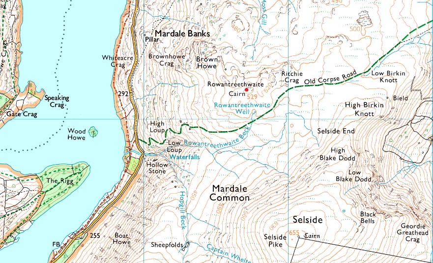
| Grid Ref: |
NY 487 121 |
| Area: |
Far Eastern |
| Group: |
E/BRA |
| Ordnance Survey: |
OL5 |
|
| |
|
Map and Photo Gallery |
|
|
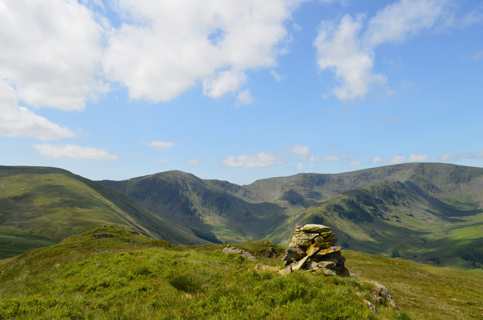 |
| Branstree, Harter Fell (Mardale) the Top of Nan Bield Pass, Mardale III Bell, and High Street from Brown Howe summit. |
| |
|
| |
|
Walks including are Brown Howe are :- |
|
|
Walking the Birketts, Branstree |
|
|
 |
|
11th June 2018 |
| ASCENT: |
1,750 Feet - 533 Metres |
| MILES: |
5 |
| BIRKETTS: |
4, Branstree - High Howes - Selside Pike - Brown Howe |
| ROUTE: |
Mardale - Rowantreethwaite Beck - Branstree North Ridge - Branstree - Artle Crag - Survey Pillar - High Howes - Captain Whelter Bog - Selside Pike - Selside End - Old Corpse Road - Brown Howe - Rowantreethwaite Beck - Mardale |
|
| |
|
Selside Pike & The Naddle Forest from Swindale |
|
|
|
|
20th July 2014 |
| ASCENT: |
2,080 Feet – 634 Meters |
| MILES: |
10.8 |
| WAINWRIGHTS: |
1, Selside Pike |
| ROUTE: |
Rosgill Moor – Scalebarrow Tarn – Scalebarrow Knott – Harper Hills – Powley’s Hill – Hare Shaw – Old Corpse Road – Selside End – Selside Pike – Rowantreethwaite Cairn – Aaron’s Bield –High Naddle Forest – Wallow Crag – Hugh’s Laithes Pike – Naddle Beck – Naddle Farm – Scalebarrow Knott – Rosgill Moor |
|
| |
| Back to top |
 |
|