 |
Darling Fell |
 |
 |
Overview |
 |
|
| Height: |
1,286 Feet - 391 Metres |
| Grid Ref: |
NY 129 225 |
| Area: |
North Western |
| Group: |
W/FEL |
| Ordnance Survey: |
OL4 |
|
| |
|
Map and Photo Gallery |
|
|
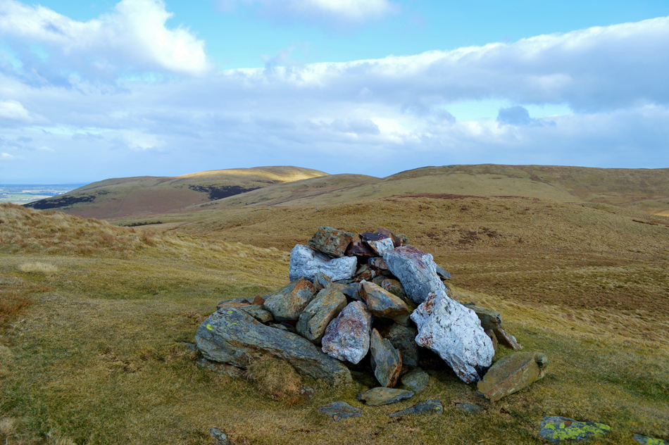 |
| Darling Fell summit cairn. |
| |
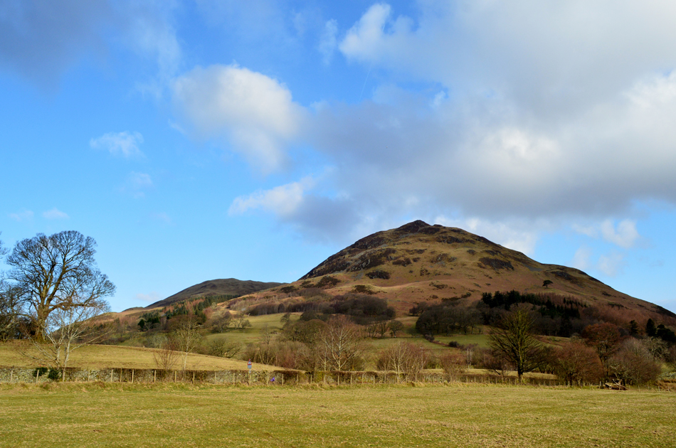 |
| Loweswater Fell (C) seen with Darling Fell (L) |
| |
|
| |
|
Walks including Darling Fell are :- |
|
|
Low Fell & Fellbarrow from Loweswater |
|
|
 |
|
24th January 2026 |
| ASCENT: |
1,560 Feet - 475 Metres |
| MILES: |
5.7 |
| WAINWRIGHTS: |
2, Low Fell - Fellbarrow |
| ROUTE: |
Waterend - Miresdyke - Mosser Fell Road - Darling Fell - Crabtree Beck - Loweswater Fell - Low Fell - Sourfoot Fell - Smithy Fell - Fellbarrow - Mosser Fell Road - Waterend |
|
| |
|
Walking the Birketts - Fellbarrow Round from Loweswater |
|
|
|
|
17th March 2018 |
| ASCENT: |
1,670 Feet - 509 Metres |
| MILES: |
5.7 |
| BIRKETTS: |
7, Darling Fell - Loweswater Fell - Low Fell - Sourfoot Fell - Smithy Fell - Fellbarrow - Hatteringill Head |
| ROUTE: |
Mosser Fell Road - Darling Fell - Crabtree Beck - Loweswater Fell - Low Fell - Sourfoot Fell - Smithy Fell - Fellbarrow - Hatteringill Head - Fellbarrow - Mosser Fell Road |
|
| |
|
Fellbarrow & Low Fell |
|
|
|
|
29th June 2014 |
| ASCENT: |
1,445 Feet 440 Meters |
| MILES: |
5.2 |
| WAINWRIGHTS: |
2, Fell Barrow – Low Fell |
| ROUTE: |
Loweswater – Miresyke – Mosser Road – Fellbarrow – Smithy Fell – Watching Crag – Low Fell – Crabtree Beck – Mosser Road – Loweswater |
|
| |
| Back to top |
 |
|
