|
Lad Hows |
 |
 |
Overview |
 |
|
| Height: |
1,397 Feet - 426 Metres |
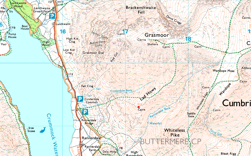
| Grid Ref: |
NY 171192 |
| Area: |
North Western |
| Group: |
NW/GRA |
| Ordnance Survey: |
OL4 |
|
| |
|
Map and Photo Gallery |
|
|
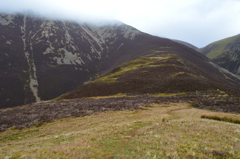 |
| Grasmoor and The Lad Hows ridge from Lad Hows summit. |
|
| |
|
Walks including Lad Hows are:- |
|
|
Walking the Birketts, Grasmoor to Whiteless Pike Circuit |
|
|
 |
|
23rd March 2019 |
| ASCENT: |
3,040 Feet - 927 Metres |
| MILES: |
6.4 |
| BIRKETTS: |
6, Lad Hows - Grasmoor - Wandope - Thirdgill Head Man - Whiteless Pike - Rannerdale Knotts |
| ROUTE: |
Rannerdale Farm - Squat beck - Lad Hows - Grasmoor - Wandope - Thirdgill Head Man - Whiteless Edge - Whiteless Pike - Low Bank - Rannerdale Knotts - Rannerdale Farm |
|
| |
|
A bitterly cold day on Whiteside, Hopegill Head and Grasmoor |
|
|
|
|
10th February 2017 |
| ASCENT: |
3,311 Feet - 1,009 Metres |
| MILES: |
7 |
| WAINWRIGHTS: |
3 Whiteside - Hopegill Head - Grasmoor |
| ROUTE: |
Lanthwaite Green - Liza Beck - Whin Benn - Whiteside - Hopegill Head - Sand Hill - Coledale Hause - Grasmoor North East Ridge - Grasmoor - Lad Hows - Cinderdale Common - Lanthwaite Green |
|
| |
|
Grasmoor via Dove Crag Arête |
|
|
|
|
14th June 2012 |
| ASCENT: |
2,550 Feet, 777.4 Metres |
| MILES: |
6.3 |
| WAINWRIGHTS: |
1, Grasmoor |
| ROUTE: |
Lanthwaite Green – Gasgale Gill – Dove Crags Arête – Grasmoor – Lad Hows – Cinderdale Common – Hause Point – Lake Road – Lanthwaite Green |
|
| |
| Back to top |
 |
|