|
Loweswater Fell |
 |
 |
Overview |
 |
|
| Height: |
1,352 Feet - 412 Metres |
| Grid Ref: |
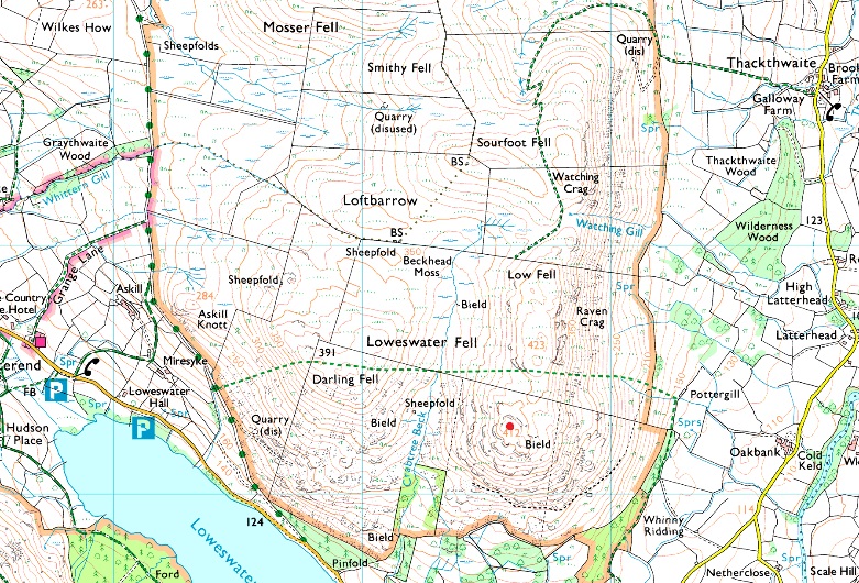
NY 135 222 |
| Area: |
Western |
| Group: |
W/FELL |
| Ordnance Survey: |
OL4 |
|
| |
|
Map and Photo Gallery |
|
|
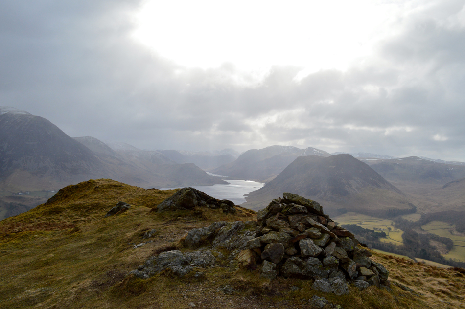 |
| Crummock Water and Mellbreak from Loweswater Fell. |
| . |
|
| |
|
Walks including Loweswater Fell are:- |
|
|
Low Fell & Fellbarrow from Loweswater |
|
|
 |
|
24th January 2026 |
| ASCENT: |
1,560 Feet - 475 Metres |
| MILES: |
5.7 |
| WAINWRIGHTS: |
2, Low Fell - Fellbarrow |
| ROUTE: |
Waterend - Miresdyke - Mosser Fell Road - Darling Fell - Crabtree Beck - Loweswater Fell - Low Fell - Sourfoot Fell - Smithy Fell - Fellbarrow - Mosser Fell Road - Waterend |
|
| |
|
Walking the Wainwrights in 30 Walks - Walk 23 The Loweswater Fells |
|
|
|
|
9th July 2016 |
| ASCENT: |
5,000 Feet - 1,525 Meters |
| MILES: |
15.2 |
| WAINWRIGHTS: |
7, Mellbreak - Hen Comb - Gavel Fell - Blake Fell - Burnbank Fell - Fellbarrow - Low Fell |
| ROUTE: |
Loweswater - Kirkgate Farm - White Crag - Mellbreak - Mosedale - Mosedale Beck - Hen Comb - White Oak Moss - White Oak - Gavel Fell - Fothergill Head - Blake Fell - Burnbank Fell - Jenkinson Place - Hudson Place - Grange Lane - Mosser Road - Mosser Fell - Fellbarrow - Low Fell - Crabtree Beck - Mosser Road - Loweswater Road
|
|
| |
|
Walking the Birketts - Fellbarrow Round from Loweswater |
|
|
|
|
17th March 2018 |
| ASCENT: |
1,670 Feet - 509 Metres |
| MILES: |
5.7 |
| BIRKETTS: |
7, Darling Fell - Loweswater Fell - Low Fell - Sourfoot Fell - Smithy Fell - Fellbarrow - Hatteringill Head |
| ROUTE: |
Mosser Fell Road - Darling Fell - Crabtree Beck - Loweswater Fell - Low Fell - Sourfoot Fell - Smithy Fell - Fellbarrow - Hatteringill Head - Fellbarrow - Mosser Fell Road |
|
| |
|
Fellbarrow & Low Fell |
|
|
|
|
29th June 2014 |
| ASCENT: |
1,445 Feet 440 Meters |
| MILES: |
5.2 |
| WAINWRIGHTS: |
2, Fell Barrow – Low Fell |
| ROUTE: |
Loweswater – Miresyke – Mosser Road – Fellbarrow – Smithy Fell – Watching Crag – Low Fell – Crabtree Beck – Mosser Road – Loweswater |
|
| |
|
An Afternoon on Low Fell & Fellbarrow |
|
|
|
|
31st July 2011 |
| ASCENT: |
1,500 Feet, 458 Meters |
| MILES: |
5.3 |
| WAINWRIGHTS: |
2, Low Fell & Fellbarrow |
| ROUTE: |
|
|
| |
| Back to top |
 |
|