 |
Red Knott |
 |
 |
Overview |
 |
|
| Height: |
1483 Feet - 452 Metres |
| Grid Ref: |
NY 221 179 |
| Area: |
North Western |
| Group: |
NW/DAL |
| Ordnance Survey: |
OL4 |
|
| |
|
Map and Photo Gallery |
|
|
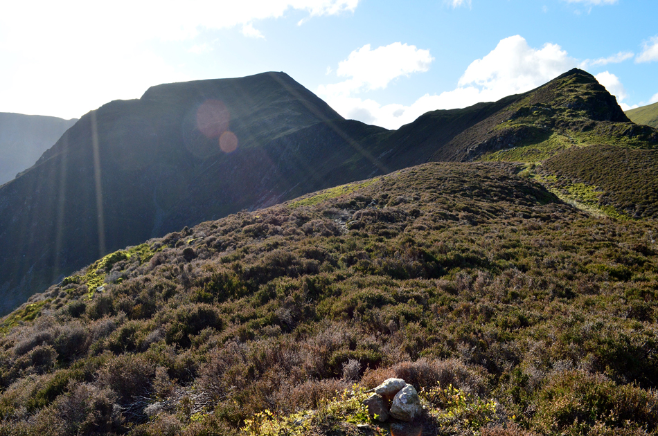 |
| Hindscarth and High Crags from Red Knott summit. |
| |
|
| |
|
Walks including Red Knott are:- |
|
|
Walking the Birketts, Dale Head Horseshoe |
|
|
 |
|
27th October 2018 |
| ASCENT: |
2,855 Feet - 871 Metres |
| MILES: |
10 |
| BIRKETTS: |
9, Skelgill Bank - Cat Bells - Maiden Moor - High Spy (Scawdel Fell) - Dale Head - Hindscarth - High Crags - Red Knott - Scope End |
| ROUTE: |
Gutherscale - Skelgill Bank - Catbells - Maiden Moor - High Spy (Scawdel Fell) - Dalehead Tarn - Dale Head - Hindscarth Edge - Hindscarth - Red Knott - Scope End - Low Snab Farm - Newlands Beck - Little Town - Skelgill - Gutherscale |
|
| |
|
The Harry Griffin 2,000 footers Walk 11 -The Newlands Round |
|
|
|
|
8th May 2015 |
| ASCENT: |
3,565 Feet - 1,087 Metres |
| MILES: |
9.7 |
| SUMMITS OVER 2,000 Ft: |
Nitting Haws - High Spy - Dale Head - Robinson - Hindscarth South Top - Hindscarth |
| ROUTE: |
Little Town - Knott End - High Crags - Maiden Moor - Narrow Moore - Nitting Haws - High Spy - Dalehead Tarn - Dale Head - Hindscarth Edge - Littledale Edge - Robinson - Littledale Edge - Hindscarth South Top - Hindscarth - High Crags - Scope End - Low Snab - Low House Farm - Newlands Church - Little Town |
|
| |
| Back to top |
 |
|
