|
Parking Information for - Roadside Parking, Wythburn, Thirlmere |
 |
 |
Parking Details and Map |
 |
|
| Nearest Post Code: |
CA12 4TP |
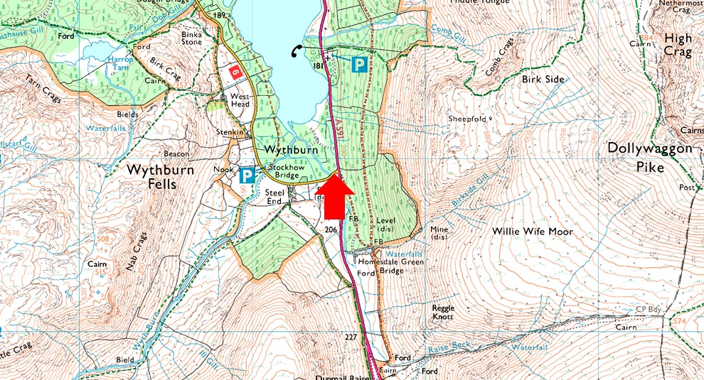
| Grid Reference: |
NY 324 812 |
| Notes: |
Roadside Parking can be found at the southern end of Thirlmere Reservoir at junction of Steel End just of the A591. If traveling from Grasmere turn left sign posted Armboth and on the immediate right you will find roadside parking for up to three cars. Parking is free. |
|
| |
|
Walks starting from this parking place |
|
|
|
Ullscarf to High Tove via Wyth Burn |
|
|
 |
|
5th October 2024 |
| ASCENT: |
2,483 Feet - 756 Metres |
| MILES: |
11.7 |
| WAINWRIGHTS: |
3, Ullscarf - High Tove - Armboth Fell |
| ROUTE: |
Wythburn - Wyth Burn - Wythburn Head - The Bog - Middle How - Greenup Edge - Ullscarf - Standing Crag - Bell Crags - Long Moss - High Tove - Armboth Fell - Armboth - Road West of Thirlmere - Thirlmere Dam - Turnip Corner |
|
| |
|
Helvellyn to Nethermost Pike from Swirls |
|
|
|
|
24th December 2018 |
| ASCENT: |
2,700 Feet - 823 Metres |
| MILES: |
6 |
| WAINWRIGHTS: |
2, Helvellyn - Nethermost Pike |
| ROUTE: |
Swirls – Helvellyn Gill - Brown Cove Crags – Helvellyn Lower Man – Helvellyn – Nethermost Pike – Birk Side – Comb Crags – Wythburn |
|
| |
|
Nethermost Pike to Clough Head |
|
|
|
|
5th October 2013 |
| ASCENT: |
4,400 Feet, 1,244 Meters |
| MILES: |
13.4 |
| WAINWRIGHTS: |
8 Nethermost Pike – Helvellyn – White Side – Raise – Stybarrow Dodd – Watson’s Dodd – Great Dodd – Clough Head |
| ROUTE: |
Wythburn – Comb Crags – Birk Side – Nethermost Pike - Helvellyn – Helvellyn Lower Man – White Side – Raise – Sticks Pass – Stybarrow Dodd – Watson’s Dodd – Great Dodd – Calfhow Pike – Clough Head – Mariel Bridge – Old Coach Road – Wanthwaite |
|
| |
|
| |
| Back to top |
 |
|