|
Caw Fell |
 |
 |
Map and Photo Gallery |
 |
|
 |
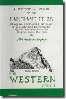
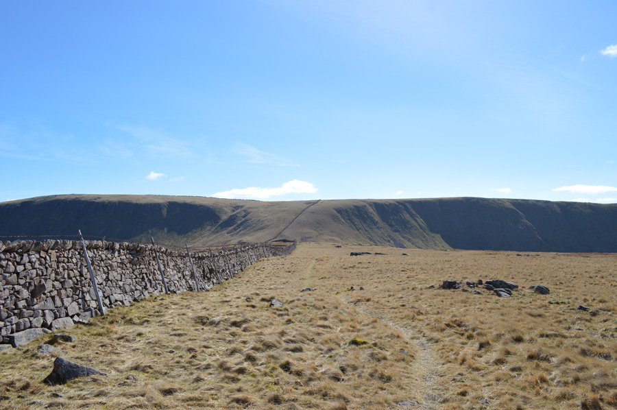
| Caw Fell seen over Bown Band. |
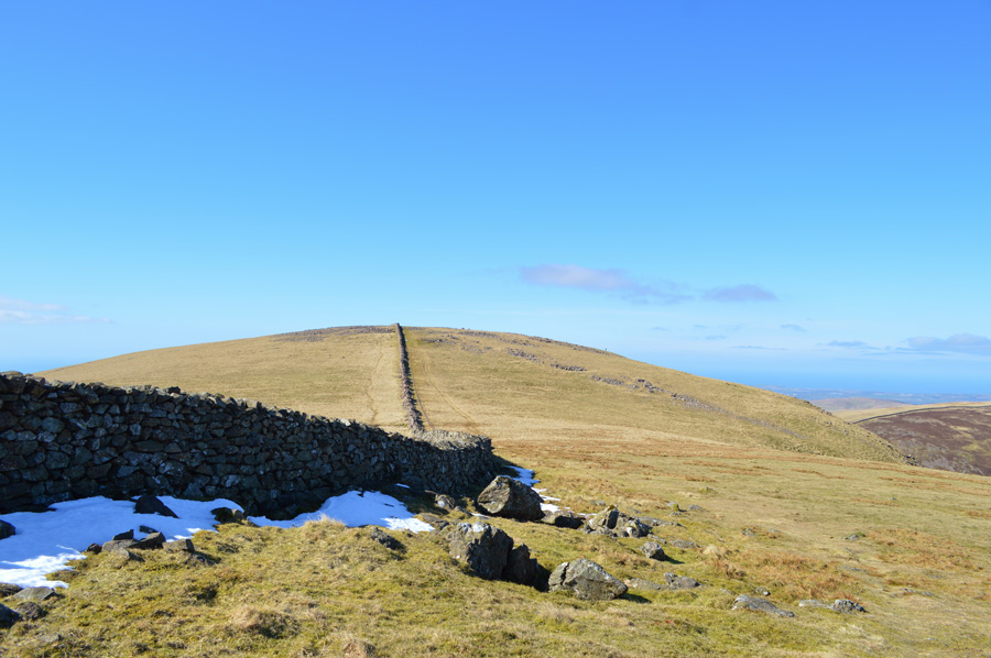 |
| Caw Fell. |
 |
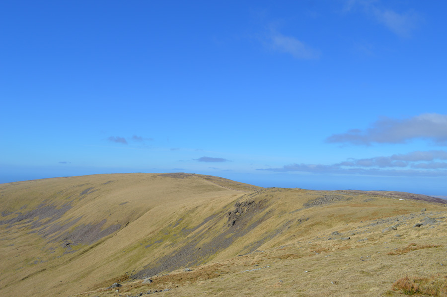
| Caw Fell from Iron Crag. |
 |
| Caw Fell from Iron Crag. |
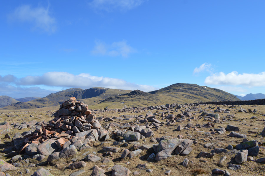 |
| Haycock, Little Gowder Crag, Scoat Fell and Steeple from Caw Fell summit cairn. |
|
| |
|
There are 10 walks to choose from including Caw Fell |
|
|
Steeple via the Long Crag Ridge from Bleach Green |
|
|
 |
|
3rd May 2025 |
| ASCENT: |
3,883 Feet - 1,184 Metres |
| MILES: |
14 |
| WAINWRIGHTS: |
5, Steeple - Scoat Fell - Haycock - Caw Fell - Crag Fell |
| ROUTE: |
Bleach Green – Ennerdale Lake Path - Bowness – Irish Bridge - Ling Mell Plantations - Ennerdale Forest - Low Beck - Long Crag - Steeple - Scoat Fell - Haycock - Little Gowder Crag - Caw Fell - Iron Crag - Crag Fell - Top of Revelin Crag - Ben Gill - Bleech Green |
|
| |
|
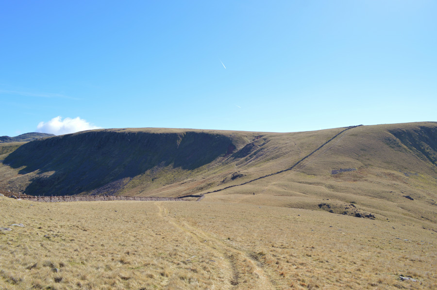
Caw Fell from Cold Fell Road |
|
|
|
|
13th May 2023 |
| ASCENT: |
2,883 Feet - 878 Metres |
| MILES: |
12.6 |
| WAINWRIGHTS: |
4, Grike - Crag Fell - Caw Fell - Lank Rigg |
| ROUTE: |
Cold Fell Road - Blakeley Moss - Red Moss - Grike - Crag Fell - Black Pots - Iron Crag (Ennerdale Fell) - Caw Fell - Iron Crag (Ennerdale Fell) - Whoap - Lank Rigg - Whoap Beck - Cold Fell Road |
|
| |
|
Seatallan & Outliers |
|
|
|
|
1st June 2021 |
| ASCENT: |
3,760 Feet - 1,147 Metres |
| MILES: |
11.5 |
| WAINWRIGHTS: |
4, Middle Fell - Seatallan - Caw Fell - Haycock |
| ROUTE: |
Wast Water - Greendale - Greendale Gill - Middle Fell - Seatallan - Potts of Ashness - Brown Band - Caw Fell - Little Gowder Crag - Haycock -Nether Beck - Netherbeck Bridge - Wast Water |
|
| |
|
The Ennerdale Horseshoe |
|
|
|
|
3rd June 2019 |
| ASCENT: |
7,700 Feet - 2,348 Metres |
| MILES: |
24 |
| WAINWRIGHTS: |
14, Great Borne - Starling Dodd - Red Pike (Buttermere) - High Stile - High Crag - Haystacks - Brandreth - Green Gable - Kirk Fell - Pillar - Scoat Fell - Haycock - Caw Fell - Crag Fell |
| ROUTE: |
Bleach Green - Ennerdale Water - Bowness - Herdus - Great Borne - Starling Dodd - Red Pike (Buttermere) - High Stile - High Crag - Gamlin End - Seat - Top of Scarth Gap - Haystacks - Innominate Tarn - Moses trod - Brandreth - Gillercomb Head - Green Gable - Windy Gap - Beck Head - Kirk Fell North Top - Kirk Fell - Baysour Slack - Top of Black Sail Pass - Looking Stead - Pillar - Wind Gap - Black Crag - Scoat Fell - Haycock - Caw Fell - Iron Crag - Crag Fell - Ben Gill - Crag Fell Farm - Bleach Green |
|
| |
|
Steeple via the Long Crag Ridge from Bleach Green |
|
|
|
|
17th June 2017 |
| ASCENT: |
3,883 Feet - 1,184 Metres |
| MILES: |
14 |
| WAINWRIGHTS: |
5, Steeple - Scoat Fell - Haycock - Caw Fell - Crag Fell |
| ROUTE: |
Bleach Green – Ennerdale Lake Path - Bowness – Irish Bridge - Ling Mell Plantations - Ennerdale Forest - Low Beck - Long Crag - Steeple - Scoat Fell - Haycock - Little Gowder Crag - Caw Fell - Iron Crag - Crag Fell - Top of Revelin Crag - Ben Gill - Bleech Green |
|
| |
|
Walking the Wainwrights in 30 Walks Walk 11 - Caw Fell to Grike from Monks Bridge |
|
|
|
|
30the April 2016 |
| ASCENT: |
3,200 Feet - 975 Meters |
| MILES: |
14.7 |
| WAINWRIGHTS: |
4, Caw Fell - Lank Rigg - Crag Fell - Grike |
| ROUTE: |
Monks Bridge - Tongue How - Worm Gill - Caw Fell - Iron Crag - Whoap - Lank Rigg - Whoap - Crag Fell - Grike - Blakeley Moss - Kinniside Stone Circle |
|
| |
|
The Harry Griffin 2,000 footers Walk 4 -Seatallan and Outliers |
|
|
|
|
21st March 2015 |
| ASCENT: |
4,425 Feet - 1,359 Meters |
| MILES: |
13.5 |
| SUMMITS OVER 2,000 Ft: |
Seatallan - Caw Fell - Iron Crag - Haycock - Scoat Fell |
| ROUTE: |
Wast Water - Greendale - Greendale Gill - Middle Fell - Seatallan - Potts of Ashness - Stockdale Head - Caw Fell - Iron Crag - Caw Fell - Little Gowder Crag - Haycock - Scoat Fell - Scoat Tarn - Nether Beck - Netherbeck Bridge - Wast Water |
|
| |
|
The Blengdale Horseshoe |
|
|
|
|
20th January 2013 |
| ASCENT: |
3,772 Feet. 1,150 Metres |
| MILES: |
12 |
| WAINWRIGHTS: |
4, Middle Fell – Seatallan – Haycock – Caw Fell |
| ROUTE: |
Greendale – Middle Fell – Seatallan – Pots of Ashes – High Pike How – Haycock – Little Gowder Crag – Caw Fell – Hause – Stockdale Moor – Sampson’s Bratfull – Blengdale Forest – Greendale |
|
| |
|
A Greendale Round |
|
|
|
|
22nd April 2011 |
| ASCENT: |
2,500 Feet, 747 Meters |
| MILES: |
10.7 |
| WAINWRIGHTS: |
5, Buckbarrow, Seatallan, Haycock, Caw Fell & Middle Fell |
| ROUTE: |
|
|
| |
| Back to top |
 |
|