|
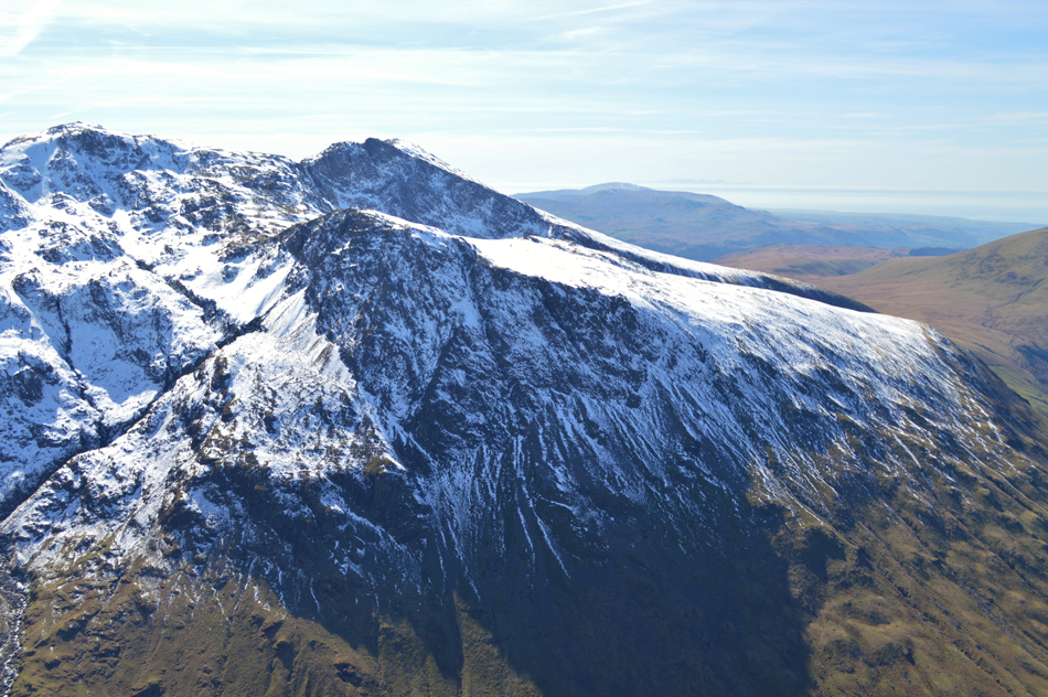
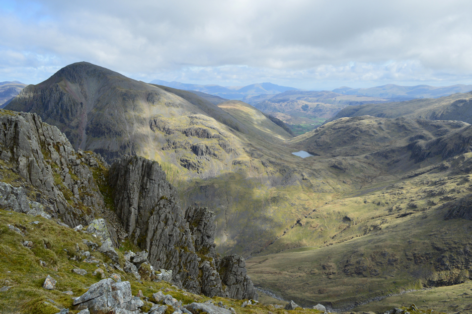
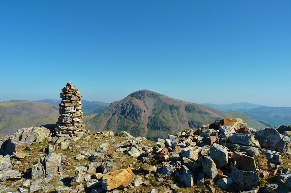
Lingmell |
 |
 |
There are 9 walks to choose from including Lingmell |
 |
|
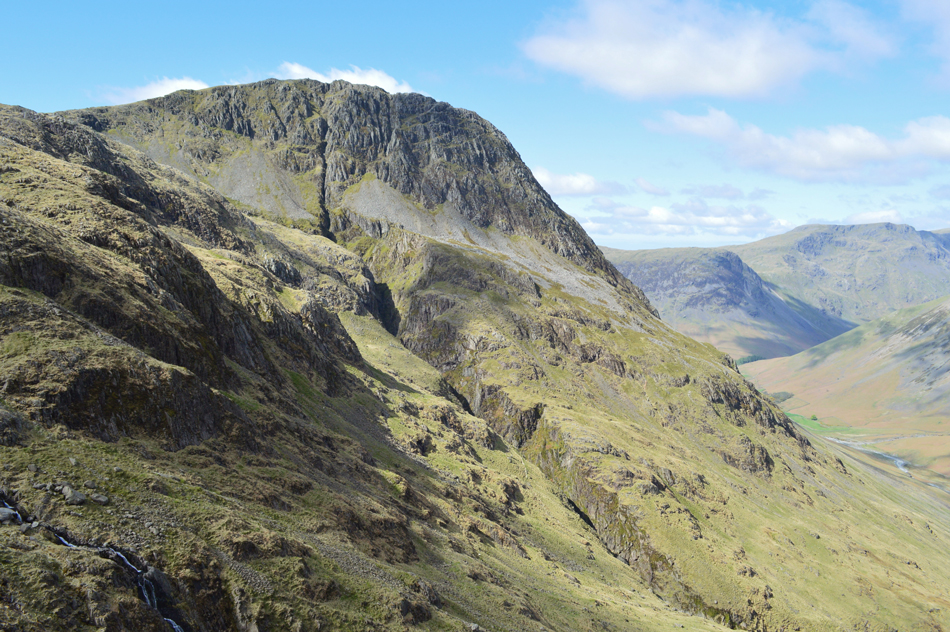
Great End & Scafell Pike from Wasdale Head |
|
|
 |
|
7th June 2022 |
| ASCENT: |
3,691 Feet 1,125 Metres |
| MILES: |
8 |
| WAINWRIGHTS: |
3, Great End - Scafell Pike - Lingmell |
| ROUTE: |
Wasdale Head - Burnthwaite - Moses Trod - Sty Head - The Band - Great End - Broad Crag - Broad Crag Col - Scafell Pike - Lingmell Col - Lingmell - Goat Crags - Down-in-the-Dale - Wasdale Head |
|
| |
|
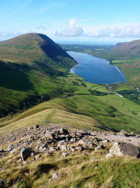
Scafell Pike and Lingmell from Wasdale Head |
|
|
|
|
2nd April 2021 |
| ASCENT: |
3,804 Feet - 1,160 Metres |
| MILES: |
6 |
| WAINWRIGHTS: |
2, Scafell Pike - Lingmell |
| ROUTE: |
Wasdale Head - Down-in-the-Dale - Lingmell Beck - Lingmell Gill - Brown Tongue - Hollow Stones - Mickledore - Scafell Pike - Lingmell Col - Lingmell - Lingmell Crag - Goat Crags - Down-in-the-Dale - Lingmell Beck - Wasdale Head |
|
| |
|
Scafell Pike and Lingmell from Wasdale Head |
|
|
|
|
8th August 2019 |
| ASCENT: |
3,804 Feet - 1,160 Metres |
| MILES: |
6 |
| WAINWRIGHTS: |
2, Scafell Pike - Lingmell |
| ROUTE: |
Wasdale Head - Down-in-the-Dale - Lingmell Beck - Lingmell Gill - Brown Tongue - Hollow Stones - Mickledore - Scafell Pike - Lingmell Col - Lingmell - Lingmell Crag - Goat Crags - Down-in-the-Dale - Lingmell Beck - Wasdale Head |
|
| |
|
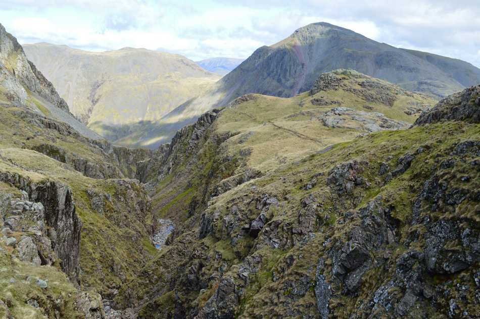
Lingmell via Piers Gill |
|
|
|
|
7th May 2018 |
| ASCENT: |
2,600 Feet - 793 Metres |
| MILES: |
5.7 |
| WAINWRIGHTS: |
Lingmell |
| ROUTE: |
Wasdale Head - Burnthwaite - Moses Trod - Lingmell Beck - Piers Gill - Lingmell Col - Lingmell - Lingmell Crags - Goat Crags - Lingmell West Ridge - Down-in-the-Dale -Wasdale Head |
|
| |
|
The Wasdale Head Watershed |
|
|
|
|
22nd April 2017 |
| ASCENT: |
5,244 Feet - 1,599 Metres |
| MILES: |
10.2 |
| WAINWRIGHTS: |
4, Scafell Pike - Lingmell - Great Gable - Kirk Fell |
| ROUTE: |
Wasdale Head - Lingmell Gill - Brown Tongue - Mickledore - Scafell Pike - Lingmell Col - Lingmell - Lingmell Col - Corridor Route - Sty Head - Great Gable - Beck Head - Rib End - Kirk Fell - Kirkfell Crags - Top of Blacksail Pass - Gatherstone Beck - Mosedale - Mosedale Beck - Wasdale Head |
|
| |
|
Walking the Wainwrights in 30 Walks - Walk 24 The Scafells and Illgill Head |
|
|
|
|
23rd July 2016 |
| ASCENT: |
5,413 Feet - 1,650 Meters |
| MILES: |
13 |
| WAINWRIGHTS: |
6, Lingmell - Scafell Pike - Scafell - Slight Side - IIIgill Head - Whin Rigg |
| ROUTE: |
Wasdale Head - Brackenclose - Lingmell - Lingmell Col - Scafell Pike - Mickledore - Foxs Tarn Gully - Foxs Tarn - Scafell - Long Green - Slight Side - Hardrigg Gill - Maiden Castle Cairn - IIIgill Head - Whin Rigg - Greathall Gill - Wast Water |
|
| |
|
The Harry Griffin 2,000 footers Walk 27 -The Roof of England |
|
|
|
|
13th September 2015 |
| ASCENT: |
5,061 Feet - 1,543 Meters |
| MILES: |
11 |
| SUMMITS OVER 2'000Ft: |
5, Lingmell - Scafell Pike - Scafell - Cam Spout Crag - Slight Side |
| ROUTE: |
Wasdale Head - Down in the Dale - Brackenclose - Lingmell - Lingmell Col - Scafell Pike - Mickledore - Foxes Tarn gully - Mickledore - Lord's Rake - Scafell - Long Green - Slight Side - Long Gill - Hardrigg Gill - Hard Rigg - Corpse Road - Brackenclose - Down in the Dale - Wasdale Head |
|
| |
|
Nothing better than this… |
|
|
|
|
27th May 2012 |
| ASCENT: |
4,509 Feet, 1,377 Metres |
| MILES: |
9.6 |
| WAINWRIGHTS: |
4, Lingmell, Scafell Pike, Scafell, Slight Side |
| ROUTE: |
Wasdale Head – Down In The Dale – Brackenclose – Lingmell – Lingmell Col – Scafell Pike – Lords Rake – Scafell – Long Green – Slight Side – Quargrigg Moss – Great How – Burnmoor Tarn – Down In The Dale – Wasdale Head |
|
| |
|
Lingmell To Slight Side via The Scafell’s |
|
|
|
|
4th September 2011 |
| ASCENT: |
4,500 Feet, 1,372 Meters |
| MILES: |
9.7 |
| WAINWRIGHTS: |
4, Lingmell, Scafell Pike, Sca Fell & Slight Side |
| ROUTE: |
Brackenclose, Lingmell, Lingmell Col, Scafell Pike, Lords Rake, Sca Fell, Long Green, Slight Side, Quagrigg Moss, Broad Tongue, Burnmoor Tarn, Wasdale Head |
|
| |
| Back to top |
 |
|