 |
Loadpot Hill |
 |
 |
Map and Photo Gallery |
 |
|
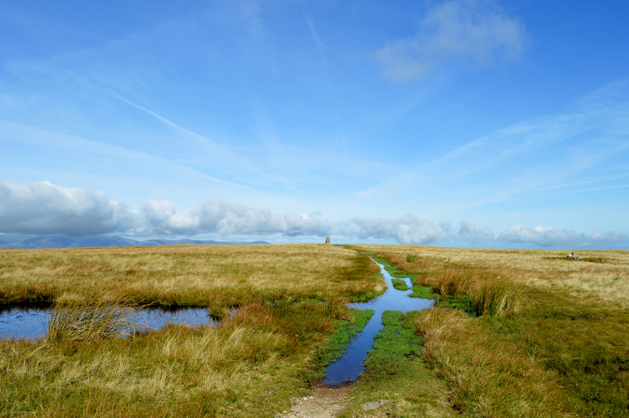 |
| Approaching Loadpot Hill from the South. |
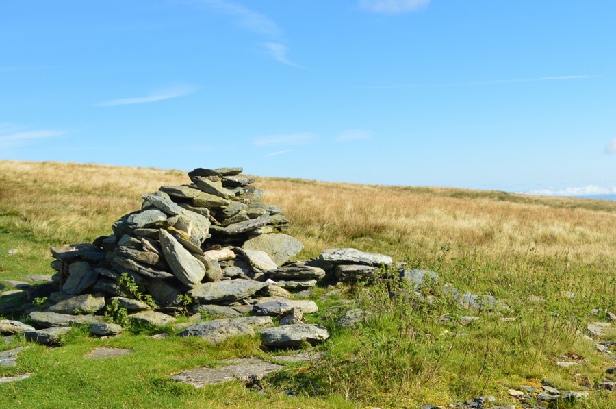 |
| The remains of Lowther House chimney, Loadpot Hill. |
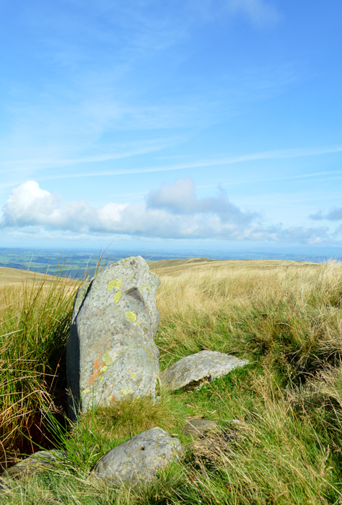 |
| Lambert Lad, Loadpot Hill. |
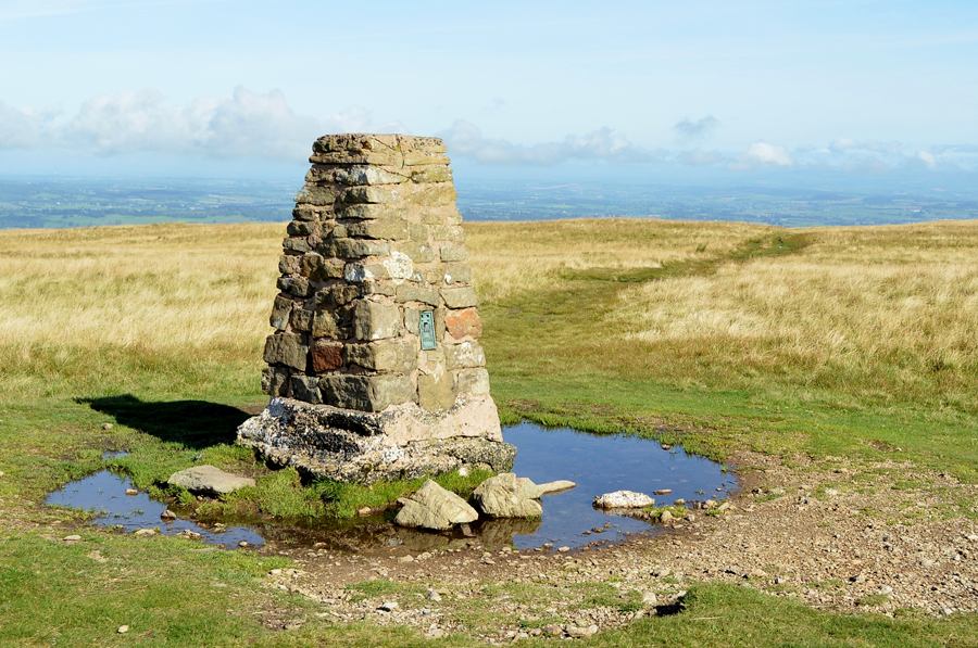 |
| Loadpot Hill summit Trig Point |
|
| |
|
There are 12 walks to choose from including Loadpot Hill |
|
|
Loadpot Hill from Roehead |
|
|
 |
|
22nd February 2026 |
| ASCENT: |
1,782 Feet - 543 Metres |
| MILES: |
9 |
| WAINWRIGHTS: |
3, Arthur's Pike - Bonscale Pike - Loadpot Hill |
| ROUTE: |
Roehead - Barton Fell - Arthur's Pike - Swarth Beck - Bonscale Pike - Loadpot Hill - High Street Roman Road - The Cockpit - Roehead |
|
| |
|
Loadpot Hill from Roehead |
|
|
|
|
29th March 2025 |
| ASCENT: |
1,782 Feet - 543 Metres |
| MILES: |
9 |
| WAINWRIGHTS: |
3, Arthur's Pike - Bonscale Pike - Loadpot Hill |
| ROUTE: |
Roehead - Barton Fell - Arthur's Pike - Swarth Beck - Bonscale Pike - Loadpot Hill - High Street Roman Road - The Cockpit - Roehead |
|
| |
|
A Fusedale Circuit |
|
|
|
|
27th February 2022 |
| ASCENT: |
2,151 Feet - 656 Metres |
| MILES: |
7 |
| WAINWRIGHTS: |
4, Bonscale Pike - Loadpot Hill - Wether Hill - Steel Knotts (Pikeawassa) |
| ROUTE: |
Martindale New Church - The Coombs - Mellgaurds - Bonscale Pike - Loadpot Hill - Wether Hill - Mere Beck - Gowk Hill - Brownthwaite Crags - Steel Knotts (Pikeawassa) - Birkie Knott - Lanty Tarn - Martindale New Church |
|
| |
|
Loadpot Hill Wild Camp |
|
|
|
|
12th - 13th June 2021 |
| ASCENT: |
2,880 Feet - 878 Metres |
| MILES: |
15.9 |
| WAINWRIGHTS: |
4, Arthur's Pike - Bonscale Pike - Loadpot Hill - Wether Hill |
| ROUTE: |
Askham – Askham Fell - The Cockpit - Barton Fell - Arthur’s Pike – Swarth Beck - Boncale Pike – Loadpot Hill CAMP – Wether hill – Gowk Hill - Fusedale - Mellguards – Path Below Bonscale Pike – The Cockpit - Heughscar Hill – Askham |
|
| |
|
Loadpot Hill from Roehead |
|
|
|
|
13th August 2020 |
| ASCENT: |
1,802 Feet - 550 Metres |
| MILES: |
9 |
| WAINWRIGHTS: |
3, Arthur's Pike - Bonscale Pike - Loadpot Hill |
| ROUTE: |
Roehead - Barton Fell - Arthur's Pike - Swarth Beck - Bonscale Pike - Lowther House Chimney - Loadpot Hill - High Street Roman Road - The Cockpit - Roehead |
|
| |
|
Walking the Birketts, Around The Cawdale Horseshoe to Loadpot Hill |
|
|
|
|
25th February 2019 |
| ASCENT: |
1,571 Feet - 479 Metres |
| MILES: |
9 |
| BIRKETTS: |
4, Low Kop - Red Crag - Wether Hill - Loadpot Hill |
| ROUTE: |
Mooreahill Farm - Cawdale Beck - Low Kop - High Kop - Red Crag - Wether Hill - Loadpot Hill - Hart Hill - The Pen - Pen End - Moorahill Farm |
|
| |
|
Arthur's Pike, Bonscale Pike and Loadpot Hill from Row Head |
|
|
|
|
12th May 2017 |
| ASCENT: |
1,480 Feet - 451 Metres |
| MILES: |
8 |
| WAINWRIGHTS: |
3, Arthur's Pike - Bonscale Pike - Loadpot Hill |
| ROUTE: |
Roehead - Barton Fell - Arthur's Pike - Swarth Beck - Bonscale Pike - Loadpot Hill - High Street Roman Road - The Cockpit - Roehead |
|
| |
|
Loadpot Hill and Heughscar Hill from Roehead |
|
|
|
|
17th September 2016 |
| ASCENT: |
2,100 Feet - 640 Meters |
| MILES: |
10.6 |
| WAINWRIGHTS: |
3, Arthur's Pike - Bonscale Pike - Loadpot Hill |
| ROUTE: |
Roehead - Barton Fell - Arthur's Pike - Swarth Beck - Bonscale Pike - Lowther House Chimney - Loadpot Hill - High Street Roman Road - The Cockpit - Heughscar Hill - Heugh Scar - Roehead |
|
| |
|
Walking the Wainwrights in 30 Walks - Walk 20 Fourteen Fells east of Ullswater |
|
|
|
|
3rd July 2016 |
| ASCENT: |
4,790 Feet - 1,460 Meters |
| MILES: |
19.9 |
| WAINWRIGHTS: |
14, Bonscale Fell - Arthurs Pike - Loadpot Hill - Wether Hill - High Raise (Martindale) - Kidsty Pike - Rampsgill Head - High Street - The Knott - Rest Dodd - The Nab - Brock Crags - Angletarn Pikes - Beda Fell |
| ROUTE: |
Martindale New Church - Mellgaurds - Bonscale Pike - Top of Swarth Beck - Arthurs Pike - Loadpot Hill - Wether Hill - Red Crag - High Raise (Martindale) - Rampsgill Head - Kidsty Pike - Straights of Riggindale - High Street - Straights of Riggindale - The Knott - Rest Dodd - The Nab - Satura Crag - Brock Crags - Angletarn Pikes - Heckbeck Head - Beda Knott - Beda Fell - Winter Crag - Martindale Old Church - Martindale New Church |
|
| |
|
The Harry Griffin 2,000 footers Walk 14 -Walking High Street |
|
|
|
|
23rd May 2015 |
| ASCENT: |
3,864 Feet - 1,178 Metres |
| MILES: |
12 |
| SUMMITS OVER 2,000 Ft: |
Loadpot Hill - Wether Hill (NY 456 167) Wether Hill (NY 455 163) - Red Crag - Raven Howe - High Raise - Kidsty Pike - Rampsgill Head - The Knott - Rest Dodd - High Street - Rough Crag |
| ROUTE: |
Martindale New Church - Howtown - Fusedale - Brock Crag - Loadpot Hill - Wether Hill - Red Crag - Raven How - High Raise - Kidsty Pike - Rampsgill Head - The Knott - Straights of Riggindale - High Street - Rough Crag - Mardale Head |
|
| |
|
Loadpot Hill via Heltondale |
|
|
|
|
19th January 2014 |
| ASCENT: |
1,969 Feet, 600 Meters |
| MILES: |
13.2 |
| WAINWRIGHTS: |
4 Wether Hill – Loadpot Hill – Bonscale Pike – Arthurs Pike |
| ROUTE: |
Roehead – Moor Divock – Heltondale – Scales Farm – Heltondale Beck – Low Cop - High Cop – The Pen – Hart Hill – Wether Hill – Loadpot Hill – Bonscale Pike – Arthurs Pike – Barton Fell – The Cockpit Stone Circle – Roehead |
|
| |
|
The Fusedale Circuit |
|
|
|
|
26th September 2010 |
| ASCENT: |
3,287 Ft 1,002 Mtrs |
| MILES: |
9 |
| WAINWRIGHTS: |
6 Hallin Fell, Steel Knott’s (Pikeawassa), Wetherhill, Loadpot Hill, Arthurs Pike, Bonscale Pike |
| ROUTE: |
|
|
| |
| Back to top |
 |
|

