|
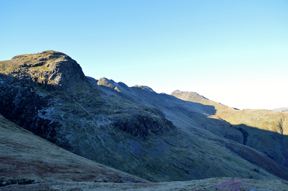
Great Knott |
 |
 |
Overview |
 |
|
| Height: |
2,283 Feet - 696 Metres |
| Grid Ref: |
NY 259 650 |
| Area: |
Southern |
| Group: |
S/BOW |
| Ordnance Survey: |
OL6 |
|
| |
|
Map and Photo Gallery |
|
|
|
| |
|
Walks including Great Knott are:- |
|
|
Bow Fell & Crinkle Crags from Old Dungeon Ghyll |
|
|
 |
|
9th May 2025 |
| ASCENT: |
3,302 Feet - 1,006 Metres |
| MILES: |
8 |
| WAINWRIGHTS: |
2, Bow Fell - Crinkle Crags |
| ROUTE: |
Old Dungeon Ghyll - Stool End Farm - The Band - Climbers Tarverse - Bow Fell - Three Tarns - Crinkle Crags - Great Knott - Red Tarn - Brown Howe - Oxendale - Stool End Farm - Old Dungeon Ghyll |
|
| |
|
Crinkle Crags via Hell Gill |
|
|
|
|
20th September 2021 |
| ASCENT: |
3,016 Feet - 919 Metres |
| MILES: |
11 |
| WAINWRIGHTS: |
Crinkle Crags |
| ROUTE: |
Rossett Bridge - Stool End Farm - Oxendale Beck - Hell Gill - Buscoe Sike - Three Tarns - Shelter Crags - Crinkle Crags - Stonesty Pike - Little Stand - Great Knott - Red Tarn (Langdale) - Brown Howe - Oxendale - Oxendale Beck - Stool End Farm - Rossett Bridge |
|
| |
|
Walking the Birketts, Pike O'Blisco and Wrynose Fell Cicuit |
|
|
|
|
5th September 2020 |
| ASCENT: |
2,165 Feet - 660 Metres |
| MILES: |
5 |
| BIRKETTS: |
5, Blake Rigg - Long Crag (Wrynose Fell) - Pike O'Blisco - Great Knott - Cold Pike |
| ROUTE: |
Wrynose Bridge - Wrynose Beck - Blake Rigg - Long Crag (Wrynose Fell) - Pike O'Blisco - Red Tarn (Langdale) - Great Knott - Cold Pike - Red Tarn (Langdale) - Redtarn Moss - Three Shire Stone - Wrynose Pass - Wrynose Bridge |
|
| |
|
Crinkle Crags via Hell Gill |
|
|
|
|
29th October 2017 |
| ASCENT: |
2,831 Feet - 863 Metres |
| MILES: |
7.5 |
| WAINWRIGHTS: |
Crinkle Crags |
| ROUTE: |
Old Dungeon Ghyll - Stool End Farm - Oxendale - Hell Gill - Buscoe Syke - Three Tarns - Crinkle Crags - Great Knott - Red Tarn - Browney Gill - Oxendale - Old Dungeon Ghyll |
|
| |
|
Crinkle Crags to Pike O’Blisco via Hell Gill |
|
|
|
|
15th December 2013 |
| ASCENT: |
3,400 Feet, 1,037 Meters |
| MILES: |
8.4 |
| WAINWRIGHTS: |
3, Crinkle Crags – Cold Pike – Pike O’Blisco |
| ROUTE: |
Old Dungeon Gill – Stool End Farm – Oxendale – Whorneyside Force – Hell Gill – Shelter Crags East Ridge Rake – Crinkle Crags – Great Knott – Cold Pike – Red Tarn – Pike O’Blisco – Wrynose Fell – Redacre Gill – Old Dungeon Gill |
|
| |
| Back to top |
 |
|