|
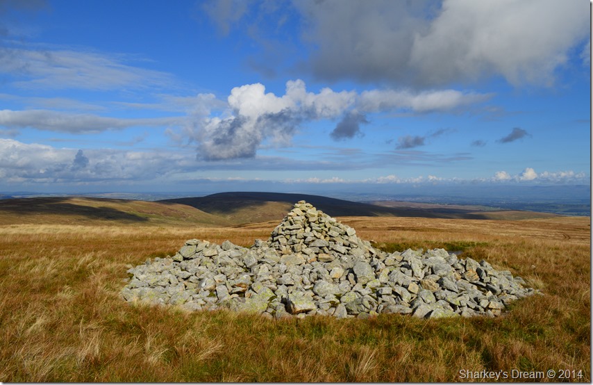
Low Raise |
 |
 |
Overview |
 |
|
| Height: |
2,473 Feet - 754 Metres |
| Grid Ref: |
NY 456 137 |
| Area: |
Far Eastern |
| Group: |
E/HST |
| Ordnance Survey: |
OL5 |
|
| |
|
Map and Photo Gallery |
|
|
|
| |
|
Walks including Low Raise are:- |
|
|
High Street from Burnbanks |
|
|
 |
|
14th May 2022 |
| ASCENT: |
3,461 Feet - 1,055 Metres |
| MILES: |
16 |
| WAINWRIGHTS: |
5, Wether Hill - Rampsgill Head - High Street - Kidsty Pike - High Raise |
| ROUTE: |
Burnbanks - Burn Banks - Four Stones Hill - Low Kop - High Kop - Wether Hill - Red Crag - Raven Howe - High Raise (no summit) - Rampsgill Head - The Knott - Straights of Riggindale - High Street - Straights of Riggindale - Kidsty Pike - High Raise - Low Raise - Long Grain - Measand End - Pultsgill Sike - Measand Beck - Haweswater Shore Path - Burnbanks |
|
| |
|
A Riggindale Round |
|
|
|
|
26th August 2017 |
| ASCENT: |
2,770 Feet - 844 Metres |
| MILES: |
10.6 |
| WAINWRIGHTS: |
5, High Street - The Knott - Rampsgill Head - Kidsty Pike - High Raise (Martindale) |
| ROUTE: |
Mardale Head - The Rigg - Rough Crag - Caspel Gate - Long Stile - High Street - Straights of Riggindale - The Knott - Rampsgill Head - Kidsty Pike - High Raise (Martindale) - Low Raise - Castle Crag (Fort) - Randale Beck - Riggindale Beck - The Rigg - Mardale Head |
|
| |
|
A Riggindale Round |
|
|
|
|
12th October 2014 |
| ASCENT: |
2,960 Feet 902 Meters |
| MILES: |
8.5 |
| WAINWRIGHTS: |
5, High Street – The Knott – Rampsgill Head – Kidsty Pike – High Raise |
| ROUTE: |
Mardale Head – Rough Crag (Riggindale) – Caspel Gate Tarn – Long Stile – High Street – Straights of Riggindale – The Knott – Rampsgill Head – Kidsty Pike – High Raise – Low Raise – Castle Crag (Mardale) – The Rigg – Mardale Head |
|
| |
|
Four Stone Hill to High Raise from Burnbanks |
|
|
|
|
8th May 2014 |
| ASCENT: |
2,800 Feet, 854 Meters |
| MILES: |
11 |
| WAINWRIGHTS: |
2, Wether Hill – High Raise (Martindale) |
| ROUTE: |
Burnbanks – Four Stones Hill – Low Kop – High Kop – Wether Hill – Red Crag – Red Crag Tarn – Raven Howe – High Raise (Martindale) – Low Raise – Long Grain – Measand End – Measand Beck – The Forces (Waterfall) – Haweswater – Burnbanks |
|
| |
|
A Riggindale Round |
|
|
|
|
3rd January 2013 |
| ASCENT: |
2,139 Feet, 663 Metres |
| MILES: |
8 |
| WAINWRIGHTS: |
5, Mardale lll Bell – High Street – Kidsty Pike – Rampsgill Head – High Raise |
| ROUTE: |
Mardale Head – Small Water Beck – Small Water – Nan Bield Pass – Mardale lll Bell – High Street – Straights of Riggindale – Kidsty Pike – Rampsgill Head – High Raise – Low Raise – Birks Crag – Lady’s Seat – Band End – Bowderthwaite Bridge – The Rigg – Mardale Head |
|
| |
| Back to top |
 |
|