 |
Gray Crag |
 |
 |
Overview |
 |
|
| Height: |
2,286 Feet - 699 Metres |
| Grid Ref: |
NY 427 117 |
| Area: |
Far Eastern |
| Group: |
E/HST |
| Ordnance Survey: |
OL5 |
| Wainwright Guidebook: |
Two |
 |
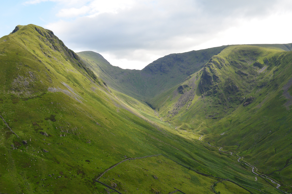
A lofty ridge, bound by exceedingly steep flanks, extends northwards from Thornthwaite Crag with a slight curve to the west, and culminates high above Hayeswater Gill in a level platform from which on both sides, fall precipitous crags split by deep gullies.
This is Gray Crag.

|
|
| |
|
Map and Photo Gallery |
|
|
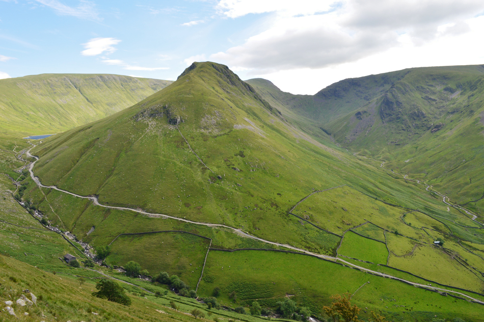 |
| Gray Crag from Brock Crags. |
 |
| The Gray Crag ridge. |
 |
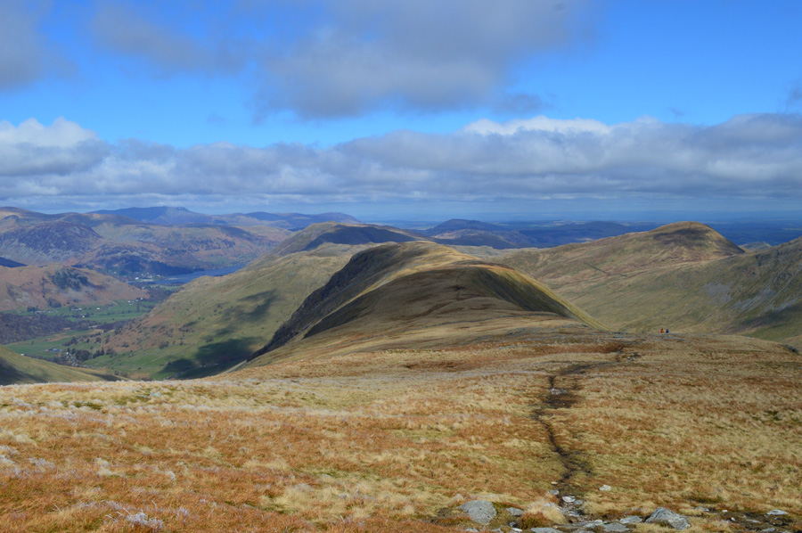
| Looking down on Hayeswater with Rest Dodd and Knott. |
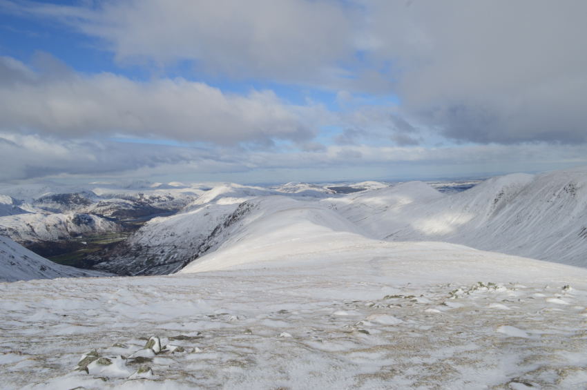 |
| Gray Crag shortly after leaving Thornthwaite Crag |
 |
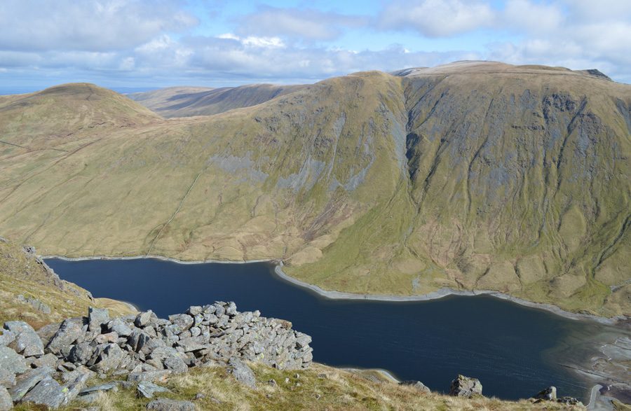
| Views towards Gray Crag, Pasture Bottom, Threshthwaite Mouth, Stoney Cove Pike and Raven Crag. |
|
| |
|
There are 10 walks to choose from including Gray Crag |
|
|
Hayeswater Circuit |
|
|
 |
|
26th October 2024 |
| ASCENT: |
2,738 Feet - 835 Metres |
| MILES: |
8 |
| WAINWRIGHTS: |
6, The Knott, Rampsgill Head - Kidsty Pike - High Street - Thornthwaite Crag - Gray Crag |
| ROUTE: |
Hartsop - Hayeswater Gill - Hayeswater - The Knott - Rampsgill Head - Kidsty Pike - Straights of Riggindale - High Street - Thornthwaite Crag - Gray Crag - Hayeswater Gill - Hartsop |
|
| |
|
Extended Hayeswater Circuit |
|
|
|
|
15th October 2023 |
| ASCENT: |
3,140 Feet - 957 Metres |
| MILES: |
10.5 |
| WAINWRIGHTS: |
8, The Knott - Rampsgill Head - High Raise (Martindale) - Kidsty Pike - High Street - Mardale III Bell - Thornthwaite Crag - Gray Crag |
| ROUTE: |
Hartsop - Hayeswater Gill - Hayeswater - The Knott - Rampsgill Head - High Raise (Martindale) - Kidsty Pike - Straights of Riggindale - High Street - Mardale III Bell - Top of Hall Cove - Thornthwaite Crag - Gray Crag - Hayeswater - Hayeswater Gill - Hartsop |
|
| |
|
Hayeswater Circuit |
|
|
|
|
14th July 2020 |
| ASCENT: |
2,738 Feet - 835 Metres |
| MILES: |
8 |
| WAINWRIGHTS: |
6, The Knott, Rampsgill Head - Kidsty Pike - High Street - Thornthwaite Crag - Gray Crag |
| ROUTE: |
Hartsop - Hayeswater Gill - Hayeswater - The Knott - Rampsgill Head - Kidsty Pike - Straights of Riggindale - High Street - Thornthwaite Crag - Gray Crag - Hayeswater Gill - Hartsop |
|
| |
|
Walking the Birketts, Hartsop Horseshoe |
|
|
|
|
2nd May 2018 |
| ASCENT: |
2,812 Feet - 857 Metres |
| MILES: |
6.2 |
| BIRKETTS: |
3, Hartsop Dodd - Stony Cove Pike - Gray Crag |
| ROUTE: |
Hartsop - Hartsop Dodd - Stony Cove Pike - Threshthwaite Mouth - Thornthwaite Crag - Gray Crag - Path above Hayeswater Gill - Hartsop |
|
| |
|
Walking the Wainwrights in 30 Walks - Walk 10 A Troutbeck Circuit |
|
|
|
|
16th April 2016 |
| ASCENT: |
4,406 Feet - 1,344 Meters |
| MILES: |
15 |
| WAINWRIGHTS: |
9, Sour Howes - Sallows - Yoke - III Bell - Froswick - Thornthwaite Crag - Gray Crag - Troutbeck Tongue - Wansfell |
| ROUTE: |
Troutbeck Bridge - Garburn Pass - Sour Howes - Sallows - Yoke - III Bell - Froswick - Thornthwaite Crag - Gray Crag - Thornthwaite Crag - Scotts Rake - Troutbeck Tounge - Trout Beck - Kirkstone Pass - Iddle Hill - Baystones - Wansfell Pike - Nanny Lane - Troutbeck - Troutbeck Bridge |
|
| |
|
The Harry Griffin 2,000 footers Walk 10 - Around Pasture Beck |
|
|
|
|
7th May 2015 |
| ASCENT: |
3,010 Feet - 918 Metres |
| MILES: |
7.2 |
| SUMMITS OVER 2,000Ft: |
Hartsop Dodd - Caudale Moor (Stony Cove Pike) - Thornthwaite Crag - Gray Crag South Top - Gray Crag North Top - Gray Crag North West Top |
| ROUTE: |
Hartsop - Hartsop Dodd - Mark Atkinson Monument - Caudale Moor (Stony Cove Pike) Threshthwaite Mouth - Thornthwaite Crag - Gray Crag South Top - Gray Crag North Top - Gray Crag North West Top - Hartsop Gill - Hartsop |
|
| |
|
Angletarn Pikes to Gray Crag from Hartsop |
|
|
|
|
31st January 2015 |
| ASCENT: |
2,800 Feet – 853 Meters |
| MILES: |
10.4 |
| WAINWRIGHTS: |
2,800 Feet – 853 Meters |
| ROUTE: |
Hartsop – Dubhow – Boredale Hause – Angletarn Pikes – Angle Tarn – Satura Crag – The Knott – Straights of Riggingdale – High Street – Thornthwaite Crag – Gray Crag – Hartsop |
|
| |
|
Hayeswater & Gray Crag from Hartsop |
|
|
|
|
10th May 2014 |
| ASCENT: |
2,093 Feet, 638 Meters |
| MILES: |
6.3 |
| WAINWRIGHTS: |
2, Thornthwaite Crag – Gray Crag |
| ROUTE: |
Hartsop – Wath Bridge – Hayeswater – Hayeswater Gill – Thornthwaite Crag – Gray Crag – Hartsop |
|
| |
|
The Hayeswater Fells from Hartsop |
|
|
|
|
10th November 2013 |
| ASCENT: |
2,600ft, 793 Meters |
| MILES: |
7.6 |
| WAINWRIGHTS: |
4, The Knott – High Street – Thornthwaite Crag – Gray Crag |
| ROUTE: |
Hartsop – Hayeswater – The Knott – Straights of Riggindale – High Street – Thornthwaite Crag – Gray Crag – Hayeswater – Filter House – Hartsop |
|
| |
|
Hartsop Dodd & Gray Crag |
|
|
|
|
24th April 2010 |
| ASCENT: |
3,012 Ft, 918 Mtrs |
| MILES: |
7 |
| WAINWRIGHTS: |
4 Hartsop Dodd, Caudale Moor (Stony Cove Pike) Thornthwaite Crag & Gray Crag |
| ROUTE: |
|
|
| |
| Back to top |
 |
|
