 |
Caudale Moor (Stony Cove Pike) |
 |
 |
Map and Photo Gallery |
 |
|
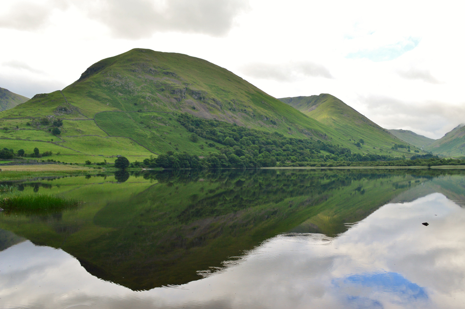 |
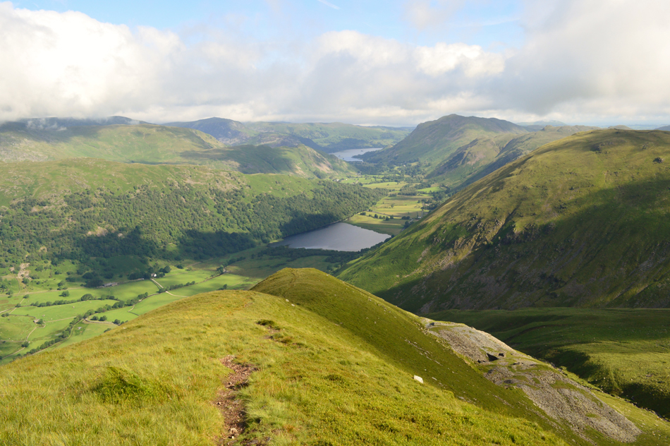
| Views over Brothers Water towards Hartsop Dodd (left) and Caudale Moor (right) |
 |
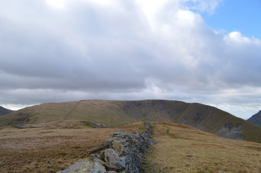
| Caudale Moor summit plateau. |
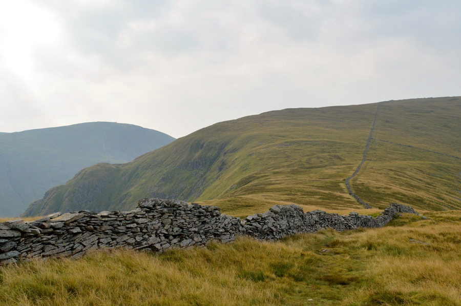 |
| Caudale Moor from the col between Hartsop Dodd. |
 |
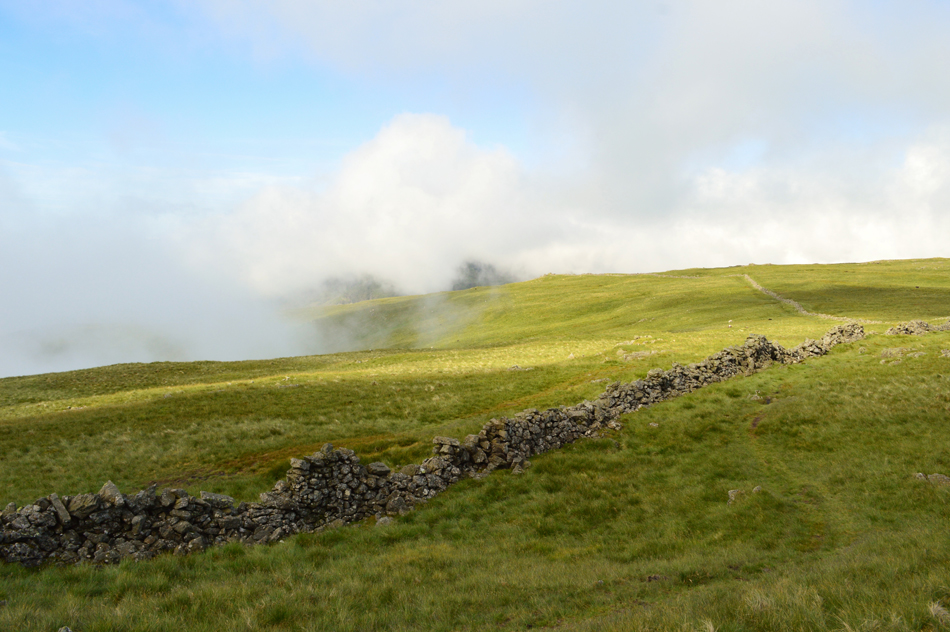
| Caudale Moor and Rough Edge. |
 |
| Brothers Water from Rough Edge. |
 |
| John Bell's Banner Monument, Caudale Moor. |
 |
| Caudale Moor summit cairn. |
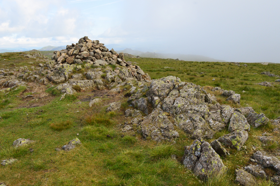 |
| Caudale Moor (Stoney Cove Pike) summit cairn. |
|
| |
|
There are 12 walks to choose from including Caudale Moor |
|
|
Stony Cove Pike via Doup Crag, Troutbeck |
|
|
 |
|
2nd June 2025 |
| ASCENT: |
2,820 Feet - 860 Metres |
| MILES: |
10.1 |
| WAINWRIGHTS: |
Caudale Moor |
| ROUTE: |
Church Bridge, Troutbeck - Limefit Holiday Park - Troutbeck - Long Green Head - Ing Lane - Troutbeck Park Farm - Trout Beck - Low Great Knott - High Great Knott - Sad Gill - Doup Crag - Caudale Moor - Stony Cove Pike - Thresthwaite Mouth - Park Fell Head - Trout Beck - Troutbeck Park Farm - Hagg Bridge - Ing Bridge - Ing Lane - Truss Lane - Permissive Path to Limefit Holiday Park - Church Bridge, Troutbeck |
|
| |
|
Kirkstone Pass to Hartsop via High Street |
|
|
|
|
2nd November 2024 |
| ASCENT: |
2,238 Feet - 682 Metres |
| MILES: |
7.7 |
| WAINWRIGHTS: |
6, Caudale Moor - Thornthwaite Crag - High Street - The Knott |
| ROUTE: |
Top of Kirkstone Pass - St Raven's Edge - Caudale Moor - Stony Cove Pike - Thresthwaite Mouth - Thornthwaite Crag - High Street - Straights of Riggindale - The Knott - Hayeswater Gill - Hartsop - Cow Bridge |
|
| |
|
High Level Circuit of Troutbeck |
|
|
|
|
10th August 2023 |
| ASCENT: |
4,251 Feet - 1,296 Metres |
| MILES: |
14 |
| WAINWRIGHTS: |
5, Yoke - III Bell - Froswick - Thornthwaite Crag - Caudale Moor |
| ROUTE: |
Church Bridge - Garburn Road - Top of Garburn Pass - Yoke - III Bell - Froswick - Thornthwaite Crag - Threshthwaite Mouth - Stony Cove Pike - Caudale Moor - John Bell's Banner - St Raven's Edge - Broad End - Kirkstone Pass - Idle Hill - Baystones - Nanny Lane - Troutbeck - Church Bridge |
|
| |
|
Walking the Birketts, Hartsop Horseshoe |
|
|
|
|
2nd May 2018 |
| ASCENT: |
2,812 Feet - 857 Metres |
| MILES: |
6.2 |
| BIRKETTS: |
3, Hartsop Dodd - Stony Cove Pike - Gray Crag |
| ROUTE: |
Hartsop - Hartsop Dodd - Stony Cove Pike - Threshthwaite Mouth - Thornthwaite Crag - Gray Crag - Path above Hayeswater Gill - Hartsop |
|
| |
|
Caudale Moor to Brock Crags via High Street |
|
|
|
|
1st July 2017 |
| ASCENT: |
4,374 Feet - 1,334 Metres |
| MILES: |
14 |
| WAINWRIGHTS: |
10, Caudale Moor (Stoney Cove Pike) - Thornthwaite Crag - High Street - Kidsty Pike - High Raise (Martindale) - Rampsgill Head - The Knott - Rest Dodd - Angletarn Pikes - Brock Crags |
| ROUTE: |
Cow Bridge - Brothers Water - Hartsop Hall - Sykeside - Kirkstone Pass - Caudale Beck - Caudale Quarry - Caudale Moor (Stoney Cove Pike) - Threshthwaite Mouth - Thornthwaite Crag - High Street - Straights of Riggindale - Kidsty Pike - High Raise (Martindale) - Rampsgill Head - The Knott - Rest Dodd - Satura Crag - Angle Tarn - Angletarn Pikes - Cat Crag - Brock Crags - Hartsop - Cow Bridge |
|
| |
|
Walking the Wainwrights in 30 Walks Walk 28 - A Scandale Skyline from Cow Bridge |
|
|
|
|
18th August 2016 |
| ASCENT: |
4,932 Feet - 1,504 Meters
|
| MILES: |
12.5 |
| WAINWRIGHTS: |
9, Hartsop Dodd - Caudale Moor (Stony Cove Pike) - Red Screes - Middle Dodd - Little Hart Crag - High Hartsop Dodd - Dove Crag - Hart Crag - Hartsop above How |
| ROUTE: |
Hartsop - Hartsop Dodd - Caudale Moor (Stony Cove Pike) - John Bell's Banner - St Raven's Edge - Kirkstone Pass - Red Screes - Smallthwaite Band - Middle Dodd - Top of Caiston Beck - Scandale Pass - Little Hart Crag - High Hartsop Dodd - Black Brow - Bakestones Moss - Dove Crag - Hart Crag - Hartsop above How - Gale Crag - Low Wood - Cow Bridge - Hartsop |
|
| |
|
A Kirkstone Skyline |
|
|
|
|
12th March 2016 |
| ASCENT: |
3,130 Feet, 954 Meters |
| MILES: |
8.3 |
| WAINWRIGHTS: |
4, Hartsop Dodd - Caudale Moor (Stonycove Pike) - Red Screes - Middle Dodd |
| ROUTE: |
Cow Bridge - Hartsop Dodd - Caudale Moor (Stony Cove Pike) - St Raven's Edge - Kirkstone Pass Inn - Red Screes - Smallthwaite Band - Middle Dodd - Hartsop Hall - Brothers Water - Cow Bridge |
|
| |
|
The Harry Griffin 2,000 footers Walk 10 - Around Pasture Beck |
|
|
|
|
7th May 2015 |
| ASCENT: |
3,010 Feet - 918 Metres |
| MILES: |
7.2 |
| SUMMITS OVER 2,000Ft: |
Hartsop Dodd - Caudale Moor (Stony Cove Pike) - Thornthwaite Crag - Gray Crag South Top - Gray Crag North Top - Gray Crag North West Top |
| ROUTE: |
Hartsop - Hartsop Dodd - Mark Atkinson Monument - Caudale Moor (Stony Cove Pike) Threshthwaite Mouth - Thornthwaite Crag - Gray Crag South Top - Gray Crag North Top - Gray Crag North West Top - Hartsop Gill - Hartsop |
|
| |
|
The Kirkstone Pass Fells |
|
|
|
|
2nd March 2014 |
| ASCENT: |
3,130 Feet, 954 Meters |
| MILES: |
8.3 |
| WAINWRIGHTS: |
4, Hartsop Dodd – Caudale Moor (Stony Cove Pike) – Red Screes – Middle Dodd |
| ROUTE: |
Cow Bridge – Hartsop – Hartsop Dodd – Caudale Moor (Stony Cove Pike) – John Bell’s Banner – St Raven’s Edge – Kirkstone Pass – Red Screes – Middle Dodd – Hartsop Hall – Brothers Water – Cow Bridge |
|
| |
|
The Kirkstone Pass Fells |
|
|
|
|
28th April 2012 |
| ASCENT: |
3,215 Feet, 980 Metres |
| MILES: |
8.8 |
| WAINWRIGHTS: |
4, Middle Dodd, Red Screes, Caudale Moor (Stony Cove Pike) & Hartsop Dodd |
| ROUTE: |
Cow Bridge – Brothers Water – Hartsop Hall – Middle Dodd – Smallthwaite Band – Red Screes – Kirkstone Pass – St Ravens Edge – John Bell’s Banner – Caudale Moor (Stony Cove Pike) – Hartsop Dodd – Hartsop – Cow Bridge |
|
| |
|
Dodging The Showers On High Street |
|
|
|
|
7th May 2011 |
| ASCENT: |
3,406 Feet, 1,038 Meters |
| MILES: |
7.7 |
| WAINWRIGHTS: |
4, The Knott, High Street, Caudale Moor, Hartsop Dodd |
| ROUTE: |
Hartsop - Hayewater Gill - The Knott - Straighst of Riggindale - High Street - Thornthwaite Crag - Thresthwaite Mouth - Stony Cove Pike - Caudale Moor - Hartsop Dodd - Hartsop |
|
| |
|
Hartsop Dodd & Gray Crag |
|
|
|
|
24th April 2010 |
| ASCENT: |
3,012 Ft, 918 Mtrs |
| MILES: |
7 |
| WAINWRIGHTS: |
4 Hartsop Dodd, Caudale Moor (Stony Cove Pike) Thornthwaite Crag & Gray Crag |
| ROUTE: |
|
|
| |
| Back to top |
 |
|

