 |
Whiteside (West Top) |
 |
 |
Overview |
 |
|
| Height: |
2,317 Feet - 707 Meters |
| Grid Ref: |
NY 170 219 |
| Area: |
North Western |
| Group: |
NW/GRI |
| Ordnance Survey: |
OL4 |
| Wainwright Guidebook: |
Six |
 |
From the ridge above, or the stream below, the natural architecture of the face cannot be appreciated, and one needs to visit Grasmoor, directly opposite, to observe the repeated pattern of aretes and scree -runs.

|
|
| |
|
Map and Photo Gallery |
|
|
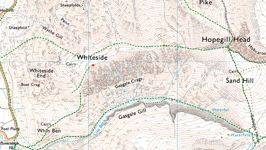 |
| Hopegill Head & Sand Hill (R) from Whiteside summit cairn |
 |
| Whiteside from Hopegill Head. |
 |
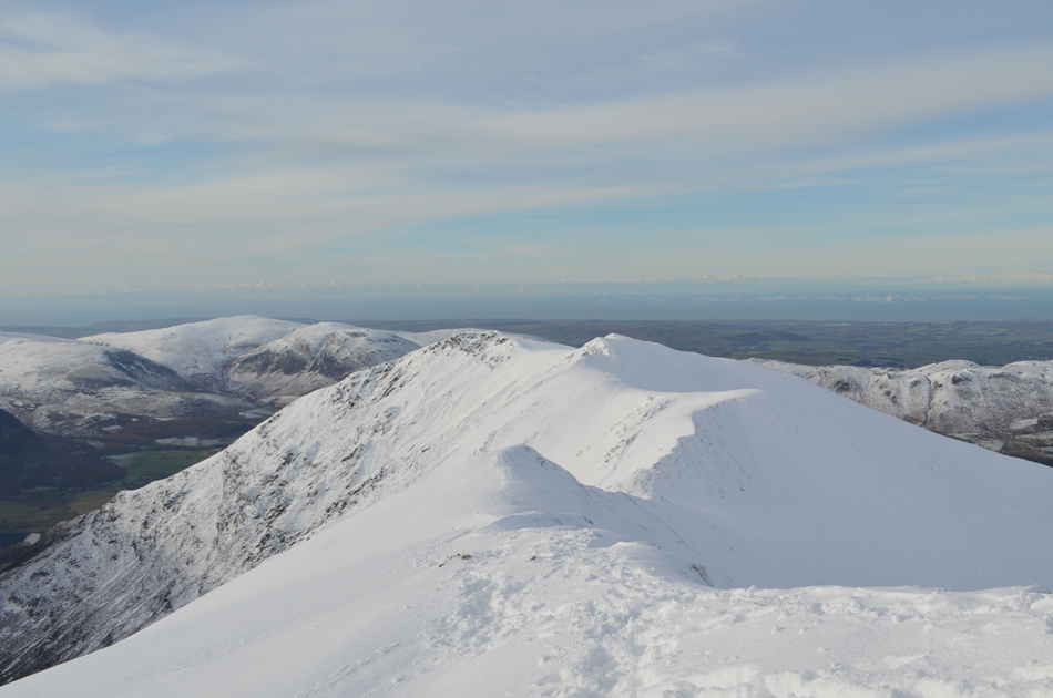
| Hopegill Head from Whiteside summit. |
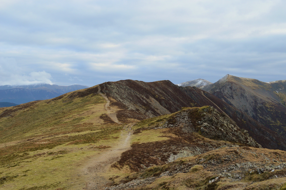 |
| Whiteside Edge from Whiteside. |
|
| |
|
There are 11 walks to choose from including Whiteside |
|
|
Grasmoor & Neighbours |
|
|
 |
|
7th February 2025 |
| ASCENT: |
3,900 Feet - 1,188 Metres |
| MILES: |
9 |
| WAINWRIGHTS: |
7, Whiteside - Hopegill Head - Grasmoor - Eel Crag (Crag Hill) - Wandope - Whiteless Pike - Rannerdale Knotts |
| ROUTE: |
Lanthwaite Green - Liza Beck - Whin Ben - Whiteside - Hopegill Head - Sand Hill - Coledale Hause - Grasmoor - Eel Crag (Crag Hill) - Wandope - Thirdgill Head Man - Whiteless Edge - Whiteless Pike - Low Bank - Rannerdale Knotts - Rannerdale Farm |
|
| |
|
Hope Gill Horseshoe |
|
|
|
|
16th March 2024 |
| ASCENT: |
2,753 Feet - 839 Metres |
| MILES: |
6.5 |
| WAINWRIGHTS: |
2, Hopegill Head - Whiteside |
| ROUTE: |
Hope Beck - Swinside - Ladyside Pike - Hopegill Head - Sand Hill - Hobcarton Head - Hopegill Head - East Top Whiteside - Whiteside - Dodd - Hope Gill - Hope Beck |
|
| |
|
Grasmoor Direct |
|
|
|
|
22nd June 2019 |
| ASCENT: |
3,384 Feet - 1,032 Metres |
| MILES: |
6.4 |
| WAINWRIGHTS: |
4, Grasmoor - Eel Crag (Crag Hill) - Hopegill Head - Whiteside |
| ROUTE: |
Lanthwaite Green - Grasmoor North West Ridge - Grasmoor End - Grasmoor - Eel Crag (Crag Hill) - Eel Crag - Coledale Hause - Sand Hill - Hopegill Head - Whiteside East Top - Gasgale Crags - Whiteside - Whin Benn - Liza Beck - Lanthwaite Green |
|
| |
|
Walking the Birketts, Hope Gill Horseshoe |
|
|
|
|
21st April 2018 |
| ASCENT: |
2,442 Feet - 744 Metres |
| MILES: |
6 |
| BIRKETTS: |
8, Dodd - Whiteside (East Top) - Whiteside (West Top) - Gasgale Crags - Hopegill Head - Sand Hill - Ladyside Pike - Swinside |
| ROUTE: |
Hope Beck - Dodd - Whiteside (East Top) - Whiteside (West Top) Gasgale Crags- Hopegill Head - Sand Hill - Ladyside Pike - Swinside - Hope Beck |
|
| |
|
A bitterly cold day on Whiteside, Hopegill Head and Grasmoor |
|
|
|
|
10th February 2017 |
| ASCENT: |
3,311 Feet - 1,009 Metres |
| MILES: |
7 |
| WAINWRIGHTS: |
3 Whiteside - Hopegill Head - Grasmoor |
| ROUTE: |
Lanthwaite Green - Liza Beck - Whin Benn - Whiteside - Hopegill Head - Sand Hill - Coledale Hause - Grasmoor North East Ridge - Grasmoor - Lad Hows - Cinderdale Common - Lanthwaite Green |
|
| |
|
Walking the Wainwrights in 30 Walks - Walk 29 Rannerdale Knotts to Barrow |
|
|
|
|
27th August 2016 |
| ASCENT: |
5,898 Feet - 1,798 Meters |
| MILES: |
15.9 |
| WAINWRIGHTS: |
13, Rannerdale Knotts - Whiteless Pike - Wandope - Grasmoor - Whiteside - Hopegill Head - Grisedale Pike - Eel Crag (Crag Hill) - Sail - Scar Crags - Causey Pike - Outerside - Barrow |
| ROUTE: |
Rannerdale Farm - Rannerdale Knotts - Whiteless Breast - Whiteless Pike - Whiteless Edge - Wandope - Grasmoor - Coledale Hause - Sand Hill - Whiteside - Hopegill Head - Grisedale Pike - Coledale Hause - Eel Crag (Crag Hill) - Sail - Scar Crags - Causey Pike - High Moss - Outerside - Barrow Door - Barrow - Braithwaite |
|
| |
|
The Harry Griffin 2,000 footers Walk 23 -Around Coledale Hause |
|
|
|
|
15th August 2015 |
| ASCENT: |
5,493 Feet - 1,675 |
| MILES: |
15 |
| SUMMITS OVER 2'000Ft: |
13, Grisedale Pike - Grisedale Pike (NY 139 221) - Hopegill Head - Ladyside Pike - Whiteside - Sand Hill - Grasmoor - Whiteless Pike - Wandope - Eel Crag (Crag Hill) - Sail - Scar Crags - Causey Pike |
| ROUTE: |
Whinlatter Pass – Kin – Sleet How – Grisedale Pike – Hobcarton Crag – Hopegill Head - Ladyside Pike - Whitleside - Traverse below Hopegill Head – Sand Hill – Grasmoor North East Ridge - Grasmoor - Thirdgill Head Man - Whiteless Edge - Whiteless Pike - Whiteless Edge - Wandope – Eel Crag (Crag Hill) – Sail – Scar Crags – Causey Pike – High Moss – Barrow Door – High Coledale – Braithwaite – Whinlatter Pass |
|
| |
|
Ladyside Pike to Grasmoor from Hopebeck |
|
|
|
|
16th November 2014 |
| ASCENT: |
4,288 Feet 1,307 Meters |
| MILES: |
10.6 |
| WAINWRIGHTS: |
4, Hopegill Head – Grisedale Pike – Grasmoor – Whiteside |
| ROUTE: |
Hopebeck – Ladyside Pike North Ridge – Ladyside Pike – Hopegill Head – Grisedale Pike – Coledale Hause – Grasmoor – Coledale Hause – Hopegill Head – Sand Hill – Whiteside – Hopebeck |
|
| |
|
Grisedale Pike, Whiteside & Force Crag Mine |
|
|
|
|
18th November 2012 |
| ASCENT: |
736 Metres 2,414 Feet |
| MILES: |
8.1 |
| WAINWRIGHTS: |
3, Grisedale Pike – Hopegill Head – Whiteside |
| ROUTE: |
Whinlatter – Kinn – Sleet How – Grisedale Pike – Hobcarton Crag – Hopegill Head – Whiteside – Hopegill Head – Sand Hill – Coledale Hause – Force Crag Mine – Coledale Valley – Whinlatter |
|
| |
|
The NW Fells from Lanthwaite Green |
|
|
|
|
20th January 2011 |
| ASCENT: |
1,814 Meters, 5,951 Feet |
| MILES: |
8.9 |
| WAINWRIGHTS: |
5, Whiteside, Hopegill Head, Wandope, Whiteless Pike & Rannerdale Knotts |
| ROUTE: |
|
|
| |
| Back to top |
 |
|
