 |
Grisedale Pike |
 |
 |
Overview |
 |
|
| Height: |
2,593 Feet - 791 Metres |
| Grid Ref: |
NY 199 226 |
| Area: |
North Western |
| Group: |
GRI |
| Ordnance Survey: |
OL4 |
| Wainwright Guidebook: |
Six |
 |
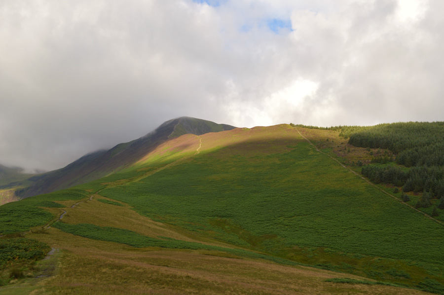
All visitors to Lakeland who come to walk on the hills turn their footsteps in due course to Grisedale Pike. It is seldom a prime objective being a little out of the way but the graceful peak piercing the western sky is a nagger of conscience and cannot be ignored. Nor should it be.
|
|
| |
|
Map and Photo Gallery |
|
|
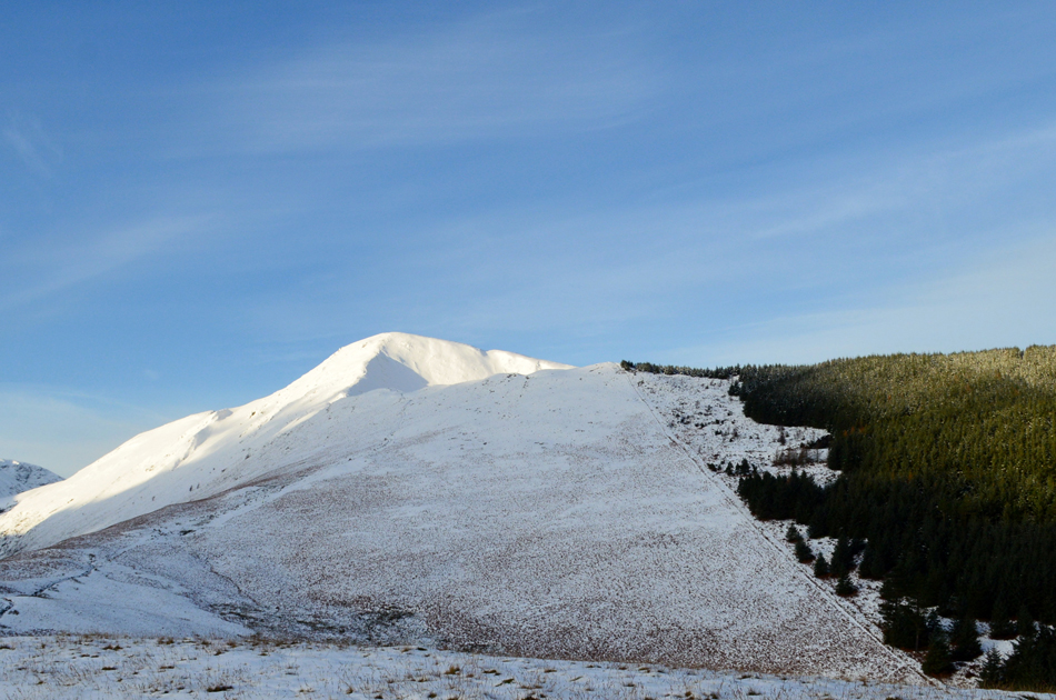 |
| Grisedale Pike from Kinn. |
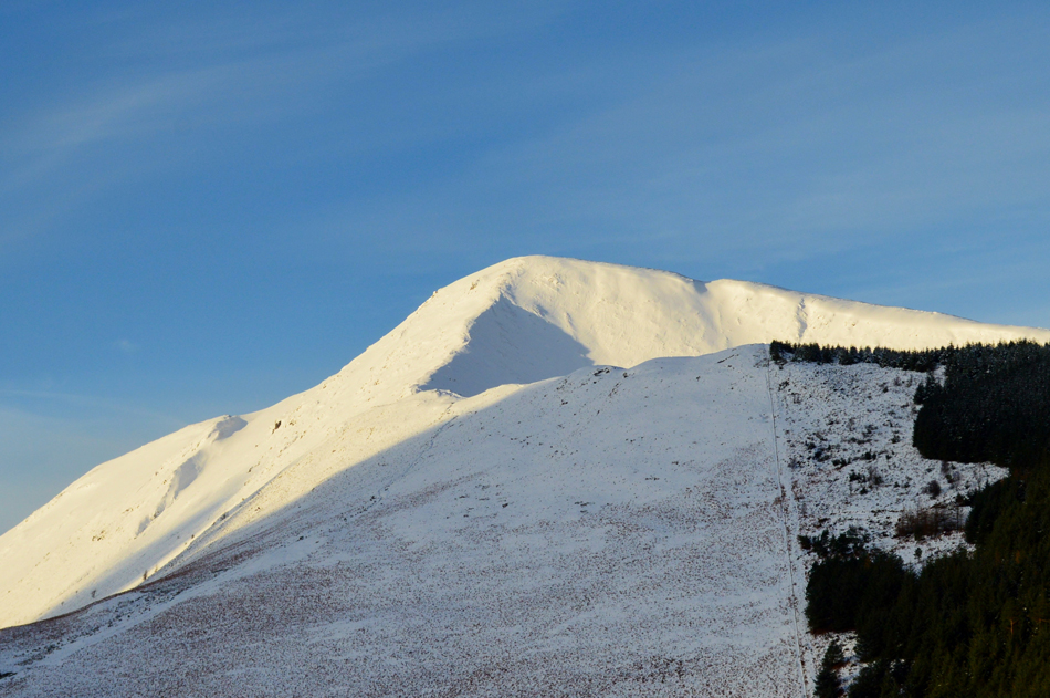 |
| A close up of Sleet How and Grisedale Pike summit. |
 |
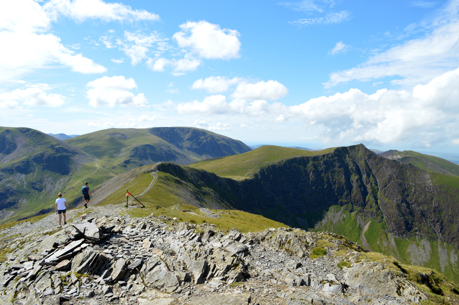
| Hopegill Head from Grisedale Pike summit |
 |
| Eel Crag (Crag Hill) Grasmoor and Hopegill Head from Grisedale Pike summit. |
|
| |
|
There are 15 walks to choose from including Grisedale Pike |
|
|
Around Coledale Hause |
|
|
 |
|
20th December 2025 |
| ASCENT: |
3,663 Feet - 1,116 Metres |
| MILES: |
8.5 |
| WAINWRIGHTS: |
4, Grisedale Pike - Hopegill Head - Eel Crag (Crag Hill) - Sail |
| ROUTE: |
Car Park, Whinlatter Pass - Kinn - Sleet How - Grisedale Pike - Hobcarton Head - Sand Hill - Coledale Hause - Eel Crag - Eel Crag (Crag Hill) - The Scar - Sail - Sail Pass - Coledale Beck - Coledale - Car Park, Whinlatter Pass |
|
| |
|
Extended Hope Gill Horseshoe |
|
|
|
|
16th March 2024 |
| ASCENT: |
3,031 Feet - 923 Metres |
| MILES: |
7.3 |
| WAINWRIGHTS: |
3, Hopegill Head - Grisedale Pike - Whiteside |
| ROUTE: |
Hope Beck - Swinside - Ladyside Pike - Hopegill Head - Sand Hill - Hobcarton Head - Grisedale Pike - Hobcarton Head - Illgill Head - East Top Whiteside - Whiteside - Dodd - Hope Gill - Hope Beck |
|
| |
|
The Coledale Horseshoe |
|
|
|
|
11th August 2022 |
| ASCENT: |
4,538 Feet - 1,384 Metres |
| MILES: |
11 |
| WAINWRIGHTS: |
9, Grisedale Pike - Hopegill Head - Wandope - Eel Crag (Crag Hill) - Sail - Scar Crags - Causey Pike - Outerside - Barrow |
| ROUTE: |
Whinlatter Pass - Kinn - Sleet How - Grisedale Pike - Hobcarton Head - Hopegill Head - Sand Hill - Coledale Hause - Wandope Moss - Wandope - Eel Crag (Crag Hill) - The Scar - Sail - Scar Crags - Causey Pike - High Moss - Outerside - Barrow Door - Barrow - Braithwaite Lodge - Braithwaite - Whinlatter Pass |
|
| |
|
Grisedale Pike via Coledale |
|
|
|
|
29th August 2021 |
| ASCENT: |
2,403 Feet - 733 Meters |
| MILES: |
6.5 |
| WAINWRIGHTS: |
Grisedale Pike |
| ROUTE: |
Whinlatter Pass - Coledale - Force Crag Mine - Coledale Hause - Hobcarton Head - Grisedale Pike - Sleet How - Kin - Whinlatter Pass |
|
| |
|
Walking the Birketts, Grisedale Pike by the North Ridge |
|
|
|
|
2nd August 2019 |
| ASCENT: |
1,705 Feet - 520 Metres |
| MILES: |
4 |
| BIRKETTS: |
2, Grisedale Pike - Hobcarton End |
| ROUTE: |
Comb Bridge - Hobcarton Plantation - Black Crag - Hobcarton End - Grisedale Pike - Sleet How - Hospital Plantation - Revelin Moss - Comb Bridge |
|
| |
|
Walking the Birketts, Grisedale Pike by the East Ridge |
|
|
|
|
28th April 2019 |
| ASCENT: |
2,434 Feet - 742 Metres |
| MILES: |
6.8 |
| BIRKETTS: |
3, Kin - Grisedale Pike - Hobcarton Head |
| ROUTE: |
Whinlatter – Kinn – Sleet How – Grisedale Pike – Hobcarton Head – Coledale Hause – Force Crag Mine – Coledale Valley – Whinlatter |
|
| |
|
A Coledale Skyline |
|
|
|
|
20th November 2016 |
| ASCENT: |
2,700 Feet - 793 Meters |
| MILES: |
7.5 |
| WAINWRIGHTS: |
2, Grisedale Pike - Hopegill Head |
| ROUTE: |
Whinlatter Pass - Kin - Sleet How - Grisdedale Pike - Hobcarton Crag - Hopegill Head - Sand Hill - Coledale Hause - Force Crag Mine - Mine Track Back To Whinlatter Pass |
|
| |
|
Walking the Wainwrights in 30 Walks - Walk 29 Rannerdale Knotts to Barrow |
|
|
|
|
27th August 2016 |
| ASCENT: |
5,898 Feet - 1,798 Meters |
| MILES: |
15.9 |
| WAINWRIGHTS: |
13, Rannerdale Knotts - Whiteless Pike - Wandope - Grasmoor - Whiteside - Hopegill Head - Grisedale Pike - Eel Crag (Crag Hill) - Sail - Scar Crags - Causey Pike - Outerside - Barrow |
| ROUTE: |
Rannerdale Farm - Rannerdale Knotts - Whiteless Breast - Whiteless Pike - Whiteless Edge - Wandope - Grasmoor - Coledale Hause - Sand Hill - Whiteside - Hopegill Head - Grisedale Pike - Coledale Hause - Eel Crag (Crag Hill) - Sail - Scar Crags - Causey Pike - High Moss - Outerside - Barrow Door - Barrow - Braithwaite |
|
| |
|
The Harry Griffin 2,000 footers Walk 23 -Around Coledale Hause |
|
|
|
|
15th August 2015 |
| ASCENT: |
5,493 Feet - 1,675 |
| MILES: |
15 |
| SUMMITS OVER 2'000Ft: |
13, Grisedale Pike - Grisedale Pike (NY 139 221) - Hopegill Head - Ladyside Pike - Whiteside - Sand Hill - Grasmoor - Whiteless Pike - Wandope - Eel Crag (Crag Hill) - Sail - Scar Crags - Causey Pike |
| ROUTE: |
Whinlatter Pass – Kin – Sleet How – Grisedale Pike – Hobcarton Crag – Hopegill Head - Ladyside Pike - Whitleside - Traverse below Hopegill Head – Sand Hill – Grasmoor North East Ridge - Grasmoor - Thirdgill Head Man - Whiteless Edge - Whiteless Pike - Whiteless Edge - Wandope – Eel Crag (Crag Hill) – Sail – Scar Crags – Causey Pike – High Moss – Barrow Door – High Coledale – Braithwaite – Whinlatter Pass |
|
| |
|
Ladyside Pike to Grasmoor from Hopebeck |
|
|
|
|
16th November 2014 |
| ASCENT: |
4,288 Feet 1,307 Meters |
| MILES: |
10.6 |
| WAINWRIGHTS: |
4, Hopegill Head – Grisedale Pike – Grasmoor – Whiteside |
| ROUTE: |
Hopebeck – Ladyside Pike North Ridge – Ladyside Pike – Hopegill Head – Grisedale Pike – Coledale Hause – Grasmoor – Coledale Hause – Hopegill Head – Sand Hill – Whiteside – Hopebeck |
|
| |
|
A Coledale Round |
|
|
|
|
8th June 2014 |
| ASCENT: |
4,200 Feet – 1,280 Meters |
| MILES: |
10.1 |
| WAINWRIGHTS: |
7, Grisedale Pike – Hopegill Head – Wandope – Eel Crag (Crag Hill) – Sail – Sail Pass – Scar Crags – Causey Pike |
| ROUTE: |
Whinlatter Pass – Kin – Sleet How – Grisedale Pike – Hobcarton Crag – Hopegill Head – Sand Hill – Wandope – Eel Crag (Crag Hill) – Sail – Scar Crags – Causey Pike – High Moss – Barrow Door – High Coledale – Braithwaite – Whinlatter Pass |
|
| |
|
Grisedale Pike & Eel Crag via the north ridge |
|
|
|
|
24th November 2013 |
| ASCENT: |
3,622 Feet, 1,104 Meters |
| MILES: |
8.1 |
| WAINWRIGHTS: |
4, Grisedale Pike – Crag Hill (Eel Crag) – Sail – Barrow |
| ROUTE: |
Whinlatter Pass – Kinn – Sleet How – Grisedale Pike – Coledale Hause – Eel Crag North Ridge – Crag Hill (Eel Crag) – The Scar – Sail – Sail Pass – High Moss – Barrow Door – Barrow – Braithwaite Lodge – Braithwaite – Whinlatter Pass |
|
| |
|
Grisedale Pike, Whiteside & Force Crag Mine |
|
|
|
|
18th November 2012 |
| ASCENT: |
736 Metres 2,414 Feet |
| MILES: |
8.1 |
| WAINWRIGHTS: |
3, Grisedale Pike – Hopegill Head – Whiteside |
| ROUTE: |
Whinlatter – Kinn – Sleet How – Grisedale Pike – Hobcarton Crag – Hopegill Head – Whiteside – Hopegill Head – Sand Hill – Coledale Hause – Force Crag Mine – Coledale Valley – Whinlatter |
|
| |
|
The Coledale Horseshoe |
|
|
|
|
6th November 2011 |
| ASCENT: |
4,200 Feet, 1,280 Meters |
| MILES: |
11.5 |
| WAINWRIGHTS: |
8, Grisedale Pike, Hopegill Head, Grasmore, Wandope, Eel Crag (Crag Hill) Sail, Scar Crags, Causey Pike |
| ROUTE: |
Braithwaite, Kin, Sleet How, Grisedale Pike, Hopegill Head, Coledale Hause, Grasmore, Wandope, Eel Cragl (Crag Hill), Sail, Scar Crags, Causey Pike, Rowling End, Uzzicar, Braithwaite |
|
| |
|
The Coledale Horseshoe |
|
|
|
|
17th July 2010 |
| ASCENT: |
1,449 Mtrs 4,100 Ft |
| MILES: |
10.25 |
| WAINWRIGHTS: |
7 Grisdale Pike, Hopegill Head, Crag Hill (Eel Crag) Sail, Scar Crags, Outerside, Barrow |
| ROUTE: |
|
|
| |
| Back to top |
 |
|
