 |
Selside Pike |
 |
 |
Overview |
 |
|
| Height: |
2,142 Feet - 655 Metres |
| Grid Ref: |
NY 490 111 |
| Area: |
Far Eastern |
| Group: |
E/BRA |
| Ordnance Survey: |
OL5 |
| Wainwright Guidebook: |
Two |
 |
One of the lesser-known fells is Selside Pike on the eastern fringe of the district, commanding the head of the shy and beautiful little valley of Swindale. Its neglect is scarcely merited, for although the summit is a dull grass mound with little reward in the views the fell has am extremely rugged eastern face that closes the valley in dramatic fashion: here are dark crags, rarely visited waterfalls, a curious dry tarn-bed set amongst moraines and, above it, a perfect hanging valley, the two being connected by a formidable gulley.
Swindale is almost the only remaining Lakeland valley that does not cater for the motorist. Please, Manchester, leave it nearly as you found it!

|
|
| |
|
Map and Photo Gallery |
|
|
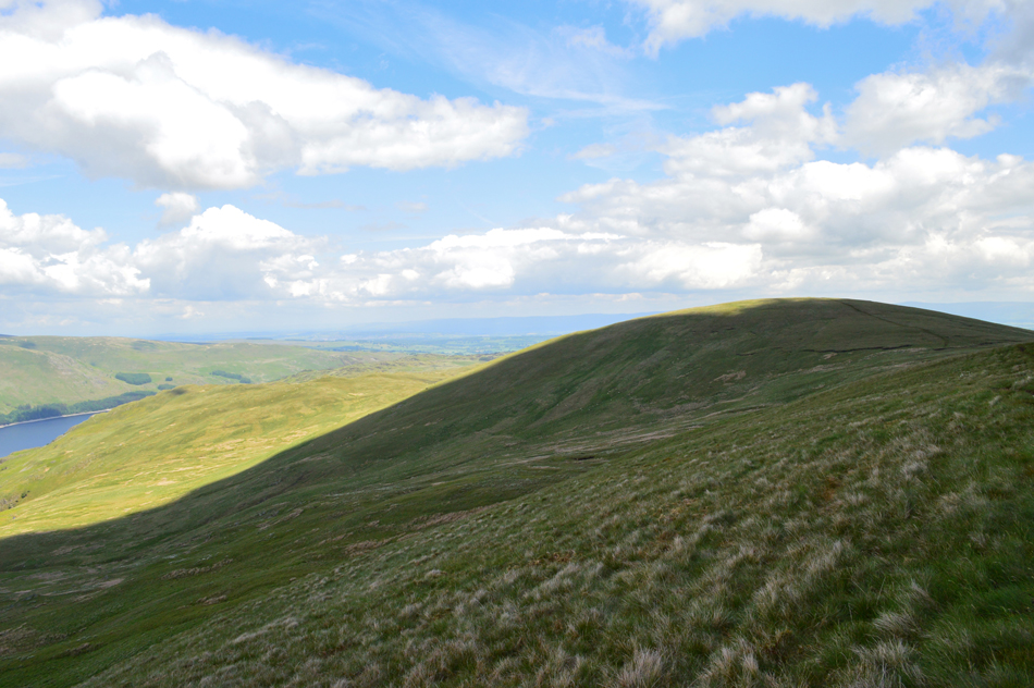 |
| Selside Pike ahead. |
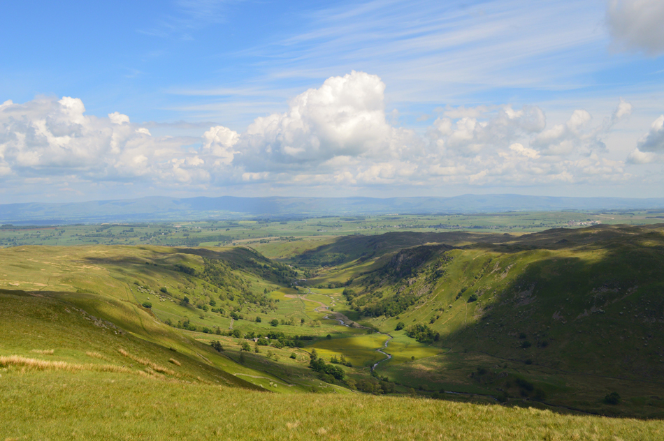 |
| The Swindale Valley from Selside Pike summit. |
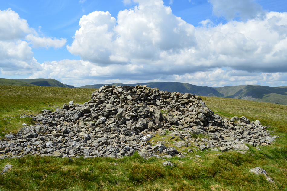 |
| Selside summit shelter. |
|
| |
|
There are 17 walks to choose from including Selside Pike |
|
|
Swindale, Mosedale, Branstree & Hare Shaw from Naddle Bridge |
|
|
 |
|
16th May 2026 |
| ASCENT: |
2,400 Feet - 731 Metres |
| MILES: |
13.6 |
| WAINWRIGHTS: |
2, Branstree - Selside Pike |
| ROUTE: |
Naddle Bridge - Old Concrete Road - Rosgill Moor - Swindale Foot - Swindale Lane - Swindale Head - Mosedale - Mosedale Cottage - Selside Brow - Branstree - Artle Crag - High Howes - Selside Pike - Selside End - Hare Shaw - Chimney - Harper Hills - Naddle Farm - Naddle Bridge |
|
| |
|
Selside Pike, Branstree & Harter Fell from Mardale Head |
|
|
|
|
25th October 2025 |
| ASCENT: |
2,630 Feet - 801 Metres |
| MILES: |
8.5 |
| WAINWRIGHTS: |
3, Selside Pike - Branstree - Harter Fell (Mardale) |
| ROUTE: |
Mardale Head - Old Corpse Road - Selside End - Selside Pike - Captain Welter Bog - High Howes - Artle Crag - Branstree - Top of Gatescarth Pass - Adam Seat - Harter Fell (Mardale) - Top of Nan Bield Pass - Small Water - Small Water Beck - Mardale Head |
|
| |
|
A High Level Circuit of Mardale Head |
|
|
|
|
20th April 2025 |
| ASCENT: |
3,600 Feet - 1,098 Metres |
| MILES: |
11 |
| WAINWRIGHTS: |
5, High Street - Mardale III Bell - Harter Fell (Mardale) - Branstree - Selside Pike |
| ROUTE: |
Mardale Head - Rough Crag - High Street - Mardale III Bell - Top of Nan Bield Pass - Harter Fell (Mardale) - Top of Gatescarth Pass - Branstree - Artle Crag - Selside Pike - Selside End - Old Corpse Road - Rowantreethwaite Beck - Mardale Head |
|
| |
|
Branstree, Selside Pike & The Old Corpse Road |
|
|
|
|
6th August 2024 |
| ASCENT: |
1,900 Feet - 579 Metres |
| MILES: |
6 |
| WAINWRIGHTS: |
2, Branstree - Selside Pike |
| ROUTE: |
Mardale Head - Gatescarth Pass - Branstree - Artle Crag - High Howes - Captain Whelter Bog - Selside Pike - Selside End - Old Corpse Road - Mardale Head |
|
| |
|
The Old Corpse Road, Selside Pike & Branstree |
p |
|
|
|
31st July 2022 |
| ASCENT: |
1,725 Feet - 526 Metres |
| MILES: |
6.3 |
| WAINWRIGHTS: |
2, Selside Pike - Branstree |
| ROUTE: |
Mardale - Old Corpse Road - Selside End - Selside Pike - Captain Welter Bog - High Howes - Artle Crag - Branstree - Branstree North Ridge - Rowantreethwaite Beck - Mardale |
|
| |
|
Branstree, Selside Pike and the Old Corpse Road |
|
|
|
|
2nd January 2022 |
| ASCENT: |
1,725 Feet - 526 Metres |
| MILES: |
6.3 |
| WAINWRIGHTS: |
2, Branstree - Selside Pike |
| ROUTE: |
Mardale - Rowantreethwaite Beck - Branstree North Ridge - Branstree - Artle Crag - Survey Pillar - High Howes - Captain Whelter Bog - Selside Pike - Selside End - Old Corpse Road - Rowantreethwaite Beck - Mardale |
|
| |
|
Branstree, Selside Pike and the Old Corpse Road |
|
|
|
|
24th June 2020 |
| ASCENT: |
1,725 Feet - 526 Metres |
| MILES: |
6.3 |
| WAINWRIGHTS: |
2, Branstree - Selside Pike |
| ROUTE: |
Mardale - Rowantreethwaite Beck - Branstree North Ridge - Branstree - Artle Crag - Survey Pillar - High Howes - Captain Whelter Bog - Selside Pike - Selside End - Old Corpse Road - Rowantreethwaite Beck - Mardale |
|
| |
|
Branstree, Selside Pike and the Old Corpse Road |
|
|
|
|
11th January 2020 |
| ASCENT: |
1,725 Feet - 526 Metres |
| MILES: |
6.3 |
| WAINWRIGHTS: |
2, Branstree - Selside Pike |
| ROUTE: |
Mardale - Rowantreethwaite Beck - Branstree North Ridge - Branstree - Artle Crag - Survey Pillar - High Howes - Captain Whelter Bog - Selside Pike - Selside End - Old Corpse Road - Rowantreethwaite Beck - Mardale |
|
| |
|
Walking the Birketts, Branstree |
|
|
|
|
11th June 2018 |
| ASCENT: |
1,750 Feet - 533 Metres |
| MILES: |
5 |
| BIRKETTS: |
4, Branstree - High Howes - Selside Pike - Brown Howe |
| ROUTE: |
Mardale - Rowantreethwaite Beck - Branstree North Ridge - Branstree - Artle Crag - Survey Pillar - High Howes - Captain Whelter Bog - Selside Pike - Selside End - Old Corpse Road - Brown Howe - Rowantreethwaite Beck - Mardale |
|
| |
|
A High Level Circuit of Mardale Head |
|
|
|
|
3rd June 2017 |
| ASCENT: |
3,300 Feet - 1,006 Metres |
| MILES: |
11 |
| WAINWRIGHTS: |
5, High Street - Mardale III Bell - Harter Fell (Mardale) - Branstree - Selside Pike |
| ROUTE: |
Mardale Head - Rough Crag - High Street - Mardale III Bell - Top of Nan Bield Pass - Harter Fell (Mardale) - Adam Seat - Top of Gatescarth Pass - Branstree - Artle Crag - Selside Pike - Selside End - Old Corpse Road - Rowantreethwaite Beck - Mardale Head |
|
| |
|
Walking the Wainwrights in 30 Walks - Walk 19 - An extended Longsleddale Circuit |
|
|
|
|
26th June 2016 |
| ASCENT: |
4,495 Feet - 1,371 Meters
|
| MILES: |
14.5 |
| WAINWRIGHTS: |
8, Shipman Knotts - Kentmere Pike - Harter Fell (Mardale) - Mardale III Bell - Branstree - Selside Pike - Grey Crag - Tarn Crag (Longsleddale) |
| ROUTE: |
Sadgill - Longsleddale Pass - Shipman Knotts - Kentmere Pike - Harter Fell (Mardale) - Top of Nan Bield Pass - Mardale III Bell - Top of Nan Bield Pass - Harter Fell - Top of Gatescarth Pass - Branstree - Artle Crag - Selside Pike - Selside Brow - Brownhowe Bottom - Tarn Crag (Longsleddale) - Grey Crag - Great Howe - Sadgill |
|
| |
|
Four remote far eastern fells from Swindale |
|
|
|
|
26th September 2015 |
| ASCENT: |
3,094 Feet - 941 Meters |
| MILES: |
13.7 |
| WAINWRIGHTS: |
4, Selside Pike - Branstree - Grey Crag - Tarn Crag (Longsleddle) |
| ROUTE: |
Swindale Lane - Old Corpse Road - Selside End - Selside Pike - Captain Whelter Bog - Howes - Branstree Tarn - Artle Crag - Branstree - Selside Brow - Brownhowe Bottom - Tarn Crag (Longsleddale) - Greycrag Tarn - Grey Crag - Harrop Pike - Brunt Tongue - Mosedale Beck - Swindale Head - Swindale Lane |
|
| |
|
The Harry Griffin 2,000 footers Walk 2 -The Fringe of Lakeland |
|
|
|
|
8th March 2015 |
| ASCENT: |
3,289 Feet - 1,003 Meters |
| MILES: |
9.6 |
| SUMMITS OVER 2,000 Ft |
Grey Crag (Longsleddale) - Tarn Crag - Branstree - Selside Pike - Adam Seat |
| ROUTE: |
Sadgill - Great Howe - Grey Crag (Longsleddale) - Greycrag Tarn - Tarn Crag - Selside Brow - Branstree - Artle Crag - Selside Pike - Branstree - Gatescarth Pass - Adam Seat - Gatescarth Pass - Sadgill |
|
| |
|
Selside Pike & The Naddle Forest from Swindale |
|
|
|
|
20th July 2014 |
| ASCENT: |
2,080 Feet – 634 Meters |
| MILES: |
10.8 |
| WAINWRIGHTS: |
1, Selside Pike |
| ROUTE: |
Rosgill Moor – Scalebarrow Tarn – Scalebarrow Knott – Harper Hills – Powley’s Hill – Hare Shaw – Old Corpse Road – Selside End – Selside Pike – Rowantreethwaite Cairn – Aaron’s Bield –High Naddle Forest – Wallow Crag – Hugh’s Laithes Pike – Naddle Beck – Naddle Farm – Scalebarrow Knott – Rosgill Moor |
|
| |
|
Tarn Crag from Swindale |
|
|
|
|
2nd March 2013 |
| ASCENT: |
2,000 Feet 609 Metres |
| MILES: |
10.5 |
| WAINWRIGHTS: |
4, Selside Pike – Branstree – Tarn Crag (Longsleddale) – Grey Crag |
| ROUTE: |
Truss Gap – Old Corpse Road – Selside End – Selside Pike – Artle Crag – Branstree – Selside Brow – Tarn Crag (Longsleddale) – Greycrag Tarn – Grey Crag – Harrop Pike – Mosedale Beck – Nabs Moor – Swindale Head – Truss Gap |
|
| |
|
The Remote Far Eastern Fells |
|
|
|
|
29th April 2011 |
| ASCENT: |
1,971 Feet, 601 Meters |
| MILES: |
9.7 |
| WAINWRIGHTS: |
4, Grey Crag (Longsleddale), Tarn Crag (Longsleddale), Branstree & Selside Pike |
| ROUTE: |
|
|
| |
| Back to top |
 |
|
