|
Bannerdale Crags |
 |
 |
Map and Photo Gallery |
 |
|
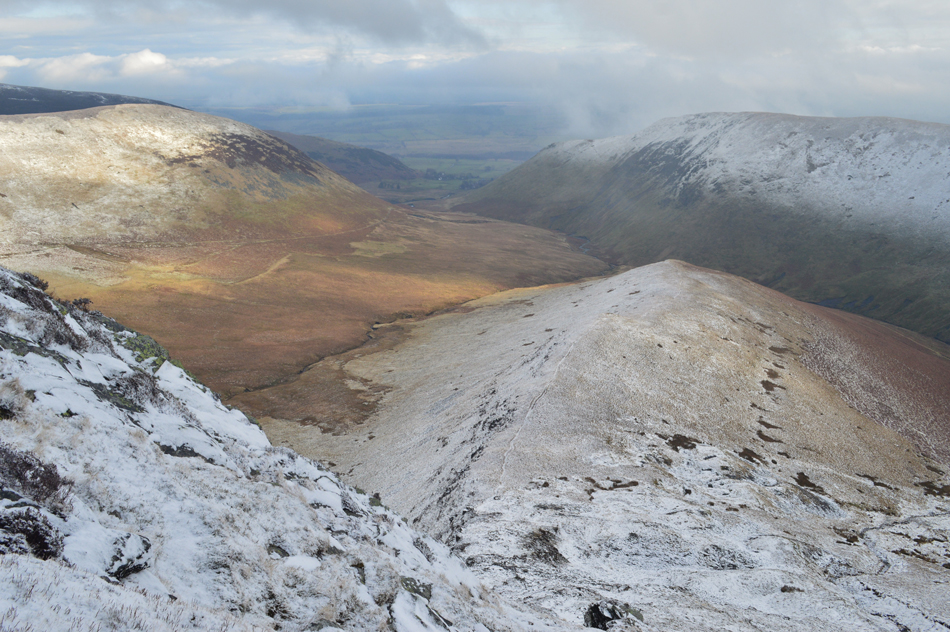 |
| Bannerdale Crags east ridge. |
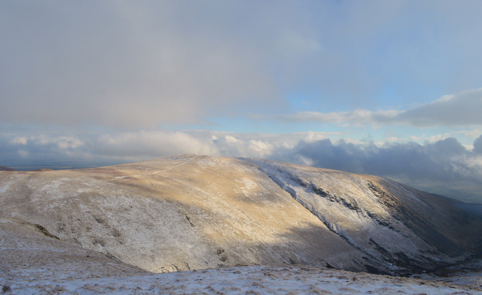 |
| Bannerdale Crags, |
 |
| Bannerdale Crags and Bannerdale Crags east ridge. |
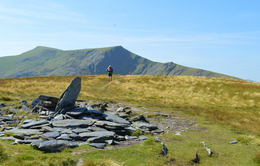 |
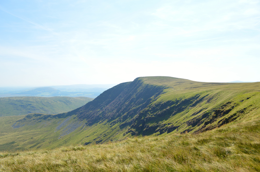
| Blencathra from Bannerdale Crags secondry summit cairn. |
|
| |
|
There are 15 walks to choose from including Bannerdale Crags |
|
|
Blencathra from Mungrisdale |
|
|
 |
|
8th August 2025 |
| ASCENT: |
2,850 Feet - 869 Metres
|
| MILES: |
8 |
| WAINWRIGHTS: |
Bannerdale Crags - Blencathra - Souther Fell
|
| ROUTE: |
Mungrisdale - River Glenderamackin - Bannerdale Crags East Ridge - Bannerdale Crags - Atkinson Pike - Blencathra - Scales Fell - Top of Mousethwaite Comb - Souther Fell - Low Beckside - Mungrisdale
|
|
| |
|
Blencathra from Mungrisdale |
|
|
|
|
9th July 2023 |
| ASCENT: |
2,904 Feet - 885 Metres |
| MILES: |
8.7 |
| WAINWRIGHTS: |
4. Bowscale Fell - Bannerdale Crags - Blencathra - Souther Fell |
| ROUTE: |
Mungrisdale - River Glenderamackin - Bannerdale - Bowscale Fell - Bannerdale Crags - Atkinson Pike - Blencathra - Doddick Fell Top - Scales Fell - Top of Mousthwaite Comb - Souther Fell - Low Beckside - Mungrisdale |
|
| |
|
Bannerdale Crags East Ridge from Mungrisdale |
|
|
|
|
10th September 2022 |
| ASCENT: |
1,900 Feet - 579 Metres |
| MILES: |
6 |
| WAINWRIGHTS: |
2, Bannerdale Crags - Bowscale Fell |
| ROUTE: |
Mungrisdale - River Glenderamackin - Bannerdale Crags East Ridge - Bannerdale Crags - Bowscale Fell - Bowscale Fell East Top - Raven Crags - Mungrisdale |
|
| |
|
Blencathra from Mungrisdale |
|
|
|
|
1st January 2020 |
| ASCENT: |
2,850 Feet - 869 Metres
|
| MILES: |
8 |
| WAINWRIGHTS: |
Bannerdale Crags - Blencathra - Souther Fell
|
| ROUTE: |
Mungrisdale - River Glenderamackin - Bannerdale Crags East Ridge - Bannerdale Crags - Atkinson Pike - Blencathra - Scales Fell - Top of Mousethwaite Comb - Souther Fell - Low Beckside - Mungrisdale
|
|
| |
|
Blencathra from Mungrisdale |
|
|
|
|
29th November 2018 |
| ASCENT: |
2,850 Feet - 869 Metres |
| MILES: |
8 |
| WAINWRIGHTS: |
Bannerdale Crags - Blencathra - Souther Fell |
| ROUTE: |
Mungrisdale - River Glenderamackin - Bannerdale Crags East Ridge - Bannerdale Crags - Atkinson Pike - Blencathra - Scales Fell - Top of Mousethwaite Comb - Souther Fell - Low Beckside - Mungrisdale |
|
| |
|
Walking the Birketts, Bannerdale Horseshoe |
|
|
|
|
18th August 2018 |
| ASCENT: |
2,201 Feet - 671 Metres |
| MILES: |
7 |
| BIRKETTS: |
4, Bowscale Fell East Top - Bowscale Fell - Bannerdale Crags - Souther Fell |
| ROUTE: |
Mungrisdale - Bowscale Fell East Top - Bowscale Fell - Top of Bannerdale Crags - Bannerdale Crags - White Horse Bent - River Glenderamackin - Mousthwaite Comb - Souther Fell South Top - Souther Fell Mungrisdale |
|
| |
|
Blencathra from Mungrisdale |
|
|
|
|
5th February 2017 |
| ASCENT: |
2,850 Feet - 869 Metres |
| MILES: |
8 |
| WAINWRIGHTS: |
Bannerdale Crags - Blencathra - Souther Fell |
| ROUTE: |
Mungrisdale - River Glenderamackin - Bannerdale Crags East Ridge - Bannerdale Crags - Atkinson Pike - Blencathra - Scales Fell - Top of Mousethwaite Comb - Souther Fell - Low Beckside - Mungrisdale |
|
| |
|
Walking the Wainwrights in 30 Walks Walk 27 - The Back O'Blencathra |
|
|
|
|
16th August 2016 |
| ASCENT: |
4,805 Feet - 1,465 Meters
|
| MILES: |
16.5 |
| WAINWRIGHTS: |
7, Carrock Fell - High Pike (Caldbeck) - Bowscale Fell - Bannerdale Crags - Mungrisdale Common - Blencathra - Souther Fell |
| ROUTE: |
Mungrisdale - Mosedale - Further Gill Syke - Carrock Fell - Miton Hill - High Pike (Caldbeck) - Cumbrian Way - Grainsgill Beck - River Caldew - Bowscale Fell north ridge - Bowscale Fell - Bannerdale Crags - Glederamackin Col - Mungrisdale Common - Blencathra - Scales Fell - Top of Mousthwaite Comb - Souther Fell - Mosedale |
|
| |
|
The Harry Griffin 2,000 footers Walk 26 -Blencathra and Neighbours |
|
|
|
|
5th September 2015 |
| ASCENT: |
4,600 Feet - 1,403 Meters |
| MILES: |
13.6 |
| SUMMITS OVER 2'000Ft: |
6, Blencathra (Halls Fell Top) - Knowe Crags - Bowscale Fell (NY 333 305) - Bowscale Fell (NY 340 310) - Bannerdale Crags (NY 329 296) - Bannerdale Crags (NY 336 290) |
| ROUTE: |
Threlkeld - near Gategill Farm - Hall's Fell - Hall's Fell Ridge - Blencathra - Scales Fell - Scales Tarn - Blencathra - Knowe Crags - Blencathra summit Tarn - Atkinson Pike - Glenderamackin Col - Bowscale Fell - Bannerdale Crags - River Glenderamackin - top of Mousthwaite Combe - Scaley Beck - Diddick Gill - Gategill Farm - Threlkeld |
|
| |
|
Bowscale Fell to Souther Fell from Mungrisdale |
|
|
|
|
4th October 2014 |
| ASCENT: |
2,200 Feet – 671 Meters |
| MILES: |
7.3 |
| WAINWRIGHTS: |
3, Bowscale Fell – Bannerdale Crags – Souther Fell |
| ROUTE: |
Mungrisdale – Bowscale Fell East Ridge – Bowscale Fell – Bannerdale Crags – White Horse Bent – River Glenderamackin – Top of Mousthwaite Comb – Souther Fell – Mungrisdale |
|
| |
|
Bannerdale Crags east ridge & the Halls Fell ridge |
|
|
|
|
21st April 2014 |
| ASCENT: |
2,700 Feet – 823 Meters |
| MILES: |
7.2 |
| WAINWRIGHTS: |
2, Bannerdale Crags – Blencathra |
| ROUTE: |
Scales – Mousthwaite Combe – River Glederamackin – White Horse Bent – Bannerdale Crags East Ridge – Bannerdale Crags – Atkinson Pike – Blencathra (Halls Fell Top) – Hall’s Fell Ridge – Path Above Doddick Back To Scales – Scales |
|
| |
|
The Mungrisdale Fells |
|
|
|
|
19th October 2013 |
| ASCENT: |
1,942 Feet, 592 Meters |
| MILES: |
9.3 |
| WAINWRIGHTS: |
3, Souther Fell – Bannerdale Crags – Bowscale Fell |
| ROUTE: |
Mungrisdale – Low Beckside – Souther Fell – Mousthwaite Comb – River Glenderamackin – White Horse Bent – Bannerdale Crags – Bowscale Fell – Tarn Crags – Bowscale Tarn – Bowscale (Hamlet) – Mungrisdale |
|
| |
|
The Old Crown Round |
|
|
|
|
27th April 2013 |
| ASCENT: |
7,204 Feet 2,195 Metres |
| MILES: |
25.2 |
| WAINWRIGHTS: |
9, Carrock Fell – Bowscale Fell – Bannerdale Crags – Blencathra – Mungrisdale Common – Skiddaw – Great Calva – Knott – High Pike |
| ROUTE: |
Hesket Newmarket – Carrock Beck Ford – Carrock Fell – Mosedale – Bowscale Fell – Bannerdale Crags – Foul Crags – Blencathra – Mungrisdale Common – The Stake – Skiddaw House – Sale How – Skiddaw – Blake Hill – Hare Crag – Dash Beck – Great Calva – Top of Hause Gill – Knott – Great Lingy Hill – Iron Crag – High Pike – Low Pike – How Beck – Wood Hall – Hesket Newmarket |
|
| |
|
Souther Fell & the Bannerdale East Ridge |
|
|
|
|
8th September 2012 |
| ASCENT: |
2,360Ft, 719 Metres |
| MILES: |
8.4 |
| WAINWRIGHTS: |
3, Souther Fell, Bannerdale Crags & Bowscale Fell |
| ROUTE: |
Inn – Souther Fell – River Glenderamackin – Bannerdale Crags East Ridge – Bannerdale Crags – Bowscale Fell – Tarn Crags – Bowscale Tarn – Bowscale Township – Mungrisdale Village – Mill Inn |
|
| |
|
The Bannerdale Round |
|
|
|
|
31st October 2010 |
| ASCENT: |
2,560Ft, 780 Mtrs |
| MILES: |
8.7 |
| WAINWRIGHTS: |
3 Souther Fell, Bannerdale Crags & Bowscale Fell |
| ROUTE: |
|
|
| |
| Back to top |
 |
|