|
The Greenburn Horseshoe |
 |
|
 |
|
2nd June 2026 |
| ASCENT: |
2,277 Feet - 694 Metres |
| MILES: |
8.1 |
| WAINWRIGHTS: |
4, Helm Crag - Gibson Knott - Calf Crag - Steel Fell (Dead Pike) |
| ROUTE: |
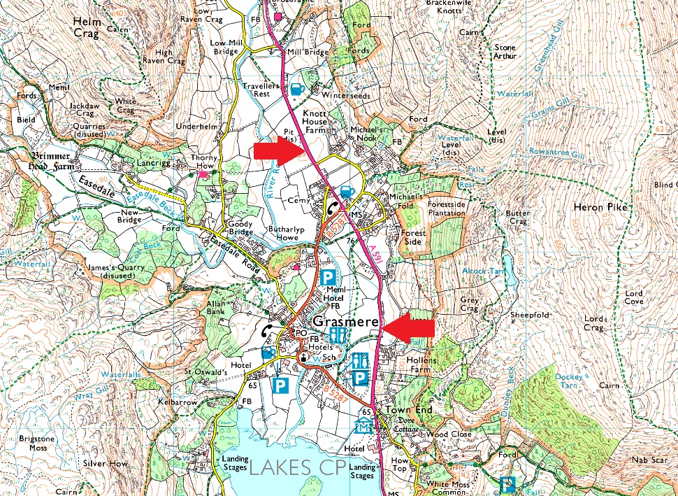
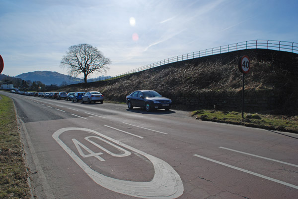
A591 - Grasmere - Easdale Road - Lancrigg - White Crag - Helm Crag - Bracken Hause - Gibson Knott - Pike of Carrs - Calf Crag - Steel Fell Tarn - Steel Fell - Cotra Breast - Ghyll Foot - Underhelm - A591 |
|
| |
|
Silver How & Loughrigg Fell from Grasmere |
|
|
|
|
4th April 2026 |
| ASCENT: |
2,340 Feet - 713 Metres |
| MILES: |
10.1 |
| WAINWRIGHTS: |
2, Silver How - Loughrigg Fell |
| ROUTE: |
Lay-by A591 - Stock Lane - Red Bank Road - Kelbarrow - Silver How - Spedding Crag - Dow Bank - Traverse Path Below Huntingstile Crag - High Close YHA - Footpath by Intake Wood - Loughrigg Fell - Black Mire - Loughrigg Brow - Miller Bridge - River Rothay - Pelter Bridge - Coat How - Rydal Water - White Moss Common Woods - Footbridge over River Rothay - Penny Rock Woods - Grasmere Lake Weir - Daffodil Hotel - Lay-by A591 |
|
| |
|
Fairfield from Grasmere |
|
|
|
|
21st September 2025 |
| ASCENT: |
2,694 Feet - 821 Metres |
| MILES: |
6.2 |
| WAINWRIGHTS: |
3, Stone Arthur - Great Rigg - Fairfield |
| AVERAGE PACE: |
A591 - Greenhead Gill - Stone Arthur - Great Rigg - Fairfield - Grisedale Hause - Hause Gap - Hause Moss - Tongue Gill - A591 |
|
| |
|
Fairfield from Grasmere |
|
|
|
|
28th September 2024 |
| ASCENT: |
2,694 Feet - 821 Metres |
| MILES: |
6.2 |
| WAINWRIGHTS: |
3, Stone Arthur - Great Rigg - Fairfield |
| AVERAGE PACE: |
A591 - Greenhead Gill - Stone Arthur - Great Rigg - Fairfield - Grisedale Hause - Hause Gap - Hause Moss - Tongue Gill - A591 |
|
| |
|
Boxing Day on Fairfield |
|
|
|
|
26th December 2023 |
| ASCENT: |
2,694 Feet - 821 Metres |
| MILES: |
6.2 |
| WAINWRIGHTS: |
3, Stone Arthur - Great Rigg - Fairfield |
| AVERAGE PACE: |
A591 - Greenhead Gill - Stone Arthur - Great Rigg - Fairfield - Grisedale Hause - Hause Gap - Hause Moss - Tongue Gill - A591 |
|
| |
|
Greenburn Horseshoe |
|
|
|
|
7th November 2023 |
| ASCENT: |
2,277 Feet - 694 Metres |
| MILES: |
8.1 |
| WAINWRIGHTS: |
4, Helm Crag - Gibson Knott - Calf Crag - Steel Fell (Dead Pike) |
| ROUTE: |
A591 - Grasmere - Easdale Road - Lancrigg - White Crag - Helm Crag - Bracken Hause - Gibson Knott - Pike of Carrs - Calf Crag - Steel Fell Tarn - Steel Fell - Cotra Breast - Ghyll Foot - Underhelm - A591 |
|
| |
|
Blea Rigg to Tarn Crag from Grasmere |
|
|
|
|
29th July 2023 |
| ASCENT: |
2,428 Feet - 740 Metres |
| MILES: |
9.2 |
| WAINWRIGHTS: |
3, Blea Rigg - Sergeant Man - Tarn Crag (Easedale) |
| ROUTE: |
A591 - Butharlyp How - Easedale Road - Goody Bridge - New Bridge - Easedale Tarn - Blea Rigg - Sergeant Man - Codale Head - Tarn Crag (Easedale) - Tarn Crag East Ridge - Far Easedale - New Bridge - Goody Bridge - Butharlyp How - A591 |
|
| |
|
Fairfield & Seat Sandal from Grasmere |
|
|
|
|
17th June 2023 |
| ASCENT: |
3,176 Feet - 968 Metres |
| MILES: |
6.2 |
| WAINWRIGHTS: |
4, Stone Arthur - Great Rigg - Fairfield - Seat Sandal |
| AVERAGE PACE: |
A591 - Greenhead Gill - Stone Arthur - Great Rigg - Fairfield - Grisedale Hause - Seat Sandal - Seat Sandal South Ridge - Tongue Gill - Mill Bridge - A591 |
|
| |
|
Fairfield & Seat Sandal from Grasmere |
|
|
|
|
2nd October 2022 |
| ASCENT: |
3,176 Feet - 968 Metres |
| MILES: |
6.2 |
| WAINWRIGHTS: |
4, Stone Arthur - Great Rigg - Fairfield - Seat Sandal |
| ROUTE: |
A591 - Greenhead Gill - Stone Arthur - Great Rigg - Fairfield - Grisedale Hause - Seat Sandal - Seat Sandal South Ridge - Tongue Gill - Mill Bridge - A591 |
|
| |
|
Silver How, Grasmere, Rydal Lake & the Rydal Coffin Route |
|
|
|
|
29th January 2022 |
| ASCENT: |
1,777 Feet - 542 Metres |
| MILES: |
8.6 |
| WAINWRIGHTS: |
Silver How (no summit) |
| ROUTE: |
A591 - Broadgate - Grasmere - Kelbarrow - Silver How - Wyke Plantation - Grasmere Lake - Rydal Water - Rydal - Rydal Coffin Route - Town End - Grasmere - Broadgate - A591 |
|
| |
|
Easedale Tarn, Easedale & Helm Crag |
|
|
|
|
23rd October 2021 |
| ASCENT: |
1,648 Feet - 502 Metres |
| MILES: |
6 |
| WAINWRIGHTS: |
Helm Crag |
| ROUTE: |
A591 - Grasmere - Easedale Road - Goody Bridge - Easedale Beck - Sourmilk Gill - Easedale Tarn - Easedale - Stythwaite Steps - Bracken Hause - Helm Crag - Helmside - A591 |
|
| |
|
Fairfield & Seat Sandal from Grasmere |
|
|
|
|
10th October 2021 |
| ASCENT: |
3,176 Feet - 968 Metres |
| MILES: |
6.2 |
| WAINWRIGHTS: |
4, Stone Arthur - Great Rigg - Fairfield - Seat Sandal |
| ROUTE: |
A591 - Greenhead Gill - Stone Arthur - Great Rigg - Fairfield - Grisedale Hause - Seat Sandal - Seat Sandal South Ridge - Tongue Gill - Mill Bridge - A591 |
|
| |
|
Almost Fairfield from Grasmere |
|
|
|
|
10th October 2020 |
| ASCENT: |
2,947 Feet - 899 Metres |
| MILES: |
6.5 |
| WAINWRIGHTS: |
2, Stone Arthur - Great Rigg |
| ROUTE: |
A591 - Michael's Nook - Greenhead Gill - Stone Arthur - Great Rigg - Fairfield (almost) - Great Rigg - Grains Gill - Rowantree Gill - Alcock Tarn - Michael's Nook - A591 |
|
| |
|
Walking the Birketts, Tarn Crag East Ridge to Sergeant Man |
|
|
|
|
7th October 2018 |
| ASCENT: |
2,165 Feet - 660 Metres |
| MILES: |
7.5 |
| BIRKETTS: |
3, Tarn Crag - Codale Head - Sergeant Man |
| ROUTE: |
A591 - Grasmere - Easedale Road - Goody Bridge - Sourmilk Gill - Tarn Crag East Ridge - Tarn Crag - Codale Head - Easedale Tarn - Sourmilk Gill - Easedale Road - Grasmere - A591 |
|
| |
|
Walking the Birketts, Helm Crag to Steel Fell Horseshoe |
|
|
|
|
24th June 2018 |
| ASCENT: |
2,277 Feet - 694 Metres |
| MILES: |
8.1 |
| BIRKETTS: |
4, Helm Crag - Gibson Knott - Calf Crag - Dead Pike (Steel Fell) |
| ROUTE: |
A591 - Grasmere - Easdale Road - Lancrigg - White Crag - Helm Crag - Bracken Hause - Gibson Knott - Pike of Carrs - Calf Crag - Steel Fell Tarn - Steel Fell - Cotra Breast - Ghyll Foot - Underhelm - A591 |
|
| |
|
Fairfield from Grasmere |
|
|
|
|
13th January 2018 |
| ASCENT: |
2,906 Feet - 886 Metres |
| MILES: |
6.5 |
| WAINWRIGHTS: |
3, Stone Arthur - Great Rigg - Fairfield |
| ROUTE: |
A591 - Greenhead Gill - Stone Arthur - Great Rigg - Fairfield - Hause Gap - Tongue Gill - Mill Bridge - A591 |
|
| |
|
Fairfield via Rydal Head |
|
|
|
|
28th May 2017 |
| ASCENT: |
3,763 Feet - 1,146Metres |
| MILES: |
10.3 |
| WAINWRIGHTS: |
2, Fairfield - Seat Sandal |
| ROUTE: |
A591 - Grasmere - Rydal Coffin Route - Rydal - Rydal Valley - Rydal Beck - Rydal Head - Link Hause - Fairfield - Grisedale Hause - Seat Sandal - Seat Sandal South Ridge - Mill Bridge - A591 |
|
| |
|
Walking the Wainwrights in 30 Walks - Walk 1 A Greenburn Skyline |
|
|
|
|
16th January 2016 |
| ASCENT: |
3,150 Feet - 961 Meters |
| MILES: |
11.2 |
| WAINWRIGHTS: |
5, Helm Crag - Gibson Knott - Calf Crag - Sergeant Man - Steel Fell |
| ROUTE: |
A591 - Butharlyp Howe - Easedale Road - Helm Crag - Gibson Knott - Calf Crag - Brownrigg Moss - Broadstone Head - Sergeant Man - Broadstone Head - Brownrigg Moss - Steel Fell Tarn - Steel Fell - Cotra Breast - Helm Side - Low Mill Bridge - Goody Bridge - Grasmere - A591 |
|
| |
|
Making the most of it, Stone Arthur to Elterwater |
|
|
|
|
21st September 2013 |
| ASCENT: |
3,097 Feet, 944 Meters |
| MILES: |
13.5 |
| WAINWRIGHTS: |
4, Stone Arthur – Great Rigg – Heron Pike – Nab Scar |
| ROUTE: |
A591 – Stone Arthur – Great Rigg – Heron Pike – Nab Scar – Rydal – Rydal Church – Rydal Water – Loughrigg Terrace – Loughrigg Tarn – Skelwith Bridge – Skelwith Force – Elterwater – Walthwaite Bottom – Hammerscar Plantation – Grasmere – A591 |
|
| |
|
Fairfield |
|
|
|
|
17th January 2009 |
| ASCENT: |
873 Mtrs 2863 ft |
| MILES: |
xxx |
| WAINWRIGHTS: |
3 Stone Arthur,Great Rigg,Fairfield |
| ROUTE: |
xxxx |
|
| |
|